animal, animals, antilles, aquatic, bodies, body, bonaire, caribbean, dweller, dwellers
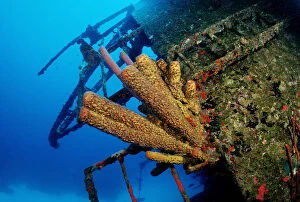
Yellow Sponge at the Hilma Hooker wreck, Bonaire, Netherlands Antilles, Caribbean
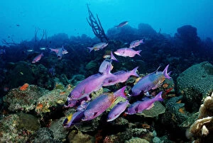
animal, animals, anthozoa, antilles, aquatic, bodies, body, bonaire, caribbean, clepticus
Creole wrasse (Clepticus Parra), Bonaire, Netherlands Antilles, Caribbean