mail_outline sales@mediastorehouse.com
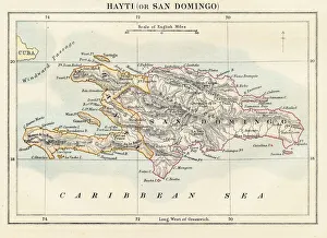
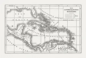
Haiti and Dominican republic map 1883Encyclopedia Britannica 9th Edition New York Samuel L. Hall 1883 Vol XI
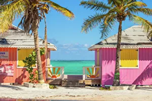
Colorful buildings on the Turks and Caicos islandsLocated in the Blue hills Road neighborhood of Providenciales. Vivid blue of the Caribbean sky and sea with the white sands of Grace bay beach, Turks & Caicos, and bright yellow beach umbrellas
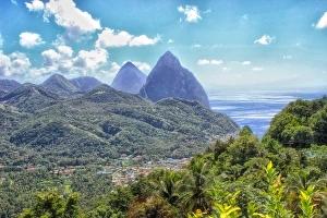
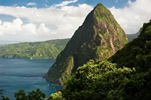
The Pitons, Soufrière, St LuciaThe volcanic mountainous peaks known as the Pitons are now a UNESCO World Heritage Site. They dominate the surrounding landscape
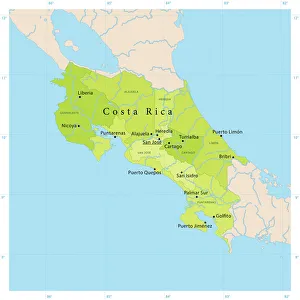
Costa Rica Vector Map+++
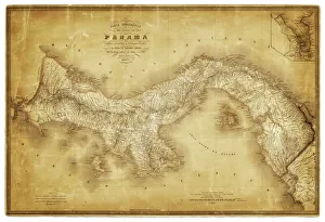
Map of Panama 1864Map of Panama - combined with 2 different texture overlays
The Pitons, Saint LuciaView of jagged Petit Piton jutting out of the blue Caribbean Sea as viewed from the slopes of neighbouring Gros Piton, near Soufriere Saint Lucia
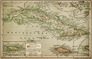
Caribbean mapAntique map of Cuba, Jamaica, Puerto Rico
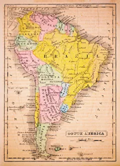
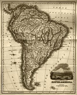
South America 1852 Map
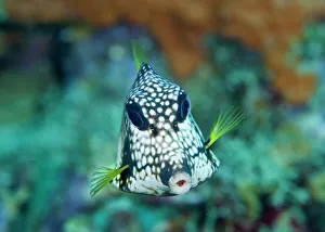
Smooth TrunkfishUnderwater view of Smooth Trunkfish (Lactophrys triqueter} swimming above coral reef in Caribbean Sea
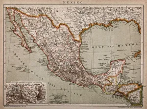
Mexico map 1897The World-Wide Atlas of Modern Geography, Political and Physical W. & A.K. Johnston - London 1897
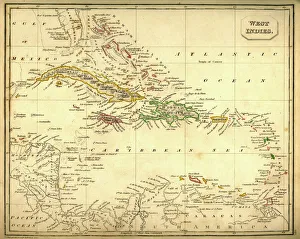
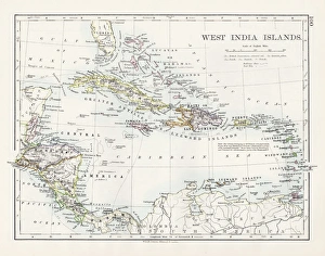
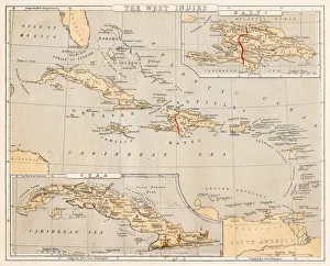
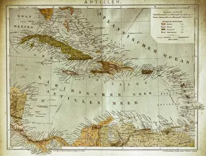
Antquie Map of The West IndiesVintage map of The West Indies from 1837
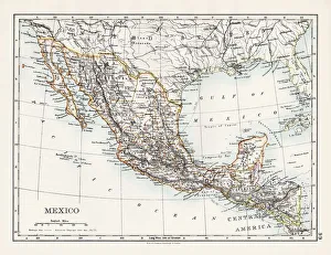
Map of MexicoAntique map of Mexico
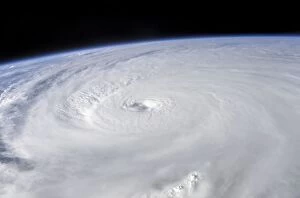
Bizarre, Caribbean Sea, Climate, Cloud, Color Image, Cuba, Destruction, DramaticBizarre, Caribbean Sea, Climate, Cloud, Color Image, Cuba, Destruction, Science Photo Library, 85757364
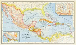
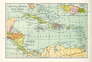
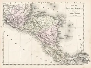
1883 Map Of Central America
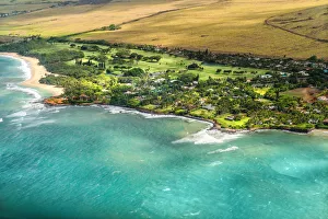
Maui Aerial View #3A wonderful aerial view of the Maui - Hawaii coastline as scene from a small airplane flying at low altitude. The beautiful lush landscape contrasts the scenic beaches and wonderful turquoise waters
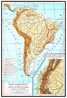
South America, river and mountains mapIllustrator of a South America, river and mountains map
Antique Map of Central America and West IndesVintage map of Central America and West Indes, from 1894
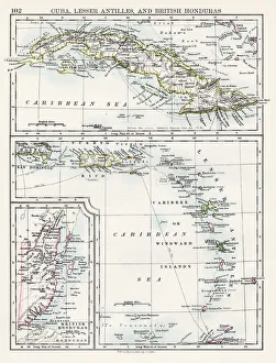
Cuba lesser antilles map 1897The World-Wide Atlas of Modern Geography, Political and Physical W. & A.K. Johnston - London 1897
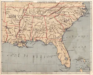
Map of USA Southern states 1869Cornells Grammars-School Geography - S.S. Cornell - New York D. Appleton and Company 1869
West indies map 1897The World-Wide Atlas of Modern Geography, Political and Physical W. & A.K. Johnston - London 1897
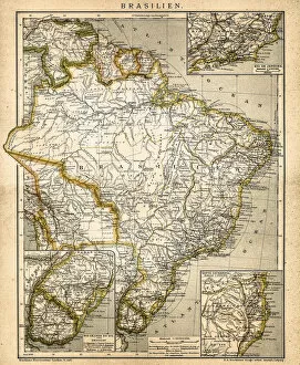
Map of South America (early 19th century steel engraving)A steel engraving of a map from the early 19th century of Brazil and Paraguay in South America, from A System of Geography, Popular and Scientific, or A Physical, Political
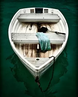
Small Fishing Boat Drifting of a Pier in Grand CaseSolo boat adrift on the shore of Grand Case Saint Martin. Anchored for the night. Twilight brings dark skies and seas, contrasting the bright tones of the worn yet sea worthy row boat
Pinel Island Pinel Bay Saint Martin Sint Maarten CaribbeanA dramatic view of the Pinel Bay, Pinel Island, ilet de Pinel, Petite Clef, Rue de Grande Caye as seen from a high vantage point. Island of Saint Martin Sint Maarten, Caribbean
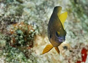
Beau Gregory FishUnderwater view of Beau Gregory fish (Eupomacentrus leucostictus) swimming above coral reef in Caribbean Sea
Thick jungle near the top of Gros Piton, Saint LuciaDense green jungle near at the peak of Gros Piton. Gros Piton, at 798m, is Saint Lucias second tallest peak, and is a UNESCO World Heritage Site
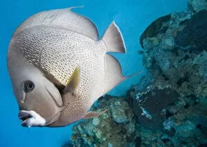
Gray Angelfish (Pomacanthus arcuatus) swimming near coral reefCaribbean Sea, Cayman Islands, Grand Cayman Island
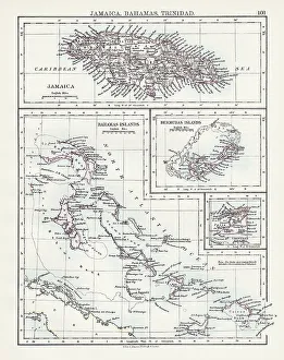
Jamaica Bahamas Trinidad map 1897The World-Wide Atlas of Modern Geography, Political and Physical W. & A.K. Johnston - London 1897
Central America map 1893Johnsonas Universal Cyclopedia - Charles Kendall - New York 1893
West Indies map 1869Cornells Grammars-School Geography - S.S. Cornell - New York D. Appleton and Company 1869
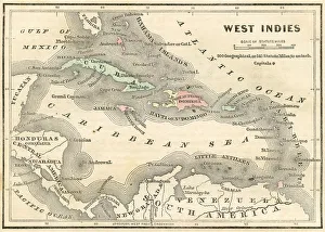
West Indies map 1855System of Geography for the use of schools by Sidney E. Morse - Published by Harper & Brothers - New York 1855
West Indies map 1856Colton and Fitchs Modern School Geography by George W. Fitch - New York 1856
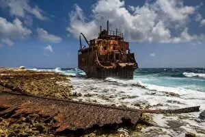
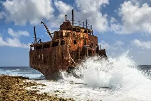
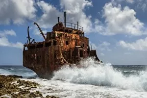
Shipwreck on Little CuracaoLittle Curacao is a very small uninhabited Island near Cura?ao, where this small oiltanker stranded in 1988
A shipwreck on the coast of Little CuracaoThe shipwreck of an small oiltanker, that stranded here on Little Curacao. Built in 1964 and shipwrecked in 1988
Voyages of Christopher Columbus, wood engraving, published c. 1882Map with the routes of the four voyages of Christopher Columbus in the Caribbean Sea. Wood engraving, published c. 1882
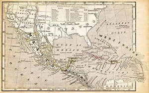
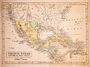
Mexico, Texas, Guatimala and West Indies 1852 Map
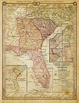
usa - southern states 1884map of north carolina, south carolina, georgia and florida 1884
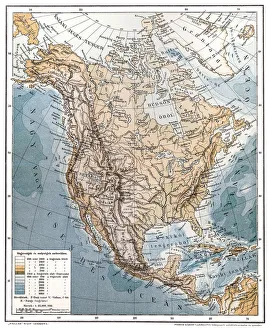
North AmericaAntique illustration of a North America
South America mapAntique illustration of a South America map
West indies, Antilles mapIllustration of a West indies, Antilles map
Joined Jellyfish MirrorJelly fish mirror from the oceanic coast of California
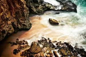
Cupecoy Shoreline Saint MartinA shoreline view of the beautiful cupecoy coast. A long exposure capturing the surf. Cupecoy Beach at Sunset - Twilight on the Caribbean Island of Sint Maarten - Saint Martin
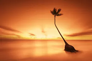
Alone palm tree on a secluded beachAlone palm tree located on a secluded Bavaro Beach, Punta Cana, Dominican Republic. A long exposure at sunrise creates a surreal and idyllic mood
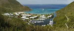
Day time at Rocher de l ansi MarcelA beautiful Cove, Resort, and Marina located on Anse Marcel, Saint Martin Located on the North Shore of Saint Martin / Sint Maarten
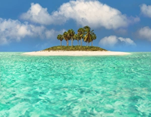
Caribbean ParadiseIn a very remote area off the coast of St. Lucia - Martinique there is a tiny deserted Cay which exemplifies the idyllic paradise. A dozen palm trees tower over the petite Key
Shipwreck on coast of Little Curacao, CaribbeanShip wreck on the small island of Klein Curacao (little Curacao) near the larger island of Curacao in the Caribbean
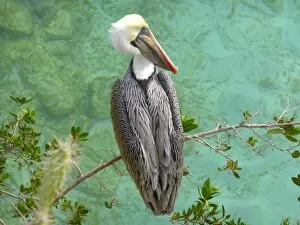
A brown pelican (Pelecanus occidentalis)
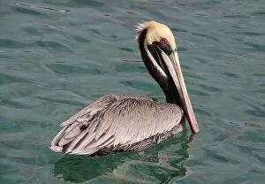
Brown pelican swimming on Cura?aoA brown pelican swimming in the Caribbean Sea at Cura?ao
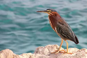
Green heronThe green heron (Butorides virescens) is a small heron of North and Central America