mail_outline sales@mediastorehouse.com
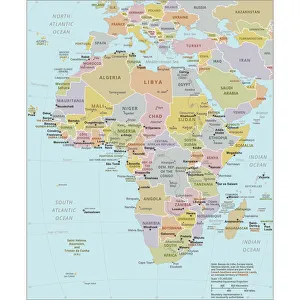
Political Map of AfricaVector Illustration of the policital map of Africa Reference map as created by the US Central Intelligence Agency
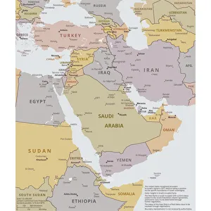
Political map of The Middle EastVector illustration of the policital map of The Middle East Reference map was created by the US Central Intelligence Agency
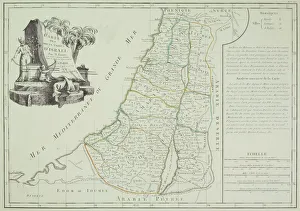
Antique map of Israel
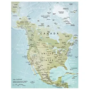
North America mapVector illustration of a detailed map of North America. Reference map was created by the US Central Intelligence Agency and is available as a public domain map at the University of Texas Libraries
Old Recording Machineshttp://csaimages.com/images/istockprofile/csa_vector_dsp.jpg
Smiling Nursehttp://csaimages.com/images/istockprofile/csa_vector_dsp.jpg
Woman with newspaperhttp://csaimages.com/images/istockprofile/csa_vector_dsp.jpg
Population charthttp://csaimages.com/images/istockprofile/csa_vector_dsp.jpg
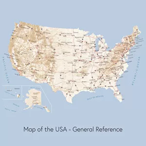
Map of the USA general referenceVector illustration of a map of the United States of America. The reference map used in the creation of this illustration is public domain map available at the University of Texas website: http
Large satellite dish, Auckland, New Zealand, PublicGround
Pie chart illustration of grassland, wetland, farmland, forest, mountain and built-up areas of Spain
Road made of binary code leading towards a stylized circuit board, conceptual image for data highway, broadband connection, 3D illustration
Eye with binary numbers, symbolic image for digitalisation
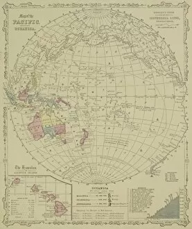
Antique map of Pacific Oceanica with inset of islands
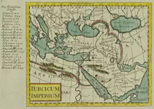
Antique map of the Turkish Empire
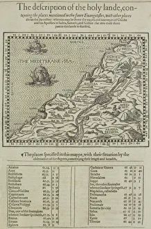
Antique map of the holy land with table of data
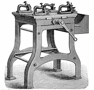
Machines for making metal letters used for printingIllustration of A machines for making metal letters used for printing
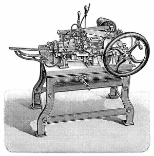
Complete casting machine from Kustermann & CoIllustration of a complete casting machine from Kustermann & Co. in Berlin
Illustration of gas chromatography
Illustration of the processes involved in storing sound on a CD
Digital illustration of human brain and information from left side of visual cortex receiving information from right visual field
Digital illustration of human brain and mapping of visual field onto retina matching arrangement of data on surface of visual cortex
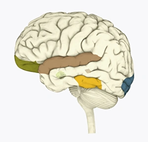
Digital illustration of areas of information highlighted in human brain
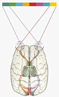
Digital illustration of frontal lobe and parietal lobe areas (orange) in left hemispheres (blue), and pathway of data from parietal lobe to frontal lobe (green) in human brain
Pie chart illustration representing grassland, forest, farmland and built-up areas of Portugal
Pie chart iIllustration of percentage of population in urban and rural areas, example of Portugal with a majority of rural population
Pie chart illustration representing farmland, forest, mountain, and built-up areas of Germany
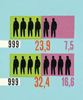
Population chart represented by outlines of people
Small umbrella on a hard drive, symbolic image for data protection
Multimedia eye, symbolic image for data stream analysis
Old lead letters forming the word DOWNLOAD
Old files, archive
Three notebooks connected to a cloud which is filled with binary code, conceptual image for cloud computing, networking, IT infrastructure, 3D illustration
A cable ball in spaceA ball made af many coloured ethernet cables, resembling earth with the moon orbiting it
Ball of cables in outer spaceA ball made from ethernet cables in colours resembling earth
Laptop connected to cable ballA laptop viewed from the side connected to a ball made of ethernet cables
Laptop showing graph connected to cable ballLaptop showing a red graph connected through red cable to a ball made of ethernet cables
Woman filing
Man working at desk covered with files