mail_outline sales@mediastorehouse.com
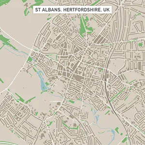
St Albans Hertfordshire UK City Street MapVector Illustration of a City Street Map of St Albans, Hertfordshire, UK. Included files are EPS (v10) and Hi-Res JPG. Data courtesy from Ordnance Survey: VectorMap District https
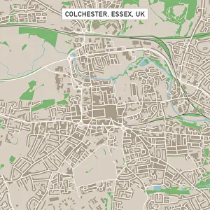
Colchester Essex UK City Street MapVector Illustration of a City Street Map of Colchester, Essex, UK. Included files are EPS (v10) and Hi-Res JPG. Data courtesy from Ordnance Survey: VectorMap District https
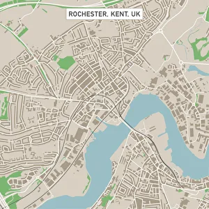
Rochester Kent UK City Street MapVector Illustration of a City Street Map of Rochester, Kent, UK. Included files are EPS (v10) and Hi-Res JPG. Data courtesy from Ordnance Survey: VectorMap District https
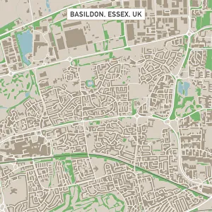
Basildon Essex UK City Street MapVector Illustration of a City Street Map of Basildon, Essex, UK. Included files are EPS (v10) and Hi-Res JPG. Data courtesy from Ordnance Survey: VectorMap District https
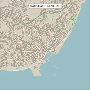
Ramsgate Kent UK City Street MapVector Illustration of a City Street Map of Ramsgate, Kent, UK. Included files are EPS (v10) and Hi-Res JPG. Data courtesy from Ordnance Survey: VectorMap District https
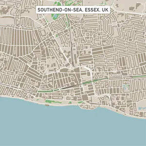
Southend-on-Sea Essex UK City Street MapVector Illustration of a City Street Map of Southend-on-Sea, Essex, UK. Included files are EPS (v10) and Hi-Res JPG. Data courtesy from Ordnance Survey: VectorMap District https
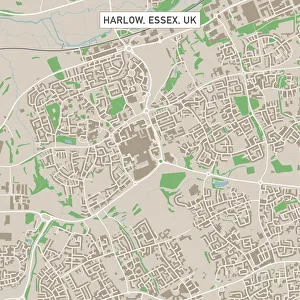
Harlow Essex UK City Street MapVector Illustration of a City Street Map of Harlow, Essex, UK. Included files are EPS (v10) and Hi-Res JPG. Data courtesy from Ordnance Survey: VectorMap District https
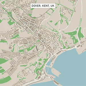
Dover Kent UK City Street MapVector Illustration of a City Street Map of Dover, Kent, UK. Included files are EPS (v10) and Hi-Res JPG. Data courtesy from Ordnance Survey: VectorMap District https
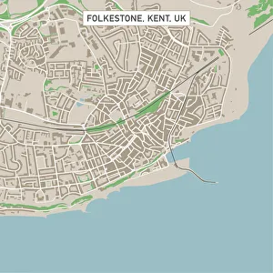
Folkestone Kent UK City Street MapVector Illustration of a City Street Map of Folkestone, Kent, UK. Included files are EPS (v10) and Hi-Res JPG. Data courtesy from Ordnance Survey: VectorMap District https
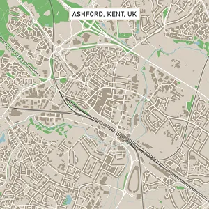
Ashford Kent UK City Street MapVector Illustration of a City Street Map of Ashford, Kent, UK. Included files are EPS (v10) and Hi-Res JPG. Data courtesy from Ordnance Survey: VectorMap District https
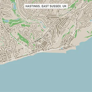
Hastings East Sussex UK City Street MapVector Illustration of a City Street Map of Hastings, East Sussex, UK. Included files are EPS (v10) and Hi-Res JPG. Data courtesy from Ordnance Survey: VectorMap District https
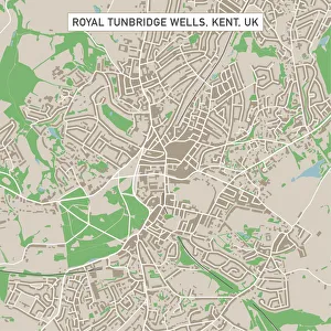
Royal Tunbridge Wells Kent UK City Street MapVector Illustration of a City Street Map of Royal Tunbridge Wells, Kent, UK. Included files are EPS (v10) and Hi-Res JPG. Data courtesy from Ordnance Survey: VectorMap District https
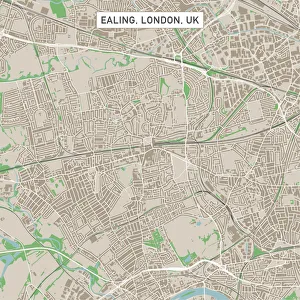
Ealing London UK City Street MapVector Illustration of a City Street Map of Ealing, London, UK. Included files are EPS (v10) and Hi-Res JPG. Data courtesy from Ordnance Survey: VectorMap District https
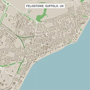
Felixstowe Suffolk UK City Street MapVector Illustration of a City Street Map of Felixstowe, Suffolk, UK. Included files are EPS (v10) and Hi-Res JPG. Data courtesy from Ordnance Survey: VectorMap District https
Clacton-on-Sea Essex UK City Street MapVector Illustration of a City Street Map of Clacton-on-Sea, Essex, UK. Included files are EPS (v10) and Hi-Res JPG. Data courtesy from Ordnance Survey: VectorMap District https
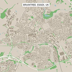
Braintree Essex UK City Street MapVector Illustration of a City Street Map of Braintree, Essex, UK. Included files are EPS (v10) and Hi-Res JPG. Data courtesy from Ordnance Survey: VectorMap District https
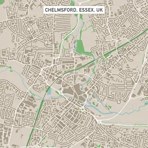
Chelmsford Essex UK City Street MapVector Illustration of a City Street Map of Chelmsford, Essex, UK. Included files are EPS (v10) and Hi-Res JPG. Data courtesy from Ordnance Survey: VectorMap District https
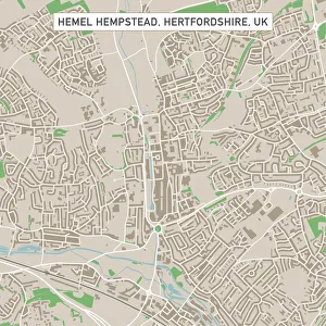
Hemel Hempstead Hertfordshire UK City Street MapVector Illustration of a City Street Map of Hemel Hempstead, Hertfordshire, UK. Included files are EPS (v10) and Hi-Res JPG
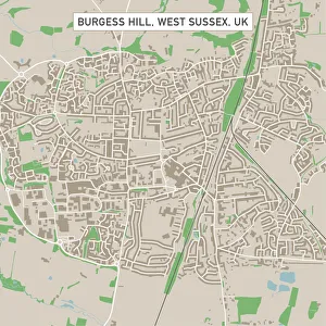
Burgess Hill West Sussex UK City Street MapVector Illustration of a City Street Map of Burgess Hill, West Sussex, UK. Included files are EPS (v10) and Hi-Res JPG. Data courtesy from Ordnance Survey: VectorMap District https
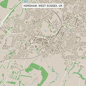
Horsham West Sussex UK City Street MapVector Illustration of a City Street Map of Horsham, West Sussex, UK. Included files are EPS (v10) and Hi-Res JPG. Data courtesy from Ordnance Survey: VectorMap District https
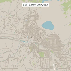
Butte Montana US City Street MapVector Illustration of a City Street Map of Butte, Montana, USA. Scale 1:60, 000. All source data is in the public domain. U.S
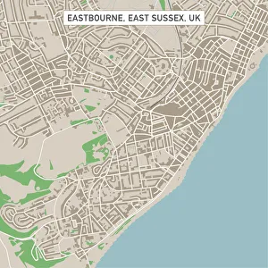
Eastbourne East Sussex UK City Street MapVector Illustration of a City Street Map of Eastbourne, East Sussex, UK. Included files are EPS (v10) and Hi-Res JPG. Data courtesy from Ordnance Survey: VectorMap District https
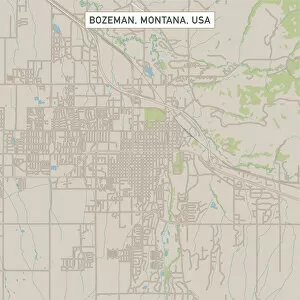
Bozeman Montana US City Street MapVector Illustration of a City Street Map of Bozeman, Montana, USA. Scale 1:60, 000. All source data is in the public domain. U.S
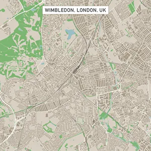
Wimbledon London UK City Street MapVector Illustration of a City Street Map of Wimbledon, London, UK. Included files are EPS (v10) and Hi-Res JPG. Data courtesy from Ordnance Survey: VectorMap District https
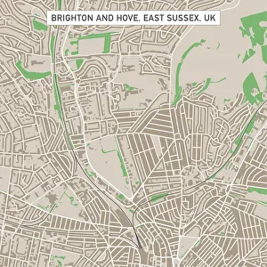
Brighton And Hove East Sussex UK City Street MapVector Illustration of a City Street Map of Brighton And Hove, East Sussex, UK. Included files are EPS (v10) and Hi-Res JPG
Digital illustration of yellow hexagon
Digital illustration of two jigsaw puzzle pieces
Diadem spider, Cross spider, European garden spider -Araneus diadematus-, habitat Europe
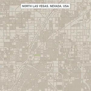
North Las Vegas Nevada US City Street MapVector Illustration of a City Street Map of North Las Vegas, Nevada, USA. Scale 1:60, 000. All source data is in the public domain. U.S
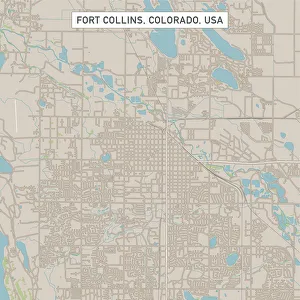
Fort Collins Colorado US City Street MapVector Illustration of a City Street Map of Fort Collins, Colorado, USA. Scale 1:60, 000. All source data is in the public domain. U.S
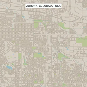
Aurora Colorado US City Street MapVector Illustration of a City Street Map of Aurora, Colorado, USA. Scale 1:60, 000. All source data is in the public domain. U.S
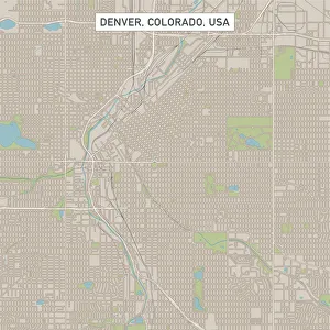
Denver Colorado US City Street MapVector Illustration of a City Street Map of Denver, Colorado, USA. Scale 1:60, 000. All source data is in the public domain. U.S
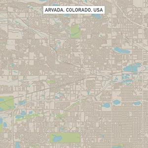
Arvada Colorado US City Street MapVector Illustration of a City Street Map of Arvada, Colorado, USA. Scale 1:60, 000. All source data is in the public domain. U.S
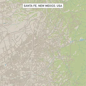
Santa Fe New Mexico US City Street MapVector Illustration of a City Street Map of Santa Fe, New Mexico, USA. Scale 1:60, 000. All source data is in the public domain. U.S
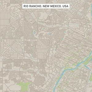
Rio Rancho New Mexico US City Street MapVector Illustration of a City Street Map of Rio Rancho, New Mexico, USA. Scale 1:60, 000. All source data is in the public domain. U.S
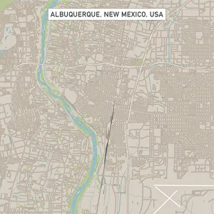
Albuquerque New Mexico US City Street MapVector Illustration of a City Street Map of Albuquerque, New Mexico, USA. Scale 1:60, 000. All source data is in the public domain. U.S
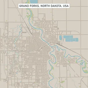
Grand Forks North Dakota US City Street MapVector Illustration of a City Street Map of Grand Forks, North Dakota, USA. Scale 1:60, 000. All source data is in the public domain. U.S
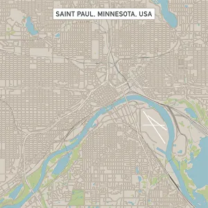
Saint Paul Minnesota US City Street MapVector Illustration of a City Street Map of Saint Paul, Minnesota, USA. Scale 1:60, 000. All source data is in the public domain. U.S
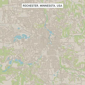
Rochester Minnesota US City Street MapVector Illustration of a City Street Map of Rochester, Minnesota, USA. Scale 1:60, 000. All source data is in the public domain. U.S
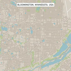
Bloomington Minnesota US City Street MapVector Illustration of a City Street Map of Bloomington, Minnesota, USA. Scale 1:60, 000. All source data is in the public domain. U.S
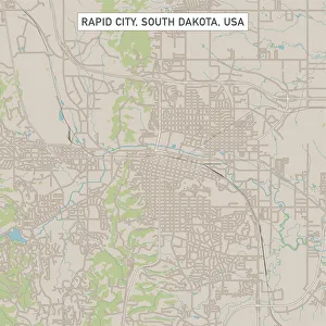
Rapid City South Dakota US City Street MapVector Illustration of a City Street Map of Rapid City, South Dakota, USA. Scale 1:60, 000. All source data is in the public domain. U.S
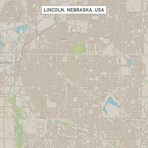
Lincoln Nebraska US City Street MapVector Illustration of a City Street Map of Lincoln, Nebraska, USA. Scale 1:60, 000. All source data is in the public domain. U.S
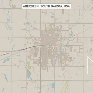
Aberdeen South Dakota US City Street MapVector Illustration of a City Street Map of Aberdeen, South Dakota, USA. Scale 1:60, 000. All source data is in the public domain. U.S
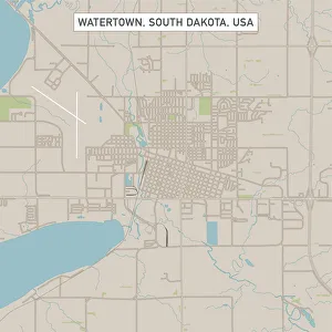
Watertown South Dakota US City Street MapVector Illustration of a City Street Map of Watertown, South Dakota, USA. Scale 1:60, 000. All source data is in the public domain. U.S
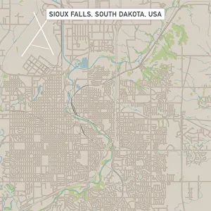
Sioux Falls South Dakota US City Street MapVector Illustration of a City Street Map of Sioux Falls, South Dakota, USA. Scale 1:60, 000. All source data is in the public domain. U.S
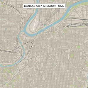
Kansas City Missouri US City Street MapVector Illustration of a City Street Map of Kansas City, Missouri, USA. Scale 1:60, 000. All source data is in the public domain. U.S
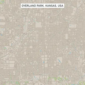
Overland Park Kansas US City Street MapVector Illustration of a City Street Map of Overland Park, Kansas, USA. Scale 1:60, 000. All source data is in the public domain. U.S
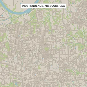
Independence Missouri US City Street MapVector Illustration of a City Street Map of Independence, Missouri, USA. Scale 1:60, 000. All source data is in the public domain. U.S