mail_outline sales@mediastorehouse.com
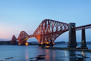
The Mighty Forth Rail Bridge at duskThe Forth Bridge over the Firth of Forth taken from South Queensferry. The Bridge is a UNESCO World Heritage Site
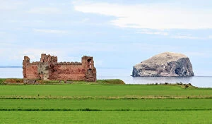
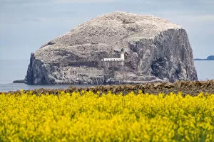
Tantallon Castle and Bass Rock, East Lothian, ScotlandTantallon Castle and Bass Rock in East Lothian. Bass Rock is a steep-sided volcanic rock, 107 metres (351 ft) at its highest point, and is home to a large colony of gannets
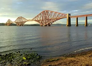
The firth of forth railway bridge looking from (South) Queensferry towards North Queensferry.The Railway bridge over the Firth of Forth, taken from Queensferry (South) to North Queensferry
Inchgarvie Island ViewInchgarvie is a small, uninhabited island in the Firth of Forth. Its name comes from Innis Garbhach which is Scottish Gaelic for " rough island"
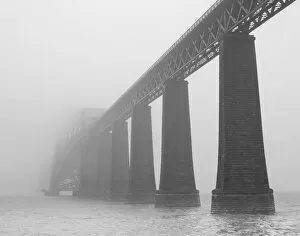
Forth Bridge in MistThe Forth Rail Bridge - an international icon of engineering - is enveloped by Sea Mist, a common sight on the firth of forth
The Forth bridge, South Queensferry, ScotlandThe Railway bridge over the Firth of Forth, taken from Queensferry (South) to North Queensferry.There were ferries at Queensferry until 1964 when the nearby Forth Road Bridge was opened
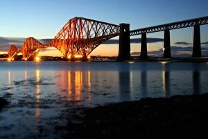
Forth Rail Bridge at dusk, from South QueensferryThe Railway bridge over the Firth of Forth, taken from Queensferry (South) to North Queensferry.There were ferries at Queensferry until 1964 when the nearby Forth Road Bridge was opened
City map of Edinburgh, capital of Scotland, lithograph, published 1897City map of Edinburgh, capital city of Scotland. Lithograph, published in 1897
Bass Rock, East Lothian, ScotlandThe Bass Rock, or simply the Bass, is an island in the outer part of the Firth of Forth in the east of Scotland. Approximately 2 kilometres (1.2 mi) offshore
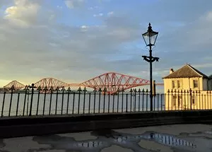
The railway bridge, view from South QueensferryThe Railway bridge over the Firth of Forth, taken from Queensferry (South) to North Queensferry. In 2012 the bridge was placed on the UNESCO world heritage tentative list
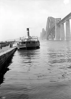
Forth Railway Bridgecirca 1925: A steamer on the River Forth near the Forth Bridge. The Forth Bridge spans the Firth of Forth at Queensferry in Lothian and is over a mile long
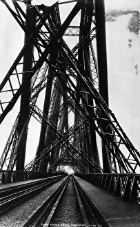
Forth BridgeThe North cantilever of the Forth Bridge, spanning the Firth of Forth at Queensferry. The steel cantilever construction was designed by John Fowler
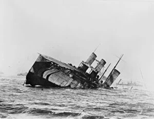
Shipwreck5th November 1918: The former Cunard liner Campania sinks in the Firth of Forth after a collision with the HMS Revenge. Built in 1893, she became one of the first seaplane carriers
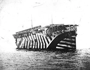
Argus At RosythNovember 1918: Airmen and seamen cheering King George V from the aircraft carrier Argus on his visit to the Fleet at Rosyth, on the Firth of Forth. The carrier is painted in dazzle camouflage
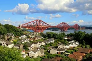
North Queensferry with the Forth railway bridge