mail_outline sales@mediastorehouse.com
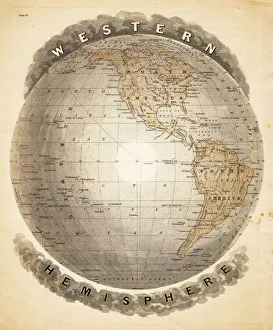
World western hemispheres 1883Warrens Common School Geography
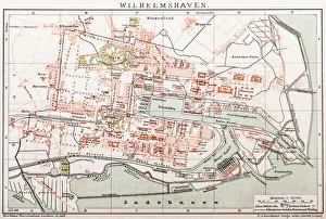
Wilhelmshaven. GermanyAntique illustration of a Wilhelmshaven, Germany map
Uyuni Salt Desert, BoliviaUyuni Salt Desert in the morning with people silhouette
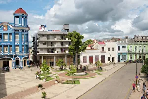
The Workers Plaza or Square Including La Cecilia Convention Center (blue building) in Camaguey, CubaThe landmark is a tourist attraction in the tropical city or urban settlement. There is valuable colonial architecture. It is a meeting place for visitors
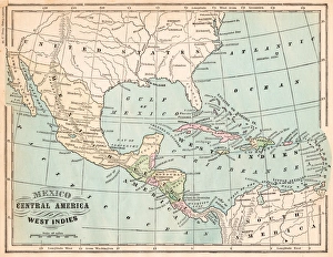
Mexico and West indies map 1875The Independent Course Comprehensive Geography by James Monteith, A.S. Barnes & Co, New York & Chicago 1875
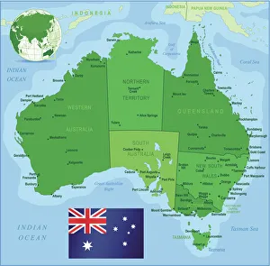
Map of Australia with states, cities and flagHighly detailed vector map of Australia with states, capitals and big cities
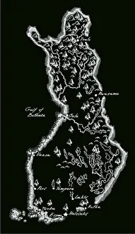
Antique Finland MapFinland Map, - Antique style. Includes mountains and water bodies. High detail - vector illustration
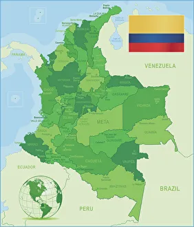
Green Map of Colombia - states, cities and flagColombia, country of northwestern South America. Its 1, 000 miles (1, 600 km) of coast to the north are bathed by the waters of the Caribbean Sea, and its 800 miles (1)
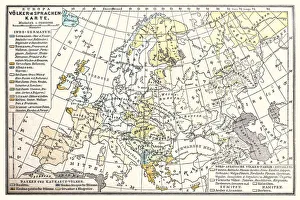
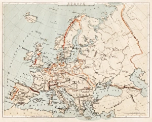
Europa map, Peoples and languages map 1896Illustration of a Europa map, Peoples and languages map 1896
Dante with Pope Adrian V engraving 1870The Dore Gallery by Edmund Ollier - Cassel, Petter and Galpin (London-New York) 1870
The Apocalyptic Procession engraving 1870The Dore Gallery by Edmund Ollier - Cassel, Petter and Galpin (London-New York) 1870
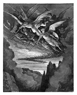
The Fallen Angels engravingThe Fallen Angels of the Wing
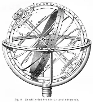
Armillary sphere engraving 1895Meyers Konversations-Lexikon. Ein Nachschlagewerk des allgemeinen Wissens, 5th edition 17 volumes Bibliographisches Institut - Leipzig 1895-1897
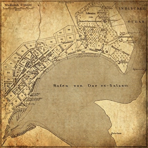
Dar es Salaam, TanzaniaAntique illustration of a Dar es Salaam, Tanzania
Digital illustration of planet Earth showing continents in green
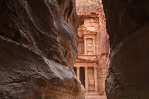
View from entrance of City of Petra, JordanPetra - Nabataeans capital city, Jordan
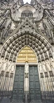
Cologne Cathedral Facade Door - Cologne, GermanyMain entrance door at Roman Catholic Cologne Cathedral in Germany. It has Gothic architecture and it`s the most visited landmark in Germany
Beautiful woman holding traditional red umbrella and walking on U Bein Bridge, Myanmar
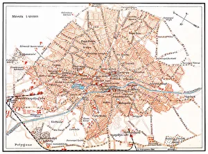
Bucharest mapIllustration of a Bucharest map
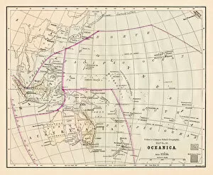
Oceania Australia map 1881Coltons Common School Geography 1881 New York Sheldon and Co
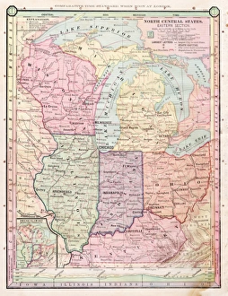
North Central states map 1886North Central states map Maps Monteith Physical Geography 1886
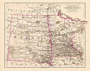
North Dakota and MInnesota map 1881Coltons Common School Geography 1881 New York Sheldon and Co
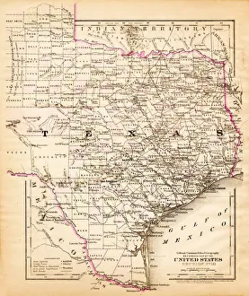
Texas map 1881Coltons Common School Geography 1881 New York Sheldon and Co
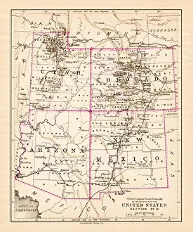
Utah Arizona New Mexico Colorado map 1881Coltons Common School Geography 1881 New York Sheldon and Co
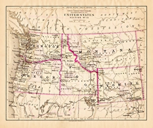
Montana Washington Oregon Idaho map 1881Coltons Common School Geography 1881 New York Sheldon and Co
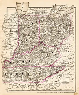
indiana Ohio Kentucky map 1881Coltons Common School Geography 1881 New York Sheldon and Co
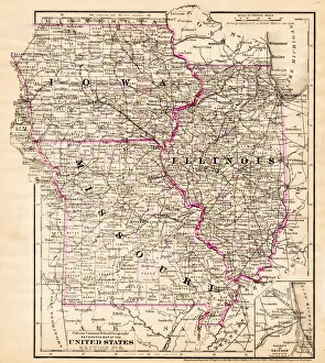
Iowa Missouri Illinois map 1881Coltons Common School Geography 1881 New York Sheldon and Co
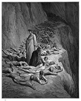
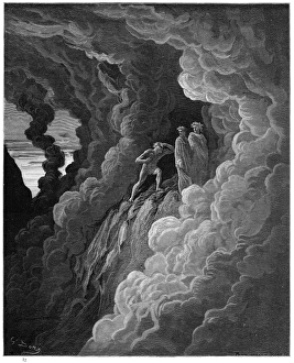
Lombardo in the Third Circle of Purgatory engraving 1870The Dore Gallery by Edmund Ollier - Cassel, Petter and Galpin (London-New York) 1870
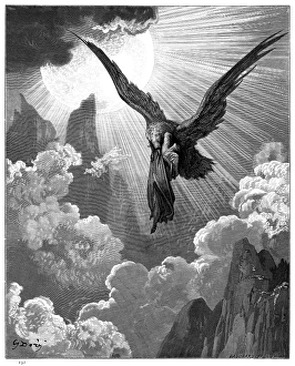
Dante and the eagle engraving 1870The Dore Gallery by Edmund Ollier - Cassel, Petter and Galpin (London-New York) 1870
Map of Europe 1869Cornells Grammars-School Geography - S.S. Cornell - New York D. Appleton and Company 1869
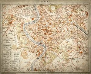
Map of Rome, Italy
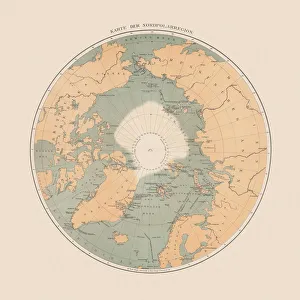
Ancient map of the Arctic Region, lithograph, published in 1883Ancient map of the Arctic Region. Lithograph, published in 1883
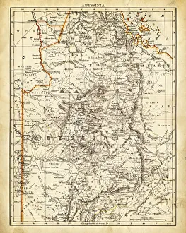
Map of Abyssinia 1897
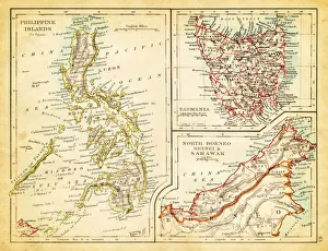
Map of Philippines Tasmania Borneo 1897Map of Tasmania Borneo Philippines
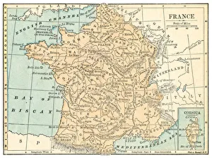
France map 1875The Independent Course Comprehensive Geography by James Monteith, A.S. Barnes & Co, New York & Chicago 1875
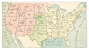
United States map 1875The Independent Course Comprehensive Geography by James Monteith, A.S. Barnes & Co, New York & Chicago 1875
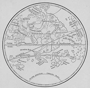
Map Of Eastern Hemisphere, 1492Map of the Eastern Hemisphere from Behaims Globe, 1492. (Kean Collection/Getty Images)
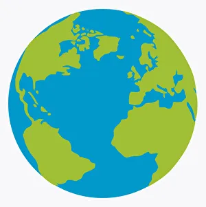
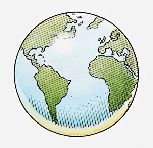
Illustration of globe showing North and South America, Africa, Europe and Atlantic Ocean
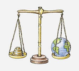
Illustration of set of scales with globe on one side and weights on the other
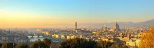
Aerial view of Duomo Cathedral in Florence Italy
Cancha de Bochas - round stones at National Park Parque Provincial Ischigualasto, Central Andes, Argentina, South America
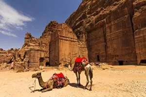
Camels near the tombs in Petra, JordanPetra, Jordan-- it is a symbol of Jordan, as well as Jordans most-visited tourist attraction. Petra has been a UNESCO World Heritage Site since 1985
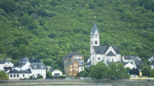
Kamp-Bornhofen and St Nikolaus Church on the River Rhine, GermanyParish Church of St. Nicholas, Kamp-Bornhofen, Rhein-Lahn-Kreis district, Rhineland-Palatinate
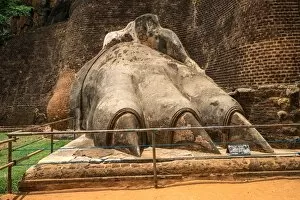
The Sigiriya Lion rock fortress in Sigiriya, Sri Lanka. Sigiriya is listed as UNESCO World Heritage Site
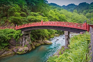
Shinkyo Bridge or sacred bridge in Nikko, Japan, a very famous bridge in Nikko. One of Japans three finest bridges together with Iwakunis Kintaikyo and Saruhashi in Yamanashi Prefecture
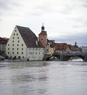
Germany, Bavaria, Regensburg, View Of River Danube, Historic Salt House, And Clock Tower
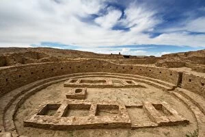
Great Kiva at Pueblo Bonito Ruin, Chaco Culture National Historic Park, New Mexico