mail_outline sales@mediastorehouse.com
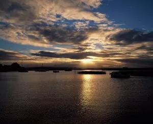
Co Tipperary, Lough Derg, Kilgarvan Harbour-Sunset
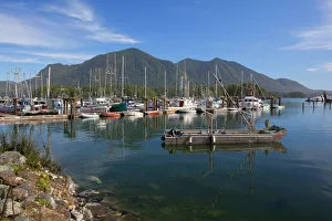
Fishermans WharfTofino, British Columbia, Canada
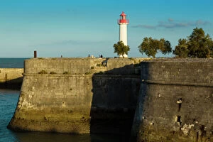
The harbour at Saint Martin de RA, Ile de RA, Poitou Charente, Charente Maritime, FranceThe harbour at Saint Martin de RA©, Ile de RA©, Poitou Charente, Charente Maritime, France
Fanad Head (FAanaid) lighthouse, County Donegal, Ulster region, Ireland, Europe. Lighthouse and its cove at sunset
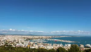
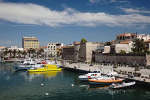
Palma de Majorca, Majorca, Balearic Islands, Spain, Europe
Cruise Ship11th March 1957: A neon sign on the mast of a ship moored in Glasgow harbour encourages people to visit the citys hospitals for an X-ray
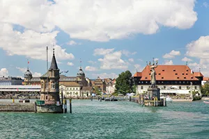
Harbour entrance of Constance with the Imperia statue created by Peter Lenk, Lake Constance, Baden-Wuerttemberg, Germany, Europe
Morning light in the harbor of Konstanz with Imperia and ships, Lake Constance, Baden-Wuerttemberg, Germany, Europe, PublicGround
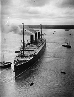
SS Berengaria4th May 1933: The giant Cunard liner Berengaria entering Southampton harbour assisted by tugs. (Photo by Edward G. Malindine/Topical Press Agency/Getty Images)
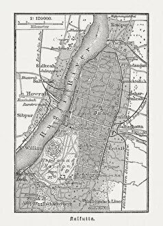
Old city map of Kolkata (Calcutta), wood engraving, published in 1897Old city map of Kolkata (Calcutta), India. Wood engraving, published in 1897
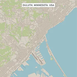
Duluth Minnesota US City Street MapVector Illustration of a City Street Map of Duluth, Minnesota, USA. Scale 1:60, 000. All source data is in the public domain. U.S
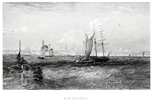
Liverpool from the Sea"Vintage engraving from 1880 of Liverpool a city and metropolitan borough of Merseyside, England, along the eastern side of the Mersey Estuary
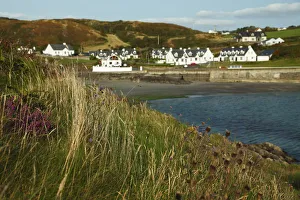
Tragumna village on the Wild Atlantic Way in West CorkCounty Cork, Ireland
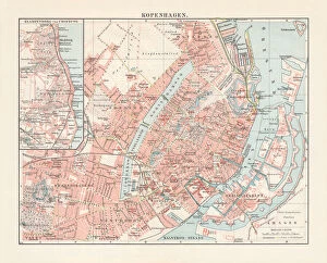
City map of Copenhagen, capital of Denmark, lithograph, published 1897City map of Copenhagen, capital city of Denmark. Lithograph, published in 1897
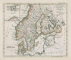
Antique map of Denmark, Norway, Sweden and FinlandWonderful hand coloured antique map, circa 1780 - 1800
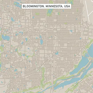
Bloomington Minnesota US City Street MapVector Illustration of a City Street Map of Bloomington, Minnesota, USA. Scale 1:60, 000. All source data is in the public domain. U.S
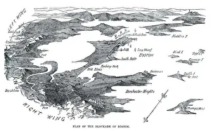
Blockade of BostonVintage engraving from 1861 showing the Plan of the Blockade of Boston during the American Revolutionary War
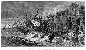
Storm in the ThamesVintage engraving showing ships being destroyed at anchor during a Storm on the Thames, Wapping, London, England
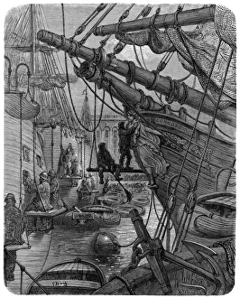
Victorian London - Docks and The ConcordiaVintage engraving showing a scene from 19th Century Victorian London England. Showing London Docks and the ship Concordia
Rime of the Ancient Mariner - in crimson colors cameVintage engraving by Gustave Dore of a scene from the Rime of the Ancient Mariner, Full many shapes, that shadows were, in crimson colors came
Alghero, city walls and marinaItaly, Sardinia, Western Sardinia, Alghero, city walls and marina
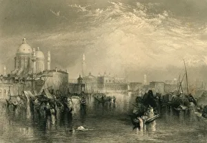
Venice (XXXL)Venice from the canal of the Giudecca.From the picture in the national gallery by J.M.W TURNER.Engraved by Sidney Armytage in 1870
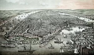
Aerial View of Vintage New YorkThis vintage illustration features an aerial view of New York in the 1800s
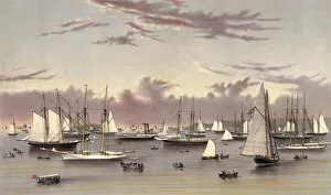
Yachts in the HarborThis 1872 vintage illustration features yachts, a steamboat, and several rowboats in a harbor
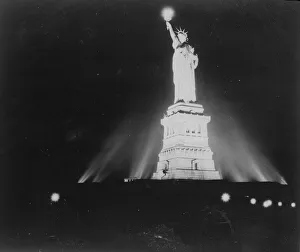
Lit-Up LibertyThe Statue of Liberty in New York, lit up for the first time since the attack on Pearl Harbour (Pearl Harbor). (Photo by Keystone/Getty Images)
Destroyer USS Deyo arriving in port1993, Action, Armed Forces, Arrival, Battle, Conflict, Defense Industry, Harbor, Military, Military Exercise, Nautical Vessel, Navy, Ocean, Outdoors, Port, Power, Sea, Shipping, Technology
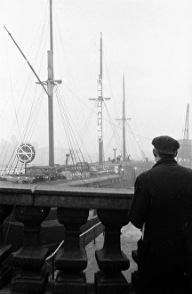
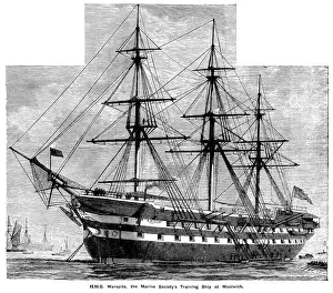
HMS Warspite at WoolwichHMS Warspite, the Marine Societys Training Ship in the River Thames at Woolwich, London. The Marine Society was founded in 1756 because of a shortage of volunteers for the British navy
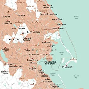
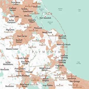
MA Plymouth Duxbury Vector Road Map. All source data is in the public domain. U.S. Census Bureau Census Tiger. Used Layers: areawater, linearwater, roads, rails, cousub, pointlm, uac10
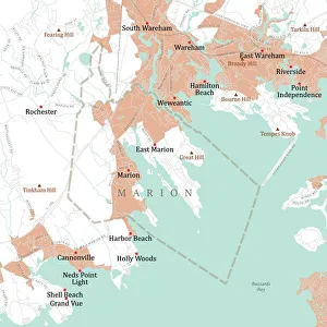
MA Plymouth Marion Vector Road Map. All source data is in the public domain. U.S. Census Bureau Census Tiger. Used Layers: areawater, linearwater, roads, rails, cousub, pointlm, uac10
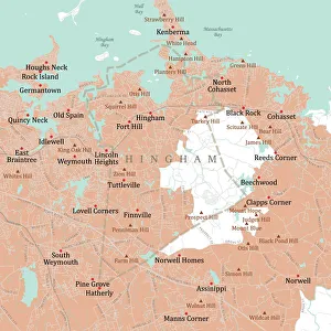
MA Plymouth Hingham Vector Road Map. All source data is in the public domain. U.S. Census Bureau Census Tiger. Used Layers: areawater, linearwater, roads, rails, cousub, pointlm, uac10
MA Plymouth Vector Road Map. All source data is in the public domain. U.S. Census Bureau Census Tiger. Used Layers: areawater, linearwater, roads, rails, cousub, pointlm, uac10
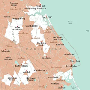
MA Plymouth Marshfield Vector Road Map. All source data is in the public domain. U.S. Census Bureau Census Tiger. Used Layers: areawater, linearwater, roads, rails, cousub, pointlm, uac10
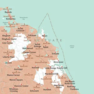
MA Plymouth Scituate Vector Road Map. All source data is in the public domain. U.S. Census Bureau Census Tiger. Used Layers: areawater, linearwater, roads, rails, cousub, pointlm, uac10
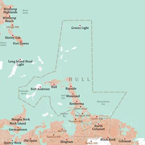
MA Plymouth Hull Vector Road Map. All source data is in the public domain. U.S. Census Bureau Census Tiger. Used Layers: areawater, linearwater, roads, rails, cousub, pointlm, uac10
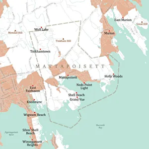
MA Plymouth Mattapoisett Vector Road Map. All source data is in the public domain. U.S. Census Bureau Census Tiger. Used Layers: areawater, linearwater, roads, rails, cousub, pointlm, uac10
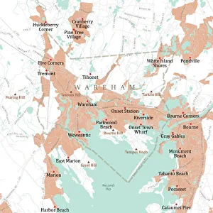
MA Plymouth Wareham Vector Road Map. All source data is in the public domain. U.S. Census Bureau Census Tiger. Used Layers: areawater, linearwater, roads, rails, cousub, pointlm, uac10
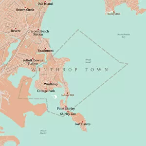
MA Suffolk Winthrop Town Vector Road Map. All source data is in the public domain. U.S. Census Bureau Census Tiger. Used Layers: areawater, linearwater, roads, rails, cousub, pointlm, uac10
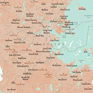
MA Suffolk Boston Vector Road Map. All source data is in the public domain. U.S. Census Bureau Census Tiger. Used Layers: areawater, linearwater, roads, rails, cousub, pointlm, uac10
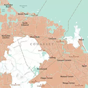
MA Norfolk Cohasset Vector Road Map. All source data is in the public domain. U.S. Census Bureau Census Tiger. Used Layers: areawater, linearwater, roads, rails, cousub, pointlm, uac10
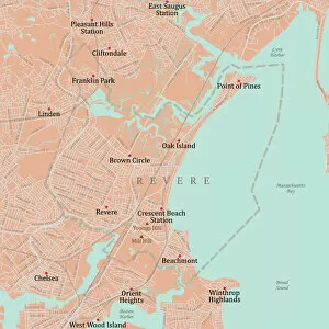
MA Suffolk Revere Vector Road Map. All source data is in the public domain. U.S. Census Bureau Census Tiger. Used Layers: areawater, linearwater, roads, rails, cousub, pointlm, uac10
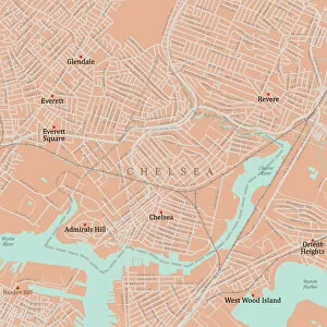
MA Suffolk Chelsea Vector Road Map. All source data is in the public domain. U.S. Census Bureau Census Tiger. Used Layers: areawater, linearwater, roads, rails, cousub, pointlm, uac10
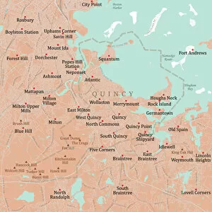
MA Norfolk Quincy Vector Road Map. All source data is in the public domain. U.S. Census Bureau Census Tiger. Used Layers: areawater, linearwater, roads, rails, cousub, pointlm, uac10
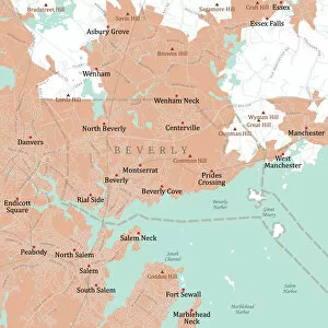
MA Essex Beverly Vector Road Map. All source data is in the public domain. U.S. Census Bureau Census Tiger. Used Layers: areawater, linearwater, roads, rails, cousub, pointlm, uac10
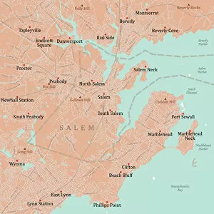
MA Essex Salem Vector Road Map. All source data is in the public domain. U.S. Census Bureau Census Tiger. Used Layers: areawater, linearwater, roads, rails, cousub, pointlm, uac10
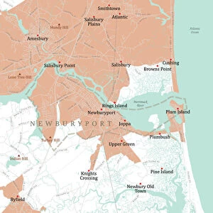
MA Essex Newburyport Vector Road Map. All source data is in the public domain. U.S. Census Bureau Census Tiger. Used Layers: areawater, linearwater, roads, rails, cousub, pointlm, uac10
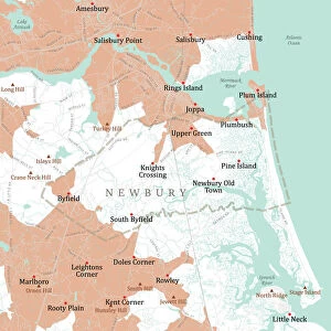
MA Essex Newbury Vector Road Map. All source data is in the public domain. U.S. Census Bureau Census Tiger. Used Layers: areawater, linearwater, roads, rails, cousub, pointlm, uac10
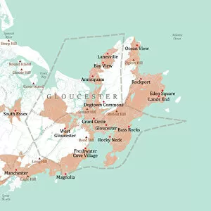
MA Essex Gloucester Vector Road Map. All source data is in the public domain. U.S. Census Bureau Census Tiger. Used Layers: areawater, linearwater, roads, rails, cousub, pointlm, uac10
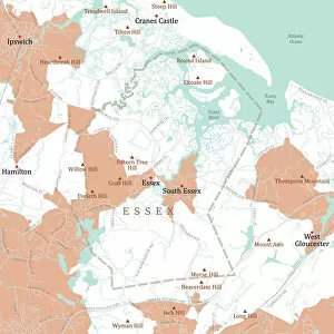
MA Essex Town Vector Road Map. All source data is in the public domain. U.S. Census Bureau Census Tiger. Used Layers: areawater, linearwater, roads, rails, cousub, pointlm, uac10