mail_outline sales@mediastorehouse.com
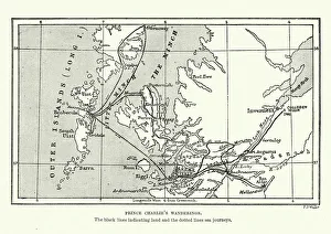
Map of Bonnie Prince Charlies WanderingsVintage caricature of Map of Bonnie Prince Charlies Wanderings after his defeat at the Battle of Culloden in 1746
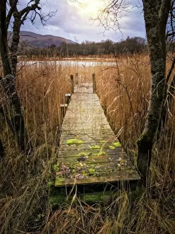
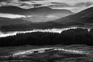
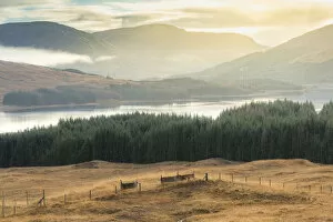
Loch Tummel JettiAn old Jetti / Pier on the tranquil water of the loch Tummel. Loch Tummel, Queens View, Pitlochry, Scotland, United Kingdom
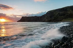
Talisker BayA beautiful sunset across Talisker Bay. Talisker Bay is a beautiful beach located in the Isle of Skye in Scotland with a sea stack on one end and a waterfall on the other
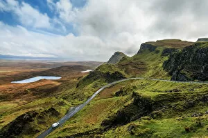
Quiraing PassA vehicle heads up the pass leading through the Quiraing. The Quiraing is a landslip on the Isle of Skye, Scotland. Its unique geological shape makes it a popular destination for artists
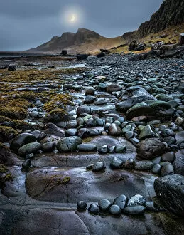
Moonrise Over Garrafad - Staffin Island Slipway UKThe moon rises over the rocky and stormy coast of Garrafad, Isle of Skye, Scotland. Near Staffin Island Slipway. United Kingdom
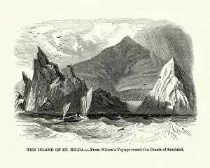
Island of St Kilda, Scotland, 19th CenturyVintage engraving of the Island of St Kilda, Scotland, 19th Century. St Kilda contains the westernmost islands of the Outer Hebrides of Scotland
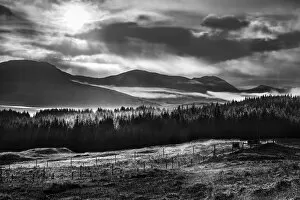
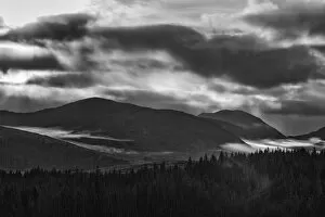
Scottish Highlands in Black in White #2Dramatic weather with atmospheric clouds over the mountainous Scottish landscape. Rain pours down over a Mountain range and rolling fields of heather in the Scottish Highlands between Glasgow
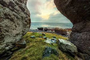
An Corran Beach Coast #1The lush rocky coast of An Corran Beach, Garrafad, Scotland, United Kingdom
scottish highland glowDramatic weather with atmospheric clouds over the mountainous Scottish landscape. Sun shines down over a Mountain range and rolling fields of heather in the Scottish Highlands between Glasgow
Scottish Highlands in Black in White #1Dramatic weather with atmospheric clouds over the mountainous Scottish landscape. Rain pours down over a Mountain range and rolling fields of heather in the Scottish Highlands between Glasgow
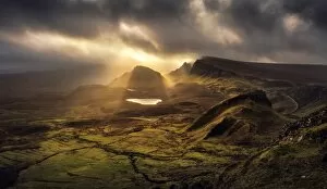
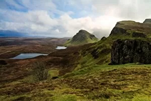
The Quiraing - Trotternish Ridge Light - Scotland #3Also referred to as The Quiraing or Cuith-Raing is a landslip on the eastern face of Meall na Suiramach, the northernmost summit of the Trotternish or Trndairnis (Scottish Gaelic)
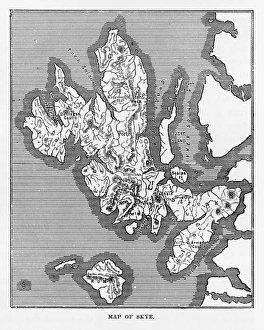
Map of the Isle of Skye, Scotland Victorian Engraving, 1840Very Rare, Beautifully Illustrated Antique Engraving of Map of the Isle of Skye, Scotland Victorian Engraving, 1840. Source: Original edition from my own archives
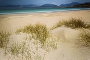
All to my selfBeautiful pristine beach on the isle Harris, the outer Hebrides Scotland
The Quiraing - Trotternish Ridge Light - ScotlandAlso referred to as The Quiraing or Cuith-Raing is a landslip on the eastern face of Meall na Suiramach, the northernmost summit of the Trotternish or Trndairnis (Scottish Gaelic)
Scottish Highlands in Black in White #3Dramatic weather with atmospheric clouds over the mountainous Scottish landscape. Rain pours down over a Mountain range and rolling fields of heather in the Scottish Highlands between Glasgow
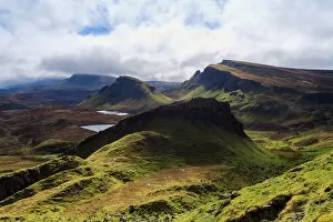
Quiraing LightSoft light wrapping around the unusual shapes of the Quiraing. The Quiraing is a landslip on the Isle of Skye, Scotland. Its unique geological shape makes it a popular destination for artists
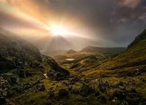
Skye dramaDramatic light brings out the textures of the Quiraing range.The Quiraing is a landslip on the Isle of Skye, Scotland. Its unique geological shape makes it a popular destination for artists
Dramatic sunset with atmospheric clouds over the mountainous Scottish landscapeBeautiful sunlight shines over a Mountain range and rolling fields of heather in the Scottish Highlands between Glasgow and Glencoe
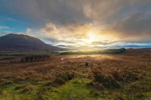
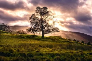
Killiecrankie Golden HourDecember brings a perpetual golden houra with the sun hanging low in the Winter Solstice sky. Lined with imperial forests, lush heather hillsides
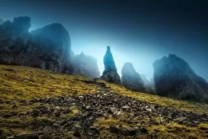
Quiraings NeedleThe Quirainga also referred to as Cuith-Raingaa is a landslip on the eastern face of Meall na Suiramach, the northernmost summit of the Trotternish or Trndairnis (Scottish Gaelic)