mail_outline sales@mediastorehouse.com
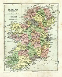
Antique map of Ireland, 1864
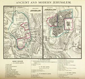
Ancient and Modern Jerusalem Map EngravingEngraved illustration of Ancient and Modern Jerusalem Map Engraving from The Popular Pictorial Bible, Containing the Old and New Testaments, Published in 1862. Copyright has expired on this artwork
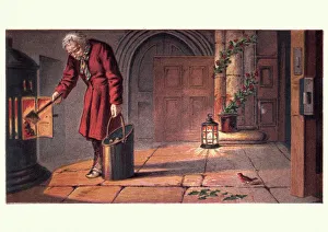
Victorian church warden lighting fire on Christmas EveVintage engraving of from the childrens story of The Robins Christmas Eve, 19th Century
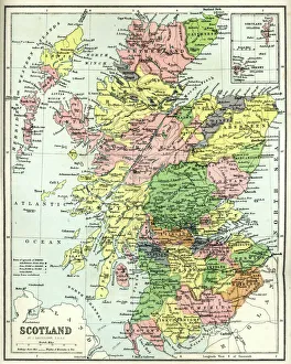
Antique map of Scotland, 1864
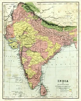
Antique map of India, 1864
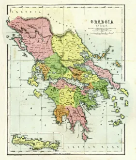
Antique map of Ancient Greece, 1864
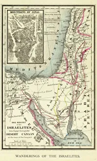
Wanderings of the Israelites Map EngravingEngraved illustration of Wanderings of the Israelites Map Engraving from The Popular Pictorial Bible, Containing the Old and New Testaments, Published in 1862. Copyright has expired on this artwork
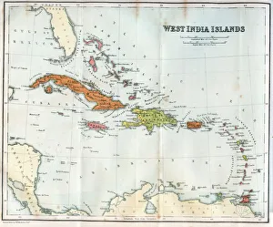
Vintage map of the West India Islands 1860s
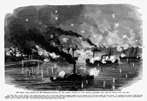
Naval Battle on the Mississippi, 1861 Civil War EngravingEngraving of the great Naval battle on the Mississippi, passage of the Second Division of the Federal Squadron past St. Philip, April 24, 1862
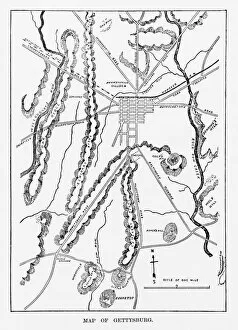
Battle of Gettysburg Map, July 3, 1863 Civil War EngravingEngraving of the Map of the Battle of Gettysburgs, Pennsylvania, July 3, 1863 Civil War Engraving from Famous Leaders and Battle Scenes of the Civil War, Published in 1864
Great Eastern Railway Single Express Locomotive, 1862Vintage engraving of a Great Eastern Railway Single Express Locomotive, 1862
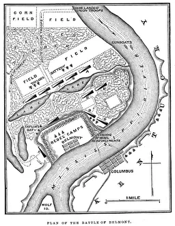
Battle of BelmontVintage engraving from 1863 of a map of the Battle of Belmont which was fought on November 7, 1861, in Mississippi County, Missouri. It was the first combat test in the American Civil War for Brig
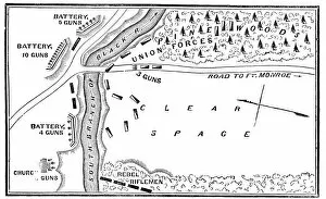
Battle of Big BethelVintage engraving from 1863 of a map of the Battle of Big Bethel also known as the Battle of Bethel Church or Great Bethel was an American Civil War battle that took place on June 10, 1861
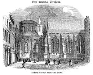
Temple Church, London, from the south (Victorian woodcut)The Temple Church, London, seen from the south. Woodcut from "Pleasant Hours: A Monthly Journal of Home Reading and Sunday Teaching; Volume III" published by the Church of England's
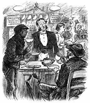
Customers in a Victorian hostelryCustomers taking tea in a Victorian hotel or pub. A waiter and waitress are serving and someone is reading a copy of " Punch"
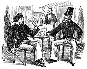
Frenchmen at a 19th century cafeTwo men having drinks, smoking and chatting at a 19th century French cafe. From a bound volume of copies of " Punch Almanack" for 1865-79
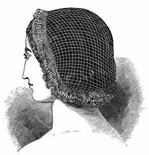
Bordered Net for Sleeping in, 19th centuryA Bordered Net for Sleeping in
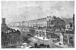
High Level Road, Hatton Garden, LondonVintage engraving showing high level road from St Sepulchres Church to Hatton Garden, Holborn, London, 1861
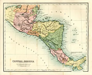
Antique map - Central AmericaAntique map of Central America, 1864
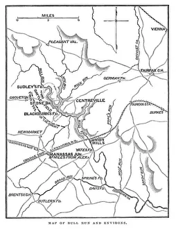
Battle of Bull RunVintage engraving from 1863 of a map of Bull Run and its environs at the time of the American Civil War. The First Battle of Bull Run
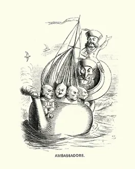
Victorian satirical cartoon about western ambassadors to China, 1869Vintage engraving of a Victorian satirical cartoon about western ambassadors to China, Punch, 1869
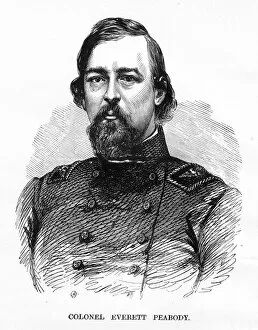
Colonel Everett Peabody Civil War EngravingEngraving of Battle of Colonel Everett Peabody Civil War Engraving from Famous Leaders and Battle Scenes of the Civil War, Published in 1864. Copyright has expired on this artwork. Digitally restored
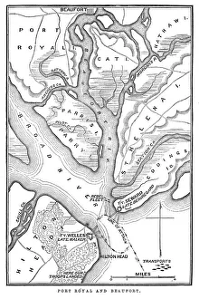
Battle of Port RoyalVintage engraving from 1863 of a map of the Battle of Port Royal which was one of the earliest amphibious operations of the American Civil War
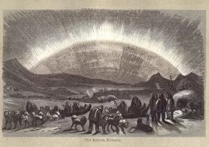
Aurora Borealis in the 19th CenturyVintage engraving of the Aurora Borealis in the 19th Century, 1860. In northern latitudes, the effect is known as the aurora borealis (or the northern lights), named after the Roman goddess of dawn
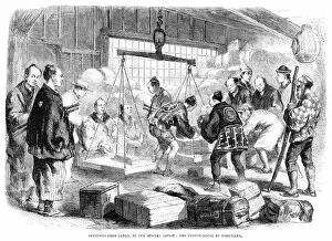
Custom House at YokohamaVintage engraving showing the Custom House at Yokohama, Japan, 1861
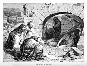
Job and His Affliction Map EngravingEngraved illustration of Job and His Affliction Map Engraving from The Popular Pictorial Bible, Containing the Old and New Testaments, Published in 1862. Copyright has expired on this artwork
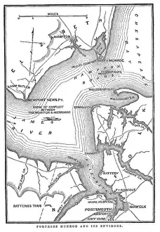
Fort Monroe and its environsVintage engraving from 1863 of a map of Fort Monroe and its environs. Fort Monroe played an important role in the American Civil War
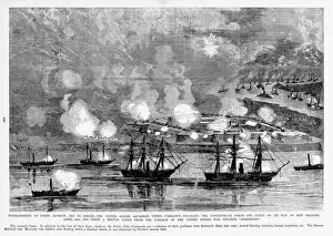
Bombardment of Forts Jackson, St. Philip, 1865 Civil War EngravingEngraving of the bombardment of Forts Jackson and St. Philip, the United States Squadron under Farragut, engaging the Confederate Forts and Fleet on its way to New Orleans, April 24, 1862
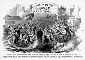
Demand of Surrender of New Orleans, 1862 Civil War EngravingEngraving of the Landing of Captain Bailey and Lieutenant Perkins on the Levee, New Orleans, with flag of truce to demand the surrender of the city to the Federal Government
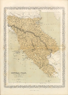
Victorian Map of Central Italy, Circa 1865Extremely Rare, Beautifully Illustrated Antique Victorian Engraved Illustration of the map of Central Italy including Tuscany, Parma and Modena from Liberators of Italy
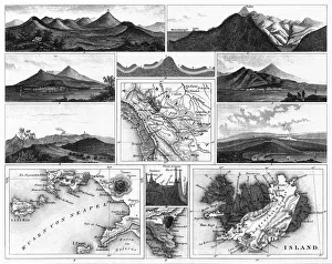
Volcanoes and Volcanic Formations and Stratification EngravingEngraved Illustrations of Volcanoes and Volcanic Formations and Stratification from Iconographic Encyclopedia of Science, Literature and Art, Published in 1851. Copyright has expired on this artwork
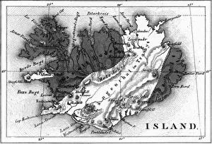
Map of Volcanic Chart of Iceland EngravingEngraved Illustrations of Volcanoes and Volcanic Formations and Stratification and the Map of Volcanic Chart of Iceland from Iconographic Encyclopedia of Science, Literature and Art
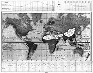
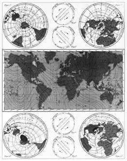
Historical Rainfall and Temperature Charts EngravingEngraved Illustrations of Historical Rainfall and Temperature Map; Temperature Charts of the World from Iconographic Encyclopedia of Science, Literature and Art, Published in 1851
Climate and Weather Charts EngravingEngraved Illustrations of Climate and Weather Charts of the World from Iconographic Encyclopedia of Science, Literature and Art, Published in 1851. Copyright has expired on this artwork
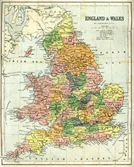
Antique map of England and Wales, 1864
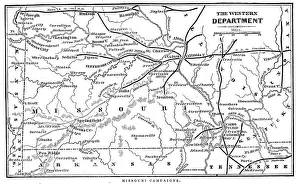
Missouri CampaignsVintage engraving from 1863 of a map of the Missouri Campaigns from the time of the American Civil War
Ship WreakVintage engraving from 1898 showing people shooting rocket toward Ship Wreak
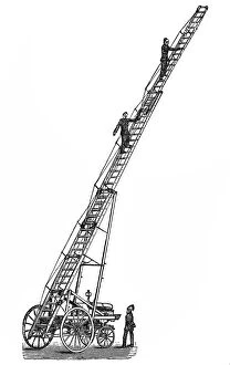
Fire Escape LadderVintage engraving of a Fire Escape Ladder
Portrait of the Young St George