mail_outline sales@mediastorehouse.com
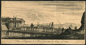
Nancy in france (XXXL)Gravure de la porte st Jean de Nancy ( Vue par dehors ) en France around 1670 -1700
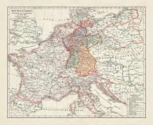
Map of Europe at the Napoleonic Wars of Liberty (1813)Map of Central Europe at the beginning of the Napoleonic Wars of Liberty in 1813. Lithograph, published in 1897
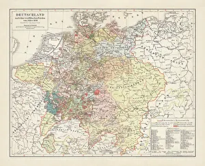
Map of Germany, after the Peace of Westphalia in 1648. Lithograph, published in 1897
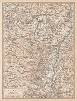
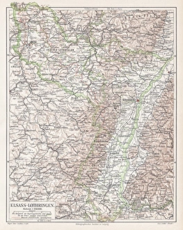
Map of Alsace-Lorraine, lithograph, published in 1875Ancient map of Alsace-Lorraine (German: Elsass-Lothringen). Lithograph, published in 1875
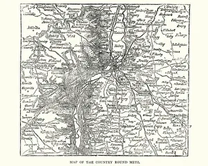
Map of the country around Metz, France, 1870Vintage engraving of a Map of the country around Metz, France, 1870
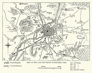
Franco Prussian War - Plan of Metz and French campVintage engraving of a scene fro the Franco Prussian War. Plan of Metz and French entrenched camp
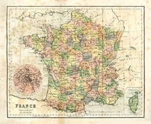
Antique map of France from 1864
Alsace-Lorraine map 1895Meyers Konversations-Lexikon. Ein Nachschlagewerk des allgemeinen Wissens, 5th edition 17 volumes Bibliographisches Institut - Leipzig 1895-1897
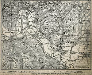
Battle of the ArdennesAntique illustration of a battle of Ardennes map
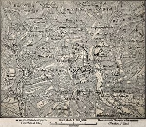
Battle of Worth mapAntique illustration of a battle of Worth map, also known as the Battle of Reichshoffe or as the Battle of FrA'schwiller
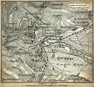
Battle of Wissembourg or Battle of Weissenburg mapAntique illustration of a Battle of Wissembourg or Battle of Weissenburg map
Place Stanislas a Arc HA rAThe arc Hera is located on the north side of the Place Stanislas, at the northern end of the Hera street and at the southern end of the Place de la CarriAšre
Place Stanislas a Fountain of Neptune