mail_outline sales@mediastorehouse.com
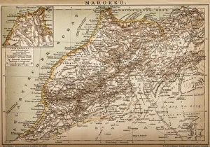
Map of Morocco
Antique illustration of Johann Sebastian Bach
Twin red haired girls bobbing for apples at party. (Photo by HUNITED STATES - CIRCA 1950s: Twin red haired girls bobbing for apples at party
Father loading apples into trunk of car at country market, son and daughter lookingUNITED STATES - CIRCA 1950s: Father loading apples into trunk of car at country market, son and daughter looking on, holding pumpkins
Man And Two Women Wearing Wool Hats And Winter Clothing Tobogganing In Snow With TreeUNITED STATES - Circa 1930s: Man And Two Women Wearing Wool Hats And Winter Clothing Tobogganing In Snow With Tree Line In Background Front View Of Smiling Faces Fun
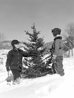
Two Boys Chopping Down Christmas Tree In Snow OutdoorUNITED STATES - Circa 1950s: Two Boys Chopping Down Christmas Tree In Snow Outdoor
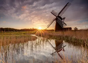
Herringfleet Windmill, Suffolk, UK. May 04, 2015. Scene shows the reflection of a windmill in a dyke or ditch at Herringfleet, Suffolk, UK
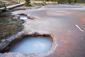
day, geology, hot spring, landscape, nature, non urban scene, outdoors, place of interestday, geology, hot spring, landscape, nature, non urban scene, outdoors, Gallo Landscapes, 106676812
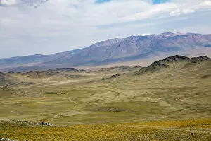
River valley, Gashuun Suhayt, Bayan Logia Province, MongoliaKhovd is one of the 21 aimags (provinces) of Mongolia, located in the west of the country. Its capital is also named Khovd
Landscape and topography of region, near Tolbo village, Khara Khoto, Bayan-olgii Province, MongoliaBayan-Olgii) is the westernmost of the 21 aimags (provinces) of Mongolia. The countrys only Muslim and Kazakh-majority aimag, it was established in Aug, 1940. Its capital is Olgii
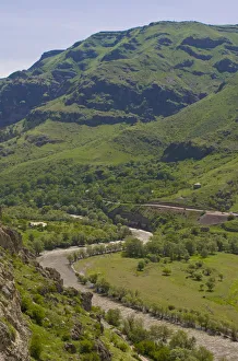
Kazbegi Mountain range, border between Georgia and Russia, Stepantsminda, Mtskheta, GeorgiaStepantsminda is a small town in the Mtskheta-Mtianeti region of north-eastern Georgia. Historically and ethnographically, the town is part of the Khevi province
River valley, Gashuun Suhayt, Khovd Province, MongoliaKhovd is one of the 21 aimags (provinces) of Mongolia, located in the west of the country. Its capital is also named Khovd
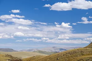
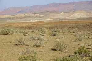
High desert valley, Altan Hokhii, Khovd Province, MongoliaKhovd is one of the 21 aimags (provinces) of Mongolia, located in the west of the country. Its capital is also named Khovd
Valley of Mtkvari (Kura) landscape, Georgian geology, a valley or dale is a depression that is longer than it is wide. The terms U-shaped and V-shaped are descriptive terms of geography to characterize the form of valleys
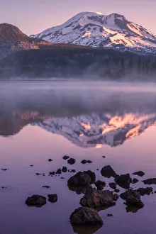
Mount Bachelor by lake in fog, Sparks Lake, Oregon, USASparks Lake is a natural body of water near the crest of the central Cascade Range in Deschutes County in the U.S. state of Oregon
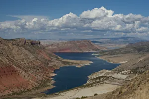
Landscape with mountains and winding river in Flaming Gorge National Recreation Area, Sheep creek canyon, Utah, USAFlaming Gorge National Recreation Area is a United States National Recreation Area located in the states of Wyoming and Utah
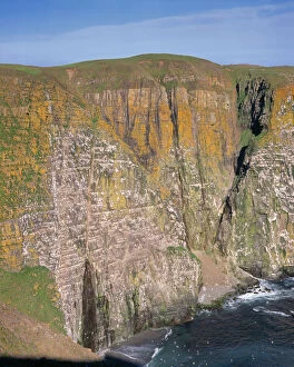
Lichen colored cliffs, Cape Saint Marys Ecological Reserve, Newfoundland, CanadaIn geography and geology, a cliff is a vertical, or near vertical, rock exposure. Cliffs are formed as erosion landforms due to the processes of erosion and weathering that produce them
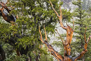
Bristlecone pine tree, Great Basin National Park, Nevada, USAGreat Basin National Park is a United States National Park located in White Pine County in east-central Nevada, near the Utah border. The park was established in 1986
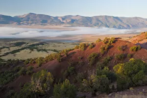
Morning fog over Browns Park, Utah, USABrowns Park is an isolated mountain valley along the Green River in Moffat County, Colorado and Daggett County, Utah in the United States
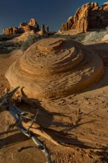
Landscape with eroded sandstones, Utah, USASandstone is a clastic sedimentary rock composed mainly of sand-sized minerals or rock grains. Like sand, sandstone may be any color, but the most common colors are tan, brown, yellow, red, grey
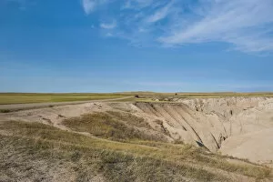
Landscape on sunny day, Badlands National Park, South Dakota, USABadlands National Park is a national park in southwestern South Dakota that protects 242, 756 acres of sharply eroded buttes, pinnacles
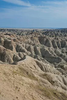
Eroded landscape in Badlands National Park, South Dakota, USABadlands National Park is a national park in southwestern South Dakota that protects 242, 756 acres of sharply eroded buttes, pinnacles
Eroded rock formations at sunset in Arches National Park with clouds, Utah, USAArches National Park is a US National Park in eastern Utah. The park is located on the Colorado River 4 miles (6 km) north of Moab, Utah
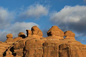
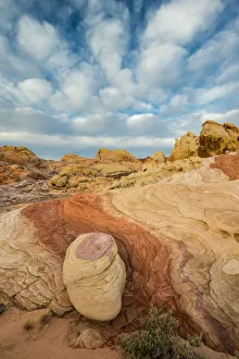
Sunset on Balancing Rock with clouds in background, Valley of Fire State Park, Nevada, USAValley of Fire State Park is the oldest state park in Nevada, USA and was designated as a National Natural Landmark in 1968. It covers an area of 42, 059 acres (17, 021 ha) and was dedicated in 1935
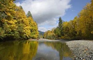
Robertson River leading into Cowichan Lake in fall, Cowichan Valley, Vancouver Island, British Columbia, CanadaCowichan Lake is a large freshwater lake located on southern Vancouver Island, British Columbia, Canada. It is located along the Cowichan Valley in the Cowichan Valley Regional District
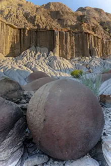
Large Concretion and Erosion formations, Theodore Roosevelt National Park North Unit, North Dakota, USATheodore Roosevelt National Park is a United States National Park comprising three geographically separated areas of badlands in western North Dakota. The park was named for U.S
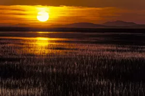
Goose Lake at sunset, Stillwater National Wildlife Refuge, Nevada, USAStillwater National Wildlife Refuge is a National Wildlife Refuge of the United States in Nevada. It is located in the Lahontan Valley, near the community of Fallon, sixty miles east of Reno
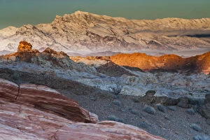
Snow covered mountains and different geological layers of rock, Valley of Fire State Park, Nevada, USAValley of Fire State Park is the oldest state park in Nevada, USA and was designated as a National Natural Landmark in 1968. It covers an area of 42, 059 acres (17, 021 ha) and was dedicated in 1935
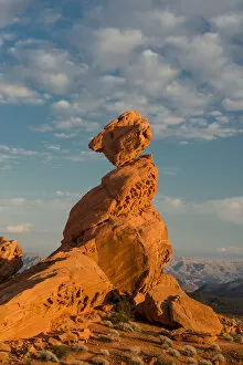
Early morning clouds and colorful rock formations, Valley of Fire State Park, Nevada, USAValley of Fire State Park is the oldest state park in Nevada, USA and was designated as a National Natural Landmark in 1968. It covers an area of 42, 059 acres (17, 021 ha) and was dedicated in 1935
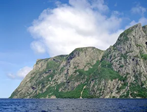
Billion year old rock of Long Range Mountains form steep cliffs above Western Brook Pond, Gros Morne National ParkGros Morne National Park is a world heritage site located on the west coast of Newfoundland. At 1, 805 km2 it is the second largest national park in Atlantic Canada; it is surpassed by Torngat
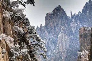
Majestic Mountain range, Yellow Mountains, ChinaA mountain is a large landform that stretches above the surrounding land in a limited area, usually in the form of a peak. A mountain is generally steeper than a hill
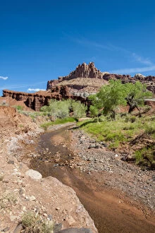
Fremont River near Fruita, Capitol Reef National Park, Utah, USA
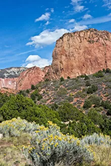
Kolob Canyon, Zion National Park, Utah, USANorth America, USA, Utah, Kolb Canyon, Zion National Park
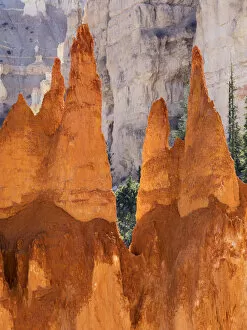
Bryce Canyon and Hoodoos along Peekaboo Loop Trail, Bryce Canyon National Park, Utah, USAUtah, Bryce Canyon National Park, Bryce Canyon and Hoodoos along Peekaboo Loop Trail
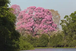
Pink Ipe tree (Handroanthus impetiginosus) by Pixiam River in Pantanal, Mato Grosso, BrazilSouth America, Brazil, Mato Grosso, The Pantanal, Pixiam River, pink ipe tree (Tabebuia impetignosa). Pink ipe trees along the Pixiam River
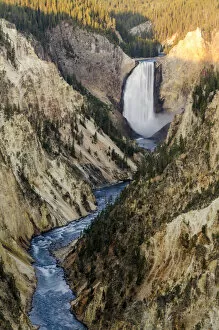
Lower Falls in Yellowstone National Park, Wyoming, USALower Falls, Yellowstone National Park, Wyoming, USA
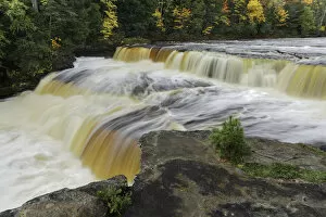
Tahquamenon Falls, Tahquamenon Falls State Park, Whitefish, Upper Peninsula, Michigan, USAThe Tahquamenon Falls State Park is a 186.88 km2 state park in the U.S. state of Michigan. It is the second largest of Michigans state parks
Ferns on shoreline of Tahquamenon River at sunrise, Paradise, Michigan, USAThe Tahquamenon River is an 143.4 km blackwater river in the U.S. state of Michigan that flows in a generally eastward direction through the eastern end of the Upper Peninsula
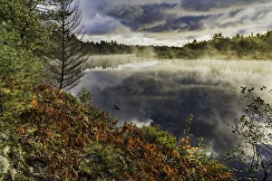
Autumn colors and mist reflecting on Council Lake at sunrise, Hiawatha National Forest, Michigan, USAHiawatha National Forest is a 362, 127 ha National Forest in the Upper Peninsula of the state of Michigan in the United States
Ancient camel thorn trees (Vachellia erioloba) in fog in Dead Vlei, Sossusvlei, Namib-Naukluft National ParkVachellia erioloba (camel thorn, giraffe thorn is a tree of southern Africa in the family Fabaceae. Its preferred habitat is the deep dry sandy soils in parts of South Africa, Botswana)
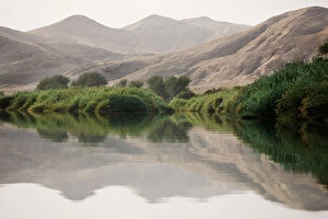
Greenery along banks of Kunene River, Kaokoveld Conservation Area, Northwestern Namibia, NamibiaThe Cunene River (Portuguese spelling) or Kunene River (Namibian spelling) is a river in Southern Africa. It flows from the Angola highlands south to the border with Namibia
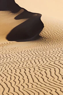
Patterns in sand, Sossusvlei, Namib-Naukluft National Park, Namib Desert, NamibiaSossusvlei (sometimes written Sossus Vlei) is a salt and clay pan surrounded by high red dunes, located in the southern part of the Namib Desert, in the Namib Naukluft National Park of Namibia
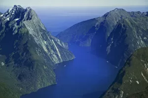
Aerial view of Milford Sound, New Zealands South IslandMilford Sound - Piopiotahi is a fiord in the south west of New Zealands South Island, within Fiordland National Park, Piopiotahi (Milford Sound) Marine Reserve
High angle view of Lake Magadi at sunset from the crater rim, Ngorongoro Crater, Ngorongoro Crater Conservation AreaNgorongoro Crater is an ancient volcanic caldera that is one of Africas most magnificent wildlife viewing areas and is part of the larger Ngorongoro Crater Conservation Area in the Arusha Region of