mail_outline sales@mediastorehouse.com
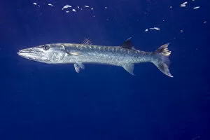
Great Barracuda -Sphyraena barracuda-, Palau
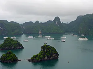
Halong Bay - VietnamA view of the famous Halong bay from Sung Son cave in north vietnam. IT is a UNESCO World Heritage Site
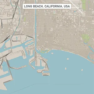
Long Beach California US City Street MapVector Illustration of a City Street Map of Long Beach, California, USA. Scale 1:60, 000. All source data is in the public domain. U.S
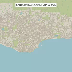
Santa Barbara California US City Street MapVector Illustration of a City Street Map of Santa Barbara, California, USA. Scale 1:60, 000. All source data is in the public domain. U.S
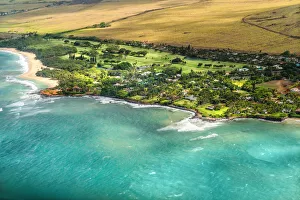
Maui Aerial View #3A wonderful aerial view of the Maui - Hawaii coastline as scene from a small airplane flying at low altitude. The beautiful lush landscape contrasts the scenic beaches and wonderful turquoise waters
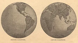
Old, Map of Eastern and Western Hemispheres, From 1875Old black and white illustration of the Eastern Hemisphere and the Western Hemisphere, from the 1800 s
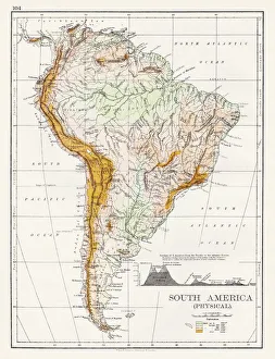
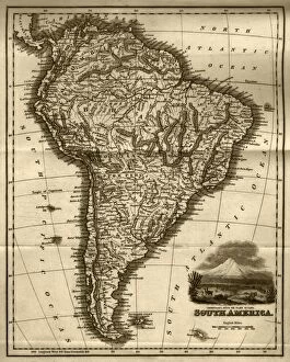
South America Physical map 1897The World-Wide Atlas of Modern Geography, Political and Physical W. & A.K. Johnston - London 1897
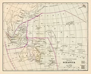
Antique Map of OceaniaVintage map of North Oceania, from 1894
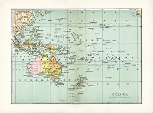
Oceania Australia map 1881Coltons Common School Geography 1881 New York Sheldon and Co
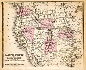
Map of Pacific states USA 1883Warrens Common School Geography
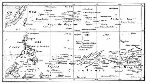
Antique illustration of Pacific Ocean Islands map
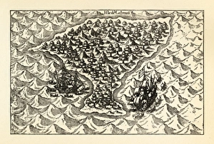
Engraving of Van Noort Sailing the Marianne Islands, 1600Very Rare, Beautifully Illustrated Antique Engraved Victorian Illustration of Historical Engraving of Van Noort Sailing the Marianne Islands, 1600. Copyright has expired on this artwork
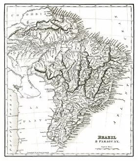
Map of Brazil and Paraguay (early 19th century steel engraving)A steel engraving of a map from the early 19th century of Brazil and Paraguay in South America, from A System of Geography, Popular and Scientific, or A Physical, Political
Map of South America (early 19th century steel engraving)A steel engraving of a map from the early 19th century of Brazil and Paraguay in South America, from A System of Geography, Popular and Scientific, or A Physical, Political
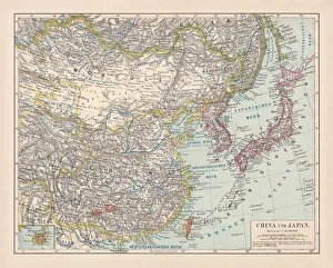
China and Japan, lithograph, published in 1881Antique map of China and Japan. Lithograph, published in 1881
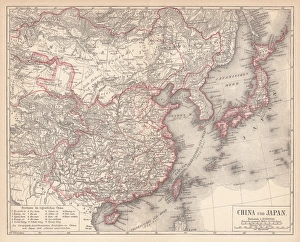
Map of China and Japan, lithograph, published in 1875Map of China and Japan. Lithograph, published in 1875
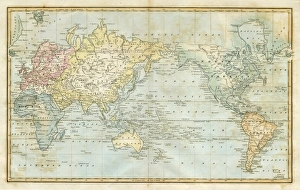
map of the world 1823map of the world - 1823 very detailed lithography
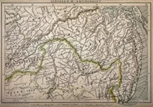
Siberia map, the Amur regionIllustration of a Siberia map, the Amur region
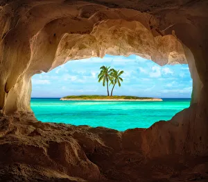
Paradise in the CaribbeanAn old Indian cave located on a remote Caribbean Island. Beautiful Caribbean sea glowing and warm sunlight bathing some remote coconut palm trees on a deserted island
Map of China and northeastern Asia
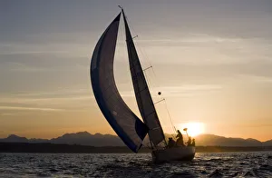
Sailboat at Sunset, Seattle, WashingtonUSA, Washington, Seattle, Setting sun lights yacht sailing in Elliot Bay on spring evening
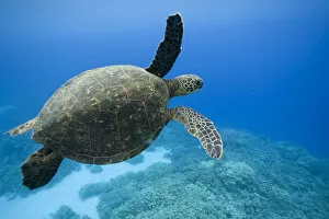
Green Sea Turtle, HawaiiUSA, Hawaii, Big Island, Underwater view of Green Sea Turtle (Chelonia mydas) swimming
Cannon beach Oregon at sunriseBeach front living on Cannon Beach Oregon at sunrise during low tide
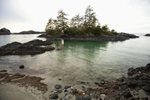
Ucluth Beach In The Wya Point Campground Near Ucluelet On Vancouver IslandBritish Columbia, Canada
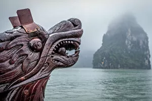
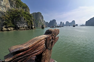
Dragon head at bow of boat - Halong Bay, VietnamThe dragon head bow of a tourist ferry boat appears beside a karst outcrop in Halong Bay, Vietnam
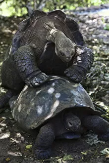
The Giant TortoiseThe Galapagos tortoise are the largest living species of tortoise. Modern Galapagos tortoises can weigh up to 417 kg (919 lb)
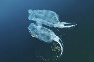
Two Bakers cyclosalps -Cyclosalpa bakeri-, Japan Sea, Primorsky Krai, Russian Federation
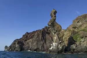
Praying Monk rock formation at the lava coast, San Salvador Island, Galapagos Islands, Ecuador
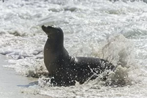
Galapagos Sea Lion -Zalophus wollebaeki- in the surf, San Cristobal Island, Galapagos Islands, Ecuador
Palm tree at sunset, Kauai, Hawaii, United States
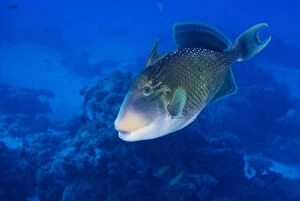
Yellowmargin Triggerfish -Pseudobalistes flavimarginatus-, Palau
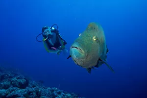
Diver and Humphead wrasse -Cheilinus undulatus-, Palau
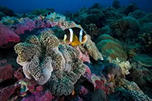
Clarks anemonefish -Amphiprion clarkii-, Palau
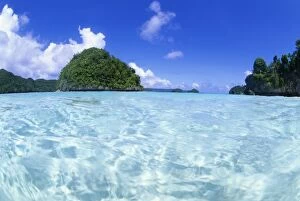
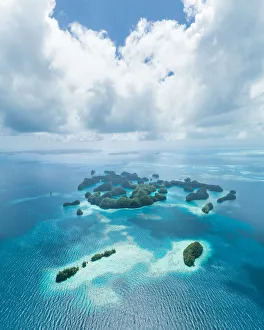
Rock Islands, Palau, Micronesia
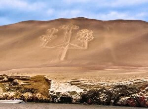
The Paracas Candelabra
Dragon on a junk, Halong Bay, Vietnam, Southeast Asia
Cruise ships in Halong Bay, VietnamA mix of steamship and junk-style cruise ships crowds around Titop Island in Halong Bay, Vietnam
Aerial view of tropical paradise islands, PalauHelicopter flight over tropical rock islands with coral reef, 70 Islands of Palau (UNESCO World Natural Heritage site)
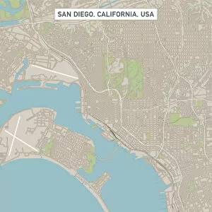
San DiegoCaliforniaUSCityStreetMap_60000Vector Illustration of a City Street Map of San Diego, California, USA. Scale 1:60, 000. All source data is in the public domain. U.S
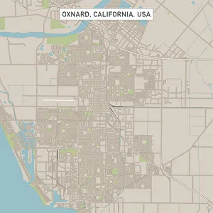
Oxnard California US City Street MapVector Illustration of a City Street Map of Oxnard, California, USA. Scale 1:60, 000. All source data is in the public domain. U.S
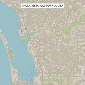
Chula Vista California US City Street MapVector Illustration of a City Street Map of Chula Vista, California, USA. Scale 1:60, 000. All source data is in the public domain. U.S
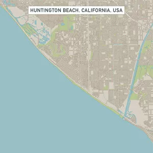
Huntington Beach California US City Street MapVector Illustration of a City Street Map of Huntington Beach, California, USA. Scale 1:60, 000. All source data is in the public domain. U.S
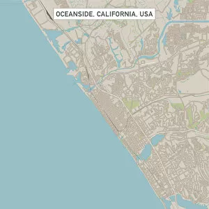
Oceanside California US City Street MapVector Illustration of a City Street Map of Oceanside, California, USA. Scale 1:60, 000. All source data is in the public domain. U.S
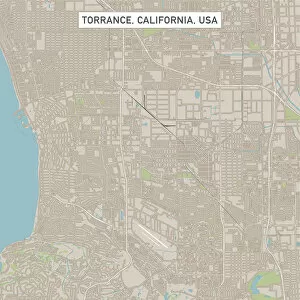
Torrance California US City Street MapVector Illustration of a City Street Map of Torrance, California, USA. Scale 1:60, 000. All source data is in the public domain. U.S
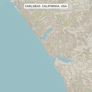
Carlsbad California US City Street MapVector Illustration of a City Street Map of Carlsbad, California, USA. Scale 1:60, 000. All source data is in the public domain. U.S
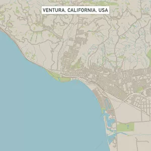
Ventura California US City Street MapVector Illustration of a City Street Map of Ventura, California, USA. Scale 1:60, 000. All source data is in the public domain. U.S
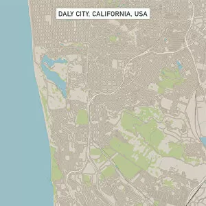
Daly City California US City Street MapVector Illustration of a City Street Map of Daly City, California, USA. Scale 1:60, 000. All source data is in the public domain. U.S
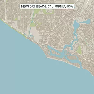
Newport Beach California US City Street MapVector Illustration of a City Street Map of Newport Beach, California, USA. Scale 1:60, 000. All source data is in the public domain. U.S