mail_outline sales@mediastorehouse.com
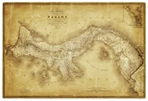
Map of Panama 1864Map of Panama - combined with 2 different texture overlays
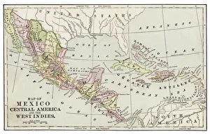
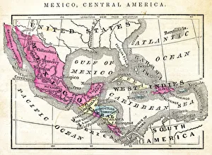
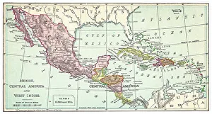
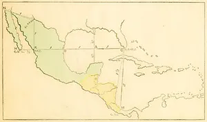
Map of Mexico and Central America 1889Indiana Educational Series The Complete Geography - Indianapolis 1889
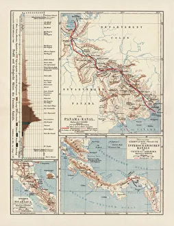
Panama Canal Project, lithograph, published in 1880Ancient map of the Panama Canal Project. Lithograph, published in 1880
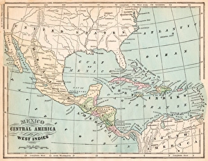
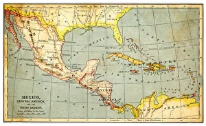
Mexico and West indies map 1875The Independent Course Comprehensive Geography by James Monteith, A.S. Barnes & Co, New York & Chicago 1875
Traditional colorful hand stitched Kuna Indian molaThe mola forms part of the traditional costume of a Kuna woman, two mola panels being incorporated as front and back panels in a blouse
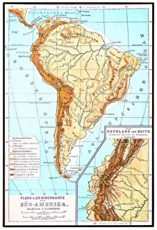
South America, river and mountains mapIllustrator of a South America, river and mountains map
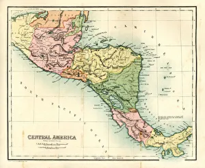
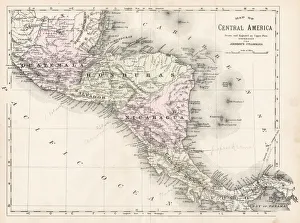
Antique map - Central AmericaAntique map of Central America, 1864
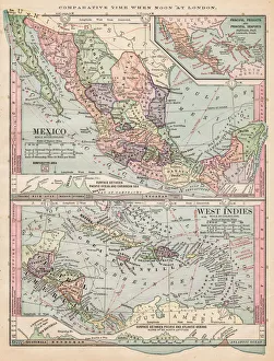
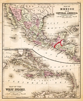
Map of Mexico and West Indies 1889Comprehensive Geography by James Monteith - American Book Company 1882, 1889
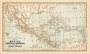
Map of Mexico Central America of 1877The Eclectic Elementary Geography by Wilson & Hinkle / Cincinnati -New York 1881
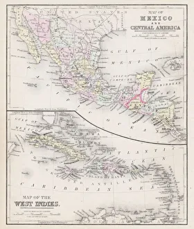
Map of Mexico and Central America 1871Colton and Fitchs Introductory School Geography - New York: Sheldon and Company 1871
Map of West Indies 1894Johnsons Universal Cyclopedia - Volume VIII New York - A. J. Johnson Company 1894
Map of Mexico and West indies 1883The Eclectic Elementary Geography by Van Antwerp, Bragg & C0 / Cincinnati -New York 1883
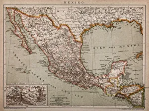
Map of MexicoAntique map of Mexico
Map of Mexico and West Indies 1895The Rand-McNally Grammar School Geography 1895 - Chicago & New York
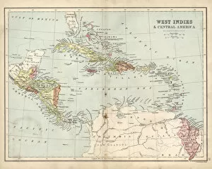
Map of Mexico, Central America and Caribbean
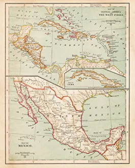
Antique Map of Central America and West IndesVintage map of Central America and West Indes, from 1894
Map of Mexico and West Indies 1877Warrens Common School Geography 1877
Antique map of West Indies and Central America, 19th Century, 1873
Central America map 1893Johnsonas Universal Cyclopedia - Charles Kendall - New York 1893
Map of Central America, 19th CenturyVintage engraving of a Map of Central America, 19th Century
Map of Mexico and West Indies 1883Warrens Common School Geography
Mexico and Central America map 1881Coltons Common School Geography 1881 New York Sheldon and Co
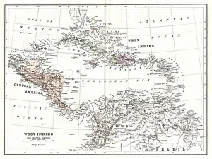
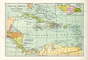
Central America and West Indies map 1875The Independent Course Comprehensive Geography by James Monteith, A.S. Barnes & Co, New York & Chicago 1875
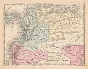
Colombia Ecuador Venezuela map 1867Mitchellas Modern Atlas - Published by E.H. Butler and Co - Philadelphia 1867
Epiphytes, bromilead and ferns, growing on tree in tropical rain forest. Parque Nacional Coiba, Isla Coiba, Panama. UNESCO World Heritage Site
Black spiny-tailed iguana, Ctenosaura similis. Brown coloration is from mud after recent rains. Parque Nacional Coiba, Panama. UNESCO World Heritage Site
Juvenile black hawk, Buteogallus anthracinus. Granito de Oro, Parque Nacional Coiba, Panama. UNESCO World Heritage Site
Flag of Panama
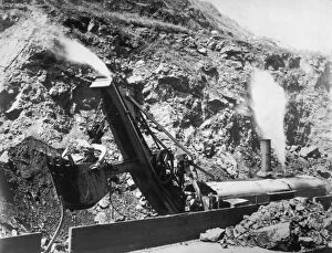
A Steam ShovelA steam shovel at work in the Bas Obispo Cut of the Panama Canal. (Photo by Topical Press Agency/Getty Images)
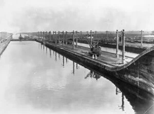
Panama Canal1st March 1927: Gatun Locks on the Panama Canal. (Photo by J. B. Helsby/Topical Press Agency/Getty Images)
Skyscrapers and Skyline of Panama CitySkyscrapers and skyline of Panama City, with estuary and bridge. Photograph taken from Panama Viejo (UNESCO World Heritage Site)
Cathedral Ruins, Panama ViejoRuined walls and cathedral tower at Panama Viejo UNESCO World Heritage Site
Bridge, Estuary, Forest, Skyscrapers, Panama CitySkyscrapers and skyline of Panama City, with estuary, bridge and national park coastal forest.Photograph taken from Panama Viejo (UNESCO World Heritage Site)
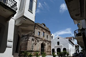
Panama CityThe ruins of ancient convent of the Society of Jesus in the historic district known as Casco Viejo or Casco Antiguo a World Heritage Site in Panama city