mail_outline sales@mediastorehouse.com
Mining Geological profiles lithograph 1895Encyclopedia Britannica 9th Edition Vol I New York, Samuel Hall 1878
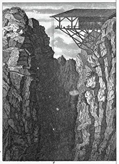
Persberg Mines, SwedenEngraved illustrations of Mining from Iconographic Encyclopedia of Science, Literature and Art, Published in 1851. Copyright has expired on this artwork. Digitally restored
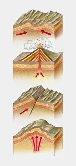
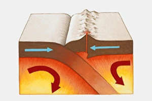
Cross section illustration of fold mountain, volcano, fault-block mountain, and dome mountain
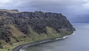
The Jurrasic Coast - Isle of SkyeA section of the Jurassic western coastline & cliffs on the Isle of Skye. This is Bearreraig Bay opposite the Old Man of Storr. The cliffs are famous for their fossils & dinosaur footprints
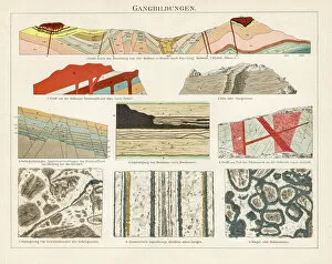
Special Geology EngravingEngraved Illustrations of Special Geology Engraving from Iconographic Encyclopedia of Science, Literature and Art, Published in 1851. Copyright has expired on this artwork. Digitally restored
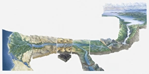
Illustration of Nile river from Lake Victoria to Nile Delta
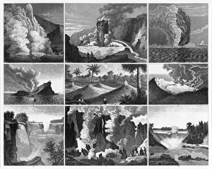
Volcanoes, Geysers and Water Falls EngravingEngraved Illustrations of Forests, Lakes, Caves and Unusual Rock Formations from Iconographic Encyclopedia of Science, Literature and Art, Published in 1851. Copyright has expired on this artwork
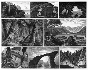
Forests, Lakes, Caves and Unusual Rock Formations EngravingEngraved Illustrations of Forests, Lakes, Caves and Unusual Rock Formations from Iconographic Encyclopedia of Science, Literature and Art, Published in 1851. Copyright has expired on this artwork
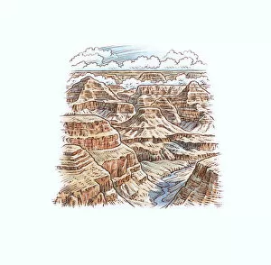
Architecture, Arizona, Awe, Beauty In Nature, Bizarre, Building Exterior, Cloud, Day, Geology, Grand Canyon, High Angle View, Horizon Over Land, Illustration and Painting, Illustrative Technique
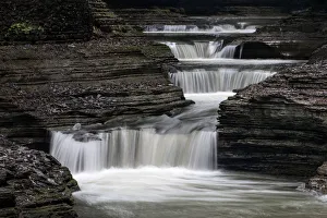
CascadesGlen Creek runs descends 400 feet past 200-foot cliffs, generating 19 waterfalls along its 2 mile course within Watkins Glen State Park, NY
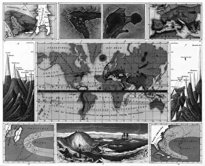
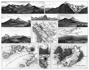
Volcanic and Hurricane Charts; Craters; and Antarctica EngravingEngraved Illustrations of Volcanic and Hurricane Charts; Craters; and Antarctica from Iconographic Encyclopedia of Science, Literature and Art, Published in 1851
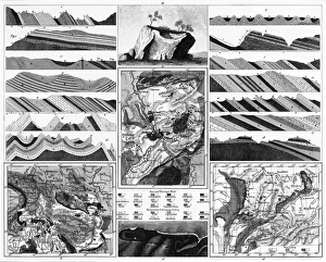
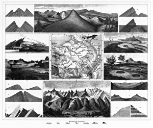
Stratification in Mountains and Basins; Fissures and Craters EngravingEngraved Illustrations of Stratification in Mountains and Basins; Fissures and Craters from Iconographic Encyclopedia of Science, Literature and Art, Published in 1851
Volcanoes and Volcanic Formations and Stratification EngravingEngraved Illustrations of Volcanoes and Volcanic Formations and Stratification from Iconographic Encyclopedia of Science, Literature and Art, Published in 1851. Copyright has expired on this artwork
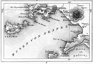
Map of Bay of Naples and Naples EngravingEngraved Illustrations of Volcanoes and Volcanic Formations and Stratification and the Map of Bay of Naples and Naples, Italy from Iconographic Encyclopedia of Science, Literature and Art
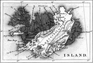
Map of Volcanic Chart of Iceland EngravingEngraved Illustrations of Volcanoes and Volcanic Formations and Stratification and the Map of Volcanic Chart of Iceland from Iconographic Encyclopedia of Science, Literature and Art
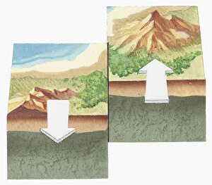
Digital illustration showing Himalayas and European Alps colliding and forced together to form mountain ranges
Digital illustration showing formation of oceanic crust with lava beneath Earths surface rising to form rocks, pushed sideways spreading ocean floor
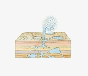
Illustration of a geyser in showing rock strata below
Digital illustration of underground gasification mixing coal with oxygen and steam while being heated and pressurized
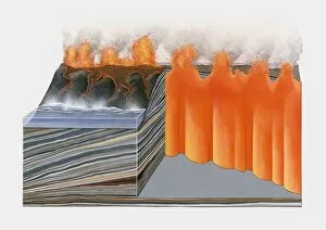
Cross section illustration of basaltic volcano
Illustration of geological periods, from Cambrian period to Quaternary period
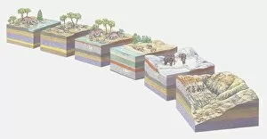
Illustration of the different stages of landform evolution and concurrent fossilization of a Triceratops dinosaur
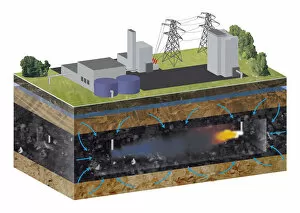
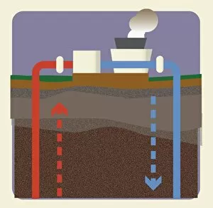
Digital illustration of geothermal energy power production from Earths resources
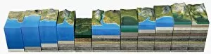
Illustration of layers of Earth showing age from devonian, carboniferous, permian, triassic, jurassic, and cretaceous
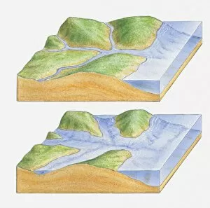
Illustration of river joining sea with level rising to form estuaries and lower river valleys known as rias
Cross section illustration showing two tectonic plates sliding past each other
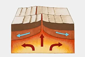
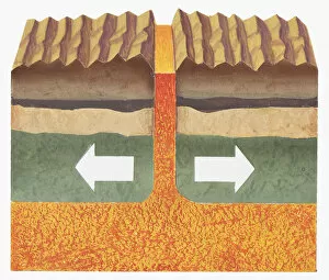
Cross section illustration showing the edges of two tectonic plates being pushed apart with magma beneath and between them
Cross section illustration of the Grand Canyon as it might have looked thousands of years ago when the river was just beginning to cut through the rock
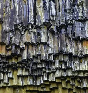
Svartifoss Geology - Basalt ColumnsThe basalt columns at Svartifoss are the inspiration of the design for the Icelandic National Theatre/Opera House in Reykjavik
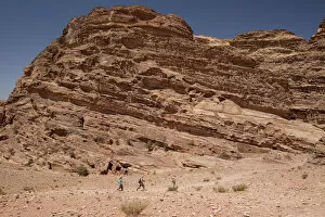
Hiking in PetraThree people hike through a remote part of Petra. The rock strata is visible
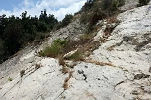
Mount Carmel, the limestone slopesThe limestone slopes of Mount Carmel next to Prophet Elijahs cave, Lower Haifa.In Jewish, Christian, and Islamic tradition
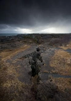
Tectonic PlatesPingvellir National PArk, Iceland. Here you see the split between the North America and Eurasia tectonic plates