mail_outline sales@mediastorehouse.com
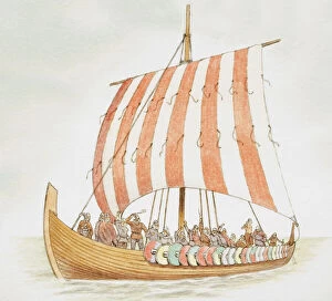
Viking longship carrying warriors
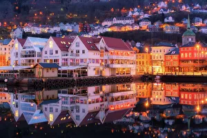
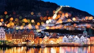
Bergen town centre at dawn, NorwayBergen is a city on Norwayas southwestern coast.The Bryggen district consists of the old wharf and its surrounding commercial buildings, and features vibrantly colored wooden houses
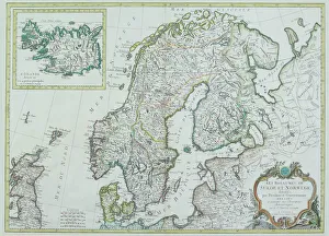
Map of Scandinavia
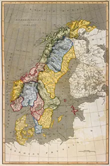
Sweden and Norway, lithograph, published in 1878Ancient map of Sweden and Norway. Lithograph, published in 1878
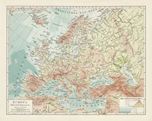
Topographic map of Europe, lithograph, published in 1897Topographic map of Europe. Lithograph, published in 1897
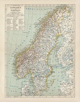
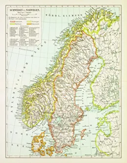
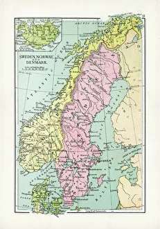
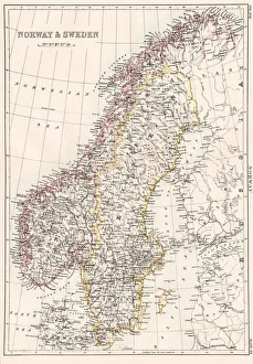
Map of Sweden and Norway 1897Map of Sweden and Norway
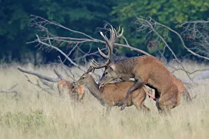
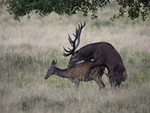
Red Deer -Cervus elaphus-, mating, Jaegersborg, Copenhagen, Denmark
Map of Norway and Sweden 1894Map of Norway and Sweden
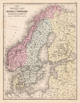
Antique Map of Sweden, Norway and DenmarkVintage map of Sweden, Norway and Denmark, from 1894
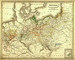
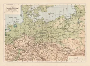
Antquie Map of PrussiaVintage map of Prussia from 1837
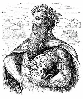
King Gambrinus, the King of BeerAntique illustration of a King Gambrinus, the King of Beer
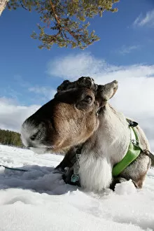
Domesticated reindeer (Rangifer tarandus), Salla, Lapland, Finland
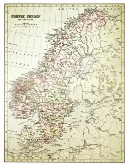
Norway and Sweden map 1884Encyclopedia Britannica 9th Edition New York Charles Scribners and Sonsl 1884 Vol XVII
Denmark Sweden Norway map 1867Mitchellas Modern Atlas - Published by E.H. Butler and Co - Philadelphia 1867
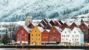
Hanseatic houses in Bryggen at winterBryggen, the old Hanseatic wharf of Bergen, which is on the UNESCO list of World Cultural Heritage Sites
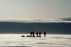
Cross-country skiers with pulkas on a glacier, backlit, Spitsbergen, Svalbard, Norway, Europe
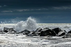
Waves charing on rocks, North Sea Coast, Holmes Country, Jutland, Denmark
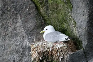
Black-legged kittiwake -Rissa tridactyla- on nest, bird cliffs, Ekkeroy, Varanger, Norway
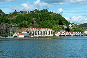
Townscape, Trellevika, Flekkefjord, Norway
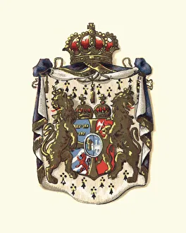
Coat of Arms of Sweden and Norway, 1898
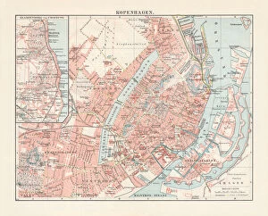
City map of Copenhagen, capital of Denmark, lithograph, published 1897City map of Copenhagen, capital city of Denmark. Lithograph, published in 1897
atmospheric, canyon, color image, condensation, copy space, day, gullfoss, haze, IcelandJohner Bildbyra AB +46 8 644 83 30 info@johner.se sales@johner.se
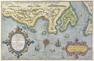
Dutch Trade Map of the Baltic SeaDutch Trade map of the Baltic Sea (hand-coloured engraving) During the last decades of the 16th century and throughout the 17th century Dutch merchants
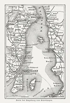
Map of Copenhagen and sourroundings, Denmark, wood engraving, published 1897Map of Copenhagen and sourroundings, Denmark. Wood engraving, published in 1897
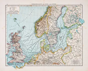
Map of North and East sea 1896Andres Allgemeiner Handatlas - Bielefeld und Leipzig 1896
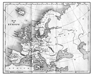
Vintage Map of Europe Mid 19th CenturyVinateg Map of Europe Mid 19th Century, circa 1850
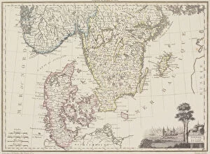
Map of Sweden with Denmark and Norway
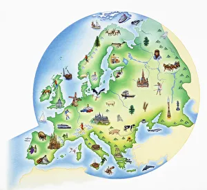
Map of Europe with illustrations of famous landmarks and items associated with various countries
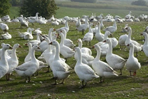
White geese in a goose farm, Skurup, Sweden
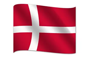
Flag of Denmark
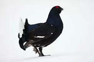
Black Grouse or Blackgame -Lyrurus tetrix, Tetrao tetrix-, Sweden, Scandinavia, Europe
Red Deer -Cervus elaphus-, couple mating, Copenhagen, Denmark
North German lowland map, 19th century view, lithograph, published 1884Old Topographic map of the North German lowland in German language. Lithograph, published in 1884
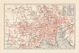
City map of Christiania (now Oslo), Norway, lithograph, published 1897City map of Christiania, now Oslo - capital of Norway. Lithograph, published in 1897
antique, archival, baltic, border, cartography, denmark, document, europe, european, finland, geography, historic, historical, latitude, longitude, map, nobody, north, norway, region, scale
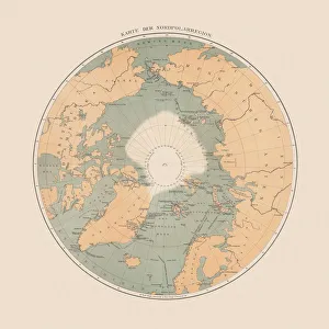
Ancient map of the Arctic Region, lithograph, published in 1883Ancient map of the Arctic Region. Lithograph, published in 1883
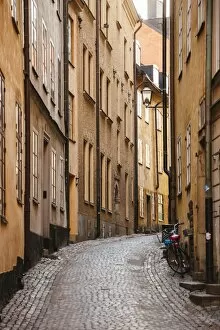
Narrow streets in Gamla Stan (Old Town) in Stockholm, Sweden
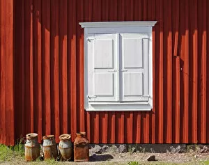
Gammelstad - the milkchurnsMilkchurns in front of a falun red house in Gammelstad, a church town near Lulea in the north of Sweden
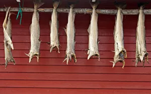
Stockfish is dried fish (mostly cod). The drying of fish is the worlds oldest known preservation method, and dried fish has a storage life of several years
Bergen old town at dawn, NorwayBergen is a city on Norwayas southwestern coast surrounded by mountains and fjords, including Sognefjord, the countryas longest and deepest
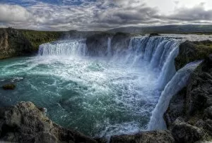
Picturesque Godafoss waterfalls in north IcelandGodafoss or Waterfall of the Gods of river Skjalfandafljot in Bardardalur creating heavy mist with dramatic looking sky
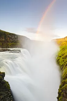
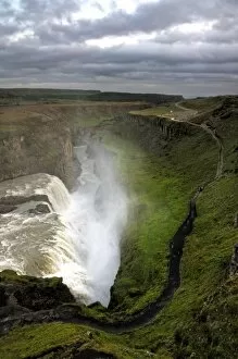
Icelandic Gullfoss waterfall canyonCanyon of Hvita river and famous Golden waterfall in south west Iceland surrounded by barren landscape covered in moss
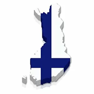
Outline and flag of Finland, 3D
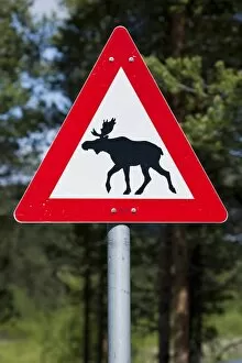
Moose warning sign, Norway, Scandinavia, Europe
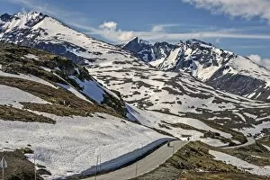
Sognefjellsvegen, road between Sognefjord and Lom, Jotunheimen, Hurrungane Mountains at the back, Sogn og Fjordane and Oppland provinces, Ostlandet or Eastern Norway, Norway
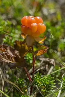
Cloudberry -Rubus chamaemorus-, Troms, Norway
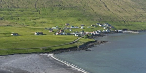
Sandvik, the northernmost village on Suouroy, Faroe Islands, Denmark
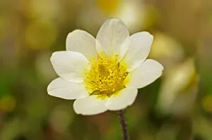
White Mountain Avens or White Dryas -Dryas octopetala-, national flower of Iceland and official territorial flower of the Swedish province of Lapland, Sweden, Europe