mail_outline sales@mediastorehouse.com
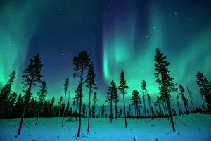
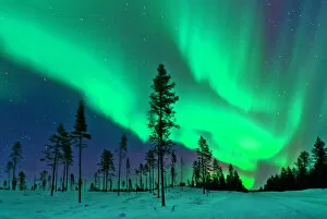
Northern Lights in the TreesA forest provides the setting for a show of the Northern Lights in Winter
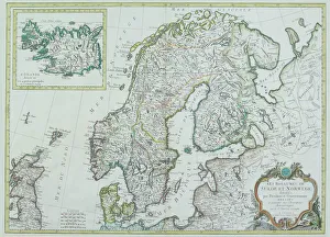
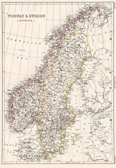
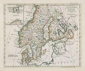
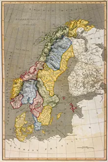
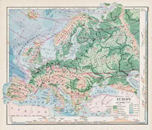
Map of Scandinavia
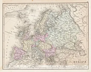
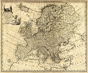
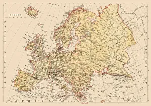
Europe map 1867Mitchellas Modern Atlas - Published by E.H. Butler and Co - Philadelphia 1867
Sweden and Norway, lithograph, published in 1878Ancient map of Sweden and Norway. Lithograph, published in 1878
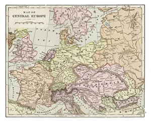
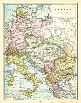
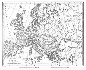
Map of central Europe 1889Indiana Educational Series The Complete Geography - Indianapolis 1889
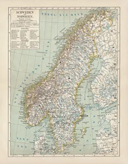
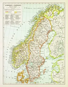
Map of Sweden and Norway 1897Map of Sweden and Norway
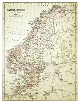
Map of Norway and Sweden 1894Map of Norway and Sweden
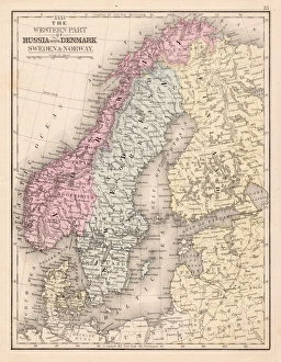
Antique Map of Sweden, Norway and DenmarkVintage map of Sweden, Norway and Denmark, from 1894
Aurora Borealis Northern Lights SwedenThe Aurora Borealis captured in a clearing in a Swedish coniferous forest
Norway and Sweden map 1884Encyclopedia Britannica 9th Edition New York Charles Scribners and Sonsl 1884 Vol XVII
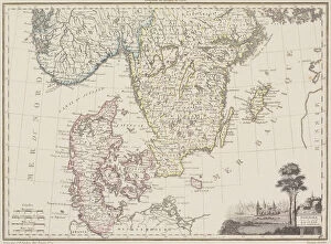
Denmark Sweden Norway map 1867Mitchellas Modern Atlas - Published by E.H. Butler and Co - Philadelphia 1867
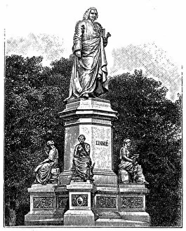
Carl Linnaeus monument in Stockholm, SwedenIllustration of Carl Linnaeus monument in Stockholm, Sweden
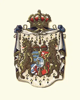
Coat of Arms of Sweden and Norway, 1898
Antique map of Denmark, Norway, Sweden and FinlandWonderful hand coloured antique map, circa 1780 - 1800
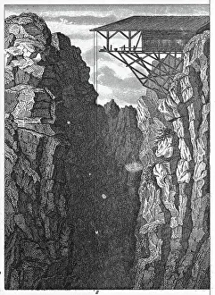
Persberg Mines, SwedenEngraved illustrations of Mining from Iconographic Encyclopedia of Science, Literature and Art, Published in 1851. Copyright has expired on this artwork. Digitally restored
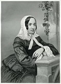
Fredrika BremerEngraving From 1873 Featuring The Swedish Writer, Fredrika Bremer. Bremer Lived From 1801 Until 1865
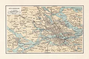
Historical city map of Stockholm and surroundings, Sweden, lithograph, 1897Historical city map of Stockholm and surroundings, Sweden. Lithograph, published in 1897
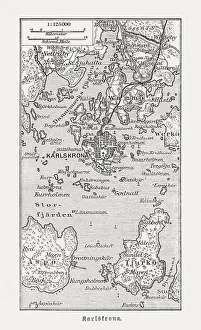
Historic map of Karlskrona and surroundings, wood engraving, published 1897Historic map of Karlskrona and surroundings. Wood engraving, published in 1897
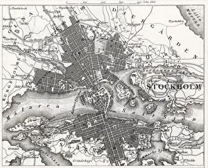
Engraving: StockholmEngraved illustrations of the City of Stockholm from Iconographic Encyclopedia of Science, Literature and Art, Published in 1851. Copyright has expired on this artwork. Digitally restored
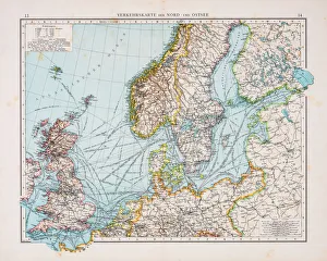
Map of North and East sea 1896Andres Allgemeiner Handatlas - Bielefeld und Leipzig 1896
Map of Europe 1897Natural Elementary Geography by Redway and Hinman - NY/Cincinnati/Chicago 1897
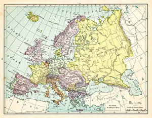
Map of Europe 1895The Rand-McNally Grammar School Geography 1895 - Chicago & New York
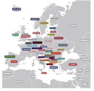
Labeled European MapLabeled European map concept showing countries with labels. EPS 10 file. Transparency effects used on highlight elements
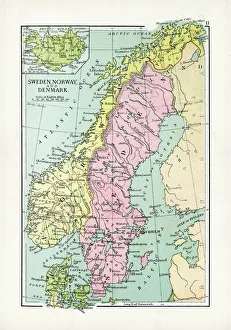
Map of Sweden with Denmark and Norway
Antique Map of Europe 1744An engraved map of Europe with ornamental cartouche and relief shown pictorially by Emanuel Bowen 1744, London, Geographer to His Majesty
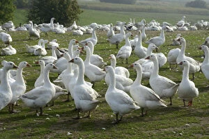
White geese in a goose farm, Skurup, Sweden
Black Grouse or Blackgame -Lyrurus tetrix, Tetrao tetrix-, Sweden, Scandinavia, Europe
Map of Central Europe 1895The Rand-McNally Grammar School Geography 1895 - Chicago & New York
Map of Europe 1889Indiana Educational Series The Complete Geography - Indianapolis 1889
antique, archival, baltic, border, cartography, denmark, document, europe, european, finland, geography, historic, historical, latitude, longitude, map, nobody, north, norway, region, scale
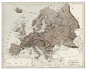
Victorian Map of EuropeEngraved illustrations of Europe in the Time of Charlemagne from Iconographic Encyclopedia of Science, Literature and Art, Published in 1851. Copyright has expired on this artwork. Digitally restored
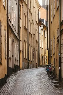
Narrow streets in Gamla Stan (Old Town) in Stockholm, Sweden
House detailDetail of a house in Gammelstad Church Town near Lulea in the north of Sweden. Gammelstad is an Unesco World Heritage Site
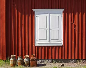
Gammelstad - the milkchurnsMilkchurns in front of a falun red house in Gammelstad, a church town near Lulea in the north of Sweden
White Mountain Avens or White Dryas -Dryas octopetala-, national flower of Iceland and official territorial flower of the Swedish province of Lapland, Sweden, Europe
Firethorn -Pyracantha sp. -, SwedenFirethorn -Pyracantha sp.-, Sweden
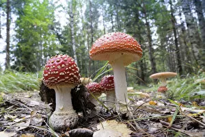
Agaric Mushrooms -Amanita muscaria-, Glaskogen nature reserve, Sweden
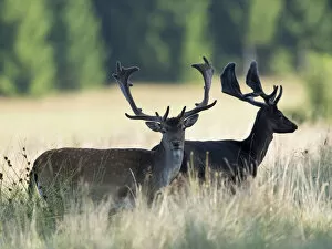
Fallow deer -Dama dama-, Vastra Gotaland County, Sweden
Person on spiral staircase
Close up of snowman with mustache
Map of Europe 1877Warrens Common School Geography 1877
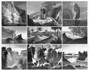
Volcanoes, Geysers and Water Falls EngravingEngraved Illustrations of Forests, Lakes, Caves and Unusual Rock Formations from Iconographic Encyclopedia of Science, Literature and Art, Published in 1851. Copyright has expired on this artwork
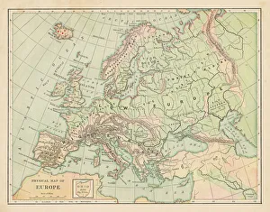
Map of Europe 1881Encyclopedia Britannica 9th Edition Vol XII Philadelphia j.M. Stoddart & Co 1881
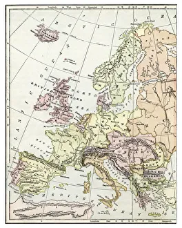
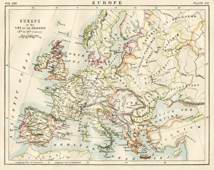
Europe time of the crusadesEncyclopedia Britannica 9th Edition Vol XII Philadelphia j.M. Stoddart & Co 1881
Europe map 1881Harpers School Geography, New York, Harpers and Brothers, 1881
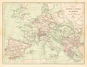
Western and Central Europe map 1881Harpers School Geography, New York, Harpers and Brothers, 1881