mail_outline sales@mediastorehouse.com
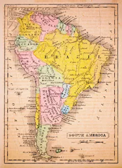
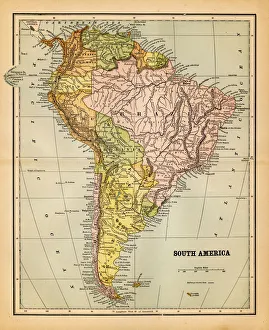
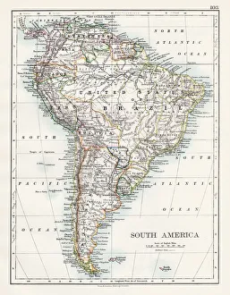
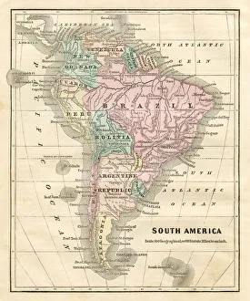
South America 1852 Map
Map of South America 19th CenturyVintage map of South America from the 19th Century
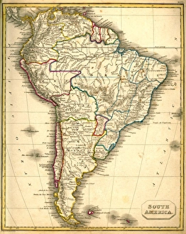
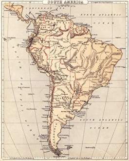
old map of south americaan old south american map (1881)
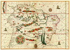
Map of South America, from a Spanish Atlas, 1582
south america 1883an old south american map (1883)
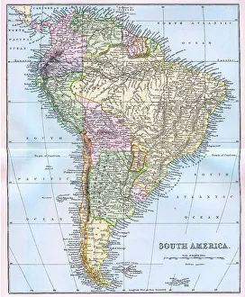
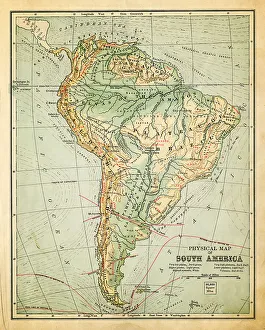
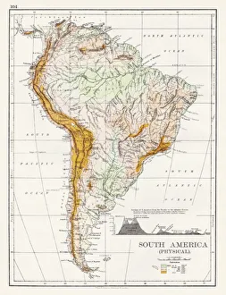
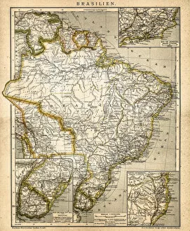
South America Physical map 1897The World-Wide Atlas of Modern Geography, Political and Physical W. & A.K. Johnston - London 1897
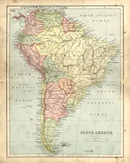
Antquie Map of South AmericaVintage map of South America from 1837
Antique damaged map of South America in the 19th CenturyVintage engraving of a Antique map of South America in the 19th Century, 1873
South America map 1897The World-Wide Atlas of Modern Geography, Political and Physical W. & A.K. Johnston - London 1897
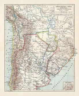
Argentina, Chile, Bolivia, Uruguay, and Paraguay, lithograph, published in 1897Argentina, Chile, Bolivia, Uruguay, and Paraguay. Lithograph, published in 1897
Map of South America 1869Cornells Grammars-School Geography - S.S. Cornell - New York D. Appleton and Company 1869
Map of South America 1855System of Geography for the use of schools by Sidney E. Morse - Published by Harper & Brothers - New York 1855
Map of South America 1856Colton and Fitchs Modern School Geography by George W. Fitch - New York 1856
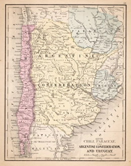
Argentina, Bolivia, Chile, Paraguay and Uruguay, lithograph, published in 1874South American countries: Argentina, Bolivia, Chile, Paraguay and Uruguay. Lithograph, published in 1874
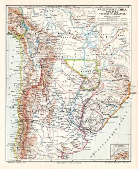
Argentina Chile Bolivia map 1895Meyers Konversations-Lexikon. Ein Nachschlagewerk des allgemeinen Wissens, 5th edition 17 volumes Bibliographisches Institut - Leipzig 1895-1897
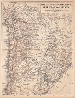
Argentina Chile Urugay map 1867Mitchellas Modern Atlas - Published by E.H. Butler and Co - Philadelphia 1867
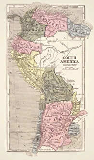
South America mapAntique illustration of a South America map
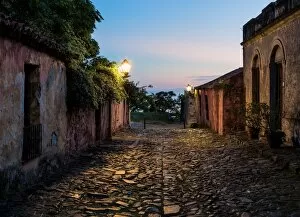
Street of SighsCalle de los Suspiros in Colonia, Urugay, which can be literally translated as the Street of Sighs. Formerly, an area to hire prostitutes (Street of Sighs was a euphemism)
Illustration national flag of Uruguay, with field of nine equal horizontal, alternating white and blue stripes, Sun of May at hoist
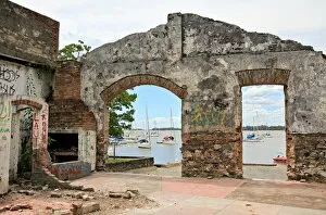
Derelict BuildingsBones of an old building standing on the shores of the Rio Uruguay in Colonia Del Sacramento, Uruguay
Colonia del Sacramento, Uruguai, PatrimAśnio Mundial da Unesco
The Basilica of the Holy Sacrament, Colonia del Sacramento, Uruguay, South AmericaThe Basilica of the Holy Sacrament is a Roman Catholic parish church in Colonia del Sacramento, Uruguay. The parish was established on 2 February 1680, being one of the oldest in the country
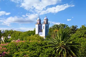
Sunset View of Colonia Lighthouse, Colonia del Sacramento, UruguayColonia del Sacramento is a city in southwestern Uruguay, by the RAio de la Plata, facing Buenos Aires, Argentina. It is one of the oldest towns in Uruguay and capital of the Colonia Department
Flag of Uruguay
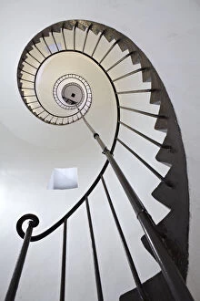
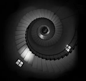
Spiral staircase in lighthouse, Uruguay
SpiralInterior of the Lighthouse in Colonia, Uruguay
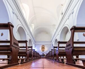
Interior Basilica of the Holy SacramentImage taken from a low angle using tripod. Interior is bright. Basilica is part of the Historic Quarter of the City of Colonia del Sacramento - declared a World Heritage Site by UNESCO
Sight from Colonia del SacramentoAśharborColonia del Sacramento is the older city in Uruguay build by Portuguese and English disputed this estrategic place.It has a port with excellent sunsets facing the other side of the river
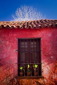
Window and house in UruguayPortuguese style house, wall and window in Uruguay.Image taken outdoors no people
Phto taken at PeAnarol Montevideo Uruguay stationIs a picture on abandoned train tracks form the quarter of PeAnarol in Montevideo
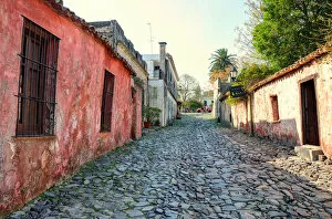
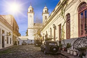
A sunny day in Colonia del Sacramento, UruguayColonia del Sacramento (formerly the Portuguese ColAonia do Sacramento) is a city in southwestern Uruguay, by the RAio de la Plata
Lot of bread in bakery of manhattanThis is a view of a lot of breads to sale