mail_outline sales@mediastorehouse.com
Sturgeon Bay Lighthouse Door County WisconsinUSA Wisconsin Door County Sturgeon Bay North Pierhead Ship Canal Lighthouse. Door County, Wisconsin
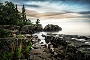
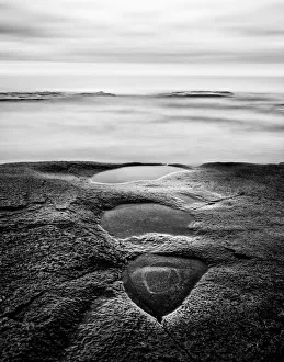
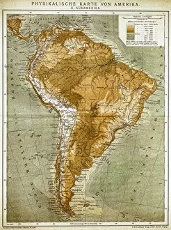
A long exposure on the coast of Lake Superior, near Grand Marais, Minnesota
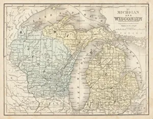
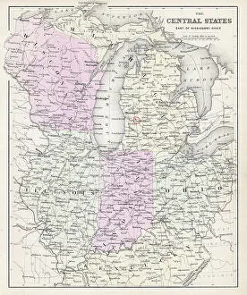
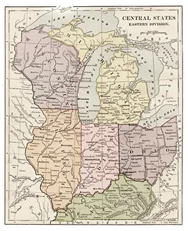
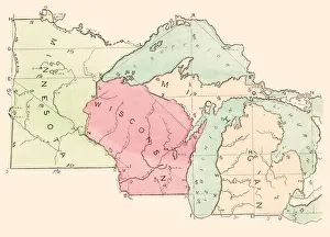
Wisconsin MIchigan map 1867Mitchellas Modern Atlas - Published by E.H. Butler and Co - Philadelphia 1867
Madison Wisconsin Capital State Street ViewView of the Wisconsin State Capital in Fall. State street pedestrian mall with trees in peak fall color. Madison
Farm and field at sunset, WisconsinSunset on a Wisconsin farm, Green County. The warm sunset glow sweeps across the corn field landscape
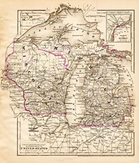
Wisconsin Michigan map 1881Coltons Common School Geography 1881 New York Sheldon and Co
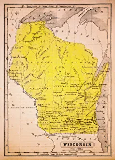
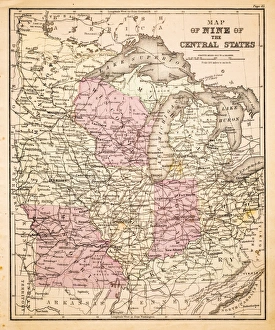
Wisconsin 1852 Map
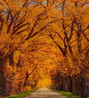
Weary RoadTree Tunnel lined Weary Road near Evansville Wisconsin
Journey Under the Stars Alt Horizontal VersionA majestic hot air balloon soars under the stars of the Milky Way, over the desert - Mesquite Dunes of Death Valley National Park
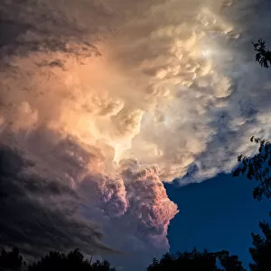
Dramatic storm clouds rolling in at sunset before the storm
Zoanthids in blueZoanthids are an order of cnidarians commonly found in coral reefs, the deep sea and many other marine environments around the world
Blue MoonCave Moonbeams illuminating through an old Indian Cave on the Island of Middle Caicos, on the Turks and Caicos Island chain
A majestic hot air balloon soars under the stars of the Milky Way, over the desert - Mesquite Dunes of Death Valley National Park
Abandoned cityMilwaukee city with reflection
North Central states map 1886North Central states map Maps Monteith Physical Geography 1886
Woman in fall fashion modeling in a Fall scene. A leaf headdress accompanied with a leaf dress isolated and emphasized with subtle blurring and vignetting
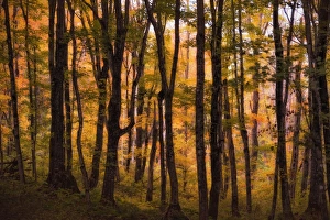
Red Forest Maple Leaves in Peak Fall Colors WisconsinEnd of the summer season brings such vibrant and colorful hues to the forest. I was walking through a Northern Wisconsin woods when I saw this canopy of red maple leaves
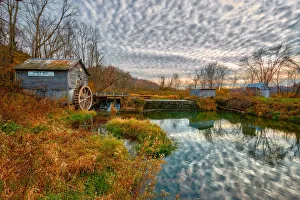
Hydes Mill in Fall ColorsWisconsins roads along miles and miles of magnificent scenery through deep woods, broad vistas from high ridges and rock bluffs over deep clear brooks
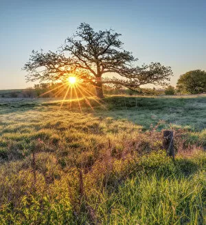
Spring Tree SunriseThis is a classic scene of Southern Wisconsin. Trees of character, grass plains rich with cobwebs, and morning dew on the prairie grass
Spiral Straircase
land of confusionThis image depicts an abstract and Escher-like view of the spiral staircase in Madisons Childrens Museum. Image was taken with a 10mm wide angle lens facing downwards
Map of Central states 1877Warrens Common School Geography 1877
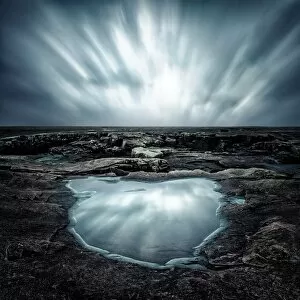
Lake Superior Coastline in BWStorm clouds whirling over a Lake Superior coastal shelf near Grand Marais, Minnesota. A pool of water reflects the fast moving storm clouds. A long exposure captures the fast moving storm formation
Wisconsin ggmap 1885Encyclopedia Britannica 9th Edition New York Charles Scribners and Sons 1885 Vol XXIV
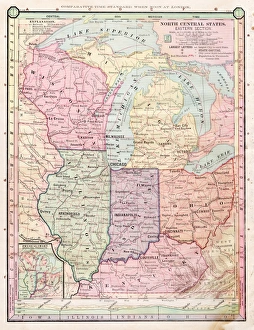
Central states eastern division map 1889Indiana Educational Series The Complete Geography - Indianapolis 1889
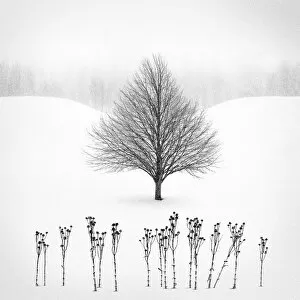
Winter TreeLocated in Rural Rock County Wisconsin, a snow curved slope with a distant tree line provides a subtle backdrop for an intricate tree bathed in a snow storm
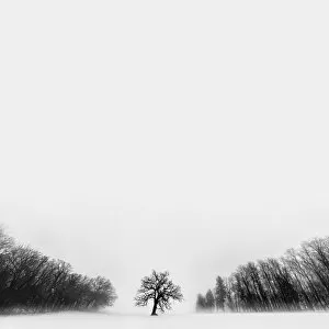
Winter Tree located in rural Rock County WisconsinA lone tree blanketed in fog and surrounded by a forests edge on both sides. Winter Tree located in rural Rock County Wisconsin
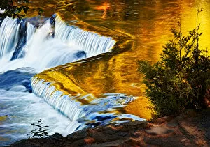
Bond FallsBeautiful river falls reflecting the golden canopy of the forests edge. Bond Falls State Park, Middle Branch, Ontonagon River East of Paulding, Michigan
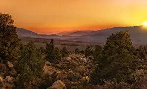
Sunrise over Owens ValleySunrise just breaking over Owens Valley, California
A closeup of a wave and wake in the refelcted sunset light. Ballard Lake, Northern Wisconsin, USA
Map of Central States USA 1883Warrens Common School Geography
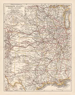
United States of America, States on Mississippi river, lithograph published 1878United States of America, States on the Mississippi river. Lithograph, published in 1878
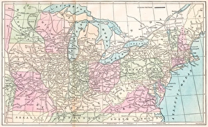
USA states map 1875The Independent Course Comprehensive Geography by James Monteith, A.S. Barnes & Co, New York & Chicago 1875
Routes of travel in the United States map 1875The Independent Course Comprehensive Geography by James Monteith, A.S. Barnes & Co, New York & Chicago 1875
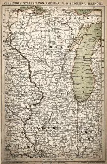
United States of America, Wisconsin, IllinoisAntique illustration of United States of America, Wisconsin, Illinois map
United States of America mapAntique illustration of a United States of America map
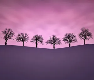
Moments TogetherSometimes you can find beauty in such frigid cold. Six intriguing trees atop a snowy rolling hillside at sunset in -10A'F weather. Located in rural Wisconsin
Fall Fashion SceneWoman in fall fashion modeling in a Fall scene. A leaf headdress accompanied with a leaf dress isolated and emphasized with subtle blurring and vignetting
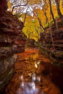
Fall colors at Pewits Nest Skillet Creek area Baraboo, WisconsinA meandering creek leads through mossy lined bluffs. The fall colors creating a warm glowing canopy. Floating autumn leaves and reflection of trees in the water
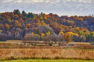
Fall colors in rural WisconsinA hillside in fall colors with a meadow below. Holstein / bovine cows grazing on a rural farm field
Wisconsin State Capitol - Capital in Spring, surrounded by a sea of blooming tulips
Ghosts over Lake SuperiorStorm clouds whirling over a Lake Superior coastal shelf near Grand Marais, Minnesota. A pool of water reflects the fast moving storm clouds. A long exposure captures the fast moving storm formation
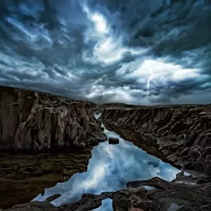
Lightning Strike Over Lake SuperiorThunderstorm with lightning strikes over a Lake Superior coastal shelf near Grand Marais, Minnesota. Crevices with pools of water reflect the storm clouds
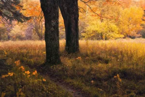
A pathway through Pictured Rocks National Lake Shore near Chapel Falls. Along the way you pass through this enchanting forest
Sable MeadowsA pathway leads from Sable Falls to the Ghost Forest near Lake Superiors coast. Along the way you pass through this enchanting meadow
Side of pink cadillac