mail_outline sales@mediastorehouse.com
Choose a picture from our Images Dated 29th May 2018 Collection for your Wall Art and Photo Gifts
275 items
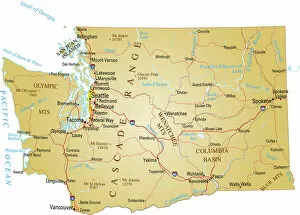
A paper map of Washington statevector illustration of map of state of washington
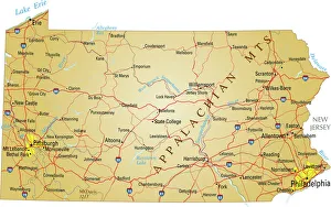
Map of PennsylvaniaVector illustration of map of Pennsylvania with major roads, rivers and lakes
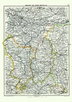
Antique map, West Yorkshire, Derby, Nottingham, Lincoln, 19th CenturyVintage engraving of a Antique map, West Yorkshire, Derby, Nottingham, Lincoln, Stafford, Leicester, Rutland, England. 19th Century
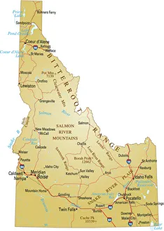
Map of IdahoVector illustration of map of Idaho with major roads, rivers and lakes
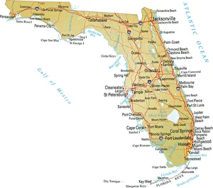
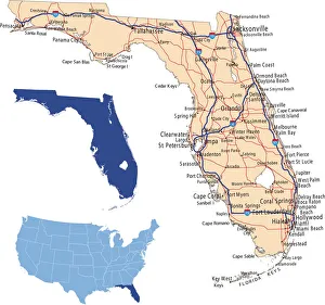
Map of FloridaVector illustratio of map of Florida with major roads, rivers and lakes
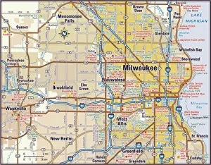
Milwaukee, Wisconsin Area Street Map
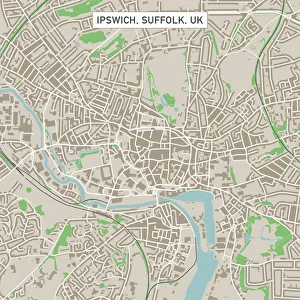
Ipswich Suffolk UK City Street MapVector Illustration of a City Street Map of Ipswich, Suffolk, UK. Included files are EPS (v10) and Hi-Res JPG. Data courtesy from Ordnance Survey: VectorMap District https
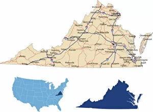
Virginia road mapillustration of Virginia state road map for your design and products
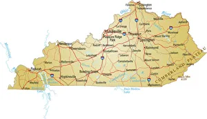
Map of kentuckyvector illustration of map of kentucky with major roads, rivers and lakes
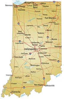
Map of IndianaVector illustration of map of Indiana with major roads, rivers and lakes
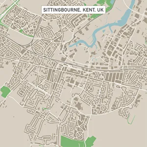
Sittingbourne Kent UK City Street MapVector Illustration of a City Street Map of Sittingbourne, Kent, UK. Included files are EPS (v10) and Hi-Res JPG. Data courtesy from Ordnance Survey: VectorMap District https
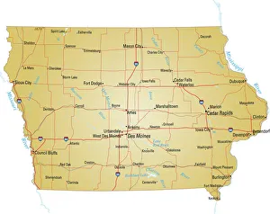
Map of IowaVector illustration of map of Iowa with major roads, rivers and lakes
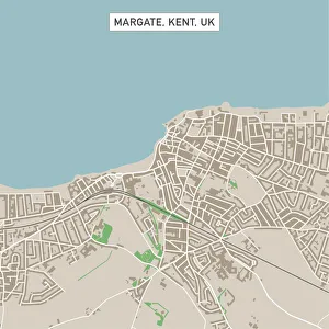
Margate Kent UK City Street MapVector Illustration of a City Street Map of Margate, Kent, UK. Included files are EPS (v10) and Hi-Res JPG. Data courtesy from Ordnance Survey: VectorMap District https
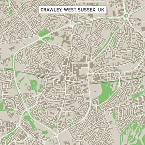
Crawley West Sussex UK City Street MapVector Illustration of a City Street Map of Crawley, West Sussex, UK. Included files are EPS (v10) and Hi-Res JPG. Data courtesy from Ordnance Survey: VectorMap District https
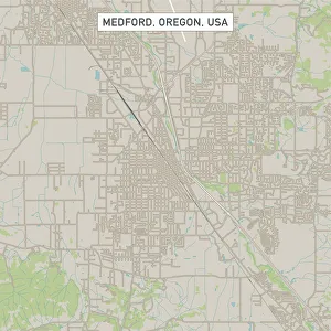
Medford Oregon US City Street MapVector Illustration of a City Street Map of Medford, Oregon, USA. Scale 1:60, 000. All source data is in the public domain. U.S
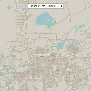
Casper Wyoming US City Street MapVector Illustration of a City Street Map of Casper, Wyoming, USA. Scale 1:60, 000. All source data is in the public domain. U.S
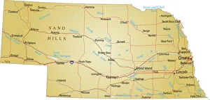
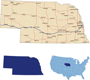
Map of NebraskaVector illustration of map of Nebraska with major roads, rivers and lakes
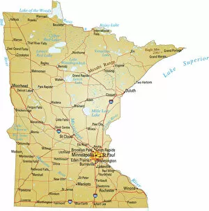
Map of MinnesotaVector illustration of map of Minnesota with major roads, rivers and lakes
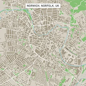
Norwich Norfolk UK City Street MapVector Illustration of a City Street Map of Norwich, Norfolk, UK. Included files are EPS (v10) and Hi-Res JPG. Data courtesy from Ordnance Survey: VectorMap District https
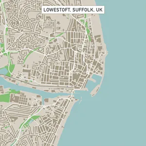
Lowestoft Suffolk UK City Street MapVector Illustration of a City Street Map of Lowestoft, Suffolk, UK. Included files are EPS (v10) and Hi-Res JPG. Data courtesy from Ordnance Survey: VectorMap District https
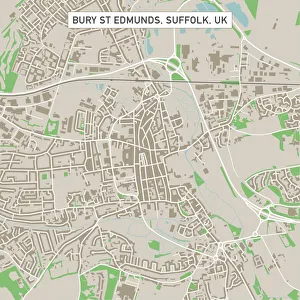
Bury St Edmunds Suffolk UK City Street MapVector Illustration of a City Street Map of Bury St Edmunds, Suffolk, UK. Included files are EPS (v10) and Hi-Res JPG. Data courtesy from Ordnance Survey: VectorMap District https
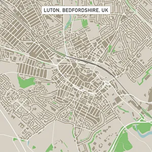
Luton Bedfordshire UK City Street MapVector Illustration of a City Street Map of Luton, Bedfordshire, UK. Included files are EPS (v10) and Hi-Res JPG. Data courtesy from Ordnance Survey: VectorMap District https
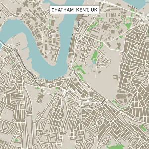
Chatham Kent UK City Street MapVector Illustration of a City Street Map of Chatham, Kent, UK. Included files are EPS (v10) and Hi-Res JPG. Data courtesy from Ordnance Survey: VectorMap District https
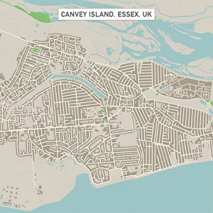
Canvey Island Essex UK City Street MapVector Illustration of a City Street Map of Canvey Island, Essex, UK. Included files are EPS (v10) and Hi-Res JPG. Data courtesy from Ordnance Survey: VectorMap District https
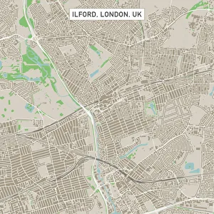
Ilford London UK City Street MapVector Illustration of a City Street Map of Ilford, London, UK. Included files are EPS (v10) and Hi-Res JPG. Data courtesy from Ordnance Survey: VectorMap District https
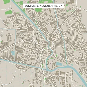
Boston Lincolnshire UK City Street MapVector Illustration of a City Street Map of Boston, Lincolnshire, UK. Included files are EPS (v10) and Hi-Res JPG
Nebraska road mapillustration of Nebraska state road map for your design and products
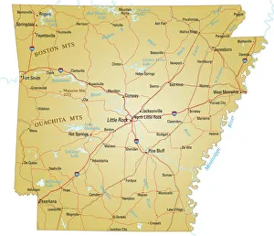
Map of ArkansasVector illustration of map of Arkansas with major roads, rivers and lakes
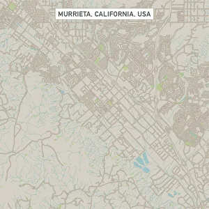
Murrieta California US City Street MapVector Illustration of a City Street Map of Murrieta, California, USA. Scale 1:60, 000. All source data is in the public domain. U.S
Row of colorful houses with cathedral background in Cobh, County Cork, Irelandireland, western europe, urban skyline, multi colored, house, city, tr, Ireland, Marius Roman Travel Photography
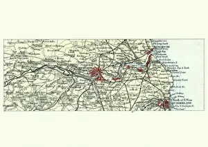
Antique map, Newcastle upon Tyne and Sunderland, 19th CenturyVintage engraving of a Antique map, Newcastle upon Tyne and Sunderland and surrounding area, England. 19th Century
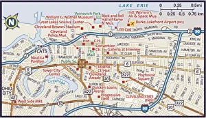
Downtown Cleveland, Ohio2011 edition
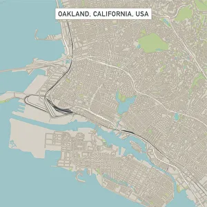
Oakland California US City Street MapVector Illustration of a City Street Map of Oakland, California, USA. Scale 1:60, 000. All source data is in the public domain. U.S
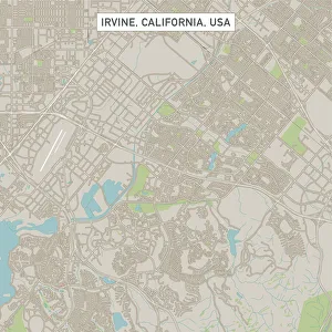
Irvine California US City Street MapVector Illustration of a City Street Map of Irvine, California, USA. Scale 1:60, 000. All source data is in the public domain. U.S
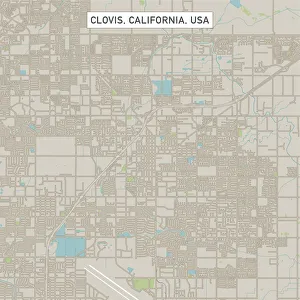
Clovis California US City Street MapVector Illustration of a City Street Map of Clovis, California, USA. Scale 1:60, 000. All source data is in the public domain. U.S
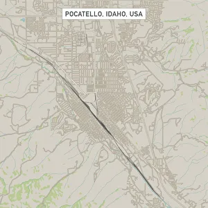
Pocatello Idaho US City Street MapVector Illustration of a City Street Map of Pocatello, Idaho, USA. Scale 1:60, 000. All source data is in the public domain. U.S
detail of hotel hotelMinimalism Architecture, 965048968
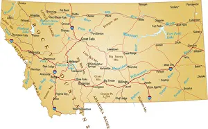
Map of MontanaVector illustration of map of Montana with major roads, rivers and lakes
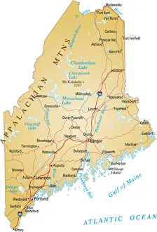
Map of MaineVector illustration of map of Maine with major roads, rivers and lakes
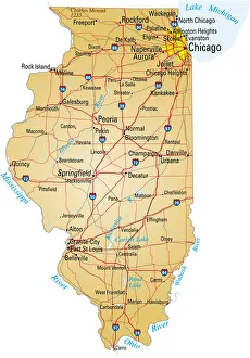
Map of Illinois showing major cities and roadsVector illustration of map of Illinois with major roads, rivers and lakes
Florida road mapillustration of Florida state road map for your design and products
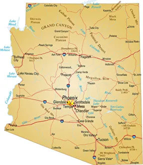
Map of Arizona, USA highways, major roads, and riversVector illustration of map fo Arizona with major roads, rivers and lakes
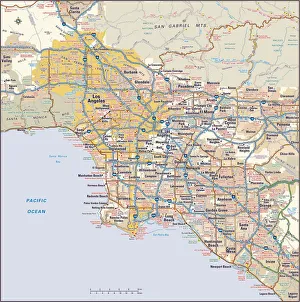
Los Angeles, California area map2011 edition
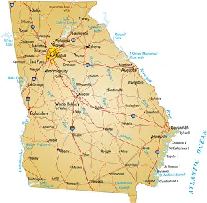
A yellow map of the state of Georgia with cities markedVector illustration of map of Georgia with major roads, rivers and lakes
Murmuration Of Canadian Snow Geese in the Skagit Valley, WashingtonSnow geese flock migrate here every year for the winter, WA, USA
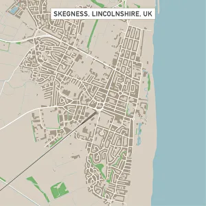
Skegness Lincolnshire UK City Street MapVector Illustration of a City Street Map of Skegness, Lincolnshire, UK. Included files are EPS (v10) and Hi-Res JPG. Data courtesy from Ordnance Survey: VectorMap District https
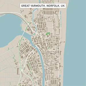
Great Yarmouth Norfolk UK City Street MapVector Illustration of a City Street Map of Great Yarmouth, Norfolk, UK. Included files are EPS (v10) and Hi-Res JPG. Data courtesy from Ordnance Survey: VectorMap District https
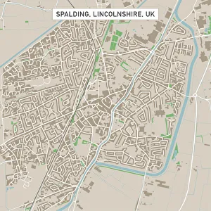
Spalding Lincolnshire UK City Street MapVector Illustration of a City Street Map of Spalding, Lincolnshire, UK. Included files are EPS (v10) and Hi-Res JPG. Data courtesy from Ordnance Survey: VectorMap District https