mail_outline sales@mediastorehouse.com
3,678 Items
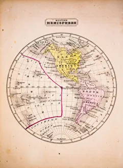
Western Hemisphere 1852 Map
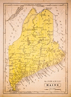
Maine 1852 Map
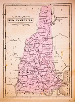
New Hampshire 1852 Map
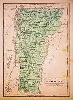
Vermont 1852 Map
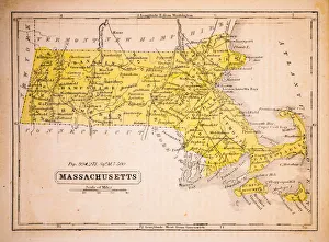
Massachusetts 1852 Map
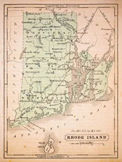
Rhode Island 1852 Map
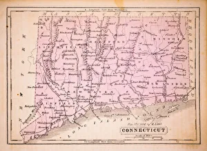
Connecticut 1852 Map
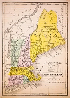
New England 1852 Map
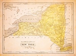
New York 1852 Map
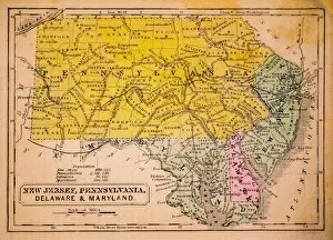
New Jersey, Pennsylvania, Delaware and Maryland 1852 Map
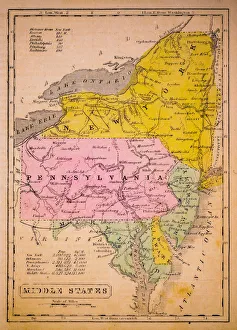
Middle States 1852 Map
Southern States 1852 Map
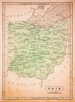
Ohio 1852 Map
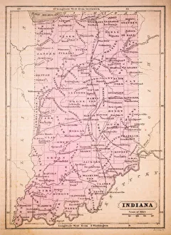
Indiana 1852 Map
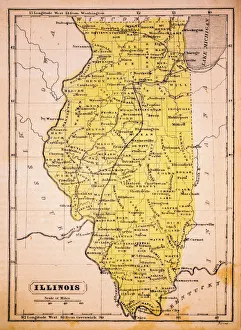
Illinois 1852 Map
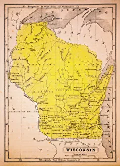
Wisconsin 1852 Map
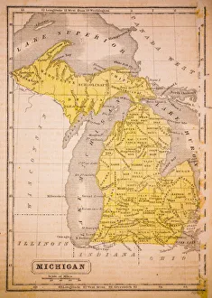
Michigan 1852 Map
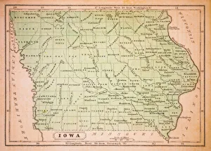
Iowa 1852 Map
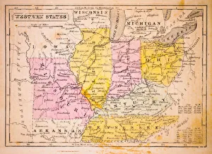
Western States 1852 Map
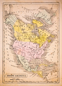
North America 1852 Map
United States 1852 Map
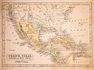
Mexico, Texas, Guatimala and West Indies 1852 Map
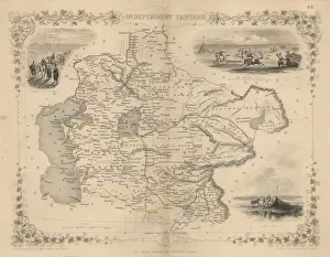
Antique map of Independent TartaryWonderfully fine engraved map 1851 of the region of Independent Tartary, which is now the area that is Kazakhstan, Uzbekistan, Turkmenistan alongside the Caspian Sea and Aral Sea
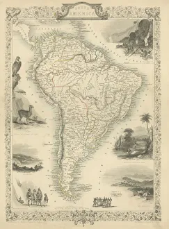
South America Engraved map 1851Finely engraved map of South America, Illustrations by J Marchant Engraved by J Rodgers Map Drawn and Engraved by J Rapkin, 1851
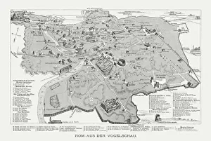
Rome in the birds eye view, published in 1878Rome in the birds eye view with the known historic buildings and places. Wood engraving, published in 1878
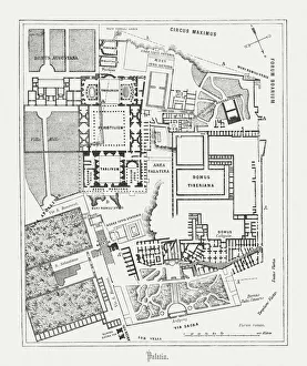
Floor plan of Palatine Hill in Rome, published in 1878Floor plan of the archaeological remains of the Palatine Hill in Rome. The Palatine Hill (Latin: Mons Palatinus, Italian: Monte Palatino)
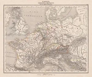
Ancient Europe under Emporer Augstus (63 BC-14 AD), published 1861Ancient map of Gaul, Germania and Britannia during the time of the first Roman Emporer Augstus (63 BC - 14 AD). Legend in Latin language. Steel engraving with colored borderlines, published in 1861
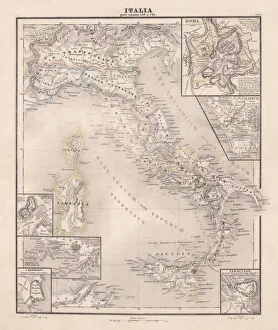
Ancent Italy, c. 450 BC, steel engraving, published in 1861The territory of Italy around 450 BC with separate maps of Rome, Roman Forum, surrounding area of Rome, Syracuse, Carthage and surrounding area of Pompeji and Naples. Legend in Latin language
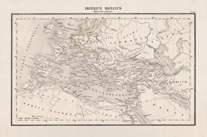
Roman Empire with provinces (115-117 AD), steel engraving, published 1861The Roman Empire and its provinces at the time of its greatest extent under Emperor Trajan in the years 115-117 AD. Legend in Latin language
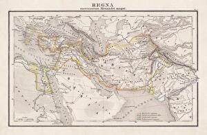
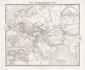
Empire of Alexander the Great, hand-coloured steel engraving, published 1861Antique map from Empire of Alexander the Great 356 - 326 BC) after the battle of Ipsos (301 BC). Legend in Latin language. Steel engraving with hand colored borderlines, published in 1861
Seleucid Empire, 3rd to 2nd century BC, published in 1861The Seleucid Empire was created after the death of Alexander the Great and dominated the Near East from the 3rd to 2nd century BC. Legend in Latin language
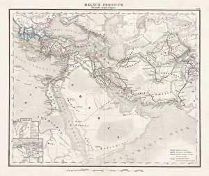
Persian Empire (c. 400 BC), steel engraving, pubolished in 1861Antique map from the Persian Empire (around 400 BC) before the conquest of Alexander the Great (334/335 BC). Legend in Latin language. Steel engraving with hand colored borderlines, published in 1861
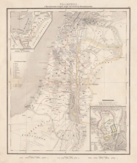
Map of Palestine, steel engraving, published in1861Ancient topographic map of Palestine and seperate map of Jerusalem in three eras: 1) Judges 2) Juda and Israel, 3) Maccabees to Titus (70 AD)
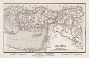
Assyria and Phersia Empire c. 500 BC, steel engraving, published 1661Antique map from Assyrian and Persian Empire, c. 500 BC. Legend in Latin language. Steel engraving with hand colored borderlines, published in 1861
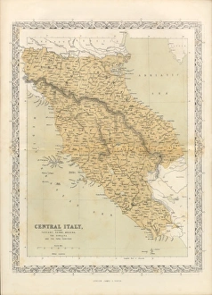
Victorian Map of Central Italy, Circa 1865Extremely Rare, Beautifully Illustrated Antique Victorian Engraved Illustration of the map of Central Italy including Tuscany, Parma and Modena from Liberators of Italy
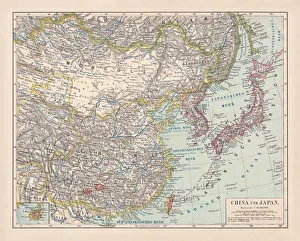
China and Japan, lithograph, published in 1881Antique map of China and Japan. Lithograph, published in 1881
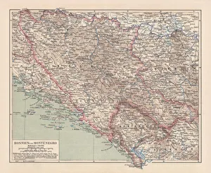
Bosnia and Montenegro, lithograph, published in 1881Ancient map of Bosnia and Montenegro. Lithograph, published in 1881
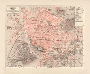
City map of Athens, lithograph, published in 1881City map of Athens. Lithograph, published in 1881
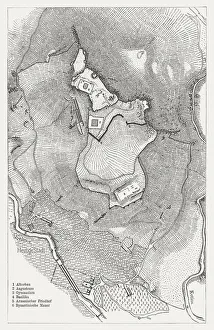
Acropolis of Pergamon, published in 1881Map of the Acropolis of Pergamon (Unesco World Heritage Site). Wood engraving, published in 1881
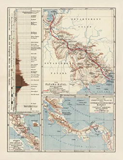
Panama Canal Project, lithograph, published in 1880Ancient map of the Panama Canal Project. Lithograph, published in 1880
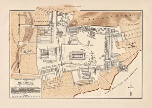
Excavations of Olympia, lithograph, published in 1880Old map of the plan of the excavations of Olympia. Lithograph, published in 1880
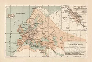
Pestilence in Europe, mid-14th century, lithograph, published in 1880Ancient map of the area of pestilence in Europe, Western Asia, and North Africa in the years 1346 - 1351. Lithograph, published in 1880
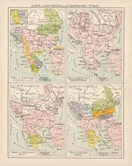
Ottoman Empire, 14th-19th century, lithograph, published in 1878Ancient map of the history of European Turkey, 15th - 19th century. Lithograph, published in 1878
Ottoman Empire, lithograph, published in 1878Ancient map of Ottoman Empire. Lithograph, published in 1878
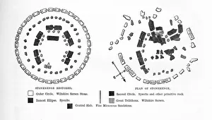
Stonehenge Before and After Restoration EngravingVery Rare, Beautifully Illustrated Antique Engraving of Stonehenge Before and After Restoration from Our Own Country, Great Britain, Descriptive, Historical, Pictorial. Published in 1880
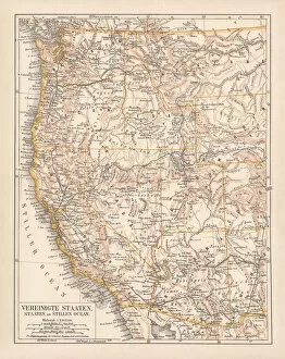
United States of America, West Coast, ithograph, published in 1878United States of America, States on the Pacific Ocean. Lithograph, published in 1878
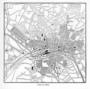
Victorian Map of Leeds, England Engraving, Circa 1840Very Rare, Beautifully Illustrated Antique Engraving of Victorian Map of Leeds, England from Our Own Country, Great Britain, Descriptive, Historical, Pictorial. Published in 1880
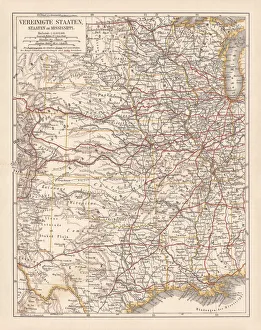
United States of America, States on Mississippi river, lithograph published 1878United States of America, States on the Mississippi river. Lithograph, published in 1878