mail_outline sales@mediastorehouse.com
3,678 Items
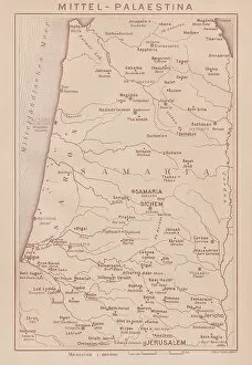
Historical map of Middle Palestine, lithograph, published in 1891Historical map of Middle Palestine. Lithograph, published in 1891
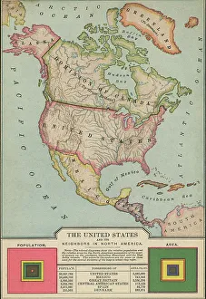
Old map of United States and its neighbors in North AmericaAntique Illustration. Copyright has expired on this artwork. From my own archives, digitally restored
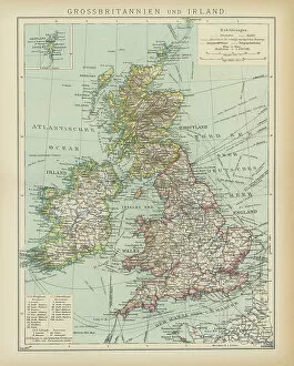
Old map of Great Britain and IrelandAntique Illustration, Copyright has expired on this artwork. From my own archives, digitally restored
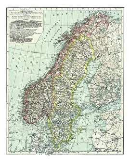
Old map of Norway and Sweden (Scandinavia)Antique Illustration. Copyright has expired on this artwork. From my own archives, digitally restored
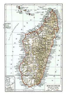
Old chromolithograph map of Madagascar, island country in the Indian OceanAntique Illustration, Copyright has expired on this artwork. From my own archives, digitally restored
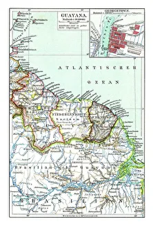
Old chromolithograph map of Guyana, country on the northern mainland of South AmericaAntique Illustration. Copyright has expired on this artwork. From my own archives, digitally restored
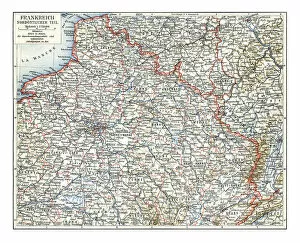
Old chromolithograph map of France - Northeast partAntique Illustration, Copyright has expired on this artwork. From my own archives, digitally restored
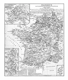
Old chromolithograph map of France - Treaty of Luneville (or Peace of Luneville) - 9 February 1801Antique Illustration, Copyright has expired on this artwork. From my own archives, digitally restored
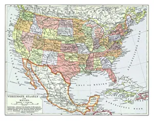
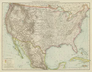
Old chromolithograph map of the United States and MexicoAntique Illustration. Copyright has expired on this artwork. From my own archives, digitally restored
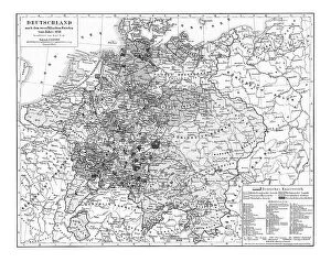
Old chromolithograph map of Germany after the Peace of Westphalia of 1648Antique Illustration, Copyright has expired on this artwork. From my own archives, digitally restored. The Peace of Westphalia
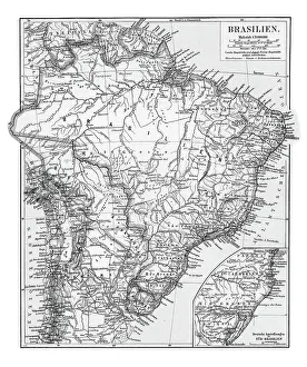
Old chromolithograph map of BrazilAntique Illustration. Copyright has expired on this artwork. From my own archives, digitally restored
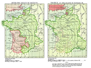
Old chromolithograph map of France after the Treaty of Bretigny and France at the death of Edward IIIAntique Illustration, Copyright has expired on this artwork. From my own archives, digitally restored
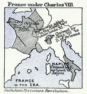
Old chromolithograph map of France under Charles VIIIAntique Illustration, Copyright has expired on this artwork. From my own archives, digitally restored
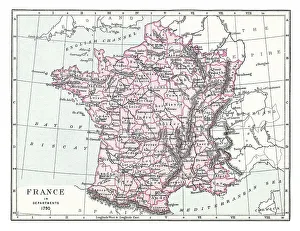
Old chromolithograph map of France in Departments, 1790Antique Illustration, Copyright has expired on this artwork. From my own archives, digitally restored
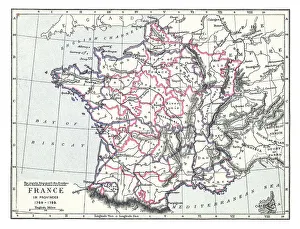
Old chromolithograph map of France in Provinces (1769-1789)Antique Illustration, Copyright has expired on this artwork. From my own archives, digitally restored
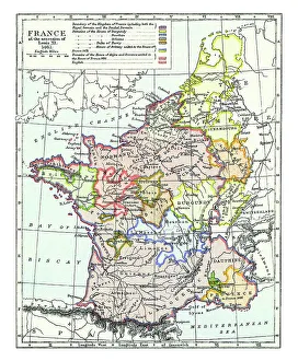
Old chromolithograph map of France of the accession of Louis XI - 1461Antique Illustration, Copyright has expired on this artwork. From my own archives, digitally restored
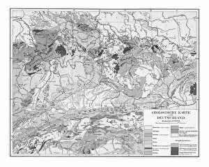
Old chromolithograph Geological map of GermanyAntique Illustration, Copyright has expired on this artwork. From my own archives, digitally restored
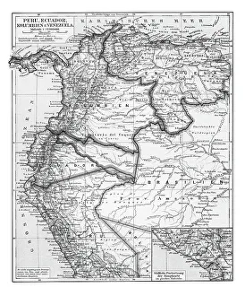
Old chromolithograph map of Peru, Ecuador, Colombia and VenezuelaAntique Illustration. Copyright has expired on this artwork. From my own archives, digitally restored
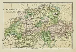
Map of SwitzerlandMarcus Ward's Home Atlas - London, 1894
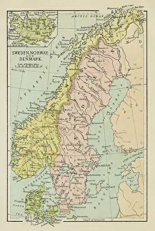
Map of Sweden, Norway and DenmarkMarcus Ward's Home Atlas - London, 1894
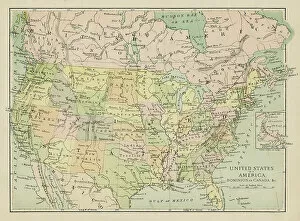
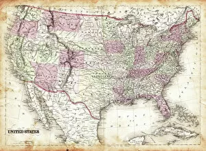
Map of the United States of AmericaMarcus Ward's Home Atlas - London, 1894
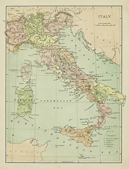
Map of ItalyMarcus Ward's Home Atlas - London, 1894
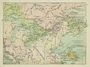
Map of CanadaMarcus Ward's Home Atlas - London, 1894
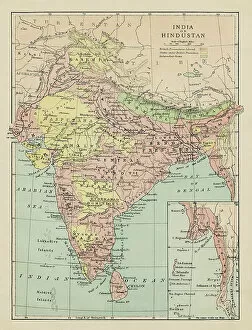
Map of India and HindustanMarcus Ward's Home Atlas - London, 1894
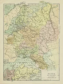
Map of RussiaMarcus Ward's Home Atlas - London, 1894
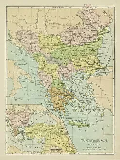
Map of TurkeyMarcus Ward's Home Atlas - London, 1894
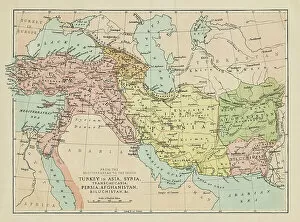
Map of Turkey, Persia, Afghanistan, SyriaMarcus Ward's Home Atlas - London, 1894
Map of United States 1856
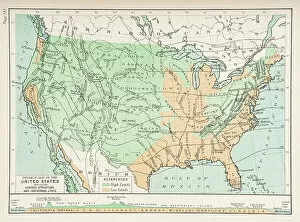
Physical map of the United States showing surface and isothermal lines 1892
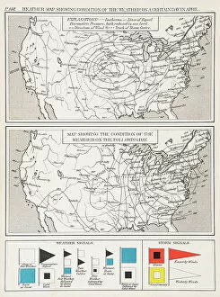
Map of the United States showing condition of the weather 1892
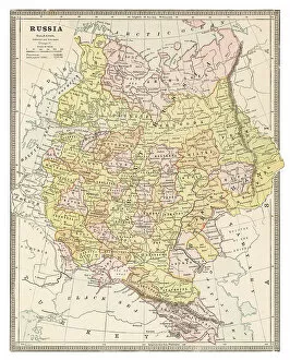
Map of Russia 1883
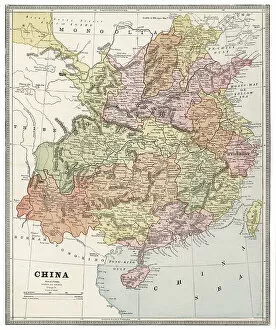
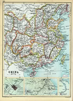
Map of China 1883
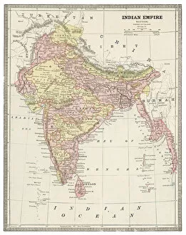
Map of India 1883
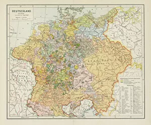
Map of Germany 1883
Cameroon map, German colonization, wood engraving, published in 1899Historical map of Cameroon during the German colonization. Wood engraving, published in 1899
Old Antique map of China, detail of Pekin and Nanjing, Shanghai, 1890s, Victorian 19th Century history, 1890s
Old Antique map of Egypt, detail of River Nile, Alexandria, Cairo, 1890s, Victorian 19th Century history
Old Antique map of Japan and Korean, detail of Tokyo bay, 1890s, Victorian 19th Century history
Old chromolithograph map of Germany around the 1550Antique Illustration, Copyright has expired on this artwork. From my own archives, digitally restored
Old chromolithograph map of United States of America (USA)Antique Illustration. Copyright has expired on this artwork. From my own archives, digitally restored
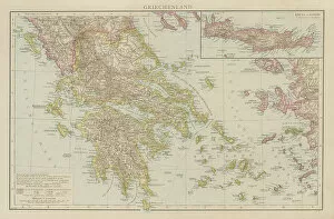
Old chromolithograph map of Greece and its islandsCopyright has expired on this artwork. From my own archives, digitally restored
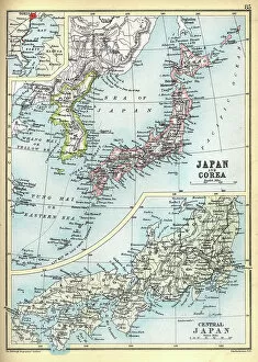
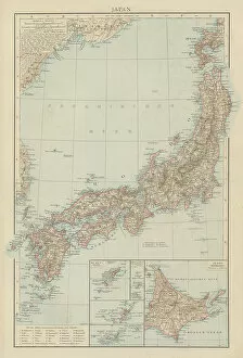
Old chromolithograph map of Japan, island country in East AsiaCopyright has expired on this artwork. From my own archives, digitally restored
Old chromolithograph map of China and Japan IslandsCopyright has expired on this artwork. From my own archives, digitally restored
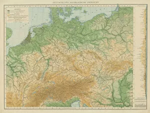
Old chromolithograph physical map of GermanyAntique Illustration. Copyright has expired on this artwork. From my own archives, digitally restored
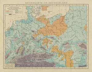
Old chromolithograph illustration of rain map of GermanyAntique Illustration. Copyright has expired on this artwork. From my own archives, digitally restored
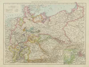
Old chromolithograph political map of GermanyAntique Illustration. Copyright has expired on this artwork. From my own archives, digitally restored
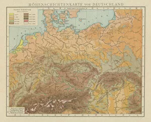
Old chromolithograph illustration altitude (topographic) map of GermanyAntique Illustration, Copyright has expired on this artwork. From my own archives, digitally restored
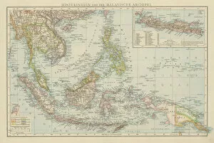
Old chromolithograph map of India and Malay ArchipelagoAntique Illustration. Copyright has expired on this artwork. From my own archives, digitally restored