Home > Map > Historical Maps
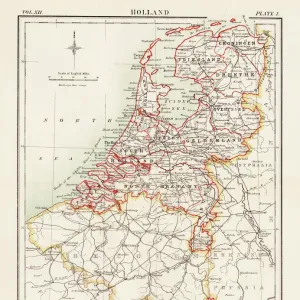
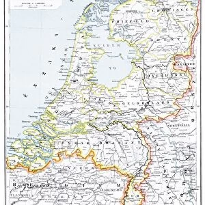
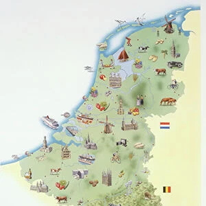
Map of the Netherlands, lithograph, published in 1877

![]()
Wall Art and Photo Gifts from Fine Art Storehouse
Map of the Netherlands, lithograph, published in 1877
Map of the Netherlands. Lithograph, published in 1877
Media ID 13666773
© ZU_09
Amsterdam Antwerp City Belgium Atlantic Ocean Belgium Benelux Contour Drawing Country Geographic Area Dutch Culture Fax Machine Friesland Island Land Netherlands North Sea Rotterdam Storytelling Topographic Map Topography Utrecht
FEATURES IN THESE COLLECTIONS
> Map
> Historical Maps
> Map
MADE IN THE USA
Safe Shipping with 30 Day Money Back Guarantee
FREE PERSONALISATION*
We are proud to offer a range of customisation features including Personalised Captions, Color Filters and Picture Zoom Tools
SECURE PAYMENTS
We happily accept a wide range of payment options so you can pay for the things you need in the way that is most convenient for you
* Options may vary by product and licensing agreement. Zoomed Pictures can be adjusted in the Cart.