mail_outline sales@mediastorehouse.com
221 Items
Ancient map of Northern Italy, lithograph, published in 1876Ancient map of Northern Italy. Lithograph, published in 1876
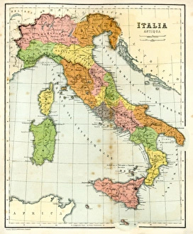
Antique Map of Ancient ItalyVintage engraving showing a Antique Map of Ancient Italy, 1864
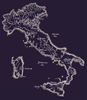
Antique map of Italy, 1864
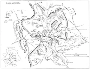
Map of Ancient RomeVintage engraving showing a plan of Ancient Rome
Antique ItalyItaly Map, - Antique style. Includes mountains and water bodies. High detail - vector illustration
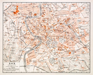
Map of Rome 1896Map of Rome, Italy
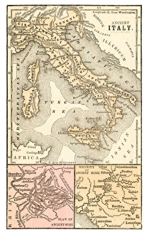
Ancient Italy map 1875The Independent Course Comprehensive Geography by James Monteith, A.S. Barnes & Co, New York & Chicago 1875
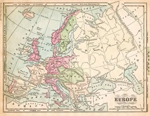
Europe map 1875The Independent Course Comprehensive Geography by James Monteith, A.S. Barnes & Co, New York & Chicago 1875
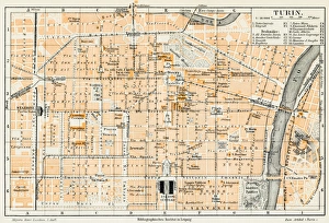
Turin Italy map 1895Meyers Konversations-Lexikon. Ein Nachschlagewerk des allgemeinen Wissens, 5th edition 17 volumes Bibliographisches Institut - Leipzig 1895-1897
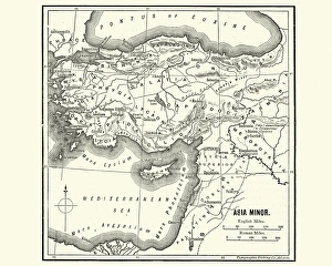
Map of Asia Minor in Ancient TimesVintage engraving of a Map of Asia Minor in Ancient Times
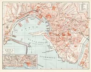
Genoa Itlay map 1895Encyclopedia Britannica 9th Edition Vol I New York, Samuel Hall 1878
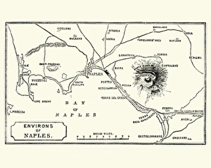
Map of Environs of Naples and Mount Vesuvius 1872Vintage engraving of Map of Environs of Naples and Mount Vesuvius 1872
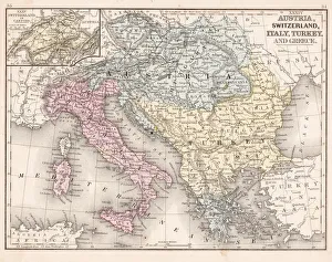
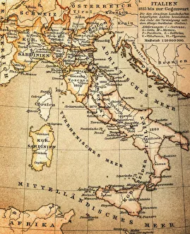
Austria Switzerland Italy map 1867Mitchellas Modern Atlas - Published by E.H. Butler and Co - Philadelphia 1867
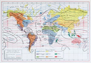
Antique colored illustrations: Isothermal lines and ethnicities of the World
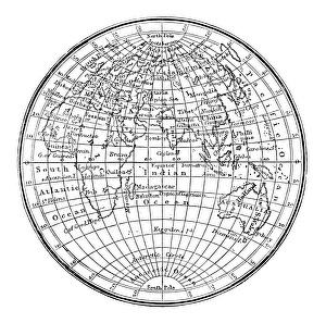
Antique engraving illustration: World map
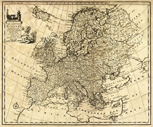
Antique Map of Europe 1744An engraved map of Europe with ornamental cartouche and relief shown pictorially by Emanuel Bowen 1744, London, Geographer to His Majesty
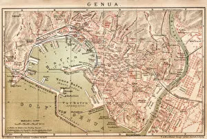
Map of Genoa 1898
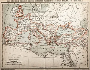
Roman empire under Trajan
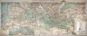
Mediterranean seaAntique map of Mediterranean Sea
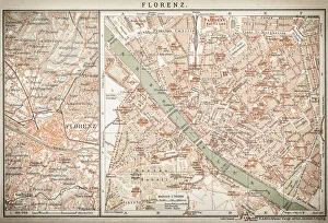
map of florenceEngraved illustrations of the City of Florence
Ethnographic map of Europe from 1898
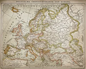
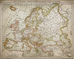
Political outline map of Europe from 1898
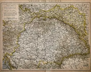
Hungary and GaliciaAntique Illustration map of a Hungary and Galicia
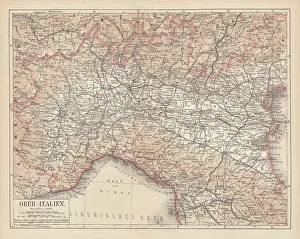
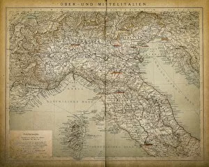
Upper and Central ItalyAntique illustration of a Upper and Central Italy
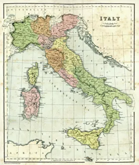
ItalyAntique illustration of Italy
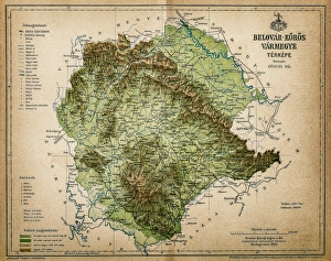
Belovar-koros, Croatio map from 1893Antique illustration of a Belovar-koros, Croatio map from 1893
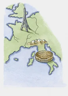
Illustration of Eiffel Tower in Paris and Colosseum in Rome on map of Europe
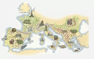
Illustrated map of France, Southern and Southeastern Europe
Works In ArchitectureMinerva (Athena in Greek), the Roman goddess of wisdom, instructs a young student to find his inspiration in Italy and Greece