mail_outline sales@mediastorehouse.com
Choose a picture from our collection for your Wall Art and Photo Gifts
1,517 Items
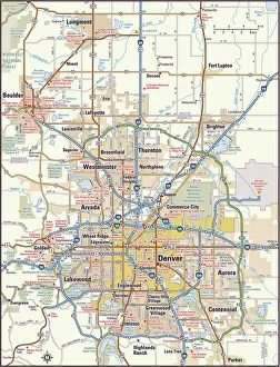
Denver, Colorado area map2011 edition
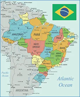
Brazil Map with Rivers and National FlagVintage Map of Brazil. Vector Illustration with Rivers and National Flag
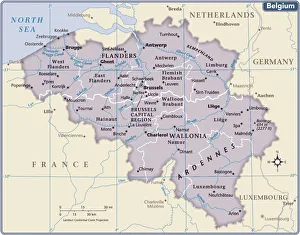
Belgium country map2011 edition
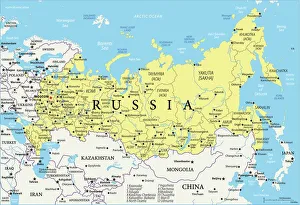
Map of RussiaReference Map of Russia
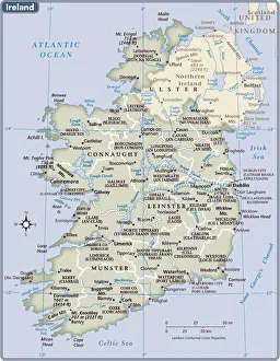
Ireland country map2011 edition
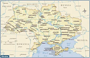
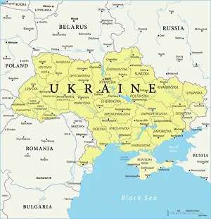
Ukraine country map2011 edition
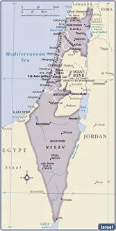
Israel Country Map 2011 EditionIsrael is a country in the Middle East, located at the eastern end of the Mediterranean Sea. It is bounded to the north by Lebanon, to the northeast by Syria, to the east and southeast by Jordan
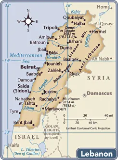
Lebanon country map2011 edition
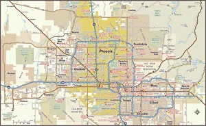
Phoenix, Arizona area map2011 edition
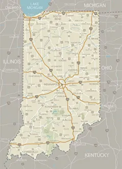
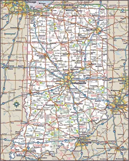
Indiana MapA detailed map of Indiana state with cities, roads, major rivers, and lakes plus National Forests. Includes neighboring states and surrounding water
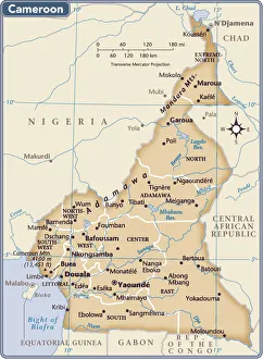
Cameroon country map2011 edition
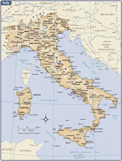
Italy country map2011 edition
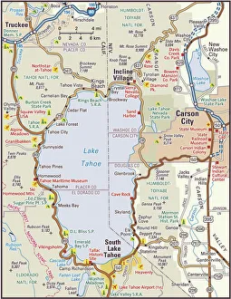
Lake Tahoe Area Map2010 edition. South Lake Tahoe and North Lake Tahoe are comprised of small cities and towns located in California and Nevada
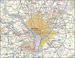
Washington, DC area map2011 edition
Indiana Highway MapReference Maps, Top Sellers Art Prints, 103312674
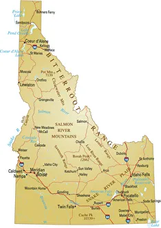
Map of IdahoVector illustration of map of Idaho with major roads, rivers and lakes
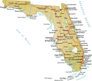
Map of FloridaVector illustratio of map of Florida with major roads, rivers and lakes
Map of UkraineReference Maps of Ukraine
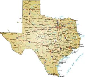
Map of TexasVector illustration of map of Texas with major roads, rivers and lakes
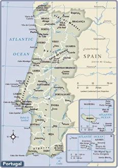
Portugal country map2011 edition
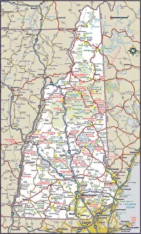
New Hampshire Highway MapReference Maps, Top Sellers Art Prints, 103312572
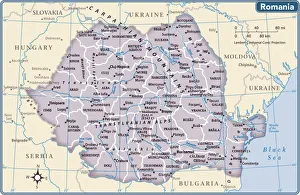
Romania country map2011 edition
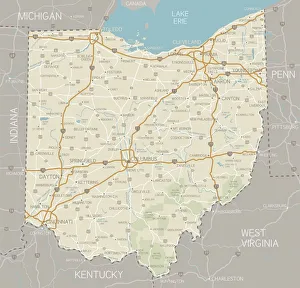
Ohio MapA detailed map of Ohio state with cities, roads, major rivers, and lakes plus National Forests. Includes neighboring states and surrounding water
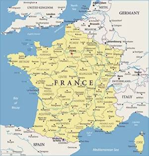
Map of France - Vector illustration
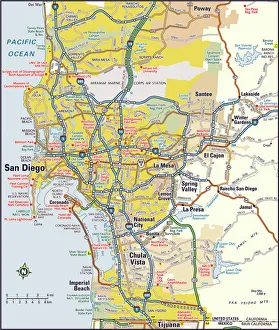
San Diego, California area map2012 edition
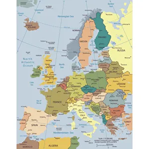
Political map of EuropeVector illustration of the policital map of Europe Reference map was created by the US Central Intelligence Agency and is available as a public domain map at the University of Texas Libraries
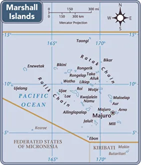
Marshall Islands country map2011 edition
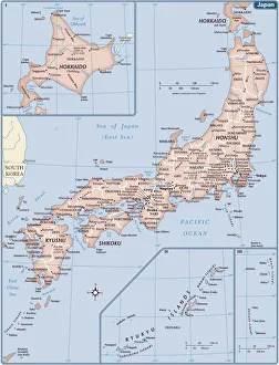
Japan country map2011 edition
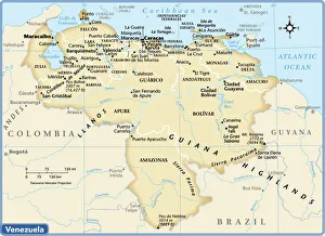
Venezuela country map2011 edition
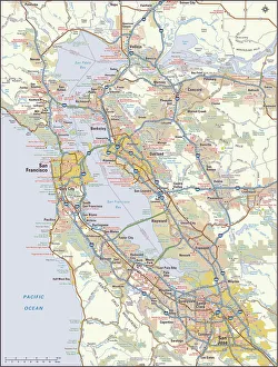
San Francisco, California area map2011 edition
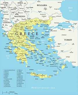
Map of Greece - Vector illustration
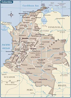
Colombia country map2011 edition
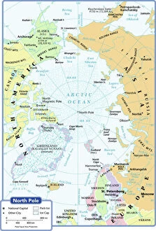
arctic ocean, cartography, map, no people, north pole, polar equal area projection, political map, arctic, Reference Maps, 102270272
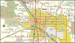
Tucson, Arizona area map2012 edition
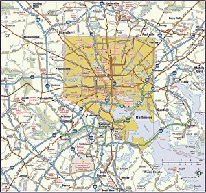
Baltimore, Maryland area2011 edition
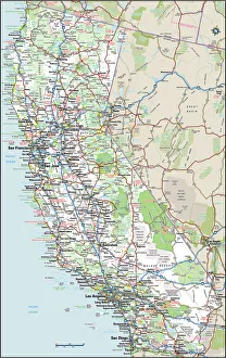
California Highway MapReference Maps, Top Sellers Art Prints, 103312667
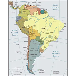
Political map of South AmericaVector illustration of the political map of South America Reference map was created by the US Central Intelligence Agency
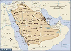
Saudi Arabia country map2011 edition
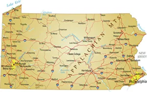
Map of PennsylvaniaVector illustration of map of Pennsylvania with major roads, rivers and lakes
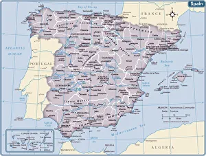
Spain country map2011 edition
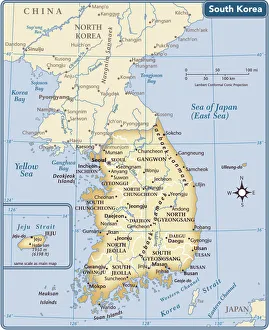
South Korea country map2011 edition
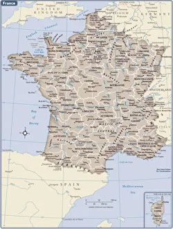
France country map2011 edition
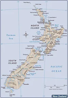
New Zealand country map2011 edition
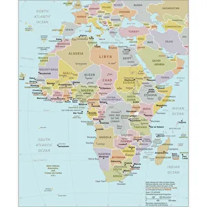
Political Map of AfricaVector Illustration of the policital map of Africa Reference map as created by the US Central Intelligence Agency
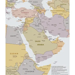
Political map of The Middle EastVector illustration of the policital map of The Middle East Reference map was created by the US Central Intelligence Agency
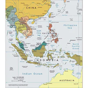
Political map of South East AsiaVector illustration of the political map of South East Asia Reference map was created by the US Central Intelligence Agency
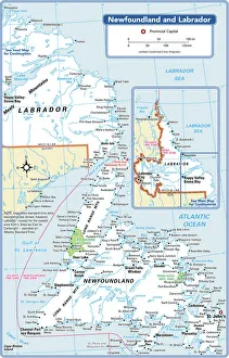
Newfoundland and Labrador Provincial MapReference Maps, 103745768
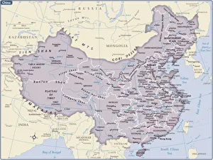
China country map2011 edition