mail_outline sales@mediastorehouse.com
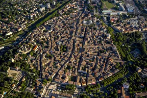
City centre, Montelimar, Rhone-Alpes, France
Sunset over Isola Bella, Lake Maggiore, ItalyBorromean islands in the gulf of Pallanza, Lake Maggiore, Piedmont, Italy
View of Oludeniz, TurkeyTo get this view you take the Lycian Way which is a pathway behind the Montana Pine Resort in OluDeniz in Turkey. It takes about 30 minutes
Aerial of lower Manhattan at sunset, New York, USAAerial of lower Manhattan skyline at sunset, New York, USA
Zacatecas, teleferico system on the Bufa mountain is an old Aerial Tram and dates from 1975, it was meant as a medium of transportation but today is more like a touristic atraction on the city
Aerial view of Havana cityscape, Havana, Cuba
Aerial view of Sanaa cityscape at twilight, YemenAerial view of Saana cityscape at twilight, Yemen
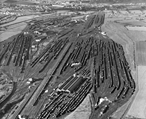
Toton Railway SidingsAn aerial view of the railway sidings at Toton, near Nottingham, 1951. (Photo by Fox Photos/Hulton Archive/Getty Images)
Aerial view of Loreto Bay, Nopolo Rock, Sierra de la Giganta, Baja California Sur, MexicoLoreto (or Concho) is a city in and municipal seat of Loreto Municipality, located on the Gulf of California in eastern Baja California Sur state, Mexico
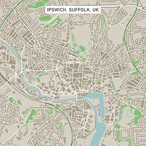
Ipswich Suffolk UK City Street MapVector Illustration of a City Street Map of Ipswich, Suffolk, UK. Included files are EPS (v10) and Hi-Res JPG. Data courtesy from Ordnance Survey: VectorMap District https
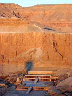
Queen Hatshepsuts Temple, Luxor, EgyptAerial view from hot air balloon of Queen Hatsheputs Temple, Valley of the Queens
Lithuania, Vilnius, Illuminated cityscape
Aerial view of lake Bled at sunrise, SloveniaAerial drone view of Bled lake and island at sunrise, Upper Carniola, Slovenia
Panoramic elevated view of Queenstown at dusk, New ZealandQueenstown, Otago, New Zealand
Sagrat Cor church at Tibidabo mountain at sunset, Barcelona, Catalonia, SpainTemple of the Sacred Heart of Jesus (Sagrat Cor) at Tibidabo mountain, Barcelona, Spain
Aerial view of Angkor wat, CambodiaAnkor Wat, Cambodia
Mortuary Temple of Hatshepsut, Luxor, EgyptMortuary Temple of Hatshepsut, Deir el-Bahari, Theban Necropolis (UNESCO World Heritage List, 1979), Luxor, Egypt. Egyptian civilisation, New Kingdom, Dynasty XVIII
Aerial view over downtown Reykjavik with ocean and mountain at back, IcelandAerial view over downtown Reykjavik from the top of Hallgrimskirkja church with ocean and mountain at back, capital city of Iceland
Southampton Dock20th June 1928: An aerial view of Southampton Dock. (Photo by Davis/Topical Press Agency/Getty Images)
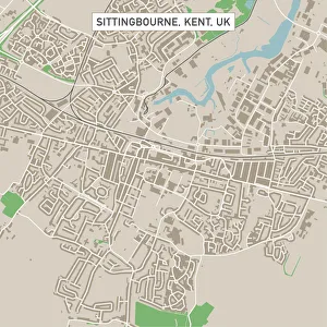
Sittingbourne Kent UK City Street MapVector Illustration of a City Street Map of Sittingbourne, Kent, UK. Included files are EPS (v10) and Hi-Res JPG. Data courtesy from Ordnance Survey: VectorMap District https
Pueblo Colorado US City Street MapVector Illustration of a City Street Map of Pueblo, Colorado, USA. Scale 1:60, 000. All source data is in the public domain. U.S
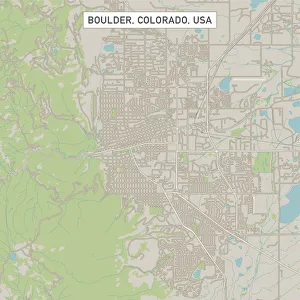
Boulder Colorado US City Street MapVector Illustration of a City Street Map of Boulder, Colorado, USA. Scale 1:60, 000. All source data is in the public domain. U.S
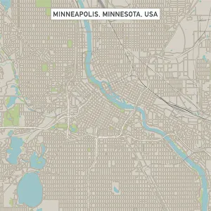
Minneapolis Minnesota US City Street MapVector Illustration of a City Street Map of Minneapolis, Minnesota, USA. Scale 1:60, 000. All source data is in the public domain. U.S
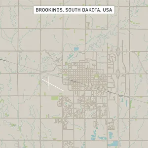
Brookings South Dakota US City Street MapVector Illustration of a City Street Map of Brookings, South Dakota, USA. Scale 1:60, 000. All source data is in the public domain. U.S
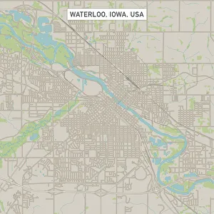
Waterloo Iowa US City Street MapVector Illustration of a City Street Map of Waterloo, Iowa, USA. Scale 1:60, 000. All source data is in the public domain. U.S
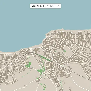
Margate Kent UK City Street MapVector Illustration of a City Street Map of Margate, Kent, UK. Included files are EPS (v10) and Hi-Res JPG. Data courtesy from Ordnance Survey: VectorMap District https
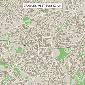
Crawley West Sussex UK City Street MapVector Illustration of a City Street Map of Crawley, West Sussex, UK. Included files are EPS (v10) and Hi-Res JPG. Data courtesy from Ordnance Survey: VectorMap District https
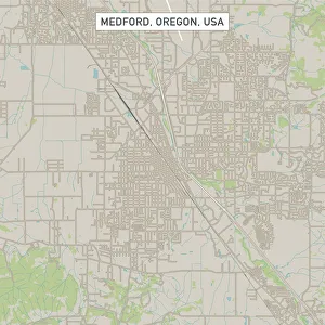
Medford Oregon US City Street MapVector Illustration of a City Street Map of Medford, Oregon, USA. Scale 1:60, 000. All source data is in the public domain. U.S
Casper Wyoming US City Street MapVector Illustration of a City Street Map of Casper, Wyoming, USA. Scale 1:60, 000. All source data is in the public domain. U.S
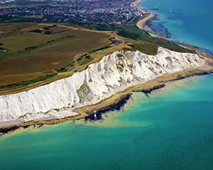
Beachy Head Aerial ViewAerial view of Beachy Head at low tide in summer with the town of Eastbourne in the background
Resort, MaldivesKurumba island, North Male Atoll, Maldives, Indian Ocean
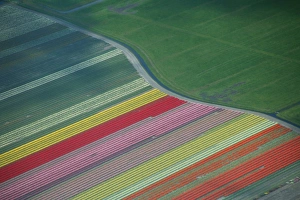
Aerial view of tulip fields in the Netherlands
View of the Temple of the Sacred Heart of Jesus at Tibidabo mountain, Barcelona, Catalonia, Spain
Cityscape of Gdansk at sunset Gdansk, PolandGdansk, Pomeranian Voievodship, Poland
New York City skyline with illuminated skyscrapers seen from above during sunrise, New York State, USA
Colorful Lviv, UkraineColorful and amazing city of Lviv in western Ukraine, around 70 kilometers from the border with Poland
Tromso, NorwayCity of Tromso and Norwegian Sea taken from an aerial point of view
New Imperial Airways Aircraft At CroydonAn aerial view of the christening ceremony for five Handley Page airliners of Imperial Airways at Croydon Aerodrome, London, 30th March 1926
Aerial view, high-rise buildings, holiday resort on the beach, Roses, Golf de Roses, Catalonia, Spain
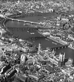
London From The Air the Palace of Westminster at lower right and County Hall at centre rightAn aerial view over the Thames in London, with the Palace of Westminster at lower right and County Hall at centre right, circa 1950
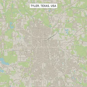
Tyler Texas US City Street MapVector Illustration of a City Street Map of Tyler, Texas, USA. Scale 1:60, 000. All source data is in the public domain. U.S
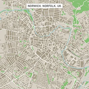
Norwich Norfolk UK City Street MapVector Illustration of a City Street Map of Norwich, Norfolk, UK. Included files are EPS (v10) and Hi-Res JPG. Data courtesy from Ordnance Survey: VectorMap District https
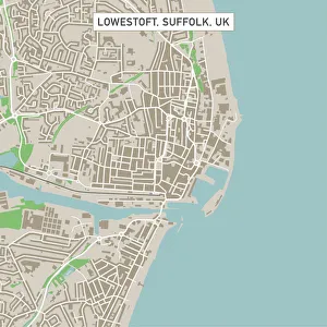
Lowestoft Suffolk UK City Street MapVector Illustration of a City Street Map of Lowestoft, Suffolk, UK. Included files are EPS (v10) and Hi-Res JPG. Data courtesy from Ordnance Survey: VectorMap District https
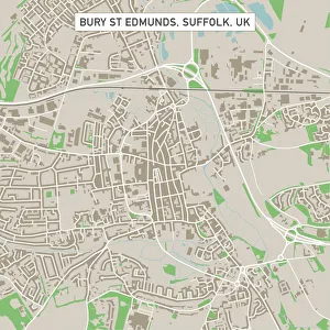
Bury St Edmunds Suffolk UK City Street MapVector Illustration of a City Street Map of Bury St Edmunds, Suffolk, UK. Included files are EPS (v10) and Hi-Res JPG. Data courtesy from Ordnance Survey: VectorMap District https
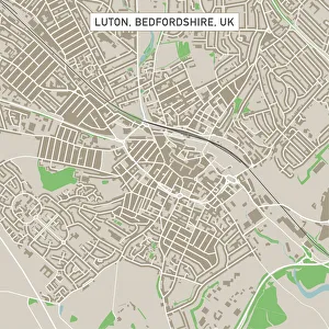
Luton Bedfordshire UK City Street MapVector Illustration of a City Street Map of Luton, Bedfordshire, UK. Included files are EPS (v10) and Hi-Res JPG. Data courtesy from Ordnance Survey: VectorMap District https
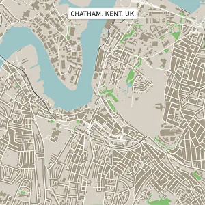
Chatham Kent UK City Street MapVector Illustration of a City Street Map of Chatham, Kent, UK. Included files are EPS (v10) and Hi-Res JPG. Data courtesy from Ordnance Survey: VectorMap District https
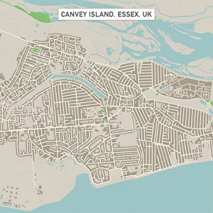
Canvey Island Essex UK City Street MapVector Illustration of a City Street Map of Canvey Island, Essex, UK. Included files are EPS (v10) and Hi-Res JPG. Data courtesy from Ordnance Survey: VectorMap District https
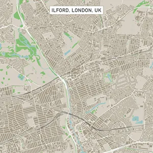
Ilford London UK City Street MapVector Illustration of a City Street Map of Ilford, London, UK. Included files are EPS (v10) and Hi-Res JPG. Data courtesy from Ordnance Survey: VectorMap District https