mail_outline sales@mediastorehouse.com
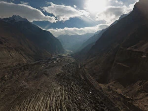
Pakistan - An aerial view of Nagar Valley, Gilgit BaltistanAn aerial view of Nagar Valley, Pakistan
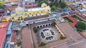
Aerial view of the aIglesia y Convento de Nuestra SeAnora de la Merceda in Antigua, GuatemalaElevated view of La Merced Church, Monastery and Fountain, one of the baroque churches in the Antigua, Guatemala. It is probably the most beautiful church in Antigua, it was was finished in 1767
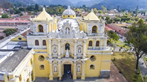
Colonial church of Nuestra SeAnora de la Merced, Antigua, GuatemalaElevated view of La Merced Church, one of the baroque churches in the Antigua, Guatemala. It is probably the most beautiful church in Antigua, it was was finished in 1767
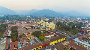
Aerial view of colonial church of Nuestra SeAnora de la Merced an city of Antigua, GuatemalaElevated view of La Merced Church, one of the baroque churches in the Antigua, Guatemala. It is probably the most beautiful church in Antigua, it was was finished in 1767
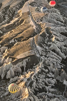
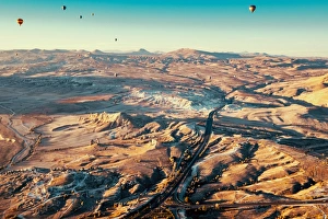
Morning flight above Goreme Valley in Cappadocia, TurkeyHot air balloons above a gorgeous landscape of Cappadocia in Turkey
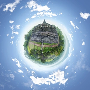
360A Aerial Panorama of Borobudur Temple, IndonesiaBorobudur Temple is a UNESCO world heritage site in Central Java, Indonesia
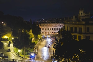
Rome, ItalyPhotograph of the streets of Rome at night, Italy, Europe
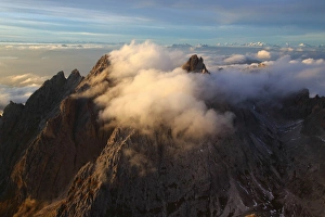
Aerial view of Odle Dolomites ItalyAerial view of the Odle group with the peaks partially hidden by clouds Dolomites South Tyrol Trentino Alto Adige Italy Europe
Ballons over CappadociaMorning flight above Goreme Valley in Cappadocia
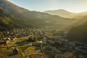
Shirakawa Go (Shirakawa-go) Beautiful Panorama Aerial View of The Historic Village
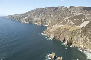
Slieve League, Donegal, Ireland
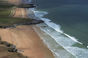
Ballymastocker bay, IrelandBallymastocker Bay near Portsalon, Fanad peninsula, Ireland
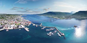
Tromso Bridge, NorwayThis is an aerial panoramic view over Tromso Bridge crossing Norwegian Sea. It connects Tromsdalen on the mainland and the island of TromsAŝya
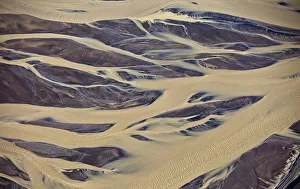
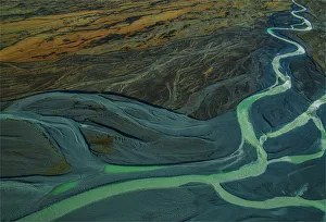
Aerial of muddy glacial riverbed, IcelandPattern of Markarfljot Riverbed
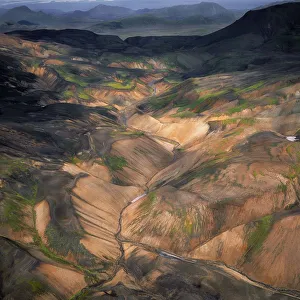
Landmannalaugar, Central Highlands, Iceland
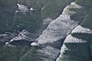
Aerial view of ways breakingWave breaking on shore, North Atlantic Ocean, Iceland
Fjardargljufur canyon, IcelandAerial view of a riverbed in Fjardargljufur canyon, shot with a drone, Iceland
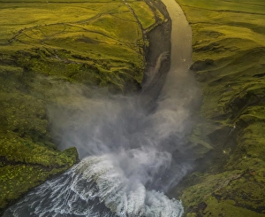
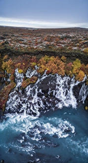
Skogafoss Waterfalls, IcelandAerial view of Skogafoss shot with a drone, Iceland
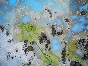
Silica, lava, moss, algae from aboveAerial view of lava, moss, silica and algae in a geothermal area, Blue Lagoon, Iceland. Image is shot with a drone
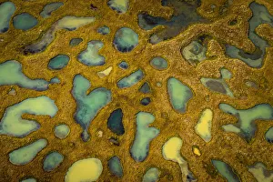
Small ponds with lava and moss, IcelandAerial of small ponds, lava and sands near the Jokulsa river a fjollum in Vikursandur, Krepputunga just north of Holuhraun
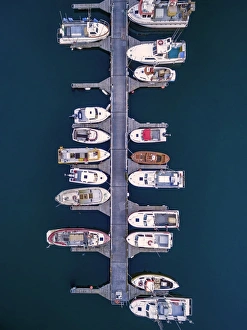
Aerial of boats, Hafnarfjordur, IcelandBoats in the Hafnarfjordur Harbor, shot with a drone, suburb of Reykjavik, Iceland
Aerial view of Hraunfossar, IcelandTop view of Hraunfossar in the autumn, picture is shot with a drone, Borgarfjordur, Iceland
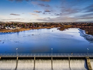
Top view of Lake Ellidavatn, Reykjavik, IcelandSmall walking bridge over Lake Ellidavatn, with neighborhoods in the background, Reykjavik, Iceland. This image is shot using a drone
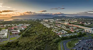
Aerial view of Neighborhood of ReykjavikTop view of Breidholt in the summertime, a neighborhood of Reykjavik, Iceland. This image is shot using a drone
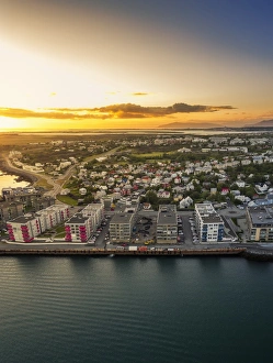
Top view- Hafnarfjordur, IcelandHafnarfjordur is a suburb of Reykjavik, Iceland. This image is shot using a drone
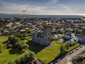
Landakot Church and Neighborhood, ReykjavikTop view-Landakotskirkja (Landakot Church) and homes, Reykjavik, Iceland. Summertime. This image is shot using a drone
Aerial of snow covered mountains and lavaTop view Mt. Grabrok, Grabrokarhraun lava field, Borgarfjordur, Western Iceland. This image is shot using a drone
River path in canyon, IcelandAerial view of snow covered landscape by Ofaerufoss Waterfall, Skafta river, Central Highlands, Iceland
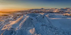
Aerial view of coastline and snow covered lava fields, IcelandLava and moss landscape with fresh snow by the seashore, Eastern Iceland. Drone photography
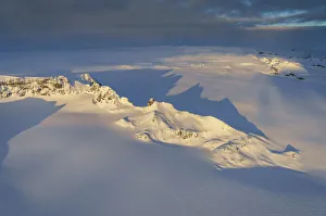
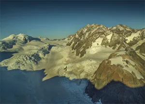
Aerial view of mountains and cliffs on a glacier, IcelandTop view of peaks and cliffs of Mt. Fingurbjorg, a Nunatak, Breidamerkurjokull glacier, Vatnajokull Ice Cap, Iceland
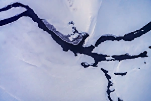
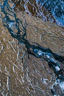
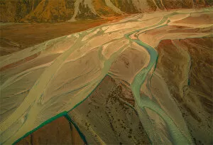
Crooked Glacial River Bed, IcelandAerial view of river bed patterns, Morsa river, Morsardalur valley, Morsarjokull glacier, Vatnajokull Ice Cap, Iceland
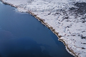
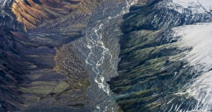
Aerial view of river bed in a valley, IcelandLandscape with river beds and mountains in the Kalfafellsdalur Valley, Eastern Iceland
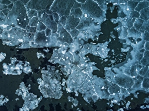
Aerial view of pack iceTop view of pancake ice, Dalvik, Northern Iceland. Image is shot using a drone
Lutnik 113th January 1959: Satellite Lutnik 1 on a wheeled dolly, aerials extended. (Photo by Keystone/Getty Images)
Aerial view, Tasman Glacial river, Mount Cook National Park, South Island of New Zealand
Aerial view of the Mount Cook Aoraki National Park, south Island of New Zealand
Hooker river Aerial, Mount-cook Aoraki National Park, south island, New Zealand
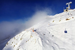
Clouds over Ski Resort mountain in French Alps
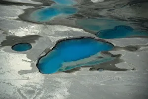
Lakes on Top of Glacier
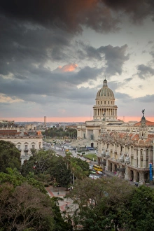
Capitol building in HavanaThe beautiful capitol building in Havana, Cuba as seen from above at sunset
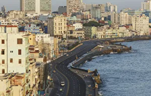
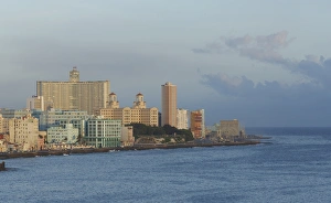
Havana. Aerial view of El MaleconThe MalecAon (officially Avenida de Maceo) is a broad esplanade, roadway and seawall which stretches for 8Akm (5 miles) along the coast in Havana, Cuba
Havana city skyline and ocean, Havana, Cuba
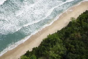
Coastline
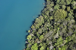
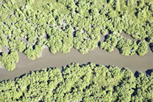
Rainforest Meeting Water
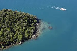
Boat Passing Rocky Point
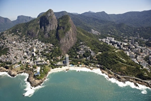
Rio de Janeiro
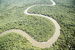
River Oxbow
River