mail_outline sales@mediastorehouse.com
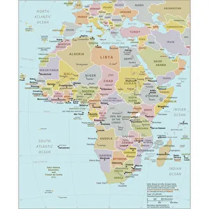
Political Map of AfricaVector Illustration of the policital map of Africa Reference map as created by the US Central Intelligence Agency
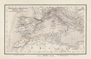
Roman Republic and Carthage during the Second Punic War (218-201-BC)Ancient map of the Roman Republic and Carthage during the Second Punic War (218 to 201 BC). Legend in Latin language. Steel engraving with hand colored borderlines, published in 1861
Map of Africahttp://csaimages.com/images/istockprofile/csa_vector_dsp.jpg
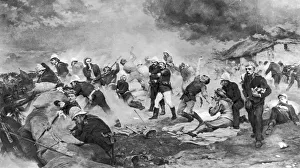
Rorkes DriftThe Defence of Rorkes Drift during the Zulu War, 22nd January 1879. A painting by Lady Elizabeth Butler, specially commissioned by Queen Victoria to commemorate the bravery of the soldiers who fought
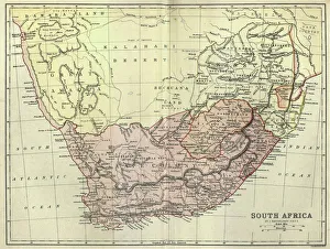
Antique map of South Africa, 1884, 19th CenturyVintage engraving of Antique map of South Africa, 1884, 19th Century
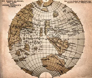
World map from 1520Western hemisphere of the Johannes SchAoner globe from 1520. expedition
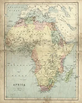
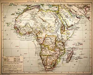
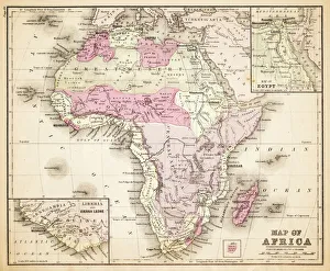
Antique map of Africa in the 19th Century, 1873Vintage engraving of a Victorian Antique map of Africa in the 19th Century, 1873
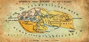
Map of the world according to Strabo 63 B.C
Africa Political MapAntique illustration of a Africa Political Map from 1893
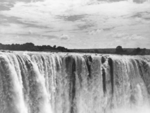
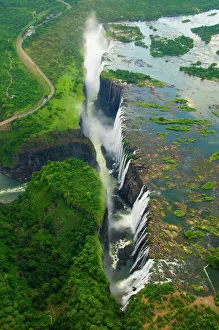
The Victoria Fallscirca 1961: A view of The Victoria Falls on the Zambezi River at Bulawayo discovered by David Livingstone in 1855. (Photo by Fox Photos/Getty Images)
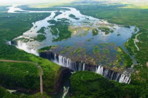
Victoria Falls, Livingstone, ZambiaKnown locally as Mosi-oa-Tunya, the " smoke that thunders", the falls are situated on the Zambezi River, on the border between Zambia and Zimbabwe
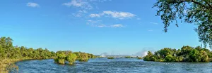
Zambezi River view with the spray from Victoria Falls in the distance. Livingstone. Zambia
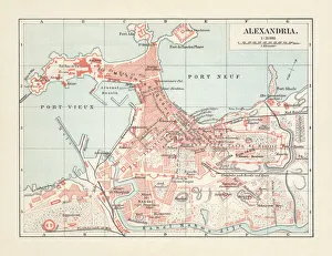
City map of Alexandria, Egypt, lithograph, published in 1897City map of Alexandria, Egypt. Lithograph, published in 1897
Hissing leopard on a tree in NamibiaA leopard shows its teeth while sitting on a tree
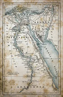
Map of EgyptIllustration of a Map of Egypt
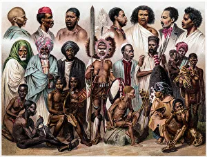
African peopleAntique illustration of a African people
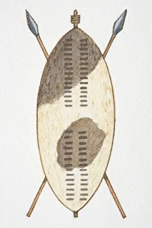
Africa, Zulu shield
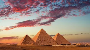
Sunset at the Pyramids, Giza, Cairo, EgyptA sunset from the Pyramids at Giza, Cairo, Egypt
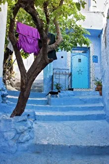
The colourful town of Chefchaoeun, MoroccoTypical blue painted street with steps in Chefchauen, Morocco, North Africa
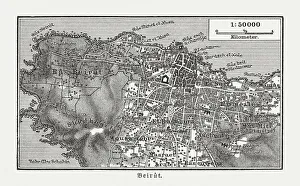
Historic city map of Beirut, Lebanon, wood engraving, published 1897Historic city map of Beirut - capital and largest city of Lebanon. Wood engraving, published in 1897
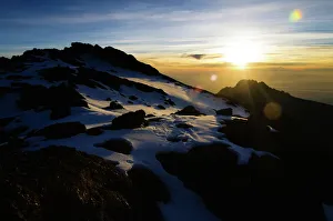
Kilimanjaro Sunrise, AfricaSunrise as seen from the summit of Mt Kilimanjaro in Tanzania, Africa
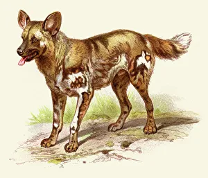
African wild dog illustration 1888Illustrated Natural History of the Three Kingdoms Illustrierte Naturgeschichte der drei Reiche Franz StrAÔé¼ssles - Wilhelm Nitzschke, Stuttgart 1888
Victoria FallsLivingstone, Zambia
Sunrise on the Crater Rim of Kibo PeakMt. Kilimanjaro, Tanzania
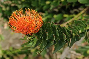
Red pincushion protea (Leucospermum cordifolium), Cape flora, Cape Floral Kingdom, South Africa
Ostrich portraitClose up of emu head. Varese, Italy
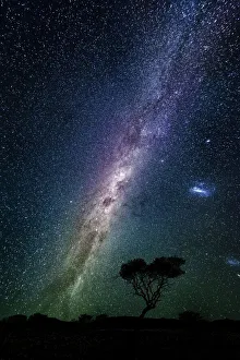
Milky way over the night sky, AfricaMilky way galaxy, stars and acacia tree, Namibia, Africa
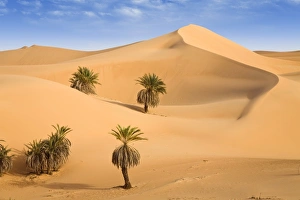
Um el Ma Oasis, date palms and sand dunes, Libyan Desert, Libya, Sahara, North Africa, Africa
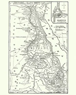
Map of Sudan, late 19th CenturyVintage engraving of a Map of Sudan, late 19th Century
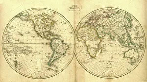
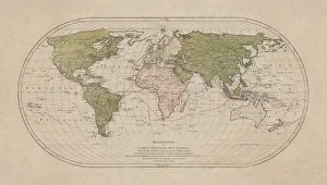
Vintage Map of the WorldVintage map of the world from 1837
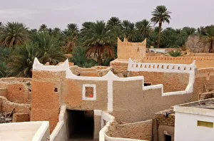
In the oasis of Ghadames, UNESCO world heritage, Libya
Sugarcane plants in Mauritius, Africa
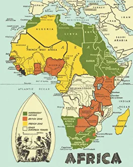
Map of Africa 1883Warrens Common School Geography
World map by Mathieu Albert Lotter, Augsburg, 1778World map from 1778. Original hand-colored copper engraving by Matthieu Albert Lotter (1741 - 1810, Augsburg) with route of James Cooks First Circumnavigation (1770), through Tahiti
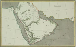
Antique map of Arabian peninsula and Persia
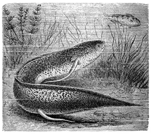
The West African lungfish (Protopterus annectens)Illustration of a The West African lungfish (Protopterus annectens)
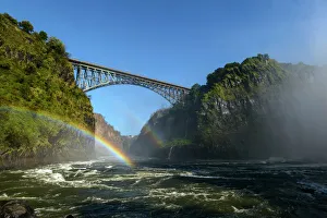
View of Bridge across the Zambezi River from the Boiling Pot. Victoria Falls. Livingstone. Zambia
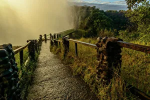
The path and bridge to The Knife Edge. Victoria Falls. Zambia
Bull Elephant by Water Hole at Sunset
Cheetah with Cub, Ndutu Plains, TanzaniaTanzania, Ngorongoro Conservation Area, Ndutu Plains, Cheetah (Acinonyx jubatas) rests in shade with young cub on savanna
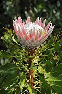
King Protea (Protea cynaroides), national flower of South Africa, Cape Floristic Region, South Africa, Africa
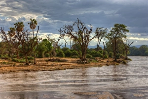
Ewaso Ng iro River in Samburu National Reserve, Kenya, East Africa, Africa, PublicGround
Aerial view of Sailboats - Cape to Rio Yacht RaceCape Town, Western Cape Province, South Africa
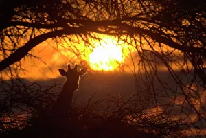
Dramatic Sunset with the Silhouette of a Giraffe. Antelope Park, Gweru, Midlands Province, Zimbabwe, Southern AfricaAntelope Park, Gweru, Midlands Province, Zimbabwe, Southern Africa
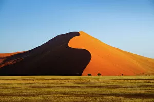
Africa, Dune, Namibia, Orange, Sand, Sossusvlei, UNESCO, UNESCO World Heritage SiteSossusvlei, Namibia
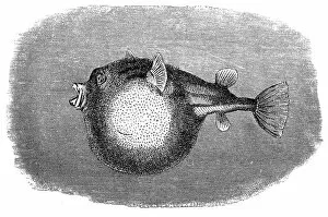
The fahaka pufferfish, Nile puffer, globe fish, lineatus puffer (Tetraodon farakah)illustration of The fahaka pufferfish, Nile puffer, globe fish, lineatus puffer (Tetraodon farakah)
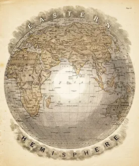
World eastern hemispheres 1883Warrens Common School Geography
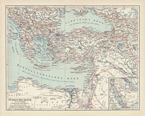
Ottoman Empire, lithograph, published in 1878Ancient map of Ottoman Empire. Lithograph, published in 1878