
Atlantic Ocean Collection (page 5)

Background imageAtlantic Ocean Collection: United States North East map 1897

United States North East map 1897
The World-Wide Atlas of Modern Geography, Political and Physical W. & A.K. Johnston - London 1897

Background imageAtlantic Ocean Collection: grass, sky, travel, fortress, castle, daytime, outdoors, rock, blue, Irish, history

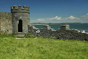
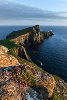
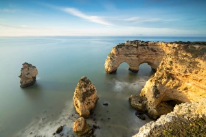
grass, sky, travel, fortress, castle, daytime, outdoors, rock, blue, Irish, history, nobody, wall, Atlantic Ocean, County Clare, 15th century, local landmark, arch, past

Background imageAtlantic Ocean Collection: tree, grass, sky, travel, castle, daytime, outdoors, blue, Irish, history, nobody

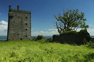
tree, grass, sky, travel, castle, daytime, outdoors, blue, Irish, history, nobody, Atlantic Ocean, County Clare, 15th century, local landmark, past, Trish Punch Landscapes & Travel Photography

Background imageAtlantic Ocean Collection: Cumulus clouds scattered over horizon of sky and ocean

Cumulus clouds scattered over horizon of sky and ocean
Atlantic Ocean south of Newfoundland, Canada

Background imageAtlantic Ocean Collection: Cumulus clouds and rain showers over sea, aerial view

Cumulus clouds and rain showers over sea, aerial view
Atlantic Ocean, Argentina

Background imageAtlantic Ocean Collection: Atlantic salmon (salmo salar) and brown trout (S. trutta)

Atlantic salmon (salmo salar) and brown trout (S. trutta)
Illustration of a Atlantic salmon (salmo salar) and brown trout (S. trutta)

Background imageAtlantic Ocean Collection: Haddock, Whiting and Codfishes

Haddock, Whiting and Codfishes
Illustration of a Haddock, Whiting and Codfishes

Background imageAtlantic Ocean Collection: Sailboats moored Grand Marais Marina

Sailboats moored Grand Marais Marina
Sailboats moored on a foggy cool morning along the Grand Marais marina. A single seagull soars along the tranquil waters edge. Grand Marais, Minnesota, USA

Background imageAtlantic Ocean Collection: Map of South America 1869

Map of South America 1869
Cornells Grammars-School Geography - S.S. Cornell - New York D. Appleton and Company 1869

Background imageAtlantic Ocean Collection: Middle states USA map 1869

Middle states USA map 1869
Cornells Grammars-School Geography - S.S. Cornell - New York D. Appleton and Company 1869

Background imageAtlantic Ocean Collection: MId-atlantic states usa map 1867

MId-atlantic states usa map 1867
Mitchells Modern Atlas - Published by E.H. Buttler & Co - Philadelphia 1867

Background imageAtlantic Ocean Collection: Rhode Island Massachusetts Connecticut 1867

Rhode Island Massachusetts Connecticut 1867
Mitchells Modern Atlas - Published by E.H. Buttler & Co - Philadelphia 1867

Background imageAtlantic Ocean Collection: Maine New Hampshire and Vermont 1867

Maine New Hampshire and Vermont 1867
Mitchells Modern Atlas - Published by E.H. Buttler & Co - Philadelphia 1867

Background imageAtlantic Ocean Collection: Map of North America 1867

Map of North America 1867
Mitchells Modern Atlas - Published by E.H. Buttler & Co - Philadelphia 1867

Background imageAtlantic Ocean Collection: Map of North America 1869

Map of North America 1869
Cornells Grammars-School Geography - S.S. Cornell - New York D. Appleton and Company 1869

Background imageAtlantic Ocean Collection: Map of South America 1855

Map of South America 1855
System of Geography for the use of schools by Sidney E. Morse - Published by Harper & Brothers - New York 1855

Background imageAtlantic Ocean Collection: Maine New Hampshire and Connecticut 1856

Maine New Hampshire and Connecticut 1856
Colton and Fitchs Modern School Geography by George W. Fitch - New York 1856

Background imageAtlantic Ocean Collection: Map of South America 1856

Map of South America 1856
Colton and Fitchs Modern School Geography by George W. Fitch - New York 1856

Background imageAtlantic Ocean Collection: Map of United States 1856

Map of United States 1856
Colton and Fitchs Modern School Geography by George W. Fitch - New York 1856

Background imageAtlantic Ocean Collection: Map of North America 1856

Map of North America 1856
Colton and Fitchs Modern School Geography by George W. Fitch - New York 1856

Background imageAtlantic Ocean Collection: Nest Point, Isle of Skye

Nest Point, Isle of Skye
Neist Point is a viewpoint on the most westerly point of Skye. Neist Point Lighthouse has been located there since 1909

Background imageAtlantic Ocean Collection: Illustration, map of the Titanics journey, starting at Southampton, calling at Cherbourg, France

Illustration, map of the Titanics journey, starting at Southampton, calling at Cherbourg, France, and Queenstown (now Cobh), Ireland, also showing the iceberg into which it crashed

Background imageAtlantic Ocean Collection: Distorted antique map of Africa

Distorted antique map of Africa

Background imageAtlantic Ocean Collection: Antique print of map and illustration of coastal Sierra Leone

Antique print of map and illustration of coastal Sierra Leone

Background imageAtlantic Ocean Collection: Cliffs framed by turquoise water Praia da Marinha Portugal

Cliffs framed by turquoise water Praia da Marinha Portugal
Sunrise on cliffs framed by turquoise water of the ocean Praia da Marinha Caramujeira Lagoa Municipality Algarve Portugal Europe

Background imageAtlantic Ocean Collection: Victorian map of the Arctic Circle

Victorian map of the Arctic Circle
A Victorian map of the Arctic Circle and beyond. From Peter Parleyas Annual - A Christmas and New Yearas Present for Young Peoplea published in London by Darton & Co in 1851

Background imageAtlantic Ocean Collection: Antique illustration of Greenland and Iceland bathymetry map

Antique illustration of Greenland and Iceland bathymetry map

Background imageAtlantic Ocean Collection: Calais, France, wood engraving, published in 1882

Calais, France, wood engraving, published in 1882
City map of Calais, France. Wood engraving, published in 1882

Background imageAtlantic Ocean Collection: Boston, Massachusetts, USA, wood engraving, published in 1882

Boston, Massachusetts, USA, wood engraving, published in 1882
Map of Boston, Massachusetts, USA. Wood engraving, published in 1882

Background imageAtlantic Ocean Collection: The World as Known to the Ancients (steel engraving)

The World as Known to the Ancients (steel engraving)
A creased and stained steel engraving of a map which shows The World as Known to the Ancientsa which aŠcontains all the Parts of which it is thought the Ancients had any knowledgea

Background imageAtlantic Ocean Collection: Western Hemisphere 1852 Map

Western Hemisphere 1852 Map

Background imageAtlantic Ocean Collection: Maine 1852 Map

Maine 1852 Map

Background imageAtlantic Ocean Collection: Massachusetts 1852 Map

Massachusetts 1852 Map

Background imageAtlantic Ocean Collection: Rhode Island 1852 Map

Rhode Island 1852 Map

Background imageAtlantic Ocean Collection: New England 1852 Map

New England 1852 Map

Background imageAtlantic Ocean Collection: New Jersey, Pennsylvania, Delaware and Maryland 1852 Map

New Jersey, Pennsylvania, Delaware and Maryland 1852 Map

Background imageAtlantic Ocean Collection: Middle States 1852 Map

Middle States 1852 Map

Background imageAtlantic Ocean Collection: Southern States 1852 Map

Southern States 1852 Map

Background imageAtlantic Ocean Collection: North America 1852 Map

North America 1852 Map

Background imageAtlantic Ocean Collection: United States 1852 Map

United States 1852 Map

Background imageAtlantic Ocean Collection: Mexico, Texas, Guatimala and West Indies 1852 Map

Mexico, Texas, Guatimala and West Indies 1852 Map

Background imageAtlantic Ocean Collection: United States of America, Atlantic coast, lithograph, published in 1878

United States of America, Atlantic coast, lithograph, published in 1878
United States of America, Atlantic coast. Lithograph, published in 1878

Background imageAtlantic Ocean Collection: Schleswig-Holstein, lithograph, published in 1878

Schleswig-Holstein, lithograph, published in 1878
Map of Schleswig-Holstein. Lithograph, published in 1878

Background imageAtlantic Ocean Collection: Spain and Portugal, lithograph, published in 1878

Spain and Portugal, lithograph, published in 1878
Ancient map of Spain and Portugal. Lithograph, published in 1878

Background imageAtlantic Ocean Collection: Grand Duchy of Oldenburg, litograph, published in 1877

Grand Duchy of Oldenburg, litograph, published in 1877
Ancient map of Grand Duchy of Oldenburg, Germany. Lithograph, published in 1877

Background imageAtlantic Ocean Collection: Map of Brazil. Lithograph, lithograph, published in 1874

Map of Brazil. Lithograph, lithograph, published in 1874
Antique map of Brazil. Lithograph, published in 1874

Background imageAtlantic Ocean Collection: Belgium and Luxembourg, lithograph, published in 1874

Belgium and Luxembourg, lithograph, published in 1874
Antique map of Belgium and Luxembourg. Lithograph, published in 1874

Background imageAtlantic Ocean Collection: Aqua Coral

Aqua Coral
A macro photo of partially frozen water that has been trapped between small compartments of a fan coral. Makes a beautiful, turquoise, translucent, stained-glass like abstract


All Professionally Made to Order for Quick Shipping