mail_outline sales@mediastorehouse.com
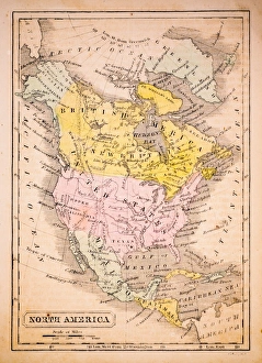
North America 1852 Map
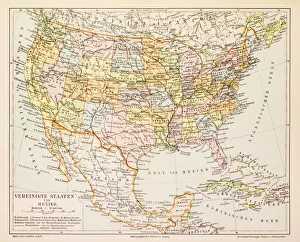
United States 1852 Map
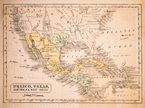
Mexico, Texas, Guatimala and West Indies 1852 Map
United States of America, Atlantic coast, lithograph, published in 1878United States of America, Atlantic coast. Lithograph, published in 1878
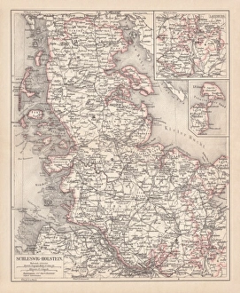
Schleswig-Holstein, lithograph, published in 1878Map of Schleswig-Holstein. Lithograph, published in 1878
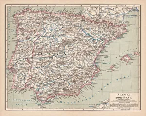
Spain and Portugal, lithograph, published in 1878Ancient map of Spain and Portugal. Lithograph, published in 1878
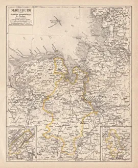
Grand Duchy of Oldenburg, litograph, published in 1877Ancient map of Grand Duchy of Oldenburg, Germany. Lithograph, published in 1877
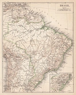
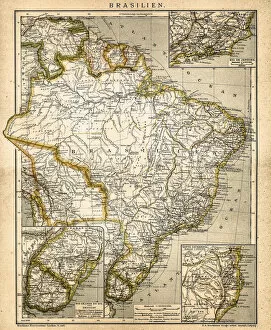
Map of Brazil. Lithograph, lithograph, published in 1874Antique map of Brazil. Lithograph, published in 1874
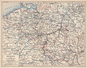
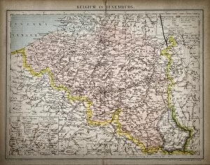
Belgium and Luxembourg, lithograph, published in 1874Antique map of Belgium and Luxembourg. Lithograph, published in 1874
Aqua CoralA macro photo of partially frozen water that has been trapped between small compartments of a fan coral. Makes a beautiful, turquoise, translucent, stained-glass like abstract
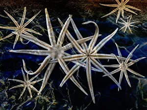
starfish in the seacomposite image of sea stars in water
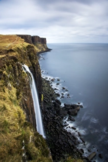
Kilt Rock and Mealt Falls in Isle of SkyeTonnaja Travel Photography, 661574320
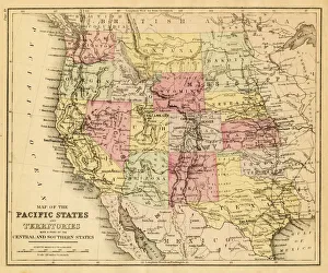
map of the Pacific states (California, Oregon, Washington) an territories with a part of central and souther states - USA (1883)
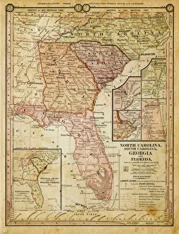
usa - southern states 1884map of north carolina, south carolina, georgia and florida 1884
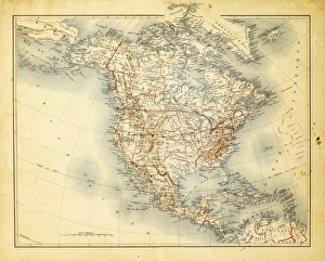
Map of North America 1882Antique Map of North America 1882
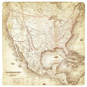
Map of United States and Mexico 1897Map of United States and Mexico
Map of United States and Mexico 1849Map of United States and Mexico
Palm trees in the florida keys
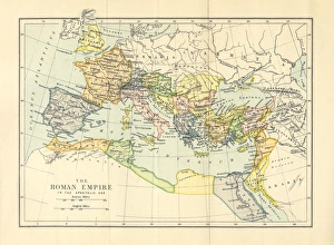
Roman Empire in the Apostolic Age Map, Engraving, 1892Very rare, beautifully detailed engraving of Roman Empire in the Apostolic Age Map, Engraving, Published in 1892. Original edition from my own archives. Copyright has expired on this artwork
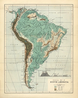
South America Physical Map, Engraving, 1892Very rare, beautifully detailed engraving of South America Physical Map, Engraving, Published in 1892. Original edition from my own archives. Copyright has expired on this artwork. Digitally restored
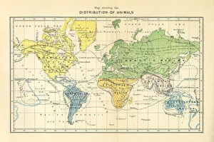
Distribution of Animals Map, Engraving, 1892Very rare, beautifully detailed engraving of North America Physical Map, Engraving, Published in 1892. Original edition from my own archives. Copyright has expired on this artwork. Digitally restored
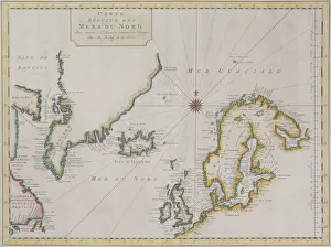
Antique map of Scandinavian region with Iceland and Greenland
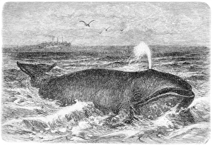
Common whaleAntique illustration of a common whale
Atlantic locomotiveAntique illustration of the Atlantic locomotive
Thomson Road SteamerAntique illustration of a Thomson Road Steamer
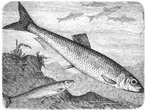
Clupea sprattus and Atlantic herringAntique illustration of alausa finta, clupea sprattus and Atlantic herring
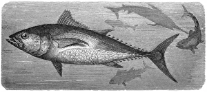
Atlantic bluefin tuna (Thunnus thynnus)Antique illustration of Atlantic bluefin tuna (Thunnus thynnus)
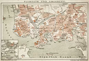
Plymouth and the surrounding area
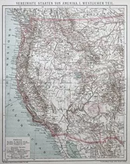
United States of AmericaAntique illustration of a United States of America, western part
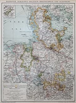
Hannover, Schleswig-Holstein, Braunschweig and Oldenburg
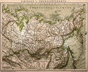
Siberia outline mapAntique illustration of Siberia outline map
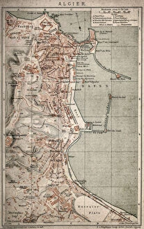
Algiers mapAntique illustration of a Algiers map
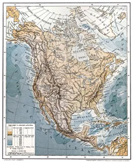
North AmericaAntique illustration of a North America
South America mapAntique illustration of a South America map
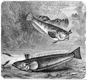
Blennius ocellaris (Butterfly blenny) and The greater weever (Trachinus draco)Illustration of a Blennius ocellaris (Butterfly blenny) and The greater weever (Trachinus draco)
Belgium and LuxembourgAntique illustration map of Belgium and Luxembourg
Atlantic ViewRocky cove at Porth Nanven near Lands End, Cornwall, England, United Kingdom, Europe
Untamed SeasCape Cornwall in Cornwall, is four miles north of Lands End near the town of St Just. Looking out into the Atlantic
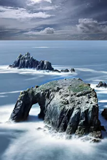
Atlantic SwellEnys Donan arch Lands - End Cornwall
Atlantic Cable BreakIllustration of workers searching for a fault after recovery of the telegraph cable from the bed of the Atlantic ocean in August 1858. (Photo by Kean Collection/Getty Images)
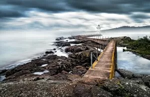
Grand Marais Lighthouse in FogThe Grand Marais lighthouse on a foggy Summer morning located on the Grand Marais Harbor - Artists Point, Minnesota, USA. Big Marsh is the direct translation of the French Grand Marais
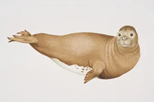
Mediterranean Monk Seal (monachus monachus), side view
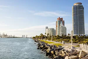
Skyline with residential condos on South Beach, Miami, Florida, USA
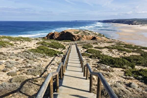
Path to Bordeira beach, Carrapateira, Algarve, PortugalPraia da Bordeira, Algrave, Portugal
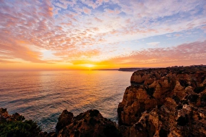
Sunset at Ponta da Piedade, Algarve, Portugal
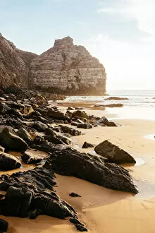
Coastal landscape at Arrifana beach, Algarve, PortugalPraia da Arrifana, Aljezur, Algarve, Portugal
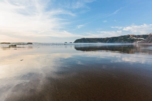
Arrifana beach during low tide, Algarve, PortugalPraia da Arrifana, Aljezur, Algarve, Portugal
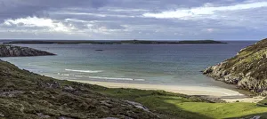
North coast beach ScotlandA typical Scottish North coast beach near Durness with islands in the middle distance