mail_outline sales@mediastorehouse.com
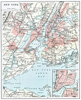
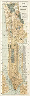
Map of New York city 1896Ilustration of a Map of New York city 1896
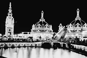
Luna Park At NightBuildings lit up at night at Luna Park, Coney Island, Brooklyn, New York City, c. 1900. (Photo by Pictorial Parade/Getty Images)
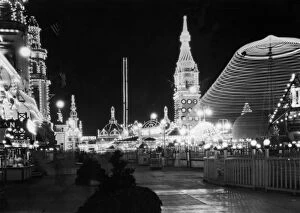
Luna Park lit up at night, Coney Island, Brooklyn, New York City, 1920s. (Photo by Archive Photos/Getty Images)
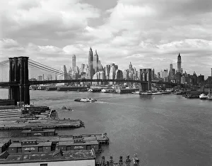
Skyline Of The Financial Section Of N. Y. The EastUNITED STATES - Circa 1950s: Skyline Of The Financial Section Of N.Y. The East River & The Brooklyn Bridge View From The Manhattan Bridge Barges Wharves Skyscrapers Piers. (Photo by H)
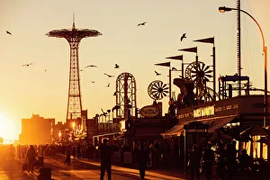
The Coney Island Boardwalk at sunset, Brighton Beach, Brooklyn, New York City, NY, USAThe Coney Island boardwalk at sunset, with the steel-frame structure of the famous Parachute Jump in the background. Brooklyn, New York City
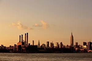
Manhattan skyline seen from Williamsburg, Brooklyn
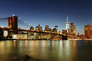
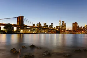
Brooklyn bridge and Manhattan at night, New York
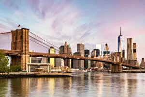
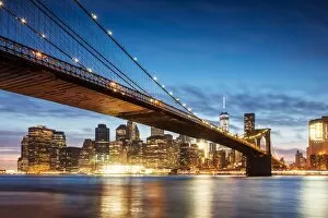
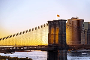
Sunset over Brooklyn Bridge and skyline of Manhattan Financial District in Downtown, New York City, NY, United StatesBrooklyn Bridge in New York City, New York State, United States
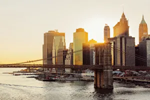
Brooklyn bridge and lower Manhattan skyline at sunrise, New York, USA
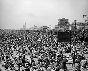
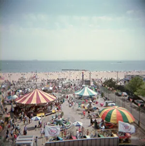
Crowded Beaches At Coney IslandThe beach and boardwalk at Coney Island, Brooklyn, New York City, 1930s. (Photo by George Enell/Getty Images)
Map of New York City 1894Huge vertical panorama map of New York 1885
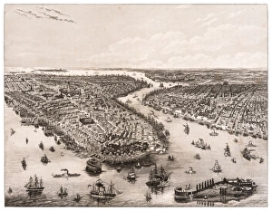
The Bay of New York and Brooklyn engraving 1853
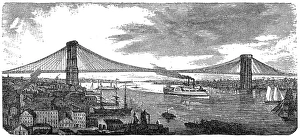
Brooklyn Bridge from 1878Illustration of a Brooklyn Bridge from 1878
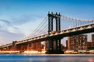
Manhattan bridge illuminated at dusk, New York cityNew York city, NY, USA
Brooklyn bridge at night, New York, USABrooklyn bridge and lower Manhattan skyline at dusk, New York, USA
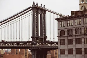
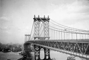
Manhattan bridge, New York city, USAManhattan bridge structure framing the Empire State building, Brooklyn, New York, USA
Manhattan bridge close-up
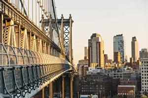
Manhattan bridge and Brooklyn at sunset, New York
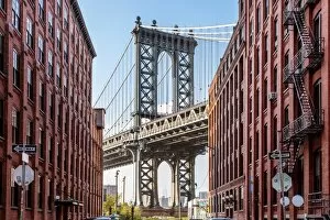
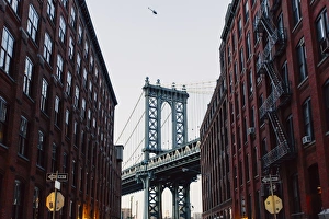
Manhattan Bridge seen from Dubmo, Brooklyn, New York City, NY, United States
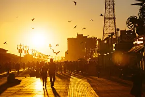
Coney Island Boardwalk at sunset, Brooklyn, NYC
Downtown, Manhattan and Brooklyn bridge at night, New York City, USA
Brooklyn Bridge and Manhattan skyline at sunset, New York City, NY, United StatesBrooklyn Bridge in New York City, New York State, United States
Brooklyn
Coney island amusement park at sea, Brooklyn
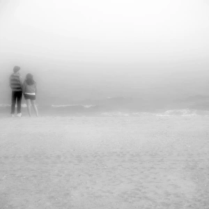
young couple standing ashore of Coney Island beachYoung couple standing ashore of Coney Island beach, in Brooklyn New York, in misty and foggy weather conditions
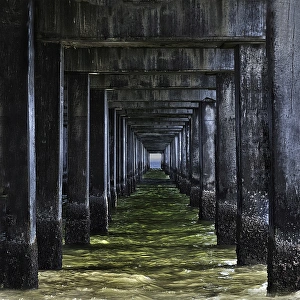
Water under pierConey Island, south on Brooklyn in New York
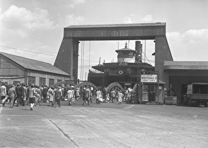
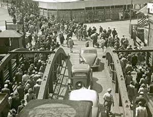
Passengers walking towards ferry gateway, (B&W)
Trying To Watch The GameA group of children trying to watch a baseball game at Ebbets Field in Brooklyn, New York circa 1920. (Photo by Paul Thompson/FPG/Getty Images)
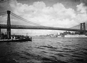
Williamsburgh BridgeMarch 1937: Williamsburgh Bridge, opened 19 December 1903, which connects Manhattan with Brooklyn in New York City. (Photo by Topical Press Agency/Getty Images)
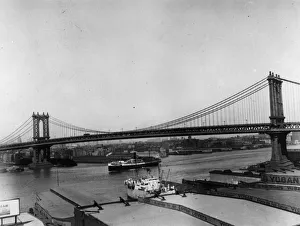
Manhattan Bridge1909: Manhattan Bridge spanning the East River between the boroughs of Manhattan and Brooklyn in New York City, opened 31 December 1909. (Photo by Topical Press Agency/Getty Images)
Passengers leaving ferry in BrooklynUNITED STATES - CIRCA 1950s: Passengers leaving ferry in Brooklyn. (Photo by George Marks/Retrofile/Getty Images)
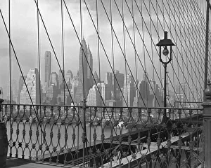
Lower Manhattan from Brooklyn Bridge, BYCUNITED STATES - CIRCA 1950s: Lower Manhattan from Brooklyn Bridge, BYC. (Photo by George Marks/Retrofile/Getty Images)
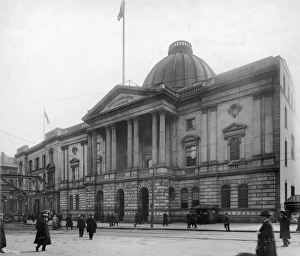
View of County Courthouse, Brooklyn, New YorkView of the County Courthouse in Brooklyn, New York. (Photo by Edwin Levick/Getty Images)
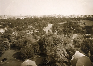
Looking North Over Prospect ParkView looking north over Prospect Park, Brooklyn, New York, 1910s. The park was designed by Frederick Law Olmsted and Calvert Vaux and was completed in the late 1860s
Manhattan Bridge, seen from Manhattan looking over the bay to Brooklyn, New Yorkcirca 1915: The Manhattan Bridge seen from Manhattan looking over the bay to Brooklyn, New York. It was completed in 1909. (Photo by Edwin Levick/Hulton Archive/Getty Images)
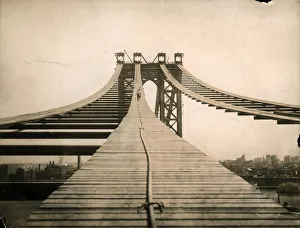
circa 1908: View of the Manhattan Bridge, which connects western Brooklyn and southeastern Manhattan, during its construction, New York City. Workers are laying down suspension cables
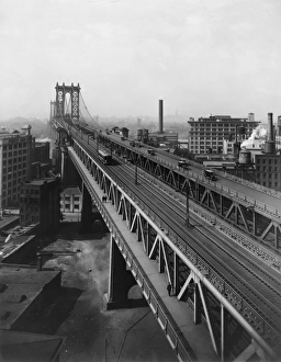
Leaving Manhattancirca 1925: Traffic, a train, and pedestrians crossing on the Manhattan Bridge, with Brooklyn in the background, New York City. (Photo by Edwin Levick/Hulton Archive/Getty Images)
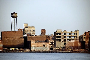
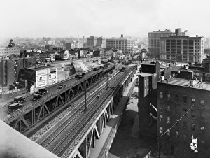
Brooklyn Railwaycirca 1925: Aerial view of the elevated train tracks running beside a highway in an industrial area of Brooklyn. Billboards and factories flank the tracks
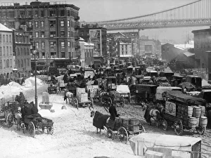
Brooklyncirca 1910: Congested traffic on a main thoroughfare in Brooklyn, New York City, looking west toward Manhattan Bridge over the East River. (Photo by Edwin Levick/Hulton Archive/Getty Images)
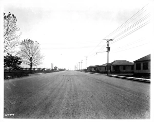
Manhattan Beach in In BrooklynManhattan Beach a long paved road in Brooklyn, New York, circa 1930. (Photo by Edwin Levick/Archive Photos/Getty Images)
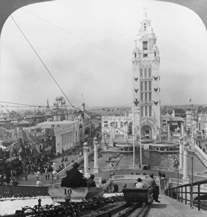
Dreamland; View from the top of the Shoot the Chutes ride at Dreamland Amusementcirca 1904: View from the top of the Shoot the Chutes ride at Dreamland Amusement Park in Coney Island, Brooklyn, New York City. The Dreamland Amusement Park opened in 1904 and burned down in 1911
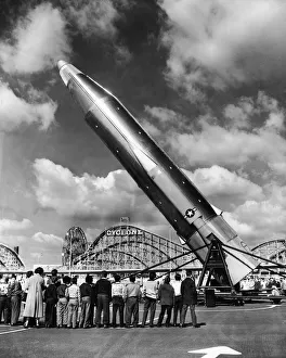
Missile And Cyclone15th May 1959: A group of children watches as the first American ICBM (intercontinental ballistic missile) rises into launching position at the Aquarium Compund, Coney Island, Brooklyn
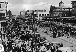
Crowds & Traffic At Old Coney IslandPostcard view of Surf Avenue, Coney Island, Brooklyn, New York, circa 1910. The view looks east with Feltmans restaurant and resort (birthplace of the hot dog as we know it)