mail_outline sales@mediastorehouse.com
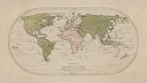
World map by Mathieu Albert Lotter, Augsburg, 1778World map from 1778. Original hand-colored copper engraving by Matthieu Albert Lotter (1741 - 1810, Augsburg) with route of James Cooks First Circumnavigation (1770), through Tahiti
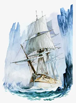
Illustration of Captain Cooks ship HMS Resolution in icy waters of Antarctic Circleantarctic circle, captain cook, cold, day, exploration, hms resolutio, Her Majestys Ships (HMS), 98954747
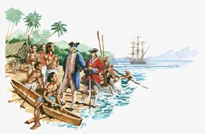
Illustration of Captain Cook arriving in Hawaiian islanders with canoes greeting Captain Cook
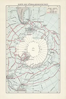
Antarctica map with sea routes of various explorers, lithograph, 1897Historical map of the unexplored Antarctica with sea routes of various explorers, 18th - 19th century. Lithograph, published in 1897
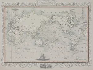
Antique map of old world depicting voyages of Captain Cookafrica, antique, archival, asia, australia, border, captain cook, carto, Antique Maps, 87719936
Antique maps of Botany Bay and Endeavour River in Australia
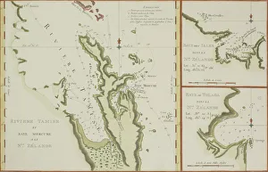
Antique maps of New Zealand