mail_outline sales@mediastorehouse.com
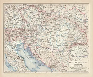
Austro-Hungarian Empire, Habsburg Monarchy, lithograph, published in 1877Ancient map of Austro-Hungarian Empire. Habsburg Monarchy. Lithograph, published in 1877
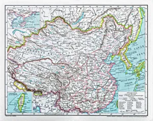
China mapillustration of a South Eastern Asia map
Sunrise with Angkor Wat, Siem Reap, Cambodia
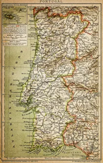
Map of PortugalAntique illustration engraving map og Portugal
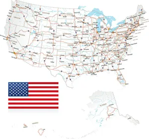
Highly detailed USA Road MapHighly detailed map of United States with roads, states, big cities, rivers and some other objects
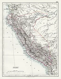
Peru map 1897The World-Wide Atlas of Modern Geography, Political and Physical W. & A.K. Johnston - London 1897
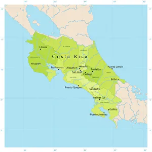
Costa Rica Vector Map+++
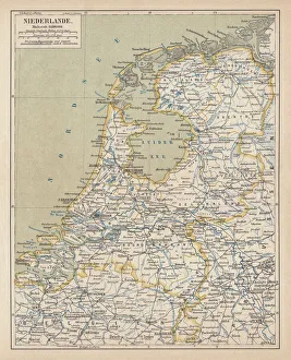
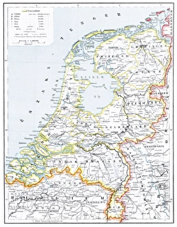
Map of the Netherlands, lithograph, published in 1877Map of the Netherlands. Lithograph, published in 1877
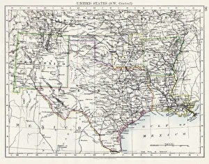
United States South West Central map 1897The World-Wide Atlas of Modern Geography, Political and Physical W. & A.K. Johnston - London 1897
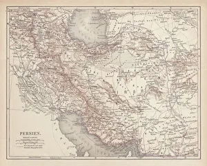
Ancient map of Persia, lithograph, published in 1877Ancient map of Persia. Lithograph, published in 1877
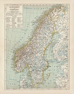
Sweden and Norway, lithograph, published in 1878Ancient map of Sweden and Norway. Lithograph, published in 1878
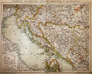
Bosnia, dalmatia, istria, croatia, slavoniaAntique illustration of a Bosnia, dalmatia, istria, croatia, slavonia map
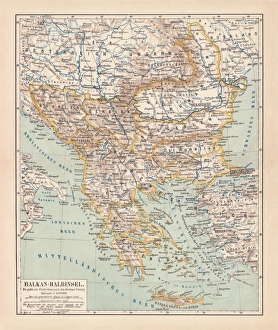
Balkan Peninsula in 1878, lithographAncient map Balkan. The political classification of the Balkan Peninsula after the Treaty of Berlin in 1878. Lithograph, published in 1878
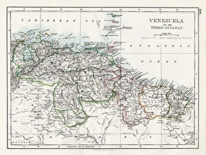
Venezuela and the Guayanas map 1897The World-Wide Atlas of Modern Geography, Political and Physical W. & A.K. Johnston - London 1897
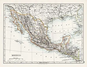
Mexico map 1897The World-Wide Atlas of Modern Geography, Political and Physical W. & A.K. Johnston - London 1897
Ottoman Empire, lithograph, published in 1878Ancient map of Ottoman Empire. Lithograph, published in 1878
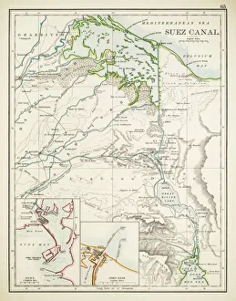
Map of Suez Canal 1897
SingaporeAntique illustration of a Republic of Singapore
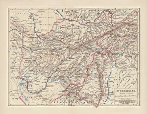
Afghanistan, lithograph, published in 1881Ancient map of Afghanistan. Lithograph, published in 1881
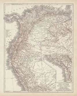
Peru, Ecuador, Colombia, Venezuela, lithograph, published in 1877Ancient map of Peru, Ecuador, Colombia, and Venezuela. Lithograph, published in 1877
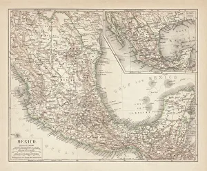
Mexico, ancient map, lithograph, published in 1877Ancient map of Mexico. Lithograph, published in 1877
RomaniaAntique map of Romania
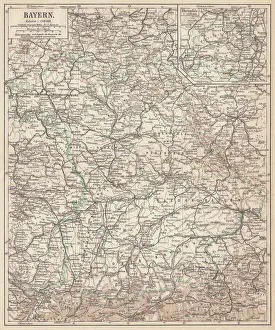
German federal state of Bavaria, lithograph, published in 1874Map of German federal state of Bavaria. Lithograph, published in 1874
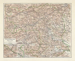
Topographic map of Styria, Austria, lithograph, published in 1897Topographic map of Styria - state (Bundesland) located in the southeast of Austria. Lithograph, published in 1897
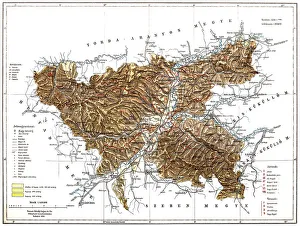
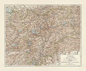
Tyrol, historical region in Austria and Italy, lithograph, published 1897Tyrol - historical region in the Alps; in northern Italy and western Austria. Lithograph, published in 1897
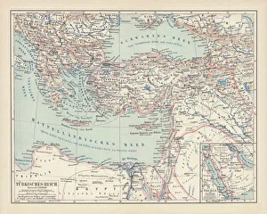
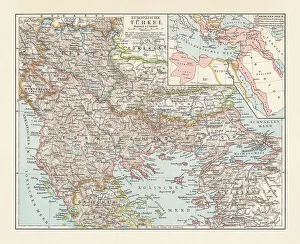
Historical map of the Ottoman Empire (Turkey), European part, 1897Historical map of European part of the Ottoman Empire (Turkey) at the end of the 19th century. Lithograph, published in 1897
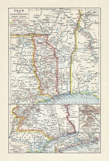
Historical map of Togo during the German colonial period (1884-1916)Historical map of Togo in West Africa during the German colonial period from 1884 to 1916. Lithograph, published in 1897
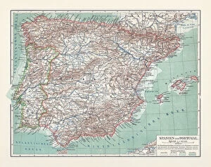
Topographic map of Spain and Portugal, lithograph, published in 1897Topographic map of Spain and Portugal. Lithograph, published in 1897
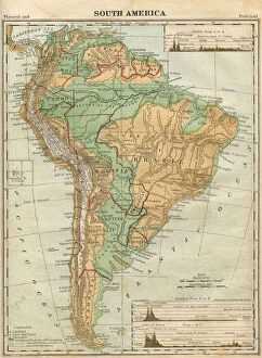
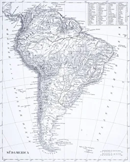
South America Map Illustration, Travel, Exploration, Antique 1871 IllustrationColor stock photo of an antique South America map illustration. Salvaged from an 1871 geography book
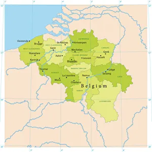
Belgium Vector MapHighly detailed vector map of Belgium. File was created on July 14, 2011. The colors in the.eps-file are ready for print (CMYK). Included files: EPS (v8) and Hi-Res JPG
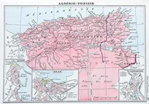
Antique map of Algeria and Tunisia
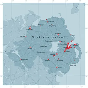
Northern Ireland Vector Road MapDetailed vector map of Northern Ireland, including main cities, roads, rivers and lakes. Source data courtesy of the former United States National Imagery and Mapping Agency NIMA (database: VMAP0)
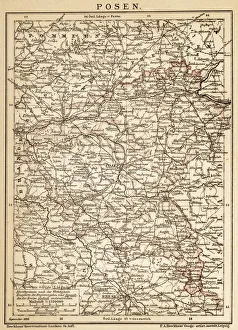
PoznanAncient map of Poznan from 1898
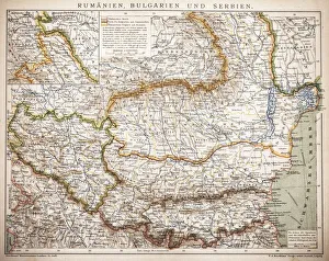
Balkan StatesMap of Rumania, Bulgaria, Serbia, Montenegro
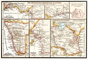
The six principal colonies of German AfricaIllustration of a The six principal colonies of German Africa
Engraving: South AmericaEngraved illustrations of South America from Iconographic Encyclopedia of Science, Literature and Art, Published in 1851. Copyright has expired on this artwork. Digitally restored
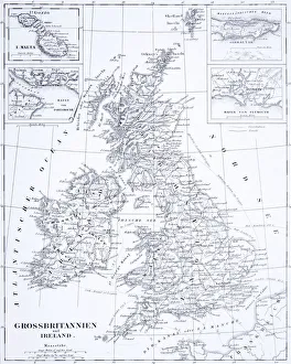
Engraving: Great Britain and IrelandEngraved illustrations of the Countries of Great Britain and Ireland from Iconographic Encyclopedia of Science, Literature and Art, Published in 1851. Copyright has expired on this artwork
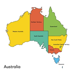
australia, map, country - geographic area, local landmark, color image, vector, illustrationVector illustration of the map of Australia with its regions and regions names
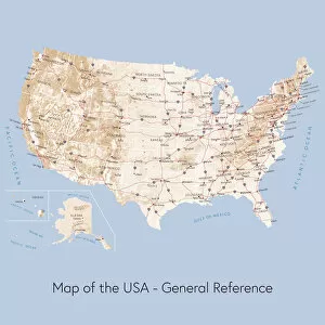
Map of the USA general referenceVector illustration of a map of the United States of America. The reference map used in the creation of this illustration is public domain map available at the University of Texas website: http
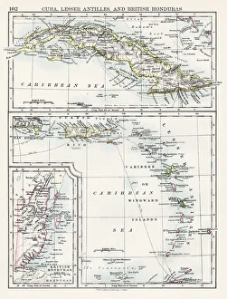
Cuba lesser antilles map 1897The World-Wide Atlas of Modern Geography, Political and Physical W. & A.K. Johnston - London 1897
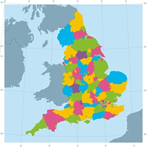
England Vector Map Colorful Administrative DivisionsVector map of England with Administrative Divisions. The colors in the.eps-file are ready for print (CMYK). Included files are EPS (v10) and Hi-Res JPG (4922 x 4922 px). Made with Natural Earth
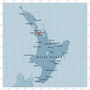
North Island Of New Zealand Vector Road MapDetailed vector map of North Island Of New Zealand, including main cities, roads, rivers and lakes. The colors in the.eps-file are ready for print (CMYK)
Map of United States with Watercolor Texture - Raster IllustrationAn abstract map of the United States with a multicoloured, rainbow hand painted watercolor texture. Map is isolated on a white background. Raster illustration
Netherlands mapillustration of a Netherlands map
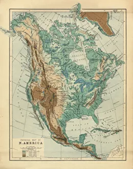
North America Physical Map, Engraving, 1892Very rare, beautifully detailed engraving of North America Physical Map, Engraving, Published in 1892. Original edition from my own archives. Copyright has expired on this artwork. Digitally restored
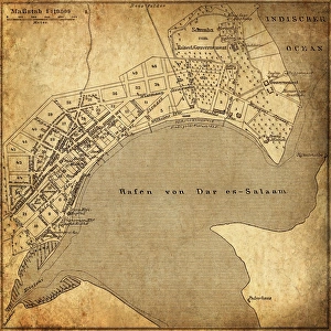
Dar es Salaam, TanzaniaAntique illustration of a Dar es Salaam, Tanzania
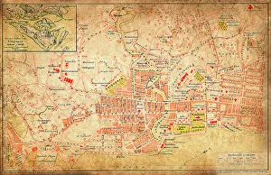
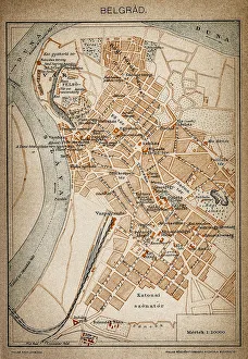
Belgrade map 1893Antique illustration of a Belgrade map 1893