mail_outline sales@mediastorehouse.com
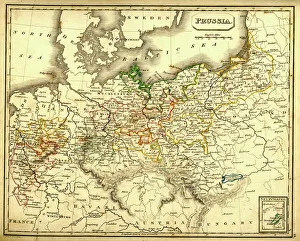
Antquie Map of PrussiaVintage map of Prussia from 1837
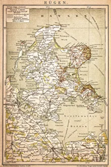
RAOEgenAntique map of RAOEgen
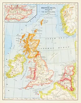
1883 British Isles Map
Germania in 2 century after Christ
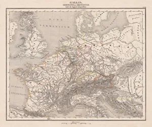
Ancient Europe under Emporer Augstus (63 BC-14 AD), published 1861Ancient map of Gaul, Germania and Britannia during the time of the first Roman Emporer Augstus (63 BC - 14 AD). Legend in Latin language. Steel engraving with colored borderlines, published in 1861
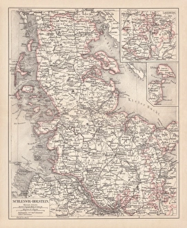
Schleswig-Holstein, lithograph, published in 1878Map of Schleswig-Holstein. Lithograph, published in 1878
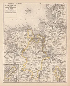
Grand Duchy of Oldenburg, litograph, published in 1877Ancient map of Grand Duchy of Oldenburg, Germany. Lithograph, published in 1877
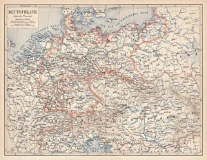
German Empire of 1871-1918, lithograph, published in 1875German Empire within the borders of 1871 - 1918. Lithograph, published in 1875
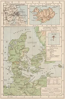
Map of Denmark and Iceland, lithograph, published in 1881Topographic map of Denmark and Iceland. Facsimile, published in 1881
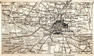
KonigsbergAntique map of Konigsberg
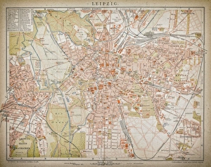
LeipzigAntique illustration of a Leipzig from 1898
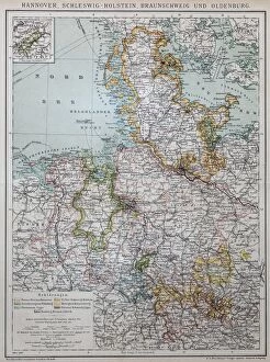
Hannover, Schleswig-Holstein, Braunschweig and Oldenburg
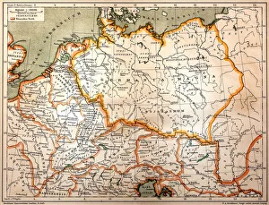
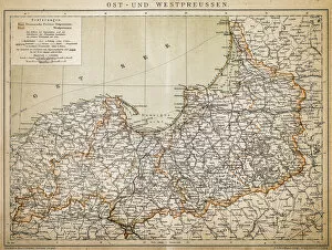
PrussiaAntique illustration of a East-West West Prussia
Nesting gannets on Helgoland, GermanyNorthern Gannets (Sula bassana or Morus bassanus) on Helgoland. Males and females bond for life. Since 1991, the Northern Gannet inhabits the rocky cliffs of Helgoland
Northern gannets on Helgoland, GermanyNorthern gannets (Sula bassana or Morus bassanus) on Helgoland. Since 1991, the Northern Gannet inhabits the rocky cliffs of Helgoland, a tiny island in the North Sea