mail_outline sales@mediastorehouse.com
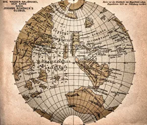
World map from 1520Western hemisphere of the Johannes SchAoner globe from 1520. expedition
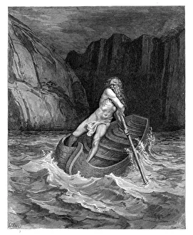
Charon the ferryman engravingCharon the ferryman of Hell engraving by Gustave Dore
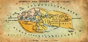
Map of the world according to Strabo 63 B.C
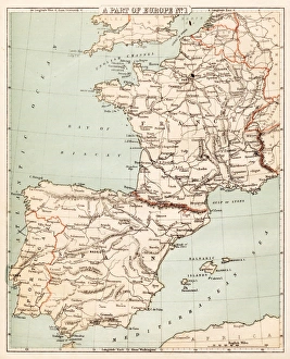
Map of Spain and France 1869Cornells Grammars-School Geography - S.S. Cornell - New York D. Appleton and Company 1869
Satan and Beelzebub engravingSatan and Beelzebub
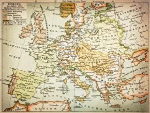
Map of Europe 1721
World map by Mathieu Albert Lotter, Augsburg, 1778World map from 1778. Original hand-colored copper engraving by Matthieu Albert Lotter (1741 - 1810, Augsburg) with route of James Cooks First Circumnavigation (1770), through Tahiti
Public street view of Guanajuato City, Mexico. A UNESCO World Heritage Site. 16th century old buildings & streets are preserved
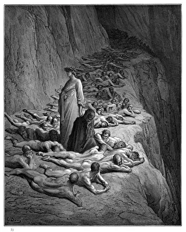
Arrival of souls purgatory engraving 1870The Dore Gallery by Edmund Ollier - Cassel, Petter and Galpin (London-New York) 1870
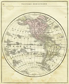
Western Hemisphere map 1856Colton and Fitchs Modern School Geography by George W. Fitch - New York 1856
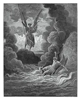
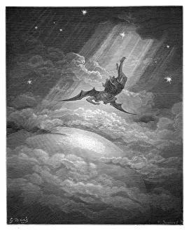
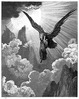
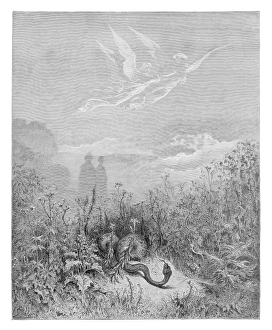
Satan approaching earth engravingSatan approaching the confines of the earth engraving by Gustave Dore
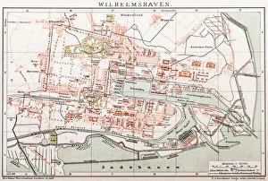
Wilhelmshaven. GermanyAntique illustration of a Wilhelmshaven, Germany map
A boat station at Perfume River (Huong river) near Thien Mu pagoda, Hue, VietnamHue is old capital of Vietnam and a UNESCO World Heritage site
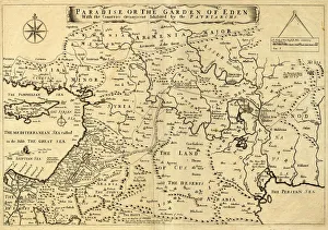
Middle East Ancient Map, Garden of Eden, 1675This may appear to be a straightforward map of the Middle East. However, closer inspection will reveal some extraordinary details, a number of descriptions on the map refer to stories from the Bible
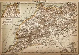
Map of Morocco
Antique illustration of Globe-fish (Diodon maculatus)
Dante with Pope Adrian V engraving 1870The Dore Gallery by Edmund Ollier - Cassel, Petter and Galpin (London-New York) 1870
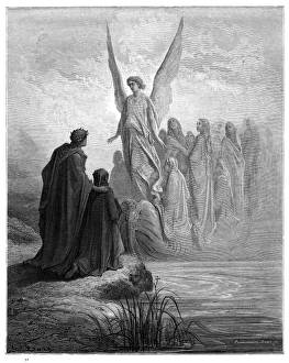
The Apocalyptic Procession engraving 1870The Dore Gallery by Edmund Ollier - Cassel, Petter and Galpin (London-New York) 1870
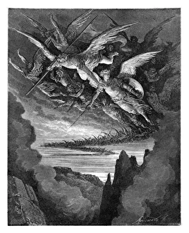
The Fallen Angels engravingThe Fallen Angels of the Wing
Red tube sponge, Caribbean Sea, British Virgin Islands, Caribbean
Common House Martin (Delichon urbica)
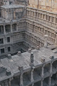
Rani Ki Vav Queens StepwellCarved pillars and walls inside Rani ki Vav (The Queens Stepwell) step well at Patan, Gujarat, India
Lombardo in the Third Circle of Purgatory engraving 1870The Dore Gallery by Edmund Ollier - Cassel, Petter and Galpin (London-New York) 1870
Dante and the eagle engraving 1870The Dore Gallery by Edmund Ollier - Cassel, Petter and Galpin (London-New York) 1870
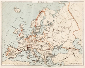
Map of Europe 1869Cornells Grammars-School Geography - S.S. Cornell - New York D. Appleton and Company 1869
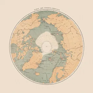
Ancient map of the Arctic Region, lithograph, published in 1883Ancient map of the Arctic Region. Lithograph, published in 1883
Red Sponge (Porifera), Trinidad, Caribbean Sea
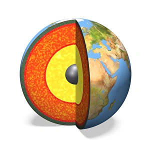
Internal structure of the Earth, 3D illustration
Status silhouette of Angkor Wat in sunrise, Cambodia
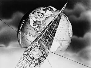
Radio tower montageUNITED STATES - CIRCA 1940s: Montage of radio tower with power lines and globe. (Photo by H. Armstrong Roberts/Retrofile/Getty Images)
Christopher Columbus Planning His Exploration Engraving, Circa 1892Beautifully Illustrated Antique Engraved Victorian Illustration of Christopher Columbus Planning His Exploration Engraving, Circa 1892
Pia da Tolomei engraving 1870The Dore Gallery by Edmund Ollier - Cassel, Petter and Galpin (London-New York) 1870
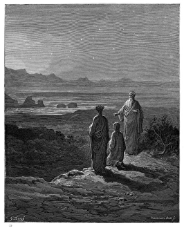
Dante, Virgil and Cato engraving 1870The Dore Gallery by Edmund Ollier - Cassel, Petter and Galpin (London-New York) 1870
Beatrice unveiled engraving 1870The Dore Gallery by Edmund Ollier - Cassel, Petter and Galpin (London-New York) 1870
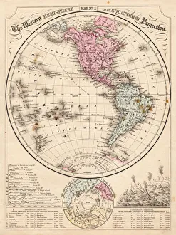
Western Hemisphere map 1867Mitchells Modern Atlas - Published by E.H. Buttler & Co - Philadelphia 1867
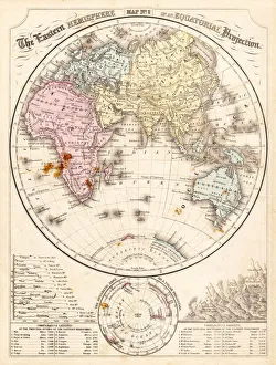
Eastern Hemisphere map 1856Mitchells Modern Atlas - Published by E.H. Buttler & Co - Philadelphia 1867
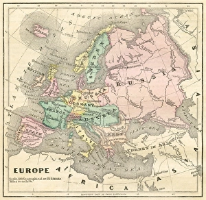
Map of Europe 1856Colton and Fitchs Modern School Geography by George W. Fitch - New York 1856
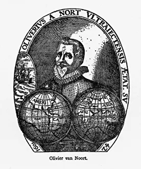
Oliver Van Noort Dutch Navigator, Victorian Illustration, 1558-1622Very Rare, Beautifully Illustrated Antique Engraved Victorian Illustration of Oliver Van Noort Dutch Navigator, Victorian Illustration, 1558-1622. Copyright has expired on this artwork
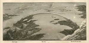
Topographical Land Sea Sky Earth Globe, Antique 1871 IllustrationColor stock photo of an antique illustration of a topographical earth globe showing land, sea and sky examples. Salvaged from an 1871 geography book
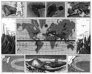
Volcanic and Hurricane Charts; Craters; and Antarctica EngravingEngraved Illustrations of Volcanic and Hurricane Charts; Craters; and Antarctica from Iconographic Encyclopedia of Science, Literature and Art, Published in 1851
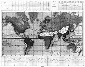
Historical Rainfall and Temperature Charts EngravingEngraved Illustrations of Historical Rainfall and Temperature Map; Temperature Charts of the World from Iconographic Encyclopedia of Science, Literature and Art, Published in 1851
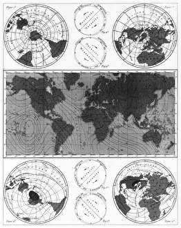
Climate and Weather Charts EngravingEngraved Illustrations of Climate and Weather Charts of the World from Iconographic Encyclopedia of Science, Literature and Art, Published in 1851. Copyright has expired on this artwork
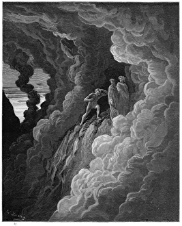
The threshold of Purgatory engravingThe threshold of purgatory engraving by Gustave Dore
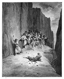
The martyrdom of St. Stephen engraving engraving by Gustave Dore
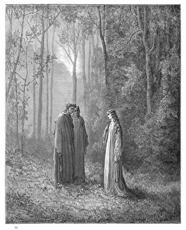
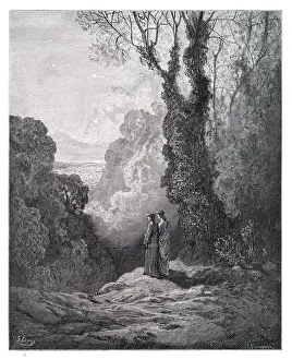
Dante and Virgil engravingDante and Virgil in the Happy Valley engraving by Gustave Dore