mail_outline sales@mediastorehouse.com
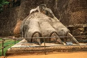
The Sigiriya Lion rock fortress in Sigiriya, Sri Lanka. Sigiriya is listed as UNESCO World Heritage Site
Shinkyo Bridge or sacred bridge in Nikko, Japan, a very famous bridge in Nikko. One of Japans three finest bridges together with Iwakunis Kintaikyo and Saruhashi in Yamanashi Prefecture
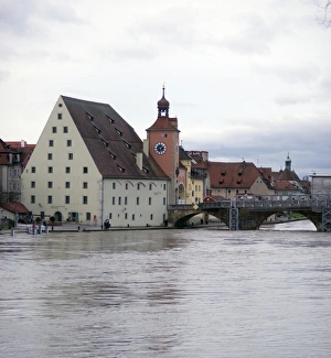
Germany, Bavaria, Regensburg, View Of River Danube, Historic Salt House, And Clock Tower
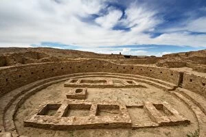
Great Kiva at Pueblo Bonito Ruin, Chaco Culture National Historic Park, New Mexico
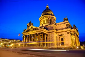
Saint Isaacs Cathedral or Isaakievskiy Sobor in Saint Petersburg, Russia is the largest Russian Orthodox cathedral (sobor) in the city. It is the largest orthodox basilica
Shenyang Imperial Palace, also named Mukden Palace, start built in 1625 year'and finished in 1636 in the Qing dynasty in China
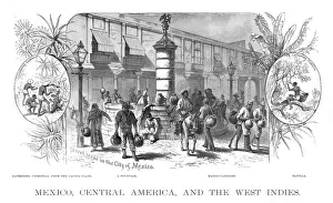
Mexico Central america scene illustration 1886Mexico Central america scene illustration Maps Monteith Physical Geography 1886
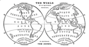
World in zones hemispheres 1881Coltons Common School Geography 1881 New York Sheldon and Co
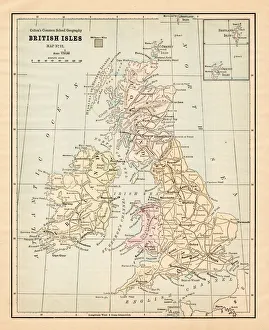
Biritsh Isles map 1881Coltons Common School Geography 1881 New York Sheldon and Co
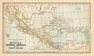
Mexico and Central America map 1881Coltons Common School Geography 1881 New York Sheldon and Co
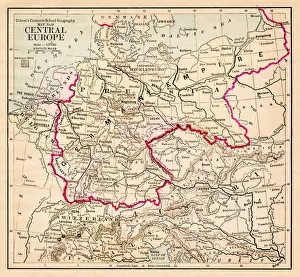
Central Europe map 1881Coltons Common School Geography 1881 New York Sheldon and Co
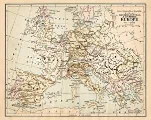
Europe map 1881Coltons Common School Geography 1881 New York Sheldon and Co
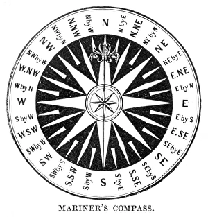
Old Compass Windrose 1881Coltons Common School Geography 1881 New York Sheldon and Co
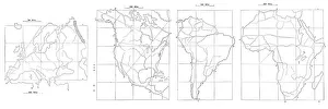
Map drawing technique 1881Coltons Common School Geography 1881 New York Sheldon and Co
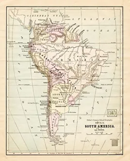
South America map 1881Coltons Common School Geography 1881 New York Sheldon and Co
Dominion of Canada map 1881Coltons Common School Geography 1881 New York Sheldon and Co
North Eastern States USA map 1881Coltons Common School Geography 1881 New York Sheldon and Co
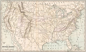
United States map 1881Coltons Common School Geography 1881 New York Sheldon and Co
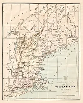
New England States USA map 1881Coltons Common School Geography 1881 New York Sheldon and Co
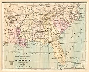
Souther States USA map 1881Coltons Common School Geography 1881 New York Sheldon and Co
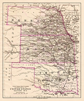
Kansas and Nebraska map 1881Coltons Common School Geography 1881 New York Sheldon and Co
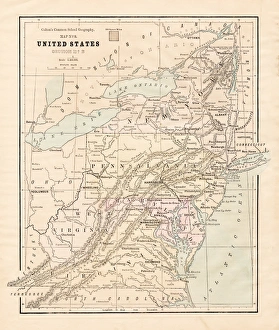
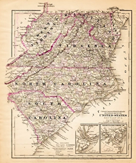
Virginia North Carolina map 1881Coltons Common School Geography 1881 New York Sheldon and Co
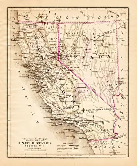
California Nevada map 1881Coltons Common School Geography 1881 New York Sheldon and Co
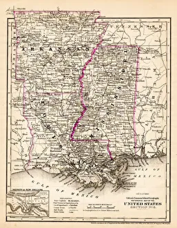
Arkansas Louisiana Pississippi map 1881Coltons Common School Geography 1881 New York Sheldon and Co
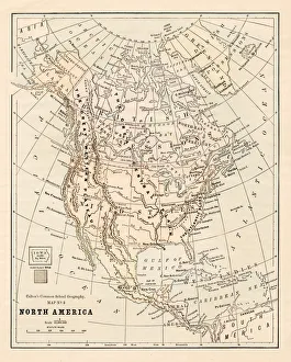
North America map 1881Coltons Common School Geography 1881 New York Sheldon and Co
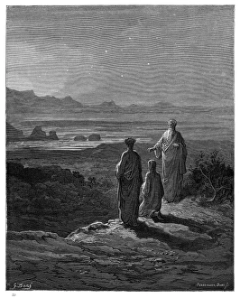
Pia da Tolomei engraving 1870The Dore Gallery by Edmund Ollier - Cassel, Petter and Galpin (London-New York) 1870
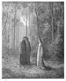
Dante, Virgil and Cato engraving 1870The Dore Gallery by Edmund Ollier - Cassel, Petter and Galpin (London-New York) 1870
Beatrice unveiled engraving 1870The Dore Gallery by Edmund Ollier - Cassel, Petter and Galpin (London-New York) 1870
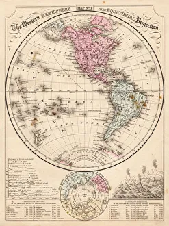
Western Hemisphere map 1867Mitchells Modern Atlas - Published by E.H. Buttler & Co - Philadelphia 1867
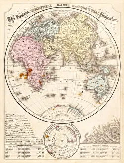
Eastern Hemisphere map 1856Mitchells Modern Atlas - Published by E.H. Buttler & Co - Philadelphia 1867
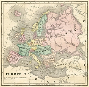
Map of Europe 1856Colton and Fitchs Modern School Geography by George W. Fitch - New York 1856
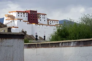
Shigatse Dzong, Tibet, ChinaShigatse fortess in Shigatse that look like Polata Palace in Lhasa. Its name is little Potala
A sheep and Shigatse Dzong, Tibet, ChinaShigatse Dzong or Shigatse Fort is a landmark of Shigatse city
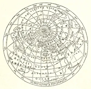
Victorian map of the Arctic CircleA Victorian map of the Arctic Circle and beyond. From Peter Parleyas Annual - A Christmas and New Yearas Present for Young Peoplea published in London by Darton & Co in 1851
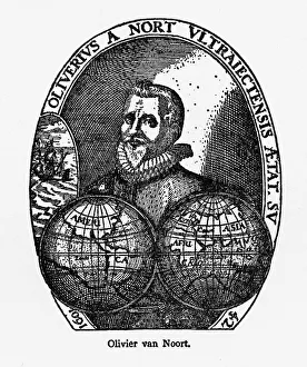
Oliver Van Noort Dutch Navigator, Victorian Illustration, 1558-1622Very Rare, Beautifully Illustrated Antique Engraved Victorian Illustration of Oliver Van Noort Dutch Navigator, Victorian Illustration, 1558-1622. Copyright has expired on this artwork
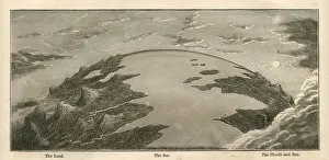
Topographical Land Sea Sky Earth Globe, Antique 1871 IllustrationColor stock photo of an antique illustration of a topographical earth globe showing land, sea and sky examples. Salvaged from an 1871 geography book
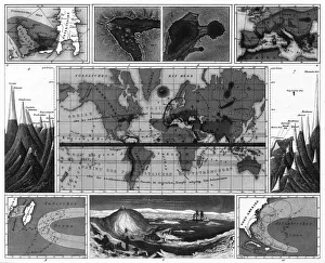
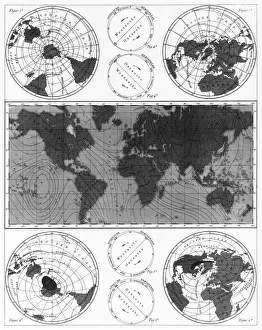
Volcanic and Hurricane Charts; Craters; and Antarctica EngravingEngraved Illustrations of Volcanic and Hurricane Charts; Craters; and Antarctica from Iconographic Encyclopedia of Science, Literature and Art, Published in 1851
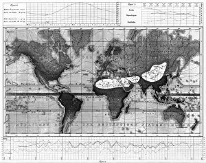
Historical Rainfall and Temperature Charts EngravingEngraved Illustrations of Historical Rainfall and Temperature Map; Temperature Charts of the World from Iconographic Encyclopedia of Science, Literature and Art, Published in 1851
Climate and Weather Charts EngravingEngraved Illustrations of Climate and Weather Charts of the World from Iconographic Encyclopedia of Science, Literature and Art, Published in 1851. Copyright has expired on this artwork
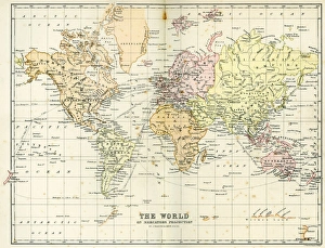
Antique Map of the WorldVintage map of the World from 1884
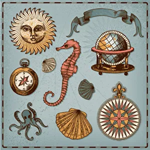
Decorative nautical setNautical design elements
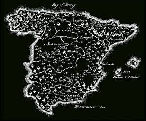
Antique SpainSpain Map, - Antique style. Includes mountains and water bodies. High detail - vector illustration
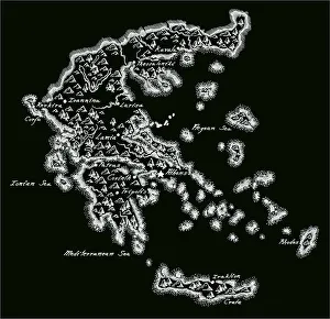
Antique Greece MapGreece Map, - Antique style. Includes mountains and water bodies. High detail - vector illustration
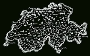
Antique SwitzerlandSwitzerland Map, - Antique style. Includes mountains and water bodies. High detail - vector illustration
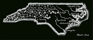
Antique North Carolina
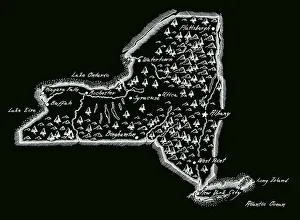
Antique New York StateNew York State Map, - Antique style. Includes mountains and water bodies. High detail - vector illustration
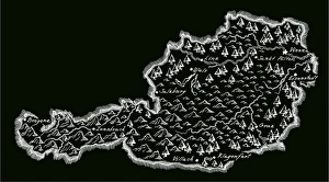
Antique AustriaAustria Map, - Antique style. Includes mountains and water bodies. High detail - vector illustration
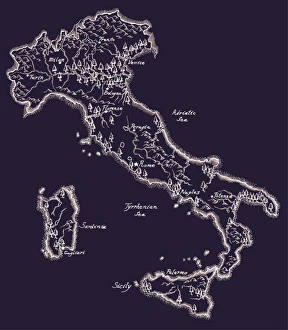
Antique ItalyItaly Map, - Antique style. Includes mountains and water bodies. High detail - vector illustration