mail_outline sales@mediastorehouse.com
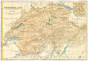
Switzerland map 1875The Independent Course Comprehensive Geography by James Monteith, A.S. Barnes & Co, New York & Chicago 1875
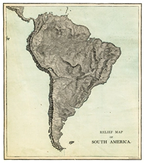
South America relief map 1875The Independent Course Comprehensive Geography by James Monteith, A.S. Barnes & Co, New York & Chicago 1875
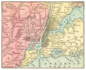
New York and Jersey map 1875The Independent Course Comprehensive Geography by James Monteith, A.S. Barnes & Co, New York & Chicago 1875
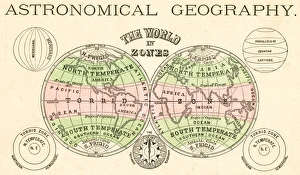
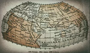
Astronomical geography map 1875The Independent Course Comprehensive Geography by James Monteith, A.S. Barnes & Co, New York & Chicago 1875
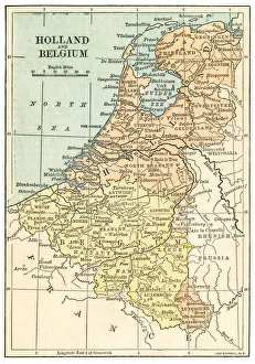
Holland and Belgium map 1875 and Belgium map 1875The Independent Course Comprehensive Geography by James Monteith, A.S. Barnes & Co, New York & Chicago 1875
North America relief map 1875The Independent Course Comprehensive Geography by James Monteith, A.S. Barnes & Co, New York & Chicago 1875
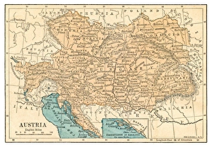
Austria map 1875The Independent Course Comprehensive Geography by James Monteith, A.S. Barnes & Co, New York & Chicago 1875
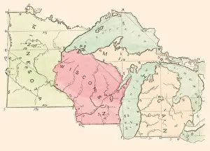
USA states map 1875The Independent Course Comprehensive Geography by James Monteith, A.S. Barnes & Co, New York & Chicago 1875
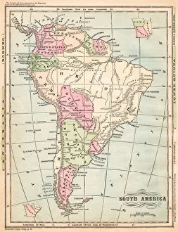
South America map 1875The Independent Course Comprehensive Geography by James Monteith, A.S. Barnes & Co, New York & Chicago 1875
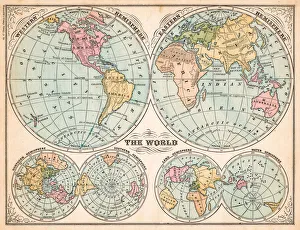
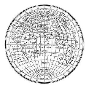
The world in hemispheres map 1875The Independent Course Comprehensive Geography by James Monteith, A.S. Barnes & Co, New York & Chicago 1875
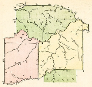
States USA map 1875The Independent Course Comprehensive Geography by James Monteith, A.S. Barnes & Co, New York & Chicago 1875
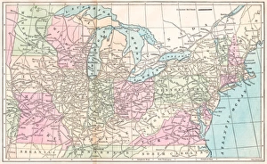
Routes of travel in the United States map 1875The Independent Course Comprehensive Geography by James Monteith, A.S. Barnes & Co, New York & Chicago 1875
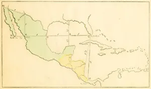
Central America and West Indies map 1875The Independent Course Comprehensive Geography by James Monteith, A.S. Barnes & Co, New York & Chicago 1875
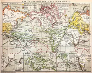
The history of geography map 1895Meyers Konversations-Lexikon. Ein Nachschlagewerk des allgemeinen Wissens, 5th edition 17 volumes Bibliographisches Institut - Leipzig 1895-1897
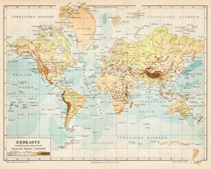
World map 1895Meyers Konversations-Lexikon. Ein Nachschlagewerk des allgemeinen Wissens, 5th edition 17 volumes Bibliographisches Institut - Leipzig 1895-1897
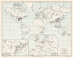
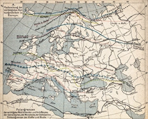
World spread of hardwood map 1895Meyers Konversations-Lexikon. Ein Nachschlagewerk des allgemeinen Wissens, 5th edition 17 volumes Bibliographisches Institut - Leipzig 1895-1897
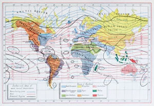
Antique colored illustrations: Isothermal lines and ethnicities of the World
Antique engraving illustration: World map
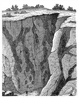
Veins in limestone on Monte CalviIllustration of a Veins in limestone on
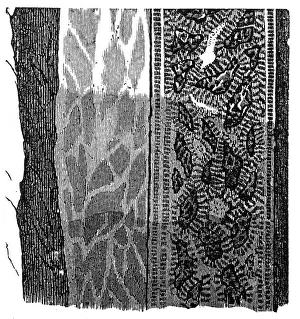
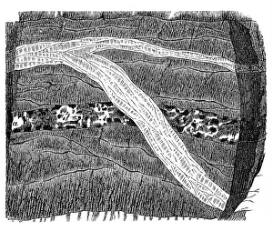
Section of a terrain, double vein
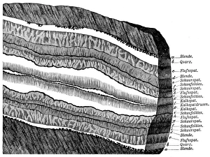
Part of a Freiberg ore mine: sulphur, quartz, gneissIllustration of a Freiberg ore mine: sulphur, quartz, gneiss
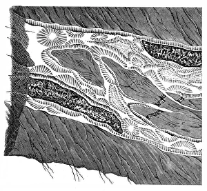
Section of a terrain, ramification and enforcement
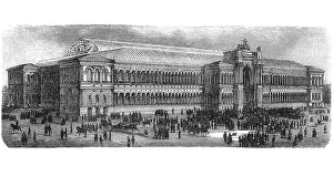
World Exhibition in Paris
Map of plant geography
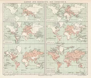
Maps for history of geography
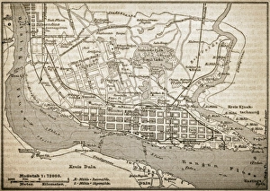
RangoonAntique illustration of Rangoon
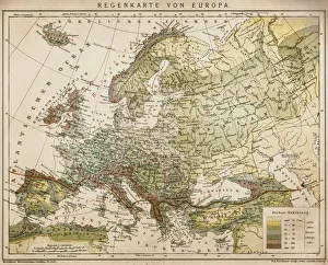
Rain map of EuropeAntique illustration of a rain map of Europe
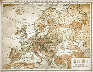
Population tightness map of Europe
Ethnographic map of Europe from 1898
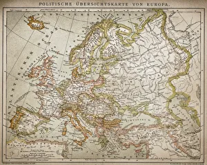
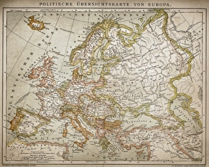
Political outline map of Europe from 1898
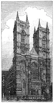
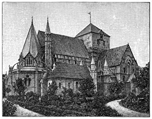
Westminster Abbey or Collegiate Church of St Peter in London, England, during the 1890s
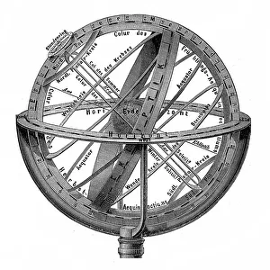
Engraving vintage Planetarium
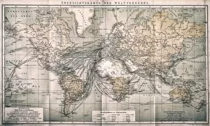
Overview map world traffic
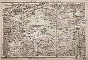
Lake LucerneAntique map of LAKE LUCERNE
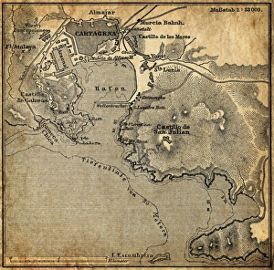
Cartagena, SpainAntique illustration of a Cartagena, Spain map
Map of Korea, ChinaAntique illustration of a Map of Korea, China
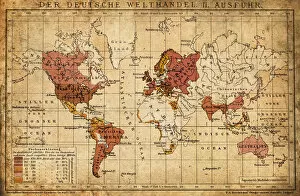
German world trade export map 1898Illustration engraving of the German world trade export map from 1898
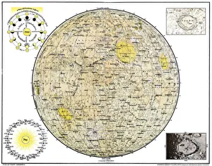
Lunar MapAntique illustration of a Lunar Map
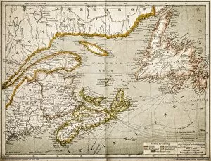
Eastern Canada and NewfoundlandIllustration of a Eastern Canada and Newfoundland
Earth map according to Claudius PtolemaeusAntique illustration of a earth map according to Claudius Ptolemaeus
Nidaros Cathedral in Trondheim, NorwayIllustration of a Nidaros Cathedral in Trondheim, Norway
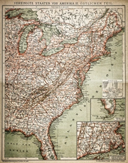
United States of America, eastern partAntique illustration of a United States of America, eastern part
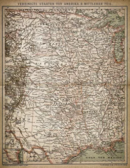
United States of America, Middle sectionAntique illustration of a United States of America, Middle section
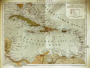
West indies, Antilles mapIllustration of a West indies, Antilles map
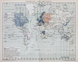
Local time world mapAntique illustration of a local time world map
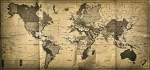
The World mapAntique illustration of a map of the World
Section of a terrainSection of Freiberg with a symmetrical lay - out structure
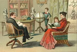
A Family Reading TogetherA woman reads to a girl while a man sits nearby with an open book on his lap and a boy spins a globe in the background, mid 1800s. (Kean Collection/Getty Images)