mail_outline sales@mediastorehouse.com
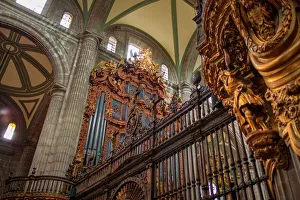
Metropolitan Cathedral Pipe OrgansMetropolitan Cathedral Pipe Organ, view from bellow
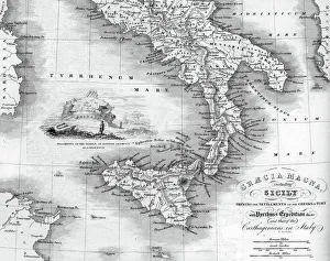
Vintage map of Magna Graecia, showing the settlements of the ancient greeks in Italy. Magna GrA|cia is the name of the coastal areas of Southern Italy on the Tarentine Gulf that was extensively
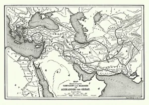
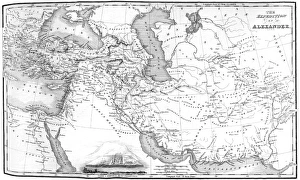
Ancient History - Map of Alexander the Great CampaignsVintage engraving of a map of the campaigns and marches of Alexander the Great
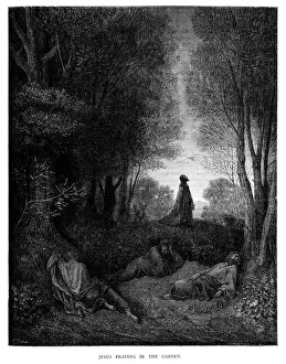
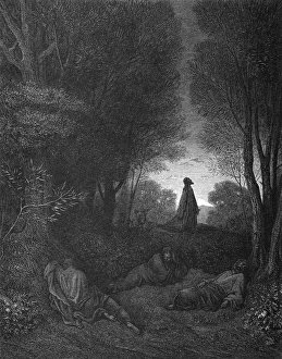
Jesus Praying in the GardenVintage engraving from the 1870 of a scene from the New Testament by Gustave Dore showing Jesus Praying in the Garden
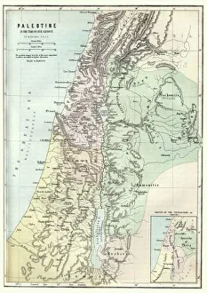
Map of Palestine in the time of Jesus ChristVintage engraving of Map of Palestine in the time of Jesus Christ
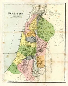
Antique Map - Biblical PalestineAntique Map from 1864 of Biblical Palestine
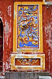
Doorway inside Imperial Palace Citadel Hue VietnamImperial City HueThua Thien Province Vietnam
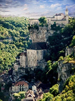
Cliff top town of Rocamadour in the Lot region of Southern FranceThe historic and medieval town of Rocamadour in the Lot Region of South West France Europe
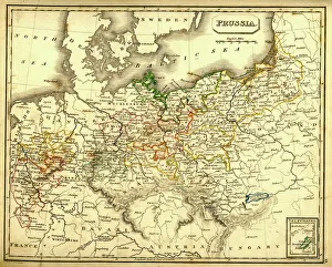
Antquie Map of PrussiaVintage map of Prussia from 1837
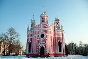
Chesme Church in winter at Saint Petersburg RussiaThe Chesme Church is a small Russian Orthodox church which located at 12 Lensoveta Street, in Saint Petersburg, Russia and was built in 1780
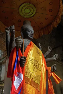
Vishnu in Angkor WatA representation of the god Vishnu in one of the halls of Angkor Wat temple (State temple). Angkor Wat was originally dedicated to Vishnu. Angkor Wat, Siem Reap, Cambodia, Southeast Asia
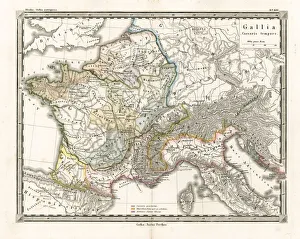
Antique Map of GaulAntique Map from 1862 of Gaul at the time of Julius Caesar. The Roman proconsul and general Julius Caesar pushed his army into Gaul in 58 BC
Aerial view of Great Wall of China, Beijing, Hebei Province, China
Athens panoramaView of the city of Athens from Lycabettus hill, located near the center. The picture was taken in the beautiful sunset
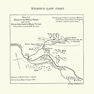
Map of the Shangani Patrol and Major Wilsons Last StandVintage engraving of a Map of the Shangani Patrol and Major Wilsons Last Stand. The Shangani Patrol (or Wilsons Patrol), comprising 34 soldiers in the service of the British South Africa Company
La Fontaines Fables - Scythian PhilosopherVintage engraving from La Fontaines Fables, Illustraed by Gustave Dore. A Scythian Philosopher
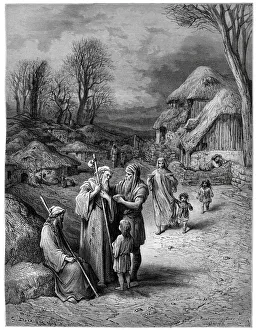
Hospitality of Barbarians to Pilgrims" Vintage engraving showing Goths, Huns and Vandals offering hospitality to christian pilgrims who are going to the Holy Land."
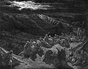
Gideon Choosing His SoldiersVintage engraving from the 1870 of a sdcene from the Old Testament by Gustave Dore showing Gideon Choosing His Soldiers
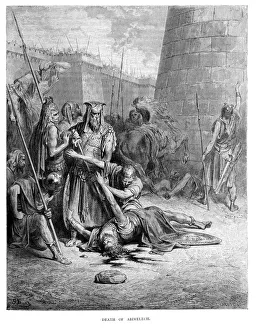
Death of AbimelechVintage engraving from the 1870 of a Scene from the Old Testament by Gustave Dore showing the Death of Abimelech. Abimelech was the son of Judge Gideon
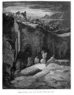
David showing Saul that he had spared his lifeVintage engraving from the 1870 of a sdcene from the Old Testament by Gustave Dore showing David showing Saul that he had spared his life
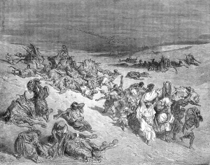
Murrain of beastsVintage engraving by Gustave DorA from 1870 showing a scene from the Old Testament Murrain of beasts
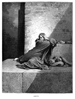
Baruch" Vintage engraving from the 1870 of a scene from the Old Testament by Gustave Dore showing Baruch ben Neriah who was the scribe, disciple, secretary
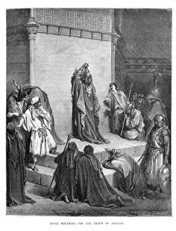
David Mourning the Death of AbsalomVintage engraving from the 1870 of a sdcene from the Old Testament by Gustave Dore showing David Mourning the Death of Absalom his son who was killed after leading a rebellion against his father
Jesus in the garden[url=http://www.istockphoto.com/file_search.php?action=file&lightboxID=11047139][img]http://img-fotki.yandex.ru/get/5809/5232617.2/0_702d2_40b270_orig[/img][/url] Jesus prays in the Garden of
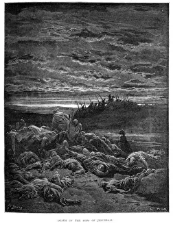
Death of the Sons JerubbaalVintage engraving from the 1870 of a sdcene from the Old Testament by Gustave Dore showing Death of the Sons of Jerubbaal
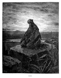
IsaiahVintage engraving from the 1870 of a scene from the Old Testament by Gustave Dore showing Isaiah. He lived approximately 2700 years ago and was a prophet in the 8th-century BC Kingdom of Judah
God gives the law[url=http://www.istockphoto.com/file_search.php?action=file&lightboxID=11047139][img]http://img-fotki.yandex.ru/get/5809/5232617.2/0_702d2_40b270_orig[/img][/url] God gives the Israelites the law in
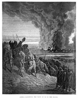
Joshua Committing Ai to FlamesVintage engraving from the 1870 of a sdcene from the Old Testament by Gustave Dore showing Joshua committing the Town of Ai to the Flames
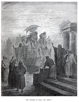
Isaac meets RebekahVintage engraving by Gustave DorA from 1870 showing a scene form the Old Testament Isaac meets Rebekah
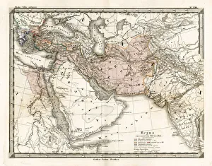
Antique Map of Alexander the Greats EmpireAntique Map from 1862 of the kingdoms of the successors of Alexander the Great. Maps text is written in Latin. [b]View More:[/b] [url=http://www.istockphoto.com/file_search.php
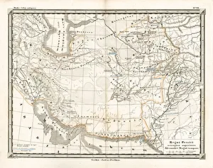
Antique Map of the Persian EmpireAntique Map from 1862 of the Persian Empire, the time of Alexander the Great. Maps text is written in Latin
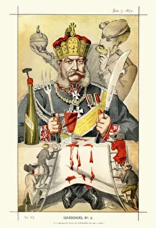
Vanity Fair Print - William I, German EmperorVictorian caricature of William I (Wilhelm I), German Emperor and King of Prussia. Under the leadership of William and his Minister President Otto von Bismarck
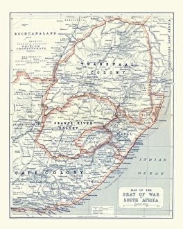
Map of South Africa during the Second Boer WarVintage Map of South Africa during the Second Boer War
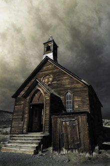
old churchold abandoned church from the 18th century rural california
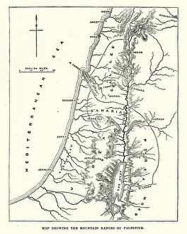
Map showing the mountain ranges of PalestineVintage engraving of Map showing the mountain ranges of Palestine, 19th Century
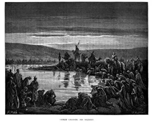
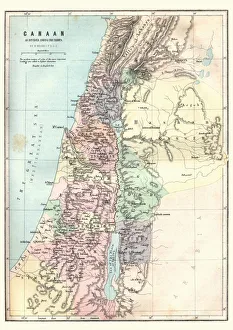
Map of Canaan as divided amoung the tribesVintage engraving of a Map of Canaan as divided amoung the tribes
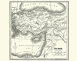
Map of Asia Minor in Ancient TimesVintage engraving of a Map of Asia Minor in Ancient Times
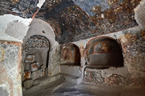
Interior View of Cave Church, CappadociaInterior view of cave church in Soganli valley, Cappadocia, Turkey, Central Anatolia.The historic mural paintings are ruined (vandalized) by some modern graffiti.UNESCO World Heritage Site
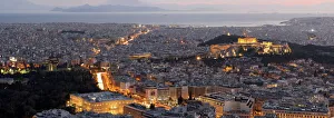
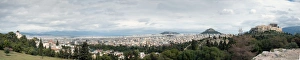
Acropolis and Athens panoramaView of the city of Athens. The picture is taken from the Pnyka hill, where ancient Greeks used to gather and debate public matters
Mithridatesillustration of a Mithridates
Persian ambassadors, invaded by the Macedonians in womens clothesIllustration of a Persian ambassadors, invaded by the Macedonians in womens clothes
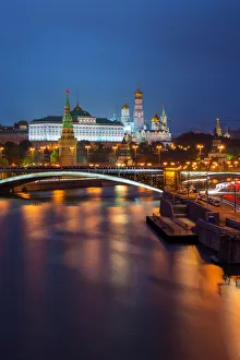
Moscow Kremlin PalaceThe Grand Kremlin Palace also translated Great Kremlin Palace, was built from 1837 to 1849 in Moscow, Russia on the site of the estate of the Grand Princes
Alexander the Greats EmpireVintage map showing the ruot eof Alexander the Great as he conqured the Middle East
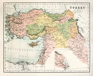
Antique Map of TurkeyAntique map of Turkey from 1867
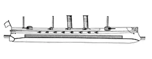
BattleshipSketch of a Battleship