mail_outline sales@mediastorehouse.com
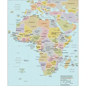
Political Map of AfricaVector Illustration of the policital map of Africa Reference map as created by the US Central Intelligence Agency
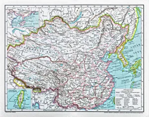
China mapillustration of a South Eastern Asia map
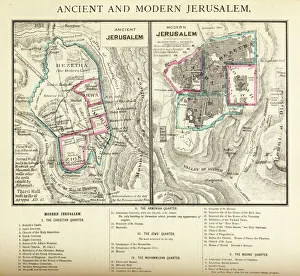
Ancient and Modern Jerusalem Map EngravingEngraved illustration of Ancient and Modern Jerusalem Map Engraving from The Popular Pictorial Bible, Containing the Old and New Testaments, Published in 1862. Copyright has expired on this artwork
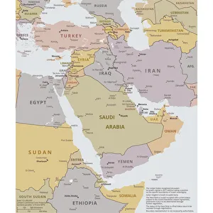
Political map of The Middle EastVector illustration of the policital map of The Middle East Reference map was created by the US Central Intelligence Agency
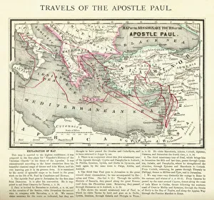
Travels of The Apostle Paul Map EngravingEngraved illustration of the Travels of The Apostle Paul Map Engraving from The Popular Pictorial Bible, Containing the Old and New Testaments, Published in 1862
SingaporeAntique illustration of a Republic of Singapore
RomaniaAntique map of Romania
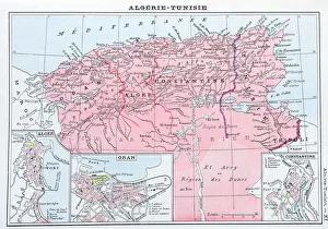
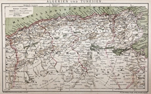
Antique map of Algeria and Tunisia
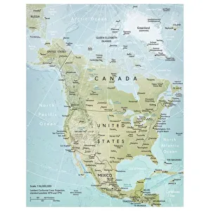
North America mapVector illustration of a detailed map of North America. Reference map was created by the US Central Intelligence Agency and is available as a public domain map at the University of Texas Libraries
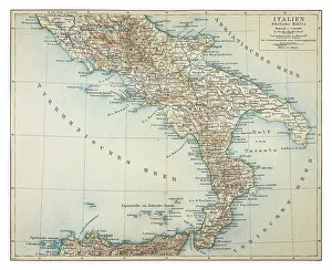
Map of southern Italy 1895
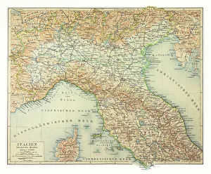
Map of northern Italy 1895
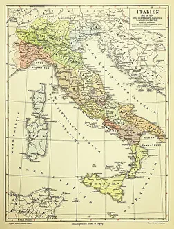
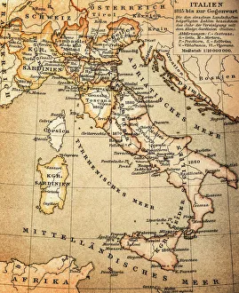
Map of Italy 1895
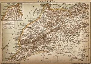
Map of Morocco
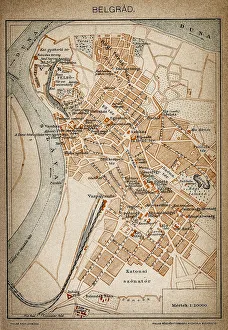
Belgrade map 1893Antique illustration of a Belgrade map 1893
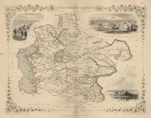
Antique map of Independent TartaryWonderfully fine engraved map 1851 of the region of Independent Tartary, which is now the area that is Kazakhstan, Uzbekistan, Turkmenistan alongside the Caspian Sea and Aral Sea
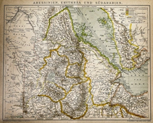
Abyssinia, Eritrea and South ArabiaAntique illustration of a Abyssinia, Eritrea and South Arabia
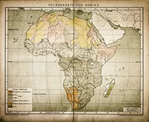
Ethnic map of AfricaAntique illustration of a ethnic map of Africa
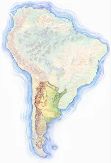
Highly detailed hand-drawn map of Argentina within the outline of South America with a compass rose and the equator
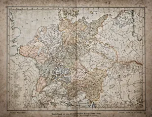
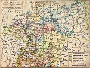
Germany until the Thirty Years War. (1493-1618)Illustration of a Germany until the Thirty Years War. (1493-1618)
Antique map of Algeria and TunisiaIllustration of a Antique map of Algeria and Tunisia
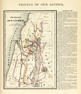
Travels of Our Savior Map EngravingEngraved illustration of the Travels of Our Savior Map Engraving from The Popular Pictorial Bible, Containing the Old and New Testaments, Published in 1862. Copyright has expired on this artwork
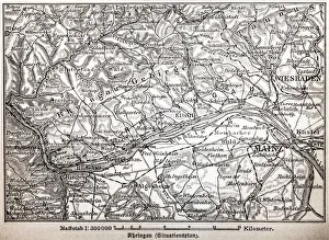
The Rheingau ( Rhine District )
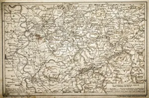
Rhenish-Westphalia coals and industrial map
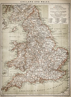
England and WalesAntique map of England and Wales
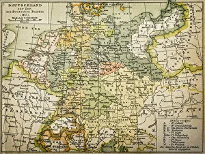
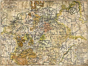
Antique map of Germany from 1815
Political outline map of Africa from 1898
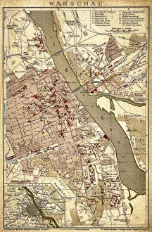
WarsawAntique illustration of a Warsaw from 1898
Germany 1547Antique map of Germany from 1547
GermanyAntique map of Germany from 1648
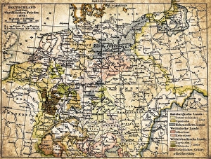
Germany map from 1786Antique map of Germany from 1786
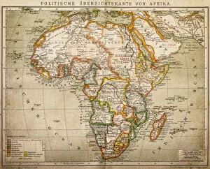
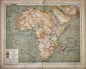
Map of AfricaAntique illustration of a map of Africa
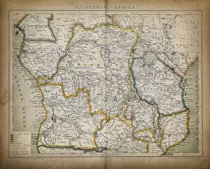
Equatorial AfricaAntique illustration of a equatorial Africa
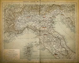
Upper and Central ItalyAntique illustration of a Upper and Central Italy
ItalyAntique illustration of Italy
Historic watchtower of the former GDR, East Germany, Treptow district, Berlin, Germany, Europe
North Carolina, NC, highlighted on a contour map of USA, United States of America, 3D illustration
State of New York, NY, highlighted on a contour map of USA, United States of America, 3D illustration
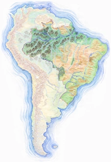
Highly detailed hand-drawn map of Brazil within the outline of South America with a compass rose and the equator
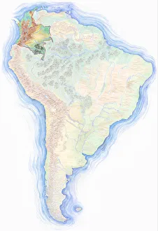
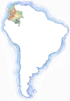
Highly detailed hand-drawn map of Colombia within the outline of South America with a compass rose and the equator
Highly detailed hand-drawn map of South America with Argentina highlighted
Green Belt, former inner-German border patrol path with the overgrown death strip, Rennsteig, Lehesten, Thuringia, Germany
Gafital valley, Praettigau, Raetikon mountain range, Graubuenden or Grisons, Switzerland, view from Gafierjoch on the border to Austria