mail_outline sales@mediastorehouse.com
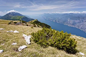
On Monte Altissimo above Nago, overlooking Lake Garda, with Monte Baldo at the rear, Trentino, Italy, Europe
Ostrich portraitClose up of emu head. Varese, Italy
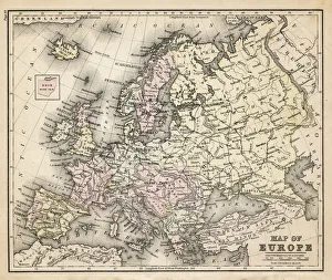
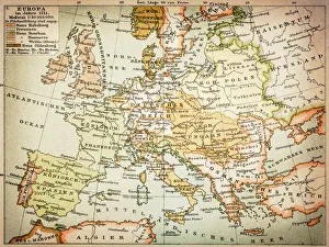
old map of european old map form 1883, showing european countries
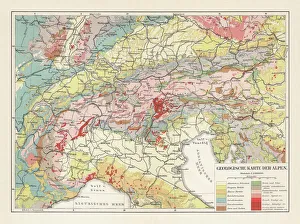
Geological map of the European Alps, lithograph, published in 1897Geological map of the European Alps. Lithograph, published in 1897
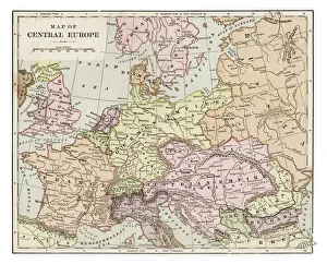
Map of central Europe 1889Indiana Educational Series The Complete Geography - Indianapolis 1889
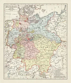
Map of the German Confederation (1815-1866), lithograph, published in 1897Map of the German Confederation between 1815 and 1866. Lithograph, published in 1897
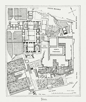
Floor plan of Palatine Hill in Rome, published in 1878Floor plan of the archaeological remains of the Palatine Hill in Rome. The Palatine Hill (Latin: Mons Palatinus, Italian: Monte Palatino)
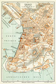
Trieste Italy map 1895Meyers Konversations-Lexikon. Ein Nachschlagewerk des allgemeinen Wissens, 5th edition 17 volumes Bibliographisches Institut - Leipzig 1895-1897
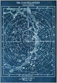
Antique colored illustrations: The constellations visible in Britain
Map of Europe 1721
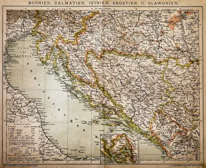
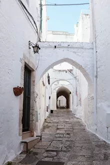
Bosnia, dalmatia, istria, croatia, slavoniaAntique illustration of a Bosnia, dalmatia, istria, croatia, slavonia map
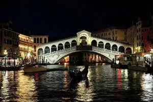
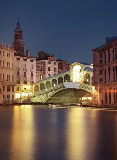
Rialto Bridge at nightRialto bridge illuminated at night, with a gondola silhouetted in the foreground. Unrecognizeable people on the bridge
Praying mantis (Mantis religiosa), close-up
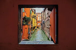
View to the canal through square window, Bologna, Emilia-Romagna, ItalyFinestrella di Via Piella - little square window in Bologna overlooking towards Canale delle Moline
Positano (Unesco world heritage), on the Amalfi coast, Italy
A spiral fractalA spiral staircase with a blue multi colored pattern photographed directly above
sunflowers under blue sky and shining sunSunflowers in Val D Orcia, Tuscany
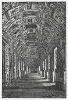
Gallery of Maps, Vatican, published in 1878The Gallery of Maps (Latin: Galleria delle carte geografiche) in the Vatican. Wood engraving, published in 1878
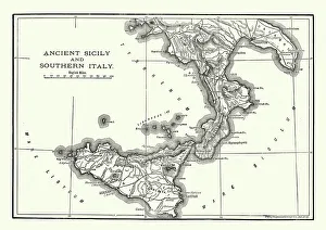
Map of Ancient Sicily and Southern ItalyVintage engraving of a Map of Ancient Sicily and Southern Italy
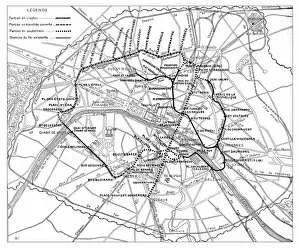
Antique engraving illustration: Paris Subway Metro map
Antquie Map of ItalyVintage map of Italy from 1815
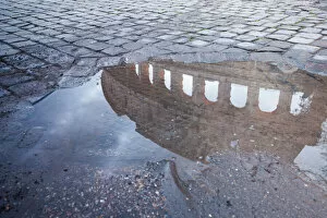
Colosseum reflected in puddle, Rome, ItalyColiseum walls reflected in puddle with cobblestone pavement. Rome, Italy
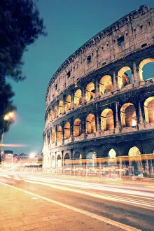
Colosseum at night with light trails from carsColosseum illuminated at night with light trails from cars passing on the street, Rome, Italy
Sunrise over old town of Vieste, Gargano, Puglia, ItalyVieste, Gargano peninsula, Apulia, Italy
Sunset over Borromeean islands, Lake Maggiore, ItalyBorromean islands in the gulf of Pallanza, Lake Maggiore, Piedmont, Italy
Panoramic sunset over Borromean islands, Lake Maggiore, ItalyBorromean islands in the gulf of Pallanza, Lake Maggiore, Piedmont, Italy
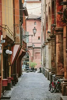
Narrow street in the old town of Bologna, Emilia-Romagna, Italy
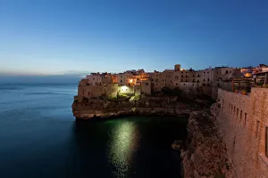
View of Polignano a Mare in the morning, Puglia region, also known as Apulia, Southern Italy, Italy, Europe
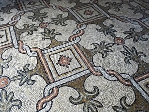
Detail of Mosaic Floor in Basilica San Vitale, Ravenna, ItalyDetail view of mosaic floor in Basilica (Church) of San Vitale, Ravenna, Italy. Early Christian Byzantine Art and Architecture. Unesco World Heritage Site
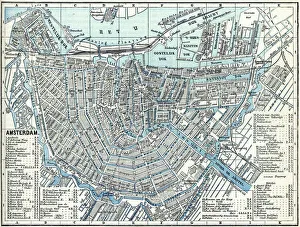
Map of city Amsterdam Netherlands from 1881 Original edition from my own archives Source : Illustriertes Konversations Lexikon 1881
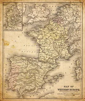
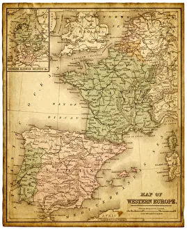
western europe map 1883a map of Western europe from 1883
western europe 1867a map of Western europe from 1867, overlay with grunge burnt texture paper
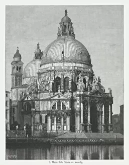
Santa Maria della Salute, Venice, Italy, wood engraving, published 1884Saint Mary of Health (Santa Maria della Salute) in Venice, built 1631 - 1670 by Baldassare Longhena (Italian architect, 1598 ? - 1682). Wood engraving, published in 1884
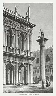
Marciana National Library, Venice, Italy, wood engraving, published in 1884The Marciana National Library, Venice, Italy. Wood engraving, published in 1884
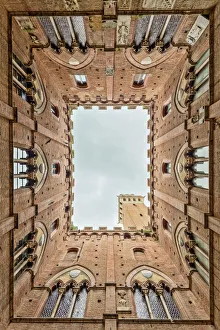
Low angle view of the Torre Del Mangia from Palazzo Pubblico Siena TuscanyLow angle view of the Torre Del Mangia and decorated windows from the interior courtyard of Palazzo Pubblico Piazza Del Campo Siena Tuscany Italy Europe
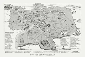
Rome in the birds eye view, published in 1878Rome in the birds eye view with the known historic buildings and places. Wood engraving, published in 1878
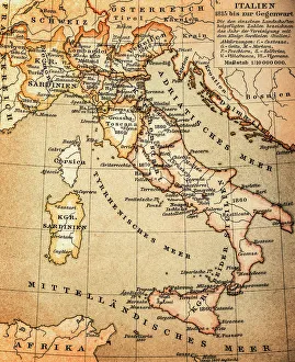
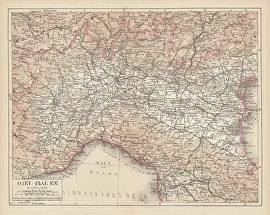
Ancient map of Northern Italy, lithograph, published in 1876Ancient map of Northern Italy. Lithograph, published in 1876
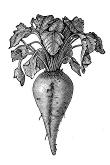
Sugar beet (Beta vulgaris)Illustration of a Sugar beet (Beta vulgaris)
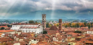
Dramatic LuccaDramatic light illuminates the historical city of Lucca in Tuscany, Italy. Lucca is a city and comune in Tuscany, Central Italy
Light trails on Rialto bridgeRialto bridge on Grand canal illuminated at night, Venice, Italy
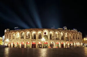
Arena of Verona illuminated at night, Italy
Old town, Ostuni (the White town), Apulia, ItalyOstuni (called the White town), Itria valley, Apulia, Italy
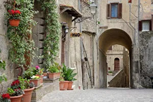
Alley with flowers in pots in Bracciano, Italy
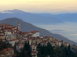
View of Sacro Monte di Varese, ItalyView of the UNESCO World Heritage listed Sacro Monte di Varese - the Sacred Mountain at Varese
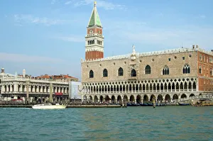
Palazzo Ducale San Marco Torre dellOrologio Clock Tower Venice Italy
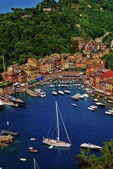
PortofinoView on Portofino, small Italian village, protected by UNESCO
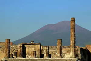
Pompeii and Mount Vesuvius as a dramatic backdrop
Val Di Funes (Vilnoss), Dolomite, ItalyThe beautiful landscape of Italian Alps in summer season