mail_outline sales@mediastorehouse.com
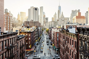
High angle view of Lower East Side Manhattan Downtown, New York City, USA
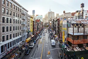
High angle view of Chinatown from Manhattan bridge, New York City, USA
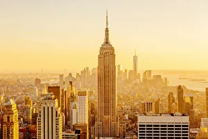
Golden sunset in Manhattan, New York City, USA
Cluster of DandelionsCluster of dandelions with seeds flying around the plant with green leaves with blue background nad white puffy clouds in the background on location for Wishing, Hope, Seed, Fragility, Inspiration
Old art deco building in New YorkOld art deco office building in 5th Avenue, in New York City, near the Soho, with a big clock indicating it is noon
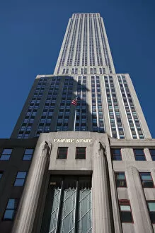
Low angle view of Empire State Building. NYCLow angle view of Empire State Building. New York City, New York. USA
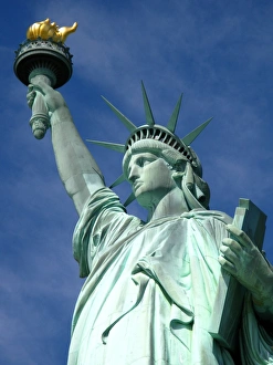
Miss LibertyLocated on the island of Liberty Island, south of Manhattan, the Statue of Liberty is one of the best known in New York and the United States monuments
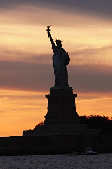
Statue Of Liberty at SunsetA silhouette of the Statue Of Liberty during sunset with orange-blue skies
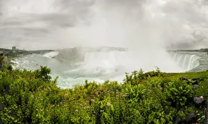
A general view of Niagara Falls areaA wide angle view of Niagara Falls area, including both Canadian and American falls, view from the Canadian side, Ontario, Canada
USA, New York State, New York City, Dripping paint on wall and asphalt
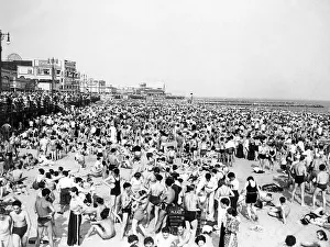
Crowd At Coney IslandUNITED STATES - CIRCA 1940s Beach Crowd At Coney Island In Bathing Suits & Street Clothes With The Boardwalk Stores & Billboards In The Background Sunbathing (Photo by H)
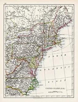
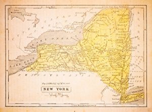
United States North East map 1897The World-Wide Atlas of Modern Geography, Political and Physical W. & A.K. Johnston - London 1897
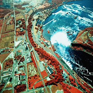
USA, New York, Niagara Falls, satellite imagea014085
USA, New York, Buffalo, satellite imagea014430
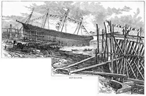
Ship building in Maine USA engraving 1883Warrens Common School Geography
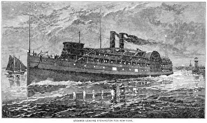
Steamer leaving new york 1883Warrens Common School Geography
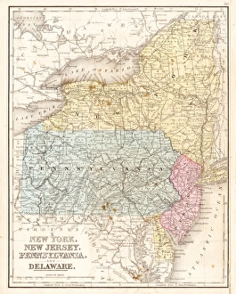
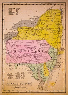
Map of Middle states USA 1883Warrens Common School Geography
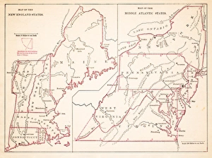
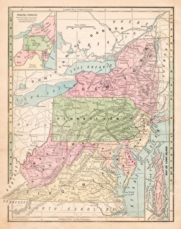
North Eastern States USA map 1881Coltons Common School Geography 1881 New York Sheldon and Co
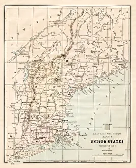
Middle states USA map 1869Cornells Grammars-School Geography - S.S. Cornell - New York D. Appleton and Company 1869
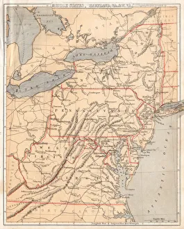
MId-atlantic states usa map 1867Mitchells Modern Atlas - Published by E.H. Buttler & Co - Philadelphia 1867
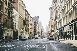
Broadway, Soho, New York City, United States
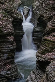
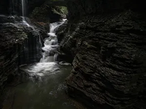
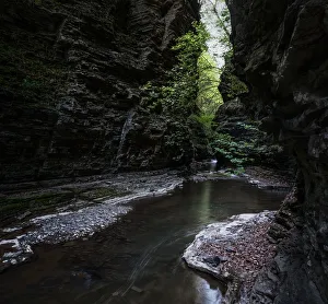
Steep fallsGlen Creek runs descends 400 feet past 200-foot cliffs, generating 19 waterfalls along its 2 mile course within Watkins Glen State Park, NY
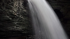
Waterfall close upGlen Creek runs descends 400 feet past 200-foot cliffs, generating 19 waterfalls along its 2 mile course within Watkins Glen State Park, NY
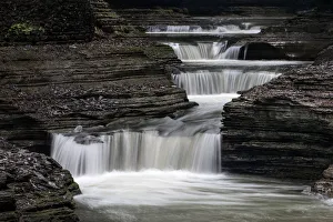
CascadesGlen Creek runs descends 400 feet past 200-foot cliffs, generating 19 waterfalls along its 2 mile course within Watkins Glen State Park, NY
Watkins Glen WaterfallGlen Creek runs descends 400 feet past 200-foot cliffs, generating 19 waterfalls along its 2 mile course within Watkins Glen State Park
CanyonGlen Creek runs descends 400 feet past 200-foot cliffs, generating 19 waterfalls along its 2 mile course within Watkins Glen State Park, NY
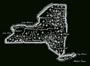
New York 1852 Map
Middle States 1852 Map
United States of America, Atlantic coast, lithograph, published in 1878United States of America, Atlantic coast. Lithograph, published in 1878
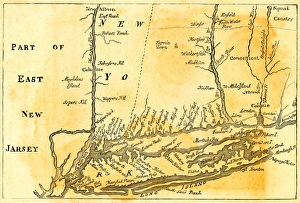
Vintage Map of New York at the beginning of the 18th Century. from 1880
Antique New York StateNew York State Map, - Antique style. Includes mountains and water bodies. High detail - vector illustration
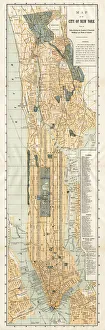
Map of New York City 1894Huge vertical panorama map of New York 1885
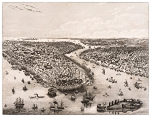
The Bay of New York and Brooklyn engraving 1853
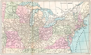
USA middle states map 1875The Independent Course Comprehensive Geography by James Monteith, A.S. Barnes & Co, New York & Chicago 1875
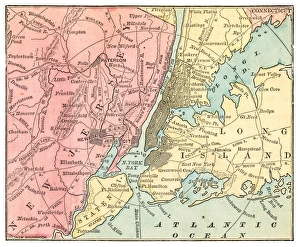
New York and Jersey map 1875The Independent Course Comprehensive Geography by James Monteith, A.S. Barnes & Co, New York & Chicago 1875
Routes of travel in the United States map 1875The Independent Course Comprehensive Geography by James Monteith, A.S. Barnes & Co, New York & Chicago 1875
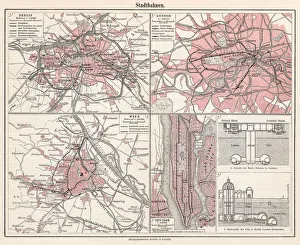
City railways map 1895Meyers Konversations-Lexikon. Ein Nachschlagewerk des allgemeinen Wissens, 5th edition 17 volumes Bibliographisches Institut - Leipzig 1895-1897
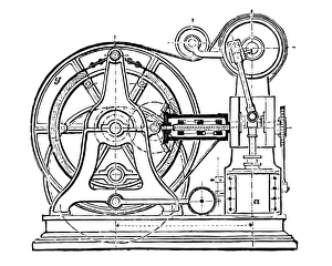
Steam elevator from Otis brothers in New York
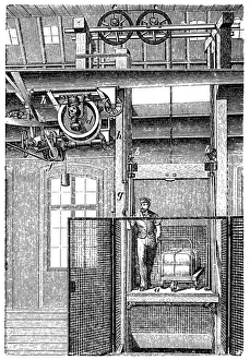
Transmission elevatorAntique illustration of a Transmission elevator
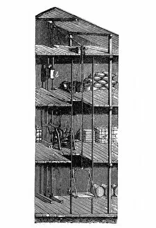
Hand goods liftAntique illustration of a Hand goods lift
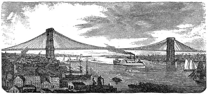
Brooklyn Bridge from 1878Illustration of a Brooklyn Bridge from 1878
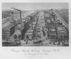
New York Starch FactoryIllustration of T. Kingsford and Sons starch factory in Oswego, New York circa 1850. (Photo by Kean Collection/Getty Images)
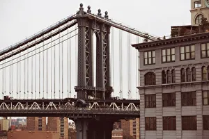
Manhattan bridge close-up