mail_outline sales@mediastorehouse.com
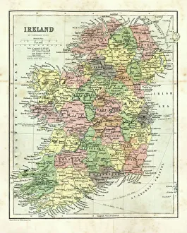
Antique map of Ireland, 1864
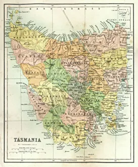
Antique Map of TasmaniaAntique map of Tasmania from 1867
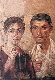
Fresco portraying Terentius Neo and his wifehistory, past, archeology, discovery, , Fresco Wall Paintings, Buena Vista Images, 170425218
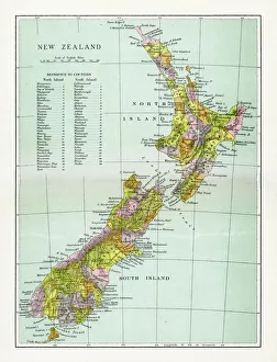
Antique Map of New ZealandVintage map of New Zealand, from 1894
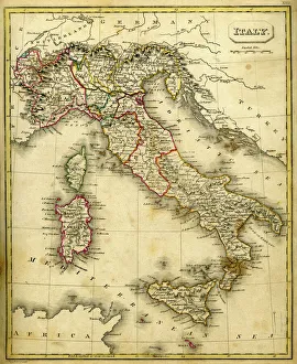
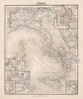
Antquie Map of ItalyVintage map of Italy fron 1837
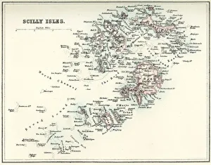
Map of the Scilly IslesVintage map from 1880 of the Scilly Isles an archipelago off the southwestern tip of the Cornish peninsula of Great Britain
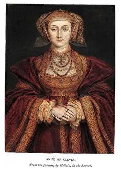
Anne of Cleves" Vintage engraving of Anne of Cleves by Hans Hobein. A German noblewoman and the fourth wife of Henry VIII of England and as such she was Queen of England from 6 January 1540 to 9 July 1540
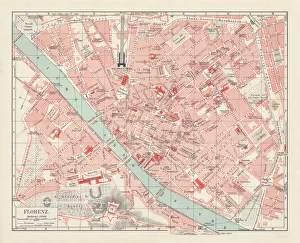
City map of Florence, Italy, lithograph, published in 1897City map of Florence - capital city of the Italian region of Tuscany. Lithograph, published in 1897
Old fashioned steam train locomotiveVintage engraving the plasn and diagram of an old fashioned steam train locomotive, the Bogie and radial tank engine by Neilson and Company of Gaslgow
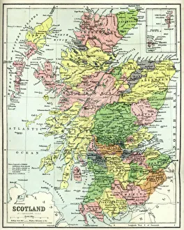
Antique map of Scotland, 1864
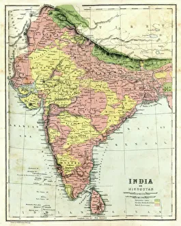
Antique map of India, 1864
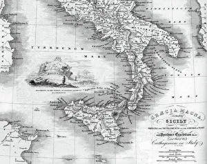
Vintage map of Magna Graecia, showing the settlements of the ancient greeks in Italy. Magna GrA|cia is the name of the coastal areas of Southern Italy on the Tarentine Gulf that was extensively
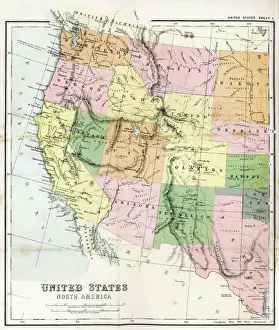
Antique Map of Western USAAntique Map from 1867 of Western United States of America
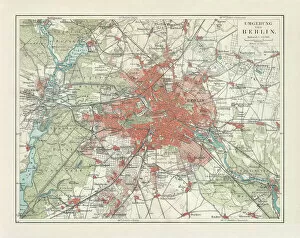
City map of Berlin and surrounding, Germany, lithograph, published 1897City map of Berlin and surrounding, capital of Germany. Lithograph, published in 1897
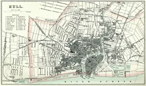
Map of HullVintage map from 1880 of Hull in the East Riding of Yorkshire, England. The city of Hull has served as market town, military supply port, trading hub, fishing and whaling centre
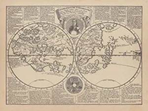
World map by Martin Behaim, 1492, wood engraving, published 1884World map by Martin Behaim, 1492. Woodcut engraving from my archive, published in 1884
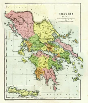
Antique map of Ancient Greece, 1864
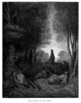
Jesus Praying in the GardenVintage engraving from the 1870 of a scene from the New Testament by Gustave Dore showing Jesus Praying in the Garden
The Chosen - Last JudgmentLast Judgment by Fra Angelico. fifteenth century
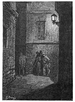
Victorian London - A shady placeVintage engraving showing a scene from 19th Century London England. A dark alley in Whitechapel circa 1870
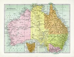
Antique Map of AustraliaVintage map of Australia, from 1894
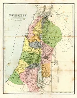
Antique Map - Biblical PalestineAntique Map from 1864 of Biblical Palestine
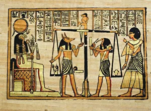
PapyrusEgyptian PapayrusMore of my photos:
Pink vintage car on a cuban beachA convertible Ford Custom Line !957 model parked under palms on the beach of Santa Maria, at Playa de l?Este, near Havana
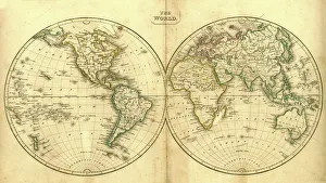
Vintage Map of the WorldVintage map of the world from 1837
La Fontaines Fables - Wolves and the SheepVintage engraving from La Fontaines Fables, Illustraed by Gustave Dore. The Wolves and the Sheep
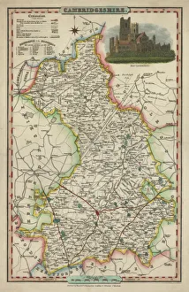
Antique map of CambridgeshireAn antique map of Cambridgeshire 1840.ašJames Pigot (1794-1842)aš showing the whole county and all its major towns and cities.Pigot started as an engraver for Deans Manchester Directory
Medicinal HerbsVintage engraving of Medicinal Herbs, including, Aconite (Monkshood), Digitalis (Foxglove), Conium (Hemlock), Hyoscyamus (Henbane) and Belladonna (Deadly Nightshade)
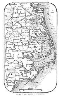
Map of Pamlico and Albemarle SoundsVintage engraving from 1863 of a map of Map of Pamlico and Albemarle Sounds at the time of the American Civil War
Old american car on El Malecon of HavanaThe Malecon (officially Avenida de Maceo) is a broad esplanade, roadway and seawall which stretches for 8Akm (5 miles) along the coast in Havana, Cuba
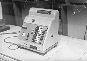
Old fashioned cash register, (B&W)
Young woman in underwear standing by mirror, (B&W)
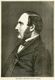
Prince Albert, consort of Queen VictoriaPrince Albert of Saxe-Coburg and Gotha, husband and Prince Consort of Queen Victoria (26 August 1819 - 14 December 1861). From " Albert The Good; Scenes in the Life of The Prince Consort"
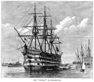
HMS Victory at Portsmouth" Vintage engraving from 1878 showing HMS Victory at Portsmouth. HMS Victory is a 104-gun first rate ship of the line of the Royal Navy, laid down in 1759 and launched in 1765
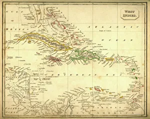
Antquie Map of The West IndiesVintage map of The West Indies from 1837
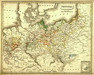
Antquie Map of PrussiaVintage map of Prussia from 1837
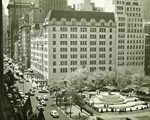
Busy street at Plaza Hotel, New York City, (B&W), (Elevated view)
Egypt, Mount Sinai, Saint Catherines Monastery, high angle view
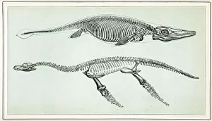
Ichthyosaurus and PlesiosaurusVintage engraving of an Ichthyosaurus and Plesiosaurus. The Ichthyosaurus is a genus of ichthyosaurs from the early Jurassic
La Fontaines Fables - Fox and the GoatVintage engraving from La Fontaines Fables, Illustraed by Gustave Dore. The Fox and the Goat
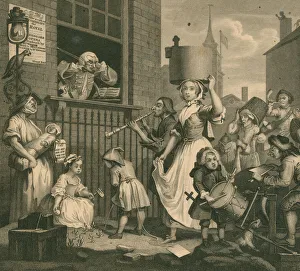
The enraged musician (XXXL)The enraged musician engraved by E.Stalker around 1840.AbobeRGB
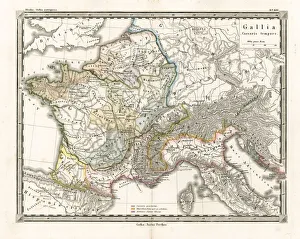
Antique Map of GaulAntique Map from 1862 of Gaul at the time of Julius Caesar. The Roman proconsul and general Julius Caesar pushed his army into Gaul in 58 BC
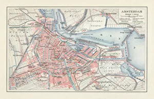
City map of Amsterdam, Netherlands, lithograph, published in 1897City map of Amsterdam, capital of the Netherlands. Lithograph, published in 1897
Ancent Italy, c. 450 BC, steel engraving, published in 1861The territory of Italy around 450 BC with separate maps of Rome, Roman Forum, surrounding area of Rome, Syracuse, Carthage and surrounding area of Pompeji and Naples. Legend in Latin language
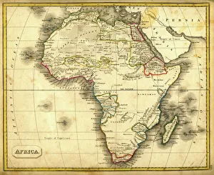
Antquie Map of AfricaVintage map of Africa from 1837
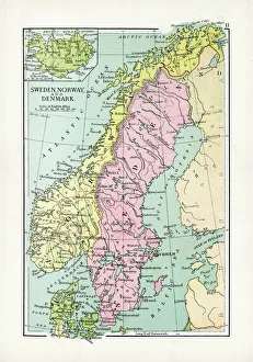
Antique Map of Sweden, Norway and DenmarkVintage map of Sweden, Norway and Denmark, from 1894
Male pharmacist working with test tubes in laboratory, (B&W)
Girl (4-5) on see-saw in park, (B&W), low angle view