mail_outline sales@mediastorehouse.com
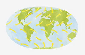
Illustration of global wind formation through rotation and deflection (Coriolis effect)
Illustration of ultraviolet light and ultraviolet waves appearing through the ozone hole
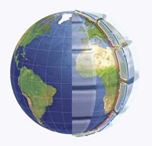
Illustration of Hadley Cells over Europe and Africa on world globe
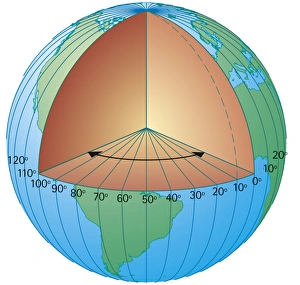
Digital cross section illustration of showing the lines of longitude measured from the centre of the Earth
Digital illustration of global warming on ozone layer
Illustration of earthquake vibrations
Illustration of the Earths layers
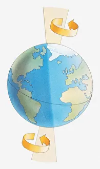
Illustration of the Earth spinning around its axis
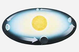
Illustration of Earth orbiting the Sun
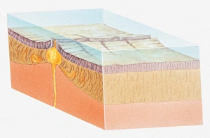
Illustration of oceanic crust
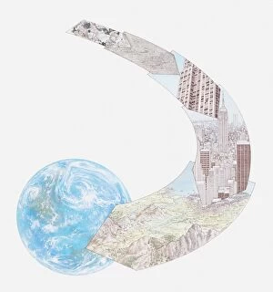
Illustration of minerals and rocks, used for constructing buildings, a landscape of mountains and a city, all forming part of the Earths topography
Illustration of satellite orbiting the Earth
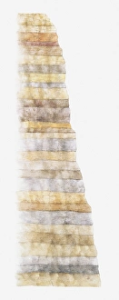
Illustration of layers of Earth showing age from devonian, carboniferous, permian, triassic, jurassic, and cretaceous
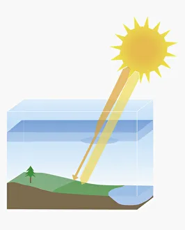
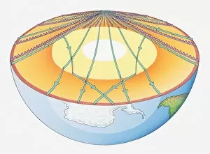
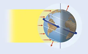
Illustration of suns rays reaching the Earth, creating the greatest heat in the tropics and impinging at oblique angle towards the poles (solar heating)
Illustration of astronaut floating in space, with spaceship and planet Earth in background
Illustration of a segment of the Earth, showing mantle, asthenosphere, lithosphere, oceanic crust and continental crust
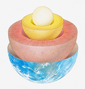
Illustration of the Earths interior showing the core, mantle and crust
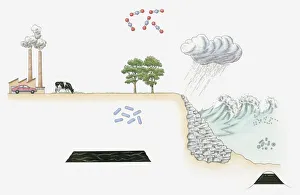
Illustration of carbon cycle on Earth
Planet Earth and clouds seen from space
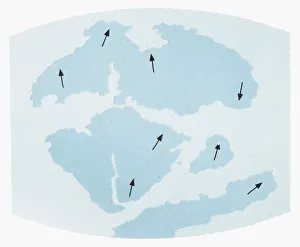
Illustration showing Earths continents 135 million years ago and their direction of movement
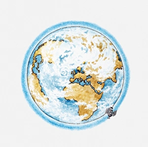
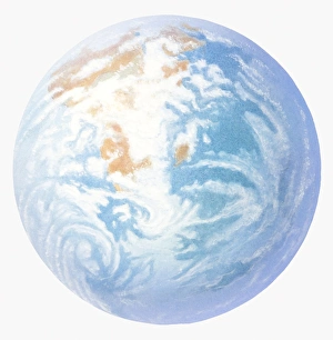
Illustration of planet Earth
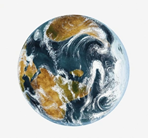
Illustration showing global wind patterns around the Earth
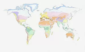
Illustration of global weather zones on world map
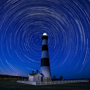
A Starry Night at Bodie Island Light HouseA Starry night at Bodie Island Light House!
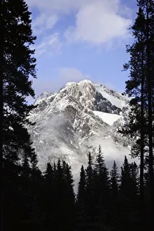
Cascade Mountains in Banff
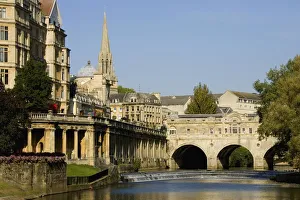
Pulteney Bridge in Bath
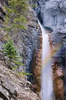
Silverton Falls
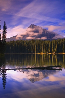
Pilot Pond in Banff
Elongated pink clouds over the Rocky Mountains
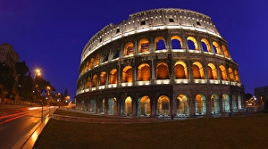
The Colosseum in Rome, Italy
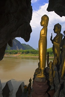
Pak Ou Caves in Laos
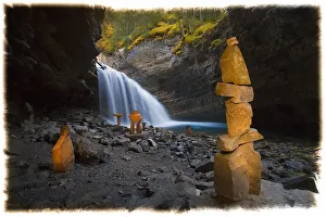
Inukshuks at Johnston Canyon in Banff
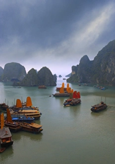
Junks on Halong Bay
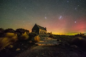
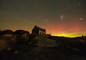
Our galaxy at nightA view of our galaxy at night - Church of The Good Shepherd with Aurora Australis and Magellanic Clouds in conjunctions. Lake Tekapo is part of a UNESCO dark sky reserve
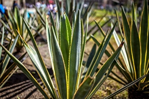
Agave plant outside Mexico City CathedralThis is an agave Plant, in the garden across Mexican Metropolitan Cathedral in Mexico City
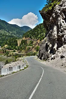
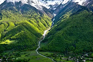
Road to Mestia of Svaneti region in GeorgiaMountains in the Upper Svaneti of Georgia. Upper Svaneti is located in the valley of the Enguri River and is a historic province in Georgia
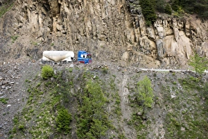
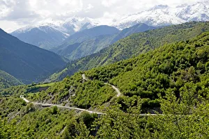
Truck on Road to Mestia of Svaneti region in GeorgiaMountains in the Upper Svaneti of Georgia. Upper Svaneti is located in the valley of the Enguri River and is a historic province in Georgia
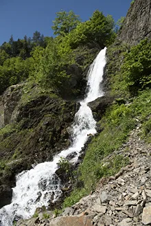
Waterfall at Road to Mestia of Svaneti region in GeorgiaMountains in the Upper Svaneti of Georgia. Upper Svaneti is located in the valley of the Enguri River and is a historic province in Georgia
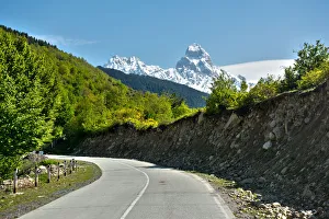
Mount Ushba in the Caucasus of GeorgiaMountains in the Upper Svaneti of Georgia. Upper Svaneti is located in the valley of the Enguri River and is a historic province in Georgia
Horizontal view on Waterfall at Mountain road at Mount Ushba in the Caucasus of GeorgiaMountains in the Upper Svaneti of Georgia. Upper Svaneti is located in the valley of the Enguri River and is a historic province in Georgia
Mountain road at Mount Ushba in the Caucasus of GeorgiaMountains in the Upper Svaneti of Georgia. Upper Svaneti is located in the valley of the Enguri River and is a historic province in Georgia
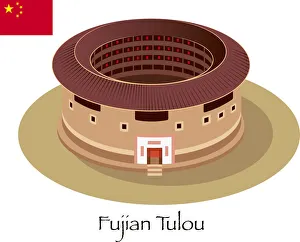
Fujian TulouVector Fujian Tulou
Aurora Australis at Church of The Good ShepherdAurora Australis conjunctions with Magellanic Clouds seen from Church of The Good Shepherd in Lake Tekapo, South Island of New Zealand.Lake Tekapo is part of a UNESCO Dark Sky Reserve
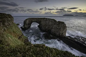
Great Pollet Arch, Portsalon, Fanad Head, County Donegal, Ireland, EuropeThe Great Pollet Sea Arch is a real hidden gem of Fanad in County Donegal. It is a amazing natural sea arch and a good example of marine erosion
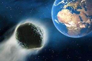
Comet hurtling towards Earth, 3D illustration
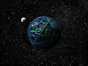
A cable ball in spaceA ball made af many coloured ethernet cables, resembling earth with the moon orbiting it
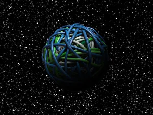
Ball of cables in outer spaceA ball made from ethernet cables in colours resembling earth
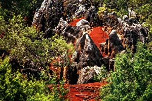
El MadroAno, (fossils in the soil)El MadroAno, is a land where you can find in the soil fossils everywhere, this place is near Japlan de Serra and is in the state of queretaro, the fossils ar mostly from sea creatures