mail_outline sales@mediastorehouse.com
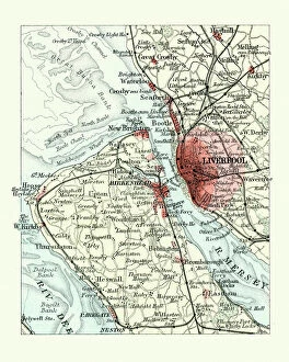
Antique map, Liverpool and Birkenhead, England, 19th CenturyVintage engraving of a Antique map, Liverpool and Birkenhead, England, 19th Century
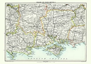
Map of South East England, Hampshire, Dorset, Wiltshire 1891Antique Map of Map of South East England, showing Hampshire, Dorset, Wiltshire, and the Isle of Wight 1891
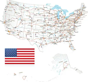
Highly detailed USA Road MapHighly detailed map of United States with roads, states, big cities, rivers and some other objects
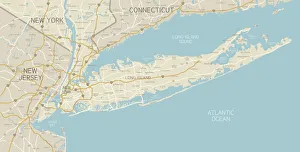
NYC Region and Long Island MapA map of the region around New York City and Long Island, including New Jersey and the coast of Connecticut. Includes major highways, cities, and lakes
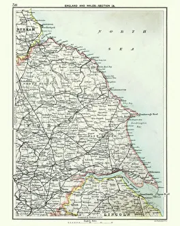
Antique map, North and East Yorkshire 19th CenturyVintage engraving of a Antique map, North and East Yorkshire 19th Century
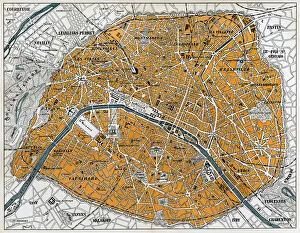
City map of Paris, lithograph, published in 1877City map of Paris, France. Lithograph, published in 1877
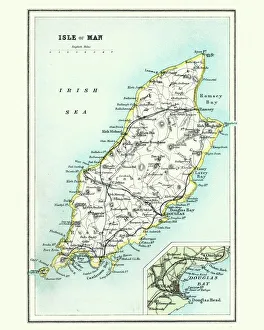
Antique map, Isle of Man 19th CenturyVintage engraving of a Isle of Man 19th Century with detail of Douglas
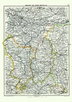
Antique map, West Yorkshire, Derby, Nottingham, Lincoln, 19th CenturyVintage engraving of a Antique map, West Yorkshire, Derby, Nottingham, Lincoln, Stafford, Leicester, Rutland, England. 19th Century
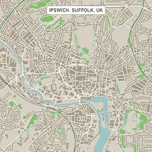
Ipswich Suffolk UK City Street MapVector Illustration of a City Street Map of Ipswich, Suffolk, UK. Included files are EPS (v10) and Hi-Res JPG. Data courtesy from Ordnance Survey: VectorMap District https
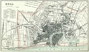
Map of HullVintage map from 1880 of Hull in the East Riding of Yorkshire, England. The city of Hull has served as market town, military supply port, trading hub, fishing and whaling centre
City map of ParisAntique illustration of a City map of Paris
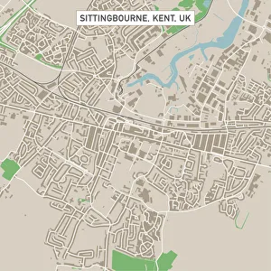
Sittingbourne Kent UK City Street MapVector Illustration of a City Street Map of Sittingbourne, Kent, UK. Included files are EPS (v10) and Hi-Res JPG. Data courtesy from Ordnance Survey: VectorMap District https
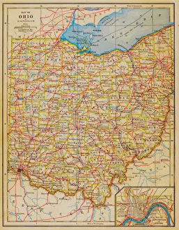
1883 Ohio State Map
Pueblo Colorado US City Street MapVector Illustration of a City Street Map of Pueblo, Colorado, USA. Scale 1:60, 000. All source data is in the public domain. U.S
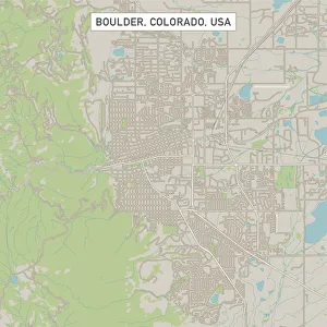
Boulder Colorado US City Street MapVector Illustration of a City Street Map of Boulder, Colorado, USA. Scale 1:60, 000. All source data is in the public domain. U.S
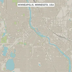
Minneapolis Minnesota US City Street MapVector Illustration of a City Street Map of Minneapolis, Minnesota, USA. Scale 1:60, 000. All source data is in the public domain. U.S
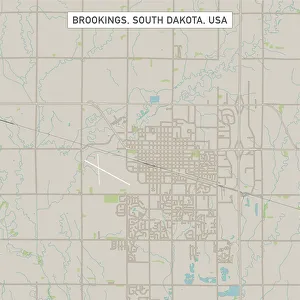
Brookings South Dakota US City Street MapVector Illustration of a City Street Map of Brookings, South Dakota, USA. Scale 1:60, 000. All source data is in the public domain. U.S
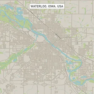
Waterloo Iowa US City Street MapVector Illustration of a City Street Map of Waterloo, Iowa, USA. Scale 1:60, 000. All source data is in the public domain. U.S
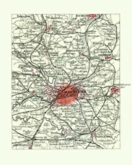
Antique map, Manchester, England, 19th CenturyVintage engraving of a Antique map, Manchester, England, 19th Century
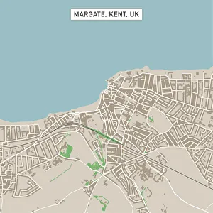
Margate Kent UK City Street MapVector Illustration of a City Street Map of Margate, Kent, UK. Included files are EPS (v10) and Hi-Res JPG. Data courtesy from Ordnance Survey: VectorMap District https
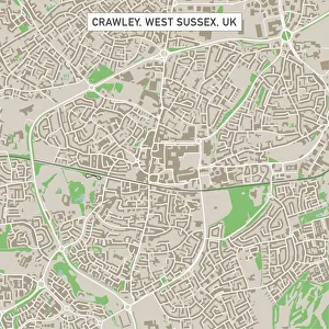
Crawley West Sussex UK City Street MapVector Illustration of a City Street Map of Crawley, West Sussex, UK. Included files are EPS (v10) and Hi-Res JPG. Data courtesy from Ordnance Survey: VectorMap District https
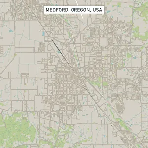
Medford Oregon US City Street MapVector Illustration of a City Street Map of Medford, Oregon, USA. Scale 1:60, 000. All source data is in the public domain. U.S
Casper Wyoming US City Street MapVector Illustration of a City Street Map of Casper, Wyoming, USA. Scale 1:60, 000. All source data is in the public domain. U.S
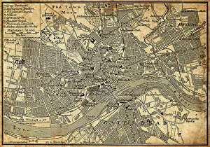
Map of Newcastle Upon TyneAntique illustration of old Newcastle Upon Tyne map
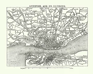
Map of Liverpool and its environs, England, 1870sVintage engraving of Map of Liverpool and its environs, England, 1870s, 19th Century
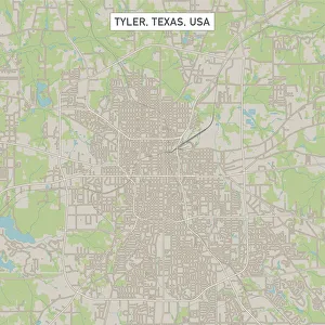
Tyler Texas US City Street MapVector Illustration of a City Street Map of Tyler, Texas, USA. Scale 1:60, 000. All source data is in the public domain. U.S
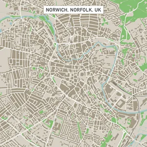
Norwich Norfolk UK City Street MapVector Illustration of a City Street Map of Norwich, Norfolk, UK. Included files are EPS (v10) and Hi-Res JPG. Data courtesy from Ordnance Survey: VectorMap District https
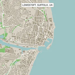
Lowestoft Suffolk UK City Street MapVector Illustration of a City Street Map of Lowestoft, Suffolk, UK. Included files are EPS (v10) and Hi-Res JPG. Data courtesy from Ordnance Survey: VectorMap District https
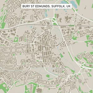
Bury St Edmunds Suffolk UK City Street MapVector Illustration of a City Street Map of Bury St Edmunds, Suffolk, UK. Included files are EPS (v10) and Hi-Res JPG. Data courtesy from Ordnance Survey: VectorMap District https
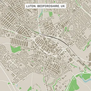
Luton Bedfordshire UK City Street MapVector Illustration of a City Street Map of Luton, Bedfordshire, UK. Included files are EPS (v10) and Hi-Res JPG. Data courtesy from Ordnance Survey: VectorMap District https
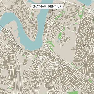
Chatham Kent UK City Street MapVector Illustration of a City Street Map of Chatham, Kent, UK. Included files are EPS (v10) and Hi-Res JPG. Data courtesy from Ordnance Survey: VectorMap District https
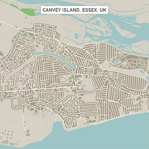
Canvey Island Essex UK City Street MapVector Illustration of a City Street Map of Canvey Island, Essex, UK. Included files are EPS (v10) and Hi-Res JPG. Data courtesy from Ordnance Survey: VectorMap District https
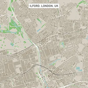
Ilford London UK City Street MapVector Illustration of a City Street Map of Ilford, London, UK. Included files are EPS (v10) and Hi-Res JPG. Data courtesy from Ordnance Survey: VectorMap District https
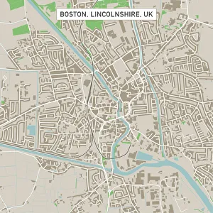
Boston Lincolnshire UK City Street MapVector Illustration of a City Street Map of Boston, Lincolnshire, UK. Included files are EPS (v10) and Hi-Res JPG
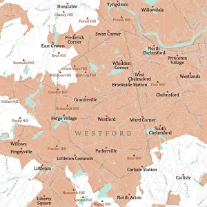
MA Middlesex Westford Vector Road Map. All source data is in the public domain. U.S. Census Bureau Census Tiger. Used Layers: areawater, linearwater, roads, rails, cousub, pointlm, uac10
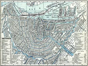
Map of city Amsterdam Netherlands from 1881 Original edition from my own archives Source : Illustriertes Konversations Lexikon 1881
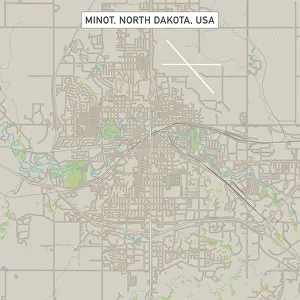
Minot North Dakota US City Street MapVector Illustration of a City Street Map of Minot, North Dakota, USA. Scale 1:60, 000. All source data is in the public domain. U.S
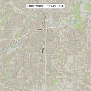
Fort Worth Texas US City Street MapVector Illustration of a City Street Map of Fort Worth, Texas, USA. Scale 1:60, 000. All source data is in the public domain. U.S
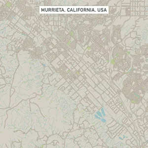
Murrieta California US City Street MapVector Illustration of a City Street Map of Murrieta, California, USA. Scale 1:60, 000. All source data is in the public domain. U.S
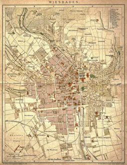
Wiesbaden, germanyAntique illustration of a Wiesbaden, Germany from 1898
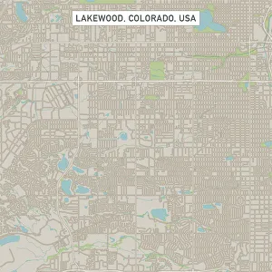
Lakewood Colorado US City Street MapVector Illustration of a City Street Map of Lakewood, Colorado, USA. Scale 1:60, 000. All source data is in the public domain. U.S
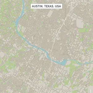
Austin Texas US City Street MapVector Illustration of a City Street Map of Austin, Texas, USA. Scale 1:60, 000. All source data is in the public domain. U.S
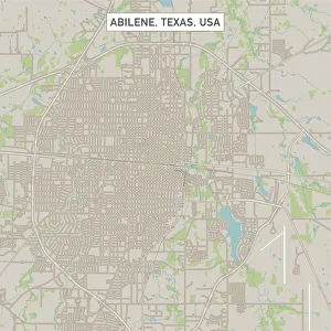
Abilene Texas US City Street MapVector Illustration of a City Street Map of Abilene, Texas, USA. Scale 1:60, 000. All source data is in the public domain. U.S
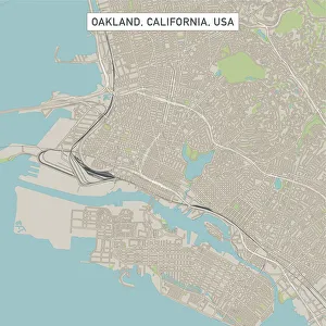
Oakland California US City Street MapVector Illustration of a City Street Map of Oakland, California, USA. Scale 1:60, 000. All source data is in the public domain. U.S
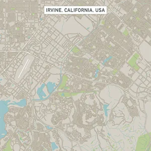
Irvine California US City Street MapVector Illustration of a City Street Map of Irvine, California, USA. Scale 1:60, 000. All source data is in the public domain. U.S
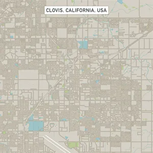
Clovis California US City Street MapVector Illustration of a City Street Map of Clovis, California, USA. Scale 1:60, 000. All source data is in the public domain. U.S
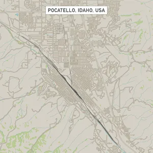
Pocatello Idaho US City Street MapVector Illustration of a City Street Map of Pocatello, Idaho, USA. Scale 1:60, 000. All source data is in the public domain. U.S
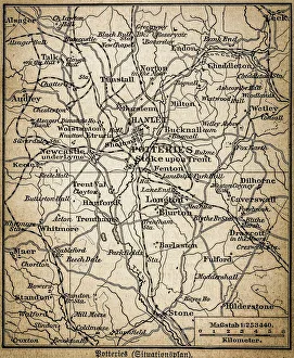
Potteries mapAntique illustration of a Potteries map