mail_outline sales@mediastorehouse.com
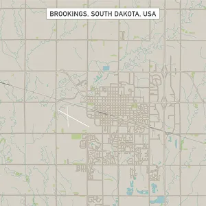
Brookings South Dakota US City Street MapVector Illustration of a City Street Map of Brookings, South Dakota, USA. Scale 1:60, 000. All source data is in the public domain. U.S
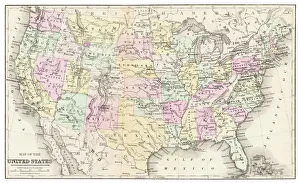
Map of USA 1877Warrens Common School Geography 1877
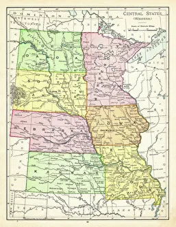
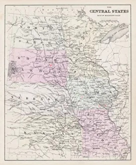
Map of central states USA 1895The Rand-McNally Grammar School Geography 1895 - Chicago & New York
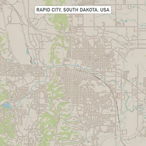
Rapid City South Dakota US City Street MapVector Illustration of a City Street Map of Rapid City, South Dakota, USA. Scale 1:60, 000. All source data is in the public domain. U.S
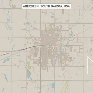
Aberdeen South Dakota US City Street MapVector Illustration of a City Street Map of Aberdeen, South Dakota, USA. Scale 1:60, 000. All source data is in the public domain. U.S
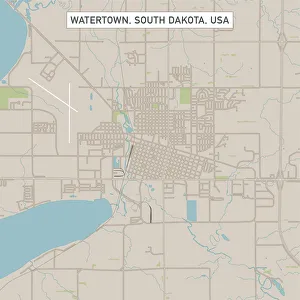
Watertown South Dakota US City Street MapVector Illustration of a City Street Map of Watertown, South Dakota, USA. Scale 1:60, 000. All source data is in the public domain. U.S
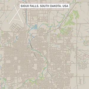
Sioux Falls South Dakota US City Street MapVector Illustration of a City Street Map of Sioux Falls, South Dakota, USA. Scale 1:60, 000. All source data is in the public domain. U.S
Map of central States USA 1877Warrens Common School Geography 1877
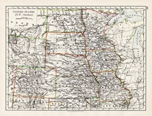
United States NW Central 1897The World-Wide Atlas of Modern Geography, Political and Physical W. & A.K. Johnston - London 1897
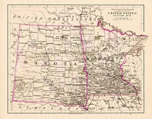
North Dakota and MInnesota map 1881Coltons Common School Geography 1881 New York Sheldon and Co
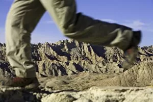
Male hiker walking in badlands, low section (focus on rock formations)Badlands National Park, South Dakota, USA
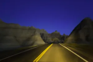
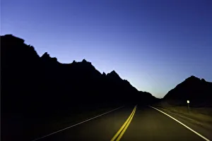
Road through sandstone buttes, night (defocused)Badlands National Park, South Dakota, USA
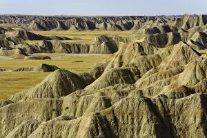
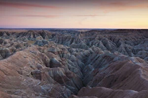
USA, South Dakota, Badlands NP, eroded landscape and grassland, autumnElevated view
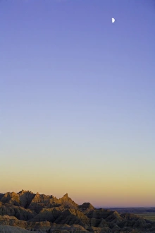
USA, South Dakota, Badlands National Park, moon over sandstone buttesdusk
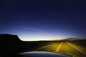
Road through sandstone buttes, night (blurred motion)Badlands National Park, South Dakota, USA
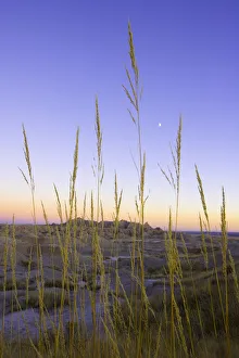
Desert grass against sandstone formations, dusk, autumnBadlands National Park, South Dakota, USA
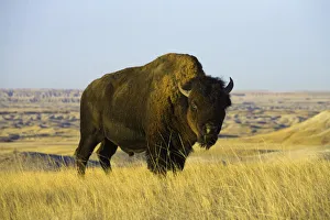
Young bison bull standing in grass, autumnBadlands National Park, South Dakota, USA
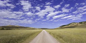
USA, South Dakota, Wind Cave National Park, dirt road across grasslandOct 2005
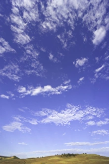
USA, South Dakota, Custer State Park, cumulus clouds over grasslandautumn morning, Oct 2005
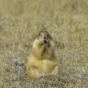
Black-tailed prairie dog (Cynomys ludovicianus) eating grass, autumnWind Cave National Park, South Dakota, USA
Road past sandstone buttes, lit by headlights, night (blurred motion)Badlands National Park, South Dakota, USA
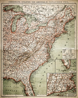
United States of America, eastern partAntique illustration of a United States of America, eastern part
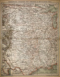
United States of America, Middle sectionAntique illustration of a United States of America, Middle section
Mount RushmoreConstruction begins on the Mount Rushmore National Memorial in South Dakota, circa 1929. The face of US president George Washington is already visible. (Photo by FPG/Hulton Archive/Getty Images)
Badlands National Park, South Dakota, ExteriorUSA, South Dakota, Interior, Badlands National Park, dusk
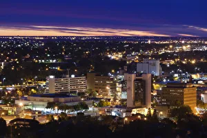
Rapid City, South Dakota, City ViewUSA, South Dakota, Rapid City, elevated view of the skyline, dawn
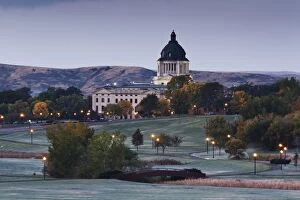
Pierre, South Dakota, Exterior ViewUSA, South Dakota, Pierre, South Dakota State Capitol, exterior, dawn
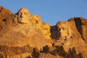
Keystone, South Dakota, Exterior ViewUSA, South Dakota, Black Hills National Forest, Keystone, Mount Rushmore National Memorial, dawn
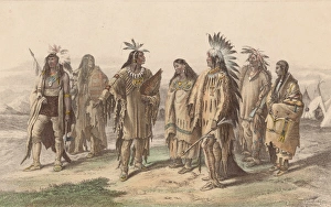
Native Americanscirca 1800: Representatives from various Native American tribes: from left to right, an Iroquois, an Assiniboine, a Crow, a Pawnee, an Assiniboine in gala dress