mail_outline sales@mediastorehouse.com
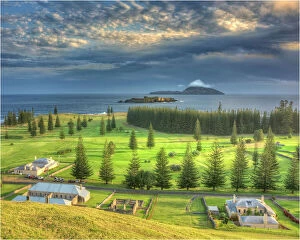
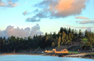
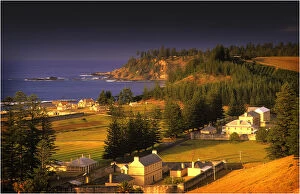
A Kingston Norfolk Island view, part of the restored British penal colony buildings and now a world heritage listed area
Kingston, Norfolk Island, is a very historic Georgian village and fully restored colonial outpost of the British Empire during the convict transportation era
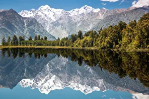
Lake Matheson with Mount Cook mirroredMatheson mirror Lake with Mount Cook at Fox Glacier. New Zealand, Westlands, South Island
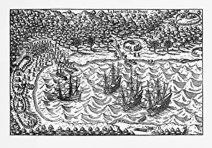
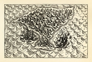
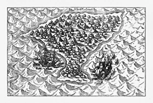
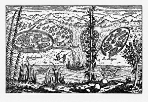
Island of Principe Historical Map by Van Noort, Circa 1598Very Rare, Beautifully Illustrated Antique Engraved Victorian Illustration of Historical Map of Van Noort at the Island of Principe, 1598. Copyright has expired on this artwork. Digitally restored
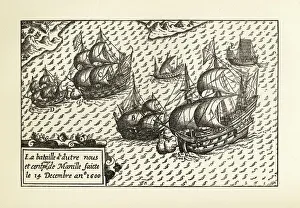
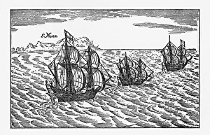
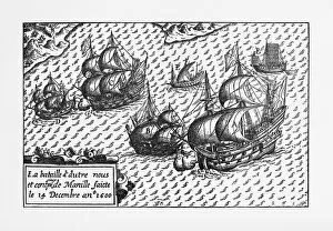
Engraving of Van Noort Landing in Manila Bay, Philippines, 1600Very Rare, Beautifully Illustrated Antique Engraved Victorian Illustration of Historical Engraving of Van Noort Landing in Manila Bay, Philippines, 1600. Copyright has expired on this artwork
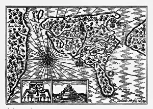
Historical Map of Dutch Navigators Island of Bali IllustrationVery Rare, Beautifully Illustrated Antique Engraved Victorian Illustration of Historical Map of Dutch Navigators on the Island of Bali. Copyright has expired on this artwork. Digitally restored
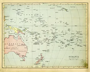
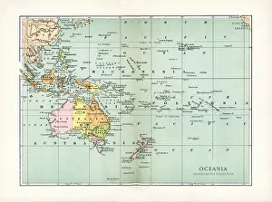
Antique Map of Oceania 1897Antique Map of the Oceania from 1897
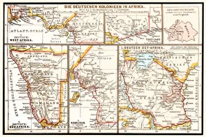
The six principal colonies of German AfricaIllustration of a The six principal colonies of German Africa
Beach resorthttp://csaimages.com/images/istockprofile/csa_vector_dsp.jpg
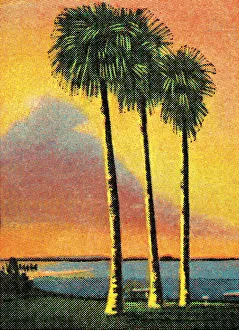
Palm treeshttp://csaimages.com/images/istockprofile/csa_vector_dsp.jpg
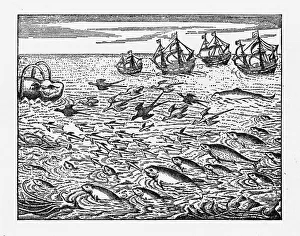
Dutch Navigators Encountering Flying Fish IllustrationVery Rare, Beautifully Illustrated Antique Engraved Victorian Illustration of Dutch Navigators Encountering Flying Fish. Copyright has expired on this artwork. Digitally restored
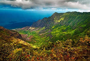
Kalalau Valley LookoutLate sunset light warms the foliage overlooking Kalalau Valley, Kauai, Hawaii, USA
Antique Map of OceaniaVintage map of North Oceania, from 1894
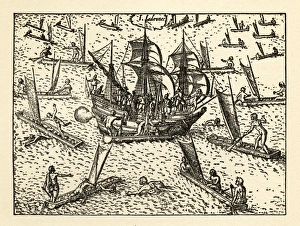
Engraving of Van Noort Sailing the Marianne Islands, 1600Very Rare, Beautifully Illustrated Antique Engraved Victorian Illustration of Historical Engraving of Van Noort Sailing the Marianne Islands, 1600. Copyright has expired on this artwork
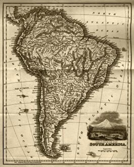
Map of South America (early 19th century steel engraving)A steel engraving of a map from the early 19th century of Brazil and Paraguay in South America, from A System of Geography, Popular and Scientific, or A Physical, Political
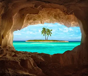
Paradise in the CaribbeanAn old Indian cave located on a remote Caribbean Island. Beautiful Caribbean sea glowing and warm sunlight bathing some remote coconut palm trees on a deserted island
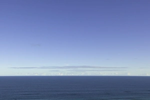
Calm sea and clear sky, South Pacific, AustraliaCalm sea with small ripples and and clear sky, fall morning, South Pacific, Great Australian Bight, South Australia, Australia
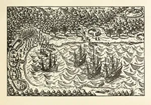
Van Noort Sailing the Strait of Magellan, Engraving of 1600Very Rare, Beautifully Illustrated Antique Engraved Victorian Illustration of Historical Engraving of Van Noort Sailing the Strait of Magellan, 1600. Copyright has expired on this artwork
Van Noort Sailing the Marianne Islands, Engraving 1600Very Rare, Beautifully Illustrated Antique Engraved Victorian Illustration of Historical Engraving of Van Noort Sailing the Marianne Islands, 1600. Copyright has expired on this artwork
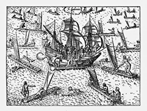
Theives Attacking Van Noort on the Marianne Islands, 1600Very Rare, Beautifully Illustrated Antique Engraved Victorian Illustration of Historical Engraving of Van Noort Attacked by Thieives on the Marianne Islands, 1600
Van Noort Landing in Manila Bay, Philippines Engraving, 1600Very Rare, Beautifully Illustrated Antique Engraved Victorian Illustration of Historical Engraving of Van Noort Landing in Manila Bay, Philippines, 1600. Copyright has expired on this artwork
Van Noort Attacked by Theives on the Marianne Islands, 1600Very Rare, Beautifully Illustrated Antique Engraved Victorian Illustration of Historical Engraving of Van Noort Attacked by Thieives on the Marianne Islands, 1600
Historical Map of Van Noort at the Island of Principe, 1599Very Rare, Beautifully Illustrated Antique Engraved Victorian Illustration of Historical Map of Van Noort at the Island of Principe, from The Golden Book of the Dutch Navigators
Historical Map of Dutch Navigators Expedition to Sumatra IllustrationVery Rare, Beautifully Illustrated Antique Engraved Victorian Illustration of Historical Map of Dutch Navigators Expedition to Sumatra. Copyright has expired on this artwork. Digitally restored
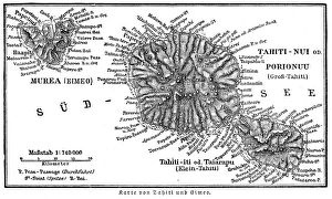
Tahiti island map 1895Meyers Konversations-Lexikon. Ein Nachschlagewerk des allgemeinen Wissens, 5th edition 17 volumes Bibliographisches Institut - Leipzig 1895-1897
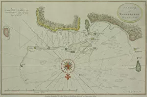
Antique map of Tongataboo in the South Pacific
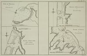
Antique maps of Tahiti and other South Pacific islands
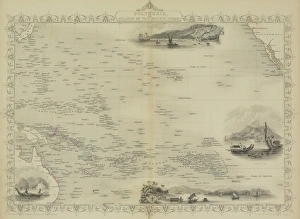
Antique map of Polynesia with vignettes
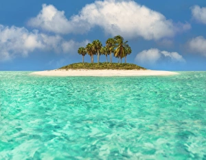
Caribbean ParadiseIn a very remote area off the coast of St. Lucia - Martinique there is a tiny deserted Cay which exemplifies the idyllic paradise. A dozen palm trees tower over the petite Key
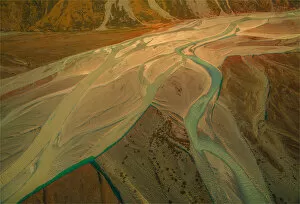
Hooker river Aerial, Mount-cook Aoraki National Park, south island, New Zealand
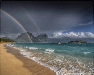
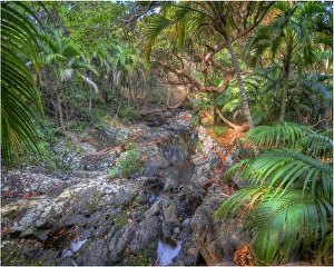
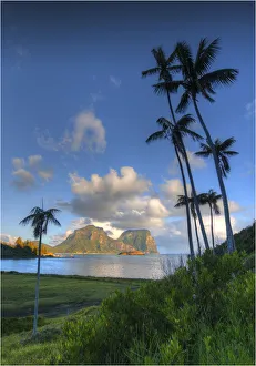
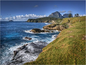
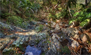
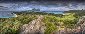
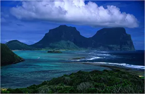
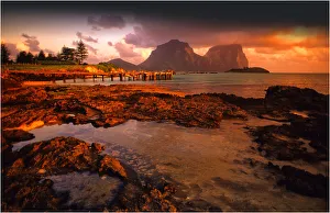
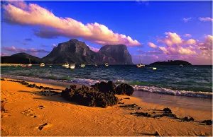
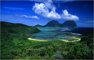
Lord Howe Island, majestic and scenically wonderful, is part of New South Wales, AustraliaLord Howe Island is a sub-tropical destination and scenically superb. The Island is an irregularly crescent-shaped volcanic remnant in the Tasman Sea between Australia and New Zealand
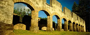
Late afternoon light near sunset, castes its golden glow onto the Coral Sandstone Arched ruins of the convict built stables, norfolk Island