
Topography Collection (page 9)

Background imageTopography Collection: Loch Ba Sunset Reflections

Loch Ba Sunset Reflections
A sunset creating dramatic lighting on reflecting mountains over Loch Ba, Rannoch Moor, Scotland. Loch Ba is a shallow irregular shaped freshwater loch on Rannoch Moor, in the Scottish West Highlands

Background imageTopography Collection: Marine compass

Marine compass

Background imageTopography Collection: Illustration of various weather conditions in different parts of the world

Illustration of various weather conditions in different parts of the world

Background imageTopography Collection: Illustration of coordinate system on cross-section globe

Illustration of coordinate system on cross-section globe

Background imageTopography Collection: Model of landform evolution in the prehistoric era, including Quaternary, Tertiary, Cretaceous

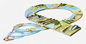
Model of landform evolution in the prehistoric era, including Quaternary, Tertiary, Cretaceous, Jurassic, Triassic, Permian, Carboniferous, Devonian, Silurian, Ordovician, Precambrian periods

Background imageTopography Collection: Three-dimensional illustration of mountain lake surrounded by forest

Three-dimensional illustration of mountain lake surrounded by forest

Background imageTopography Collection: Illustration, map of the world showing desert regions (yellow)

Illustration, map of the world showing desert regions (yellow) and regions in danger of desertification (orange)

Background imageTopography Collection: Illustration of minerals and rocks, used for constructing buildings

Illustration of minerals and rocks, used for constructing buildings, a landscape of mountains and a city, all forming part of the Earths topography

Background imageTopography Collection: Lakes on Top of Glacier

Lakes on Top of Glacier

Background imageTopography Collection: Coastline

Coastline

Background imageTopography Collection: Rainforest Meeting Water

Rainforest Meeting Water

Background imageTopography Collection: Boat Passing Rocky Point

Boat Passing Rocky Point

Background imageTopography Collection: Rio de Janeiro

Rio de Janeiro

Background imageTopography Collection: River Oxbow

River Oxbow

Background imageTopography Collection: River

River

Background imageTopography Collection: Tailings Ponds

Tailings Ponds

Background imageTopography Collection: Rural Road

Rural Road

Background imageTopography Collection: Danube River with Schloss Schoenbuehel Palace, in the distance, Melk Abbey, Wachau, Mostviertel

Danube River with Schloss Schoenbuehel Palace, in the distance, Melk Abbey, Wachau, Mostviertel, Lower Austria, Austria, Europe

Background imageTopography Collection: Isar River with the Benediktenwand Mountainlooking, view from Gaissach-Wiedmoos, Isarwinkel

Isar River with the Benediktenwand Mountainlooking, view from Gaissach-Wiedmoos, Isarwinkel, Upper Bavaria, Bavaria, Germany, Europe

Background imageTopography Collection: View of Cochem on the Moselle, Rhineland-Palatinate, Germany, Europe

View of Cochem on the Moselle, Rhineland-Palatinate, Germany, Europe

Background imageTopography Collection: Overlooking Bremner with a Moselle bend, Landkreis Cochem-Zell district, Rhineland-Palatinate

Overlooking Bremner with a Moselle bend, Landkreis Cochem-Zell district, Rhineland-Palatinate, Germany, Europe

Background imageTopography Collection: View on Bullay, Landkreis Cochem-Zell district, Rhineland-Palatinate, Germany, Europe

View on Bullay, Landkreis Cochem-Zell district, Rhineland-Palatinate, Germany, Europe

Background imageTopography Collection: View of the vineyards at Puenderich, Landkreis Cochem-Zell district, Rhineland-Palatinate

View of the vineyards at Puenderich, Landkreis Cochem-Zell district, Rhineland-Palatinate, Germany, Europe

Background imageTopography Collection: Limestone formation on the Manambolo River, Tsingy de Bemaraha National Park, Madagascar, Africa

Limestone formation on the Manambolo River, Tsingy de Bemaraha National Park, Madagascar, Africa

Background imageTopography Collection: Dugout canoe on the Canal des Pangalanes, Tamatave, Madagascar, Africa

Dugout canoe on the Canal des Pangalanes, Tamatave, Madagascar, Africa

Background imageTopography Collection: Canal des Pangalanes with various water plants, Tamatave, Madagascar, Africa

Canal des Pangalanes with various water plants, Tamatave, Madagascar, Africa

Background imageTopography Collection: Limestones in the Schrattenkalk with dolina behind it, Creux du Van, Boudry, Canton NeuchAzAtel

Limestones in the Schrattenkalk with dolina behind it, Creux du Van, Boudry, Canton NeuchAzAtel, Switzerland, Europe

Background imageTopography Collection: Early morning on the river Henne MAzAŝlle AzAa in Henne Strand, West Jutland, Denmark, Europe

Early morning on the river Henne MAzAŝlle AzAa in Henne Strand, West Jutland, Denmark, Europe

Background imageTopography Collection: Near Ninh Binh, on the way along the river to the caves of Trung Anh, dry Halong Bay, Vietnam

Near Ninh Binh, on the way along the river to the caves of Trung Anh, dry Halong Bay, Vietnam, Southeast Asia

Background imageTopography Collection: Ysper River, Ysper Gorge and forest, Austria, Europe

Ysper River, Ysper Gorge and forest, Austria, Europe

Background imageTopography Collection: View of the Elbe river with Wartturm rock formation, Bastei, Elbsandsteingebirge Elbe Sandstone

View of the Elbe river with Wartturm rock formation, Bastei, Elbsandsteingebirge Elbe Sandstone Mountains, Nationalpark Saechsische Schweiz national park, Saxon Switzerland, Saxony, Germany, Europe

Background imageTopography Collection: At the Helvetesfallet falls the river Aeman plunges about 30m between vertical cliffs

At the Helvetesfallet falls the river Aeman plunges about 30m between vertical cliffs, Oerebro laen, Sweden, Scandinavia, Europe

Background imageTopography Collection: Rowers, Old Main River near Volkach, Mainschleife, loop in the Main River, Mainfranken

Rowers, Old Main River near Volkach, Mainschleife, loop in the Main River, Mainfranken, Lower Franconia, Franconia, Bavaria, Germany, Europe

Background imageTopography Collection: Towns of Koehler, front, Escherndorf, left and Nordheim am Main, Mainschleife

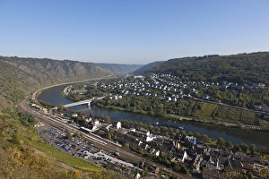
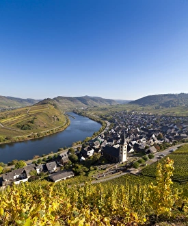
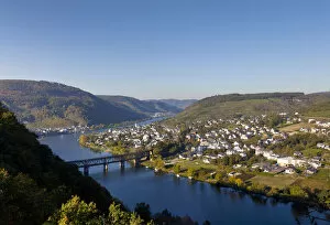
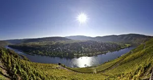
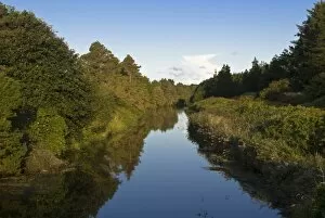
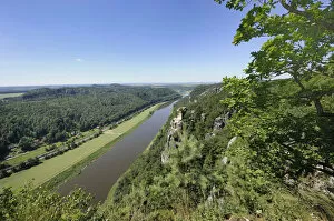
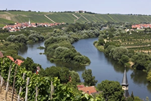
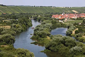
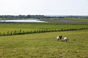
Towns of Koehler, front, Escherndorf, left and Nordheim am Main, Mainschleife, loop in the Main River, Mainfranken, Lower Franconia, Franconia, Bavaria, Germany, Europe

Background imageTopography Collection: Old Main River with the towns of Koehler, Escherndorf and Nordheim am Main, Mainschleife

Old Main River with the towns of Koehler, Escherndorf and Nordheim am Main, Mainschleife, loop in the Main River, Mainfranken, Lower Franconia, Franconia, Bavaria, Germany, Europe

Background imageTopography Collection: Old Main River, view over the towns of Koehler, Escherndorf, left, and Nordheim am Main

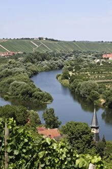
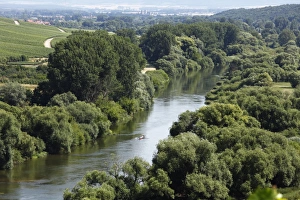
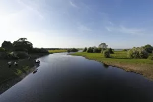
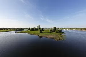
Old Main River, view over the towns of Koehler, Escherndorf, left, and Nordheim am Main, Mainschleife, loop in the Main River, Mainfranken, Lower Franconia, Franconia, Bavaria, Germany, Europe

Background imageTopography Collection: Old Main River, Nordheim am Main, Mainschleife, loop in the Main River, Mainfranken

Old Main River, Nordheim am Main, Mainschleife, loop in the Main River, Mainfranken, Lower Franconia, Franconia, Bavaria, Germany, Europe

Background imageTopography Collection: Old Main River, Muensterschwarzach in the distance, Mainschleife, loop in the Main River

Old Main River, Muensterschwarzach in the distance, Mainschleife, loop in the Main River, Mainfranken, Lower Franconia, Franconia, Bavaria, Germany, Europe

Background imageTopography Collection: Karst rocks, Burren, County Clare, Ireland, Europe

Karst rocks, Burren, County Clare, Ireland, Europe

Background imageTopography Collection: Leenane, Connemara, County Galway, Republic of Ireland, Europe

Leenane, Connemara, County Galway, Republic of Ireland, Europe

Background imageTopography Collection: Bundorragha River, Ben Gorm mountain at the back, Doolough Valley, County Mayo, Connacht province

Bundorragha River, Ben Gorm mountain at the back, Doolough Valley, County Mayo, Connacht province, Republic of Ireland, Europe

Background imageTopography Collection: Cattle on a pasture in front of the Shannon River, Clonmacnoise, County Offaly, Leinster

Cattle on a pasture in front of the Shannon River, Clonmacnoise, County Offaly, Leinster, Republic of Ireland, Europe

Background imageTopography Collection: Boat on the Shannon River, Shannonbridge, County Offaly, Leinster, Republic of Ireland, Europe

Boat on the Shannon River, Shannonbridge, County Offaly, Leinster, Republic of Ireland, Europe

Background imageTopography Collection: Shannon River near Shannonbridge, County Offaly, Leinster, Republic of Ireland, Europe

Shannon River near Shannonbridge, County Offaly, Leinster, Republic of Ireland, Europe

Background imageTopography Collection: Shannon River with Long Island near Shannonbridge, County Offaly, Leinster, Republic of Ireland

Shannon River with Long Island near Shannonbridge, County Offaly, Leinster, Republic of Ireland, Europe

Background imageTopography Collection: Isar River, Geretsried, Upper Bavaria, Bavaria, Germany, Europe

Isar River, Geretsried, Upper Bavaria, Bavaria, Germany, Europe

Background imageTopography Collection: Isar River, Isar Wetlands, Pupplinger Au, Wolfratshausen, Upper Bavaria, Bavaria, Germany, Europe

Isar River, Isar Wetlands, Pupplinger Au, Wolfratshausen, Upper Bavaria, Bavaria, Germany, Europe

Background imageTopography Collection: Wolfratshausen with the Loisach River, Upper Bavaria, Bavaria, Germany, Europe

Wolfratshausen with the Loisach River, Upper Bavaria, Bavaria, Germany, Europe


All Professionally Made to Order for Quick Shipping