mail_outline sales@mediastorehouse.com
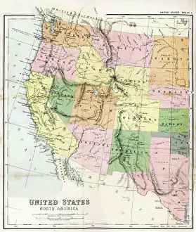
Antique Map of Western USAAntique Map from 1867 of Western United States of America
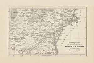
Map of Northeast United States, published in 1882Map of the Northeast United States of America. Wood engraving, published in 1882
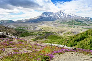
Mount St HelensNature is returning to the environment around the mountain after the catostrophic eruption, wild flowers abound in the area
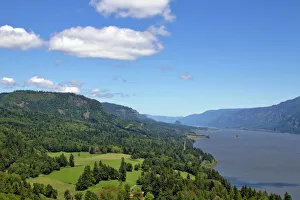
Columbia River Gorge From Cape Horn LookoutColumbia River Gorge Scenic View with blue sky and green mountain landscape from Cape Horn in Washington State in Summer
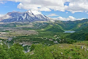
Mt St Helens and Castle Lake
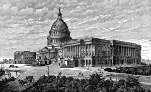
The Capitol Washington
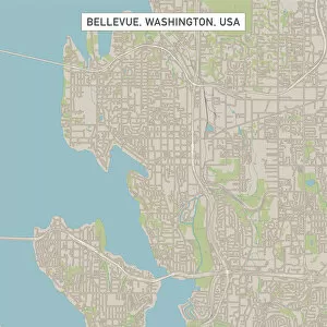
Bellevue Washington US City Street MapVector Illustration of a City Street Map of Bellevue, Washington, USA. Scale 1:60, 000. All source data is in the public domain. U.S
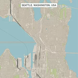
Seattle Washington US City Street MapVector Illustration of a City Street Map of Seattle, Washington, USA. Scale 1:60, 000. All source data is in the public domain. U.S
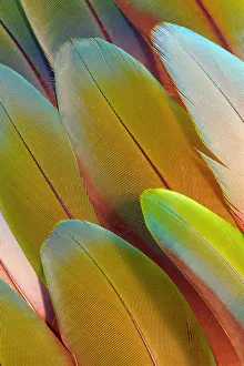
Variety of Macaw Tail Feathers in PatternA collection of colourful feathers from long-tailed, often Macaws parrots
Colorful and Distinctive Peacock Tail FeathersThese tail feathers, or coverts, spread out in a distinctive train that is more than 60 percent of the birds total body length and boast colorful " eye" markings of blue, gold, red
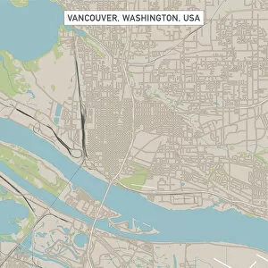
Vancouver Washington US City Street MapVector Illustration of a City Street Map of Vancouver, Washington, USA. Scale 1:60, 000. All source data is in the public domain. U.S
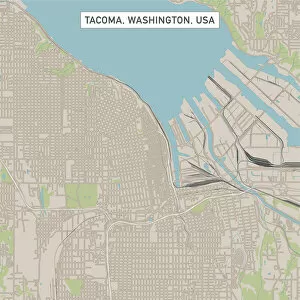
Tacoma Washington US City Street MapVector Illustration of a City Street Map of Tacoma, Washington, USA. Scale 1:60, 000. All source data is in the public domain. U.S
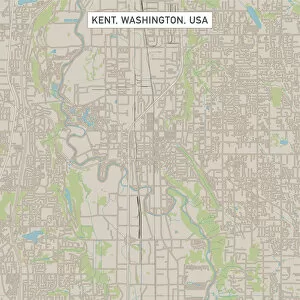
Kent Washington US City Street MapVector Illustration of a City Street Map of Kent, Washington, USA. Scale 1:60, 000. All source data is in the public domain. U.S
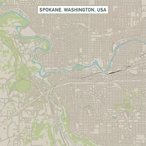
Spokane Washington US City Street MapVector Illustration of a City Street Map of Spokane, Washington, USA. Scale 1:60, 000. All source data is in the public domain. U.S
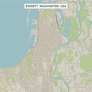
Everett Washington US City Street MapVector Illustration of a City Street Map of Everett, Washington, USA. Scale 1:60, 000. All source data is in the public domain. U.S
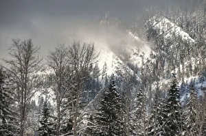
Sun Break on the MountainA brief sun break illuminates the mountain before the clouds close and the winter storm resumes
Green Parrot Feather Design, Issaquah, Wa
Issaquah, Washington State, USAGreen Parrot Feather Design
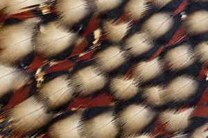
Feather design of Cabots TragopanCabots tragopan is a pheasant found in south-east China. The common and scientific names of this large bird both commemorate the ornithologist Samuel Cabot III
Baby RaccoonsThese are some adorable baby Raccoons all piled up in a tree
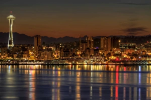
Seattle downtown skyline from alki beach dawnSeattle Washington Downtown Skyline with Space Needle on Puget Sound from Alki Beach at Dawn
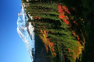
Mt Rainier fall colorMount Rainier in fall color. Taken near Mazama Ridge during the peak of fall
Sailboat at Sunset, Seattle, WashingtonUSA, Washington, Seattle, Setting sun lights yacht sailing in Elliot Bay on spring evening
Seattle Skyline from the Alki Beach Seacrest ParkSeattle Washington Downtown Skyline from Seacrest Park Fishing Pier in Alki Beach during Sunrise Dawn
Seattle City Lights and Light Trails at Blue HourSeattle Washington Freeway Traffic Light Trails with City Skyline at Evening Blue Hour
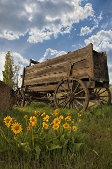
Old Wagon at Dalles Mountain RanchOld Wooden Wagon at Dalles Mountain Ranch in Columbia Hills State Park Washington State During Spring Season
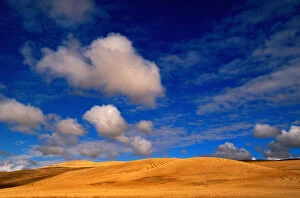
Wheat Fields in Palouse, Washington
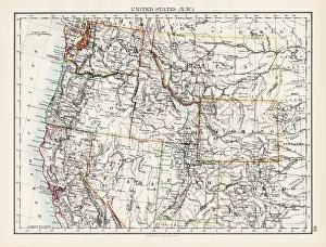
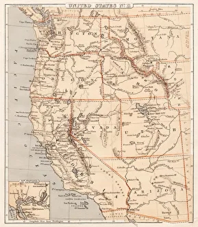
United States North West map 1897The World-Wide Atlas of Modern Geography, Political and Physical W. & A.K. Johnston - London 1897
Harbor and city at dusk, Seattle, USAWaterfront and downtown district at dusk, Seattle, Washington state, USA
Portrait View of Seattle Harbor & city at duskWaterfront and downtown district at dusk, Seattle, Washington state, USA
Skyline and downtown at dusk, Seattle, USASkyline at dusk, Seattle, Washington, USA
Aerial view of Seattle downtown at sunset, USAAerial view of Seattle downtown skyline at sunset, Seattle, Washington, USA
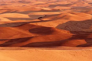
Palouse Hills. The Palouse region is located in southeastern Washington and northwestern Idahoau0612-003
north of Clearwater and Snake Rivers. The region is well known for fertile landau0612-001
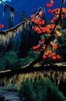
USA. Twigs with bright fall leaves and moss, Washington, autumn. Olympic National Parka036754
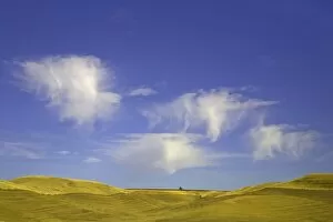
Harvested wheat field, Palouse Hills, WAHarvested wheat fields on rolling hills under blue sky and lofty cumulus clouds, fall, Palouse Hills, WA
Harvested wheat fields, Palouse Hills, WAHarvested wheat fields on rolling hills under blue sky and lofty cumulus clouds, fall, Palouse Hills, WA
Pacific USA states map 1869Cornells Grammars-School Geography - S.S. Cornell - New York D. Appleton and Company 1869
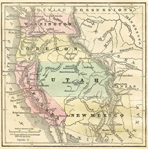
Western Pacific USA states map 1856Colton and Fitchs Modern School Geography by George W. Fitch - New York 1856
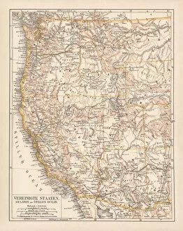
United States of America, West Coast, ithograph, published in 1878United States of America, States on the Pacific Ocean. Lithograph, published in 1878
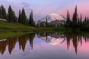
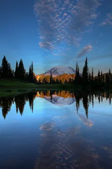
Mount Rainier Reflection Dawn
Mount Rainier ReflectionA favorite view of Mount Rainier from Tipsoo lake near Chinook Pass
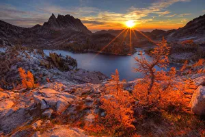
Enchantment SunriseView of Prusik Peak and Perfection Lake from the upper Enchantments. First rays of light on the fall colored larch trees. in the sky the darker grey clouds are actually smoke from the huge forest
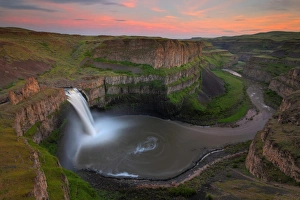
Palouse Falls SunsetThis was an amazing sunset at one of my favorite places in eastern Washington Palouse Falls State Park
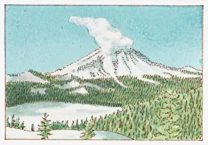
Illustration of Mount St Helens, Skamania County, Washington State, USA
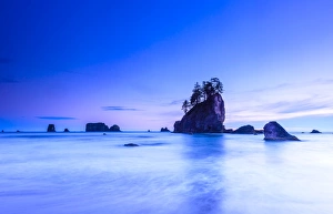
Olympic National Park coastlineThe beautiful 2nd beach near La Push within the Olympic National Park, Washington on a calm tranquil evening
Pioneer square station in seattle washingtonPioneer Square Station in Downtown Seattle Washington for bus and train passenger
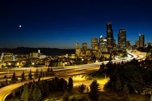
Moon over seattle downtown skylineMoon Over Seattle Washington Downtown