mail_outline sales@mediastorehouse.com
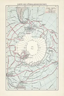
Antarctica map with sea routes of various explorers, lithograph, 1897Historical map of the unexplored Antarctica with sea routes of various explorers, 18th - 19th century. Lithograph, published in 1897
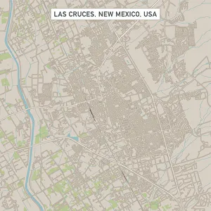
Las Cruces New Mexico US City Street MapVector Illustration of a City Street Map of Las Cruces, New Mexico, USA. Scale 1:60, 000. All source data is in the public domain. U.S
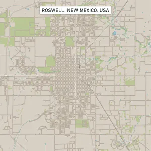
Roswell New Mexico US City Street MapVector Illustration of a City Street Map of Roswell, New Mexico, USA. Scale 1:60, 000. All source data is in the public domain. U.S
Westminster Colorado US City Street MapVector Illustration of a City Street Map of Westminster, Colorado, USA. Scale 1:60, 000. All source data is in the public domain. U.S
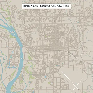
Bismarck North Dakota US City Street MapVector Illustration of a City Street Map of Bismarck, North Dakota, USA. Scale 1:60, 000. All source data is in the public domain. U.S
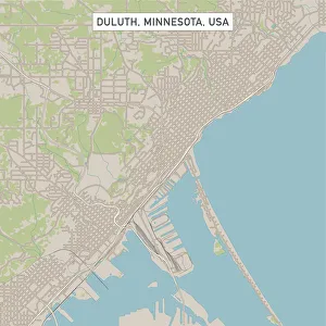
Duluth Minnesota US City Street MapVector Illustration of a City Street Map of Duluth, Minnesota, USA. Scale 1:60, 000. All source data is in the public domain. U.S
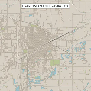
Grand Island Nebraska US City Street MapVector Illustration of a City Street Map of Grand Island, Nebraska, USA. Scale 1:60, 000. All source data is in the public domain. U.S
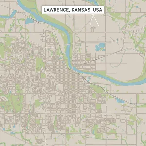
Lawrence Kansas US City Street MapVector Illustration of a City Street Map of Lawrence, Kansas, USA. Scale 1:60, 000. All source data is in the public domain. U.S
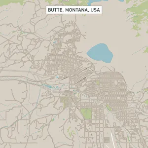
Butte Montana US City Street MapVector Illustration of a City Street Map of Butte, Montana, USA. Scale 1:60, 000. All source data is in the public domain. U.S
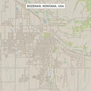
Bozeman Montana US City Street MapVector Illustration of a City Street Map of Bozeman, Montana, USA. Scale 1:60, 000. All source data is in the public domain. U.S
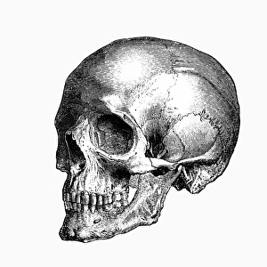
SkullEngraving From 1898 Featuring A Human Skull
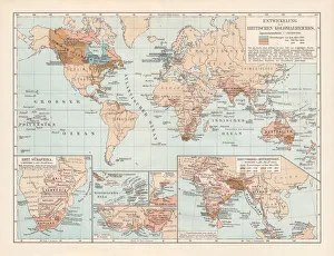
Development of the British Empire, lithograph, published 1897Map of the territorial development of the British Empire from the 17th century to the end of the 19th century. Lithograph, published in 1897
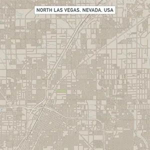
North Las Vegas Nevada US City Street MapVector Illustration of a City Street Map of North Las Vegas, Nevada, USA. Scale 1:60, 000. All source data is in the public domain. U.S
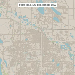
Fort Collins Colorado US City Street MapVector Illustration of a City Street Map of Fort Collins, Colorado, USA. Scale 1:60, 000. All source data is in the public domain. U.S
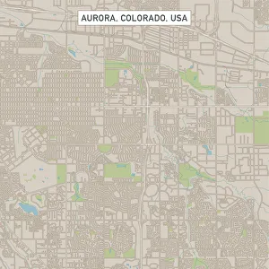
Aurora Colorado US City Street MapVector Illustration of a City Street Map of Aurora, Colorado, USA. Scale 1:60, 000. All source data is in the public domain. U.S
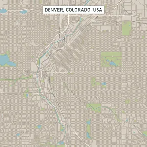
Denver Colorado US City Street MapVector Illustration of a City Street Map of Denver, Colorado, USA. Scale 1:60, 000. All source data is in the public domain. U.S
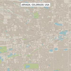
Arvada Colorado US City Street MapVector Illustration of a City Street Map of Arvada, Colorado, USA. Scale 1:60, 000. All source data is in the public domain. U.S
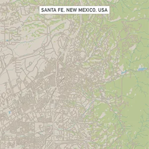
Santa Fe New Mexico US City Street MapVector Illustration of a City Street Map of Santa Fe, New Mexico, USA. Scale 1:60, 000. All source data is in the public domain. U.S
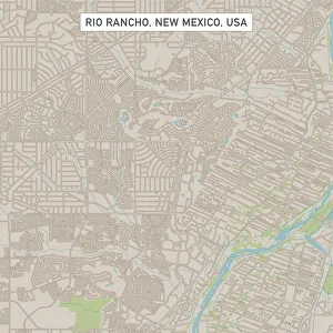
Rio Rancho New Mexico US City Street MapVector Illustration of a City Street Map of Rio Rancho, New Mexico, USA. Scale 1:60, 000. All source data is in the public domain. U.S
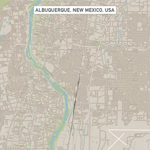
Albuquerque New Mexico US City Street MapVector Illustration of a City Street Map of Albuquerque, New Mexico, USA. Scale 1:60, 000. All source data is in the public domain. U.S
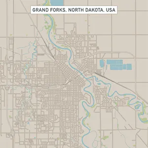
Grand Forks North Dakota US City Street MapVector Illustration of a City Street Map of Grand Forks, North Dakota, USA. Scale 1:60, 000. All source data is in the public domain. U.S
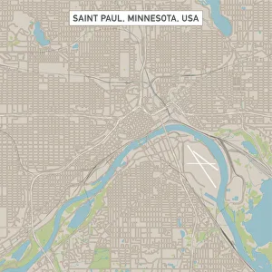
Saint Paul Minnesota US City Street MapVector Illustration of a City Street Map of Saint Paul, Minnesota, USA. Scale 1:60, 000. All source data is in the public domain. U.S
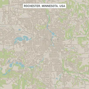
Rochester Minnesota US City Street MapVector Illustration of a City Street Map of Rochester, Minnesota, USA. Scale 1:60, 000. All source data is in the public domain. U.S
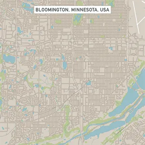
Bloomington Minnesota US City Street MapVector Illustration of a City Street Map of Bloomington, Minnesota, USA. Scale 1:60, 000. All source data is in the public domain. U.S
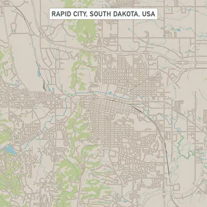
Rapid City South Dakota US City Street MapVector Illustration of a City Street Map of Rapid City, South Dakota, USA. Scale 1:60, 000. All source data is in the public domain. U.S
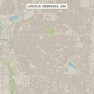
Lincoln Nebraska US City Street MapVector Illustration of a City Street Map of Lincoln, Nebraska, USA. Scale 1:60, 000. All source data is in the public domain. U.S
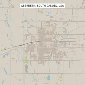
Aberdeen South Dakota US City Street MapVector Illustration of a City Street Map of Aberdeen, South Dakota, USA. Scale 1:60, 000. All source data is in the public domain. U.S
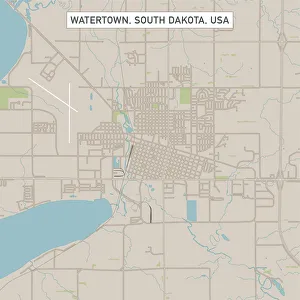
Watertown South Dakota US City Street MapVector Illustration of a City Street Map of Watertown, South Dakota, USA. Scale 1:60, 000. All source data is in the public domain. U.S
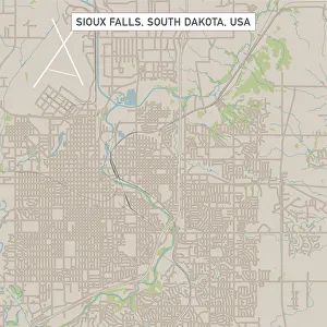
Sioux Falls South Dakota US City Street MapVector Illustration of a City Street Map of Sioux Falls, South Dakota, USA. Scale 1:60, 000. All source data is in the public domain. U.S
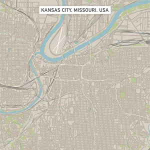
Kansas City Missouri US City Street MapVector Illustration of a City Street Map of Kansas City, Missouri, USA. Scale 1:60, 000. All source data is in the public domain. U.S
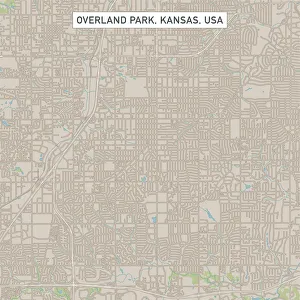
Overland Park Kansas US City Street MapVector Illustration of a City Street Map of Overland Park, Kansas, USA. Scale 1:60, 000. All source data is in the public domain. U.S
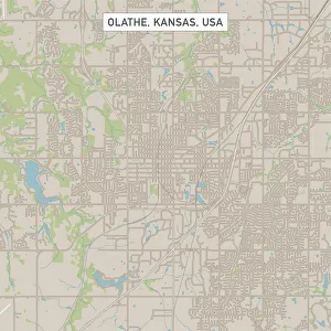
Olathe Kansas US City Street MapVector Illustration of a City Street Map of Olathe, Kansas, USA. Scale 1:60, 000. All source data is in the public domain. U.S
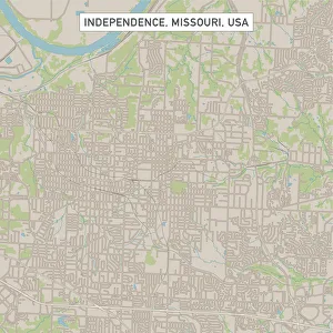
Independence Missouri US City Street MapVector Illustration of a City Street Map of Independence, Missouri, USA. Scale 1:60, 000. All source data is in the public domain. U.S
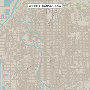
Wichita Kansas US City Street MapVector Illustration of a City Street Map of Wichita, Kansas, USA. Scale 1:60, 000. All source data is in the public domain. U.S
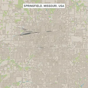
Springfield Missouri US City Street MapVector Illustration of a City Street Map of Springfield, Missouri, USA. Scale 1:60, 000. All source data is in the public domain. U.S
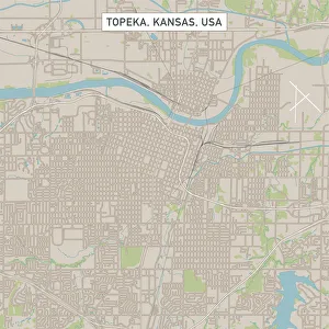
Topeka Kansas US City Street MapVector Illustration of a City Street Map of Topeka, Kansas, USA. Scale 1:60, 000. All source data is in the public domain. U.S
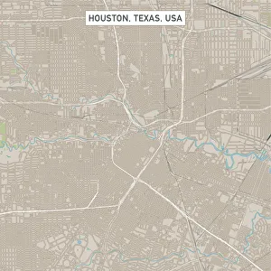
Houston Texas US City Street MapVector Illustration of a City Street Map of Houston, Texas, USA. Scale 1:60, 000. All source data is in the public domain. U.S
Broken Arrow Oklahoma US City Street MapVector Illustration of a City Street Map of Broken Arrow, Oklahoma, USA. Scale 1:60, 000. All source data is in the public domain. U.S
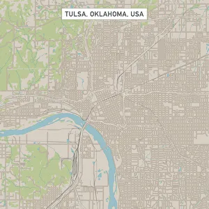
Tulsa Oklahoma US City Street MapVector Illustration of a City Street Map of Tulsa, Oklahoma, USA. Scale 1:60, 000. All source data is in the public domain. U.S
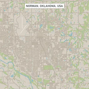
Norman Oklahoma US City Street MapVector Illustration of a City Street Map of Norman, Oklahoma, USA. Scale 1:60, 000. All source data is in the public domain. U.S
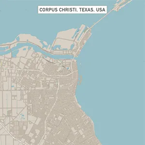
Corpus Christi Texas US City Street MapVector Illustration of a City Street Map of Corpus Christi, Texas, USA. Scale 1:60, 000. All source data is in the public domain. U.S
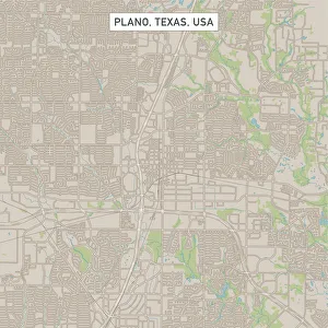
Plano Texas US City Street MapVector Illustration of a City Street Map of Plano, Texas, USA. Scale 1:60, 000. All source data is in the public domain. U.S
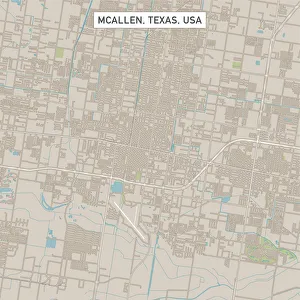
McAllen Texas US City Street MapVector Illustration of a City Street Map of McAllen, Texas, USA. Scale 1:60, 000. All source data is in the public domain. U.S
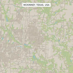
McKinney Texas US City Street MapVector Illustration of a City Street Map of McKinney, Texas, USA. Scale 1:60, 000. All source data is in the public domain. U.S
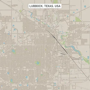
Lubbock Texas US City Street MapVector Illustration of a City Street Map of Lubbock, Texas, USA. Scale 1:60, 000. All source data is in the public domain. U.S
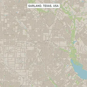
Garland Texas US City Street MapVector Illustration of a City Street Map of Garland, Texas, USA. Scale 1:60, 000. All source data is in the public domain. U.S
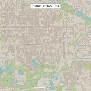
Irving Texas US City Street MapVector Illustration of a City Street Map of Irving, Texas, USA. Scale 1:60, 000. All source data is in the public domain. U.S
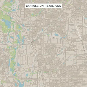
Carrollton Texas US City Street MapVector Illustration of a City Street Map of Carrollton, Texas, USA. Scale 1:60, 000. All source data is in the public domain. U.S