mail_outline sales@mediastorehouse.com
Choose a picture from our Images Dated 1st July 2010 Collection for your Wall Art and Photo Gifts
84 items
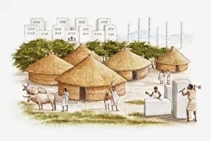
Illustration of ancient East African city of Axum showing people working marble in the foreground, conical grass huts, and royal palace in background
Illustrated map of ancient Assyrian empire
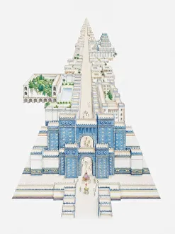
Illustration of Ishtar Gate and other buildings along Processional Way in ancient city of Babylon
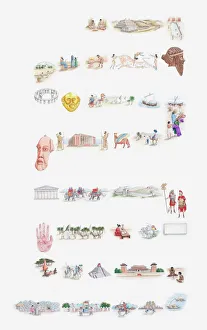
Illustration of people, customs, artefacts, monuments from ancient civilisations and indigenous cultures around the world, including Ancient Egypt, Ancient Greece, Persia, Phoenicia, Inca, Maya, Aztec
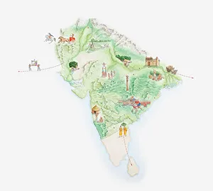
Illustrated map of India showing ancient Mauryan empire
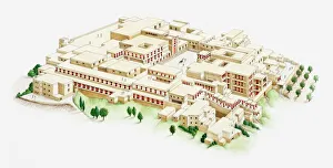
Illustration of palace of Knossos
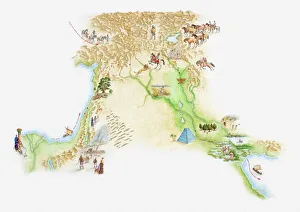
Illustrated map of ancient Japan
Illustrated map of Indus Valley civilisation
Illustrated map of ancient Persia
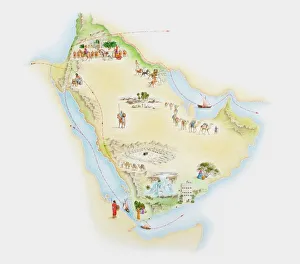
Illustrated map of ancient Arab trade routes and pilgrimage sites
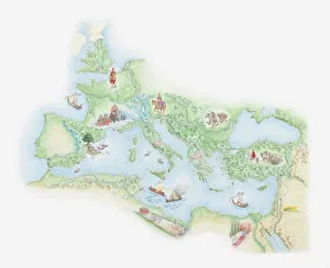
Illustrated map of Roman Empire, BC
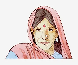
Illustration of woman wearing headscarf and bindi on her forehead
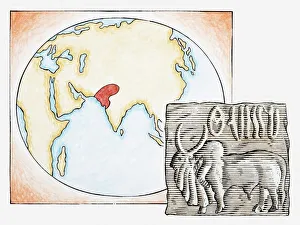
Illustration of map highlighting Indus Valley region and ancient tablet showing water buffalo
Hole through the baitballBronze whaler shark swimming through a giant ball of sardines, waiting to feed on them.Sardine run, off the East coast of South Africa
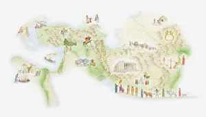
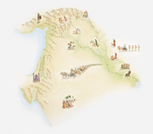
Illustrated map of ancient Sumer with rivers Tigris and Euphrates
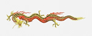
Illustration of Chinese dragon
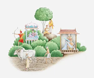
Illustration of ancient Indian caste system showing Brahmans, Kshatriyas, Vaishya, and Sudras
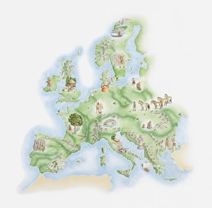
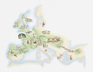
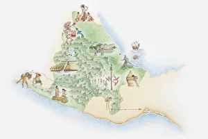
Illustrated map of Bronze Age civilisations across Europe, showing stone circles, settlements, agricultural activity
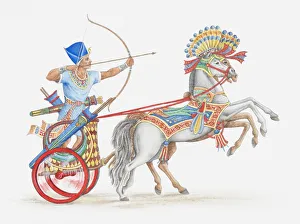
Illustration of ancient Egyptian archer on chariot
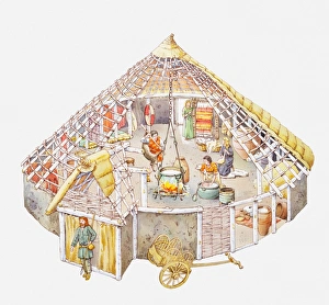
Illustration of a Celtic home showing cooking cauldron hanging on a cross-beam from the wooden frame of the house, walls made from woven branches, thatched roof, people engaged in household jobs
Illustration of reconstruction of Pueblo Bonito, Chaco Culture National Historical Park, New Mexico, USA
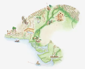
Illustrated map of Phoenician empire and trade routes
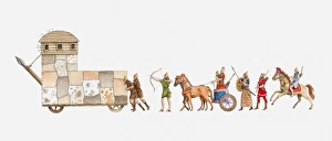
Illustration of ancient Assyrian army, battering ram pushed by men, followed by archers, a war chariot, foot soldiers and archer on horseback
Illustrated map of ancient Babylon
Illustrated map of population of Celts across Iron Age Europe
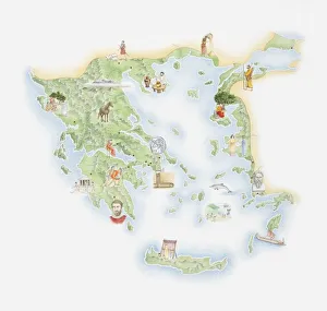
Illustrated map of Ancient Greece, BC
Illustration of ancient Sumerian next to a map highlighting ancient Sumer
Illustrated map of the land of the Aztecs
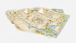
Illustration of Pyramids of Giza, aerial view
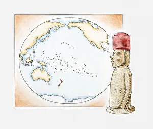
Illustration of Easter Island stone statue in front of a map highlighting Polynesian islands and New Zealand
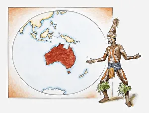
Illustration of Aboriginal tribesman in front of a map of Australia
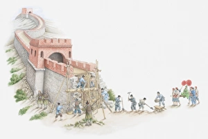
Illustration of construction of Great Wall of China
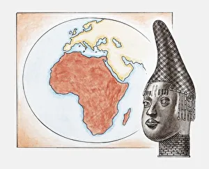
Illustration of head of Queen Mother of Benin (Iyoba) in front of map of Africa
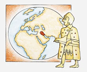
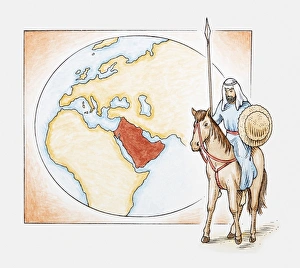
Illustration of an Arab man on horseback in front of a map of ancient Arabia
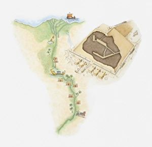
Illustrated map of Egypt showing position of pyramids and rock tombs along River Nile, next to a model of a pyramid
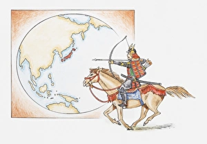
Illustration of early Samurai warrior on horseback in front of a map highlighting Japan
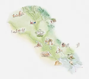
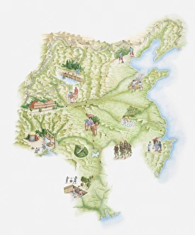
Illustrated map of ancient Chinese empire showing monuments, workers and warriors
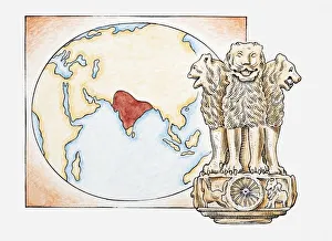
Illustration of lions statue in front of a map with India highlighted
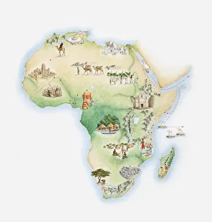
Illustrated map of Africa
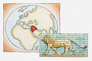
Illustration of lion in front of map highlighting territory of ancient Babylon
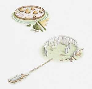
Illustration of early European village protected by palisade, and another illustration showing construction of stone circle at Stonehenge
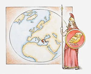
Illustration of Athena in front of map highlighting territory of ancient Greece
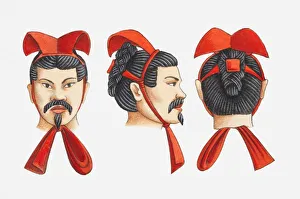
Illustration of Terracotta Army warriors headdress, front, side and rear views
Illustration of ancient Chinese city of Ch angan
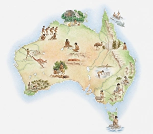
Illustrated map of Australia showing wildlife and Aborigine population
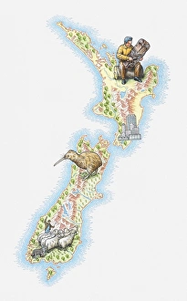
Illustrated map of New Zealand
Illustration of ancient view of the world, based on Roman map from 1st century BC
Illustration of Murex shell