mail_outline sales@mediastorehouse.com
Choose a picture from our Images Dated 22nd May 2018 Collection for your Wall Art and Photo Gifts
42 items
building, citadel, coast, coastal area, corse, defence work, fortification, frenchbuilding, citadel, coast, coastal area, corse, defence work, fortifica, Erhard Nerger Photography, 999574430
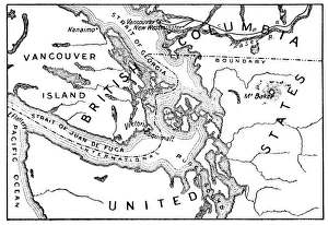
Antique Map of the San Juan Islands - 19th CenturyVintage map of the San Juan Islands. The area has been disputed since the 1850s, in the 21st century the area was finally recognized as the Salish Sea. Vintage etching circa late 19th century
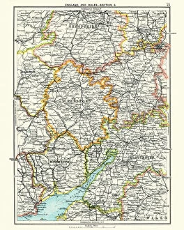
Antique map, Hereford, Worester, Monmouth, Gloucester, Shropshire, 19th CenturyAntique map, Hereford, Worester, Monmouth, Gloucester, Shropshire, England and Wales 19th Century
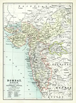
Antique map of Bombay, India, 19th CenturyAntique map of Bombay, Berar, and part of central India from 1891
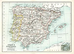
Antique map of Spain and Portugal from 1891 with a detail of Santander
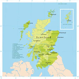
Scotland Vector MapHighly detailed vector map of Scotland. File was created on July 20, 2011. The colors in the.eps-file are ready for print (CMYK). Included files: EPS (v8) and Hi-Res JPG
Antique map, Cambridge, Hertford, Essex, Suffolk, England 19th CenturyVintage engraving of a Antique map, Cambridge, Hertford, Essex, Suffolk, England 19th Century
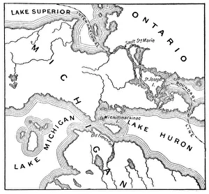
Antique Map of the Mackinac Island Area during the War of 1812 - 19th CenturyVintage map showing early territorial borders and military positions in the Mackinac area during the War of 1812. Vintage etching circa late 19th century
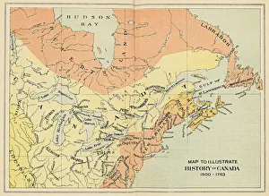
Antique Map of Canada from the 16th to 18th CenturyVintage map of Canada showing the early territorial boundaries of European Occupation. Vintage etching circa late 19th century
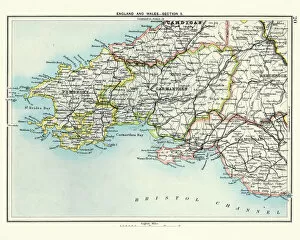
Antique map, Pembroke, Carmarthen, Glamorgan, Wales, 19th CenturyVintage engraving of a Antique map, Pembroke, Carmarthen, Glamorgan, Wales, 19th Century
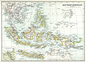
Antique map of East Indian Archipelago, including, the Phillippines, Papua New Guinea, Borneo and Java from 1891. With Detail of Batavia (Jakarta)
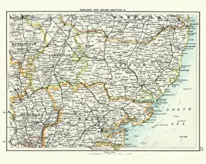
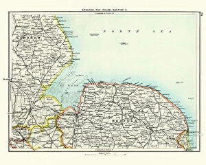
Antique map, Lincoln and Norfolk, England 19th CenturyVintage engraving of a Antique map, Lincoln and Norfolk, England 19th Century
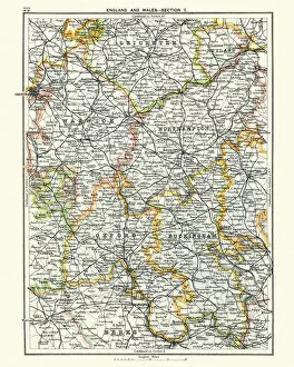
Antique map, Leicester, Warwick, Northampton, Oxford, Buckingham 19th CenturyVintage engraving of a Antique map, Leicester, Warwick, Northampton, Oxford, Buckingham. England 19th Century
Honey LilyNectaroscordum, also referred to as the Siculum or Sicilian Honey lily
White oil tank with yellow oil staircase in Saint-Pierre-des-Corps, FranceThis photograph represents, in the early morning, an oil tank in an oil depot in Saint-Pierre-des-Corps, in the Center-Val-de-Loire region, France
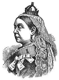
Portrait of Queen Victoria - 19th CenturyPortrait of Queen Victoria of the United Kingdom. Vintage etching circa late 19th century
Henry VIII King of England portrait illustration 1882Henry VIII ( 28 June 1491 - 28 January 1547 ) was King of England from 1509 until his death. Graveur : Hildibrand Drawing : E
Natural history, Birds, Willow warblerVintage engraving of a willow warbler (Phylloscopus trochilus) is a very common and widespread leaf warbler which breeds throughout northern and temperate Europe
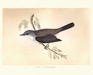
Natural history, Birds, Lesser whitethroat (Sylvia curruca)Vintage engraving of a Lesser whitethroat (Sylvia curruca) a common and widespread typical warbler which breeds in temperate Europe, except the southwest, and in western and central Asia
Natural history, Birds, Common chiffchaff (Phylloscopus collybita)Vintage engraving of a common chiffchaff (Phylloscopus collybita), or simply the chiffchaff, is a common and widespread leaf warbler which breeds in open woodlands throughout northern
Natural history, Birds, Melodious warbler (Hippolais polyglotta)Vintage engraving of a melodious warbler (Hippolais polyglotta) is an Old World warbler in the tree warbler genus Hippolais. It breeds in southwest Europe and northwest Africa
Natural history, Birds, Wood warbler (Phylloscopus sibilatrix)Vintage engraving of a wood warbler (Phylloscopus sibilatrix) common and widespread leaf warbler which breeds throughout northern and temperate Europe
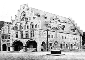
Townhall in DortmundIllustration from 19th century
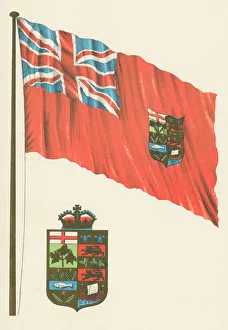
First Version of the Canadian Flag and Arms of Canada - 19th CenturyFirst version of the Canadian Flag referred to as the Canadian Red Ensign, in use from 1868 a 1921. Also the first coat of arms of Canada, in use from 1868 - 1905
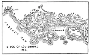
Antique Map of the Siege of Louisbourg - 18th CenturyVintage map of the Siege of Louisbourg in Nova Scotia, Canada. Vintage etching circa late 19th century
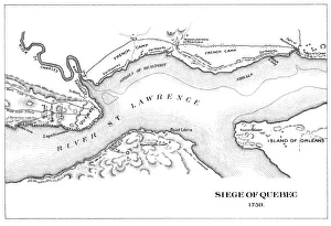
Antique Map of the Siege of Quebec - 18th CenturyVintage map of the Siege of Quebec in Quebec, Canada. Vintage etching circa late 19th century
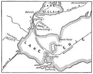
Antique Map of Detroit Area during the War of 1812 - 19th CenturyVintage map showing early territorial borders and military positions in the Detroit area during the War of 1812. Vintage etching circa late 19th century
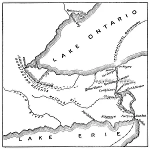
Antique Map of Niagara River Area during the War of 1812 - 19th CenturyVintage map showing early territorial borders and military positions in the Niagara River area during the War of 1812. Vintage etching circa late 19th century
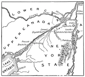
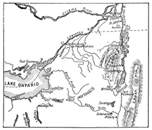
Antique Map of St. Lawrence Area during the War of 1812 - 19th CenturyVintage map showing early territorial borders and military positions in the St Lawrence area during the War of 1812. Vintage etching circa late 19th century
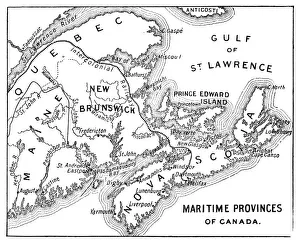
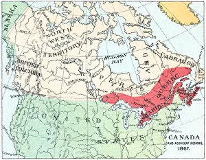
Antique Map of Maritime Provinces of Canada - 19th CenturyVintage map of the Maritime Provinces of Canada. Vintage etching circa late 19th century
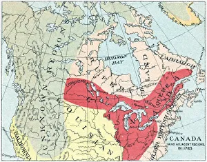
Antique Map of North America after the Seven Years War - 18th CenturyVintage map of the territories of British North America after the Seven Years War. Vintage etching circa late 19th century
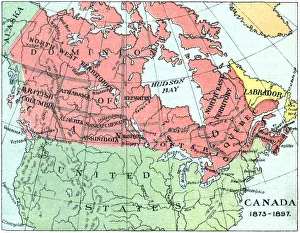
Antique Map of Canada - 19th CenturyVintage map of Canada at the end of the 19th century. Vintage etching circa late 19th century
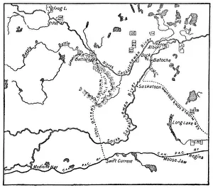
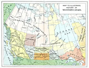
Antique Map of the North-West Rebellion in Saskatchewan, Canada - 19th CenturyVintage map of the North-West Rebellion under the leadership of Louis Riel in the North-West Territories (now the province of Saskatchewan), Canada. This is the Metis conflict area
Antique Map of North America after the Treaty of Paris - 18th CenturyVintage map of the territories of British North America after the Treaty of Paris. Vintage etching circa late 19th century
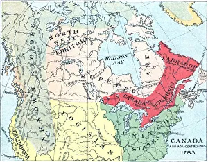
Antique Map of North America at Canadas Confederation - 19th CenturyVintage map of the territories of North America at Canadian Confederation in 1867. Vintage etching circa late 19th century
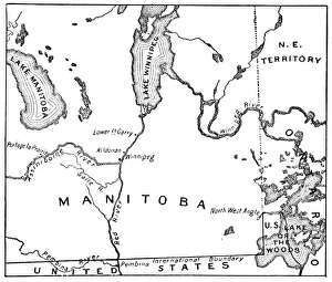
Antique Map of the New Province of Manitoba, Canada - 1870sVintage map of the newly acquired region near the city of Winnipeg, it was made the province of Manitoba, Canada. Vintage etching circa late 19th century
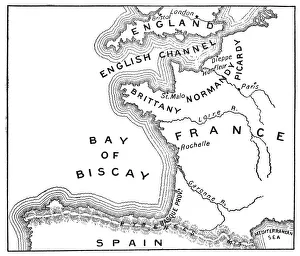
Antique Map of France - 19th CenturyVintage map of France. Vintage etching circa late 19th century
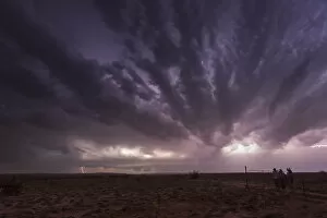
Severe warned thunderstorm near Roswell in New Mexico. USAThis severe warned thunderstorm near Roswell in New Mexico pounded the ground with lightning for hours, seen here with stunning structure and lighting up the night sky with its raw power
Antique Map of Canada - 19th CenturyVintage map of Canada. Vintage etching circa late 19th century
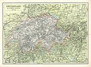
Antique map of Switzerland and the Alps from 1891